Cistern Strip

Wood, Forest in Peeblesshire

Scotland

Cistern Strip

New sports fields, Peebles High School Recently completed sports fields next to the site of the new High School currently under construction. The viewpoint is the track on the edge of the Cademuir plantation.
New sports fields, Peebles High School Credit: Jim Barton

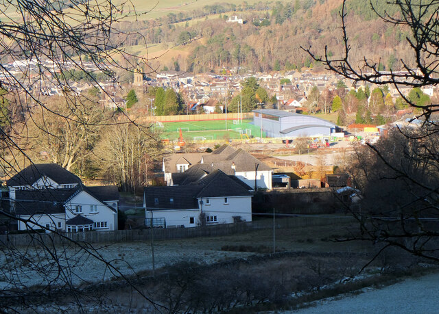
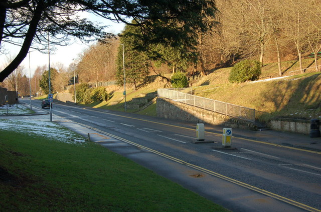
Cistern Strip, located in Peeblesshire, is a picturesque woodland area known for its serene beauty and diverse flora and fauna. Nestled in the heart of Scotland, this enchanting forest offers a tranquil escape from the bustling city life. Spanning over a vast area, Cistern Strip is a haven for nature enthusiasts and hikers alike.

The woodland is primarily composed of native tree species such as oak, birch, and Scots pine, which create a dense canopy that filters sunlight and creates a cool, shaded atmosphere. The forest floor is adorned with a rich carpet of mosses, ferns, and wildflowers, adding a splash of color to the green landscape.

Cistern Strip is home to a wide variety of wildlife, making it a popular destination for birdwatchers and animal lovers. Squirrels, badgers, and deer can frequently be spotted among the trees, while the melodious songs of various bird species fill the air. Rare and endangered species like the red squirrel and the capercaillie can also be found here, making it an important conservation area.

The forest offers numerous walking trails and paths that wind through its natural wonders, allowing visitors to explore its hidden gems. The relaxing ambiance and breathtaking scenery make Cistern Strip an excellent spot for picnics, family outings, or simply a peaceful retreat in nature.

In conclusion, Cistern Strip in Peeblesshire is a mesmerizing woodland that showcases the beauty of Scotland's natural landscape. Its lush vegetation, diverse wildlife, and serene atmosphere make it a must-visit destination for anyone seeking solace in the embrace of nature.

If you have any feedback on the listing, please let us know in the comments section below.

Cistern Strip Images

Images are sourced within 2km of 55.661478/-3.1828936 or Grid Reference NT2541. Thanks to Geograph Open Source API. All images are credited.

New sports fields, Peebles High School Recently completed sports fields next to the site of the new High School currently under construction. The viewpoint is the track on the edge of the Cademuir plantation.
New sports fields, Peebles High School
Recently completed sports fields next to the site of the new High School currently under construction. The viewpoint is the track on the edge of the Cademuir plantation.
Milestone at Kingsmeadows, Peebles The One Mile marker on Kingsmeadows Road. An overgrown footpath just to the left leads to the riverside.
Milestone at Kingsmeadows, Peebles
The One Mile marker on Kingsmeadows Road. An overgrown footpath just to the left leads to the riverside.
Old summerhouse, Kingsmeadows An old summerhouse or other outbuilding in the grounds of Kingsmeadows House. Kingsmeadows used to belong to the Hay family until its sale in 1920. Much of the surrounding land was compulsorily purchased to build houses in the early 1960s, but the big house and immediate gardens were bought by the current owners, the Standard Life insurance company. See <span class="nowrap"><a title="http://historyofpeebles.com/Page178.html" rel="nofollow ugc noopener" href="http://historyofpeebles.com/Page178.html">Link</a><img style="margin-left:2px;" alt="External link" title="External link - shift click to open in new window" src="https://s1.geograph.org.uk/img/external.png" width="10" height="10"/></span> for more background to Kingsmeadows.
Old summerhouse, Kingsmeadows
An old summerhouse or other outbuilding in the grounds of Kingsmeadows House. Kingsmeadows used to belong to the Hay family until its sale in 1920. Much of the surrounding land was compulsorily purchased to build houses in the early 1960s, but the big house and immediate gardens were bought by the current owners, the Standard Life insurance company. See LinkExternal link for more background to Kingsmeadows.
Remnant of the Wire Bridge, Peebles The post in the foreground appears to be the only surviving part of a former suspension footbridge across the Tweed here. It was a private bridge for the Kingsmeadows estate, connecting with Wire Bridge Cottage, just in view across the river. Further historical background and a photograph of the bridge are given in 'Peebles Remembered' published by The Tweeddale Society in 2005.
Remnant of the Wire Bridge, Peebles
The post in the foreground appears to be the only surviving part of a former suspension footbridge across the Tweed here. It was a private bridge for the Kingsmeadows estate, connecting with Wire Bridge Cottage, just in view across the river. Further historical background and a photograph of the bridge are given in 'Peebles Remembered' published by The Tweeddale Society in 2005.
Edderston Road, Peebles An attractive housing area on the edge of Peebles, viewed in late-March sunshine.
Edderston Road, Peebles
An attractive housing area on the edge of Peebles, viewed in late-March sunshine.
Bonnington Road, Peebles Viewed in late-March sunshine.
Bonnington Road, Peebles
Viewed in late-March sunshine.
Lane between houses, Springhill Road Peebles A short cut between Springhill Road and Springwood Terrace; Victoria Park is in view below.
Lane between houses, Springhill Road Peebles
A short cut between Springhill Road and Springwood Terrace; Victoria Park is in view below.
Replacing the gas mains, Peebles (1) Gas mains are being replaced in southern Peebles, here on Springwood Road opposite the High School.
Replacing the gas mains, Peebles (1)
Gas mains are being replaced in southern Peebles, here on Springwood Road opposite the High School.
Replacing the gas mains, Peebles (2) Road works for replacing gas mains in southern Peebles, here in Springwood Terrace.
Replacing the gas mains, Peebles (2)
Road works for replacing gas mains in southern Peebles, here in Springwood Terrace.
Glen Road, Peebles Post office and shop.
Glen Road, Peebles
Post office and shop.
Cavalry Park Industrial estate /business centre on the edge of Peebles.
Cavalry Park
Industrial estate /business centre on the edge of Peebles.
Sign, Whitehaugh Farm A fair bit of the flatter land has recently had houses built upon it.
Sign, Whitehaugh Farm
A fair bit of the flatter land has recently had houses built upon it.
South Peebles from Ven Law Garden bonfire smoke drifting across houses in the Springhill Road - Springwood Terrace area with the squat tower of Peebles High School, not the finest looking building in the town, to the left. The John Buchan Way footpath crosses the lower slopes of Cademuir to the left of the grassy spur.
South Peebles from Ven Law
Garden bonfire smoke drifting across houses in the Springhill Road - Springwood Terrace area with the squat tower of Peebles High School, not the finest looking building in the town, to the left. The John Buchan Way footpath crosses the lower slopes of Cademuir to the left of the grassy spur.
Victoria Park, Peebles A frosty morning with a few rooks congregating around a litter bin. The houses in the background are on Victoria Park Drive.
Victoria Park, Peebles
A frosty morning with a few rooks congregating around a litter bin. The houses in the background are on Victoria Park Drive.
First snow of New Year, Peebles High School Two or three centimetres of snow have fallen during the morning, whitening the playing fields. The wooded hill is Ven Law.
First snow of New Year, Peebles High School
Two or three centimetres of snow have fallen during the morning, whitening the playing fields. The wooded hill is Ven Law.
Edderston Road, Peebles Looking down the hill to the junction with Caledonian Road.
Edderston Road, Peebles
Looking down the hill to the junction with Caledonian Road.
Entrance to Dunwhinny Lodge, Peebles The entrance off Glen Road to the care home for the elderly, built by Peeblesshire County Council in 1962.
Entrance to Dunwhinny Lodge, Peebles
The entrance off Glen Road to the care home for the elderly, built by Peeblesshire County Council in 1962.
Hot air balloon over Peebles A balloon bearing the logo of the University of Edinburgh seen from Springwood Terrace on the south side of the Tweed.
Hot air balloon over Peebles
A balloon bearing the logo of the University of Edinburgh seen from Springwood Terrace on the south side of the Tweed.
Show me another place!

Cistern Strip is located at Grid Ref: NT2541 (Lat: 55.661478, Lng: -3.1828936)

Unitary Authority: The Scottish Borders

Police Authority: The Lothians and Scottish Borders

What 3 Words

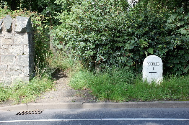
///shrimps.sigh.stolen. Near Peebles, Scottish Borders

Related Wikis

Venlaw

Venlaw Castle, also known as Smithfield Castle, lies north of Peebles on the Edinburgh Road in the Borders of Scotland. Since 1949, it has been operated...

Peebles railway station (1855)

Peebles railway station was the first site of the railway station in Peebles, Scottish Borders, Scotland from 1855 to 1962 on the Peebles Railway. ��2...

Peebles railway station (1864)

Peebles railway station was the second site of the railway station in Peebles, Peeblesshire, Scotland from 1864 to 1962 on the Peebles Railway. == History... ==

County Buildings, Peebles

County Hall is a municipal structure in Rosetta Road in Peebles, Scotland. The building, which was the meeting place of Peeblesshire County Council, is...

Peebles Hydro

Peebles Hydro is an early 20th century hotel and spa resort in Peebles, in the historic county of Peebles-shire in the Scottish Borders. It is one of...

Peebles

Peebles (Scottish Gaelic: Na Pùballan) is a town in the Scottish Borders, Scotland. It was historically a royal burgh and the county town of Peeblesshire...

Chambers Institution

The Chambers Institution is a municipal structure in the High Street in Peebles, Scotland. The structure, which was designed to accommodate a library,...

Peebles Old Parish Church

The Old Parish Church of Peebles is one of several Christian churches in Peebles, Borders, Scotland. It is a congregation of the Church of Scotland....

Nearby Amenities

Located within 500m of 55.661478,-3.1828936
Man Made: tower
Lat/Long: 55.6590988/-3.1802033
Ven Law Hill
Ele: 311
Natural: peak
Lat/Long: 55.6573844/-3.180198
Smithfield Castle
Historic: archaeological_site
Lat/Long: 55.6588884/-3.1890509
Addr City: Peebles
Addr Housename: Garage Cottage
Addr Street: Edinburgh Road
Lat/Long: 55.6599471/-3.1891349
Addr City: Peebles
Addr Housename: The Steading
Addr Street: Edinburgh Road
Lat/Long: 55.6597849/-3.1892679
The data included in this document is from www.openstreetmap.org. The data is made available under ODbL.

Have you been to Cistern Strip?

Leave your review of Cistern Strip below (or comments, questions and feedback).