Bank Clump

Wood, Forest in Perthshire

Scotland

Bank Clump

Reedbeds at Port Allen
Reedbeds at Port Allen Credit: Mike Pennington

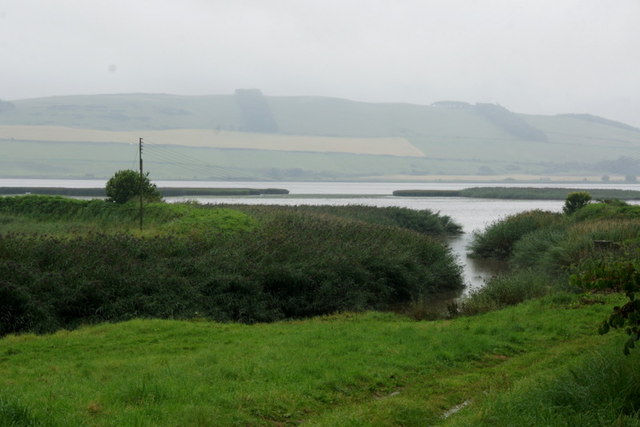
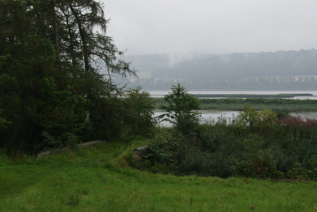
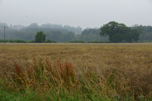
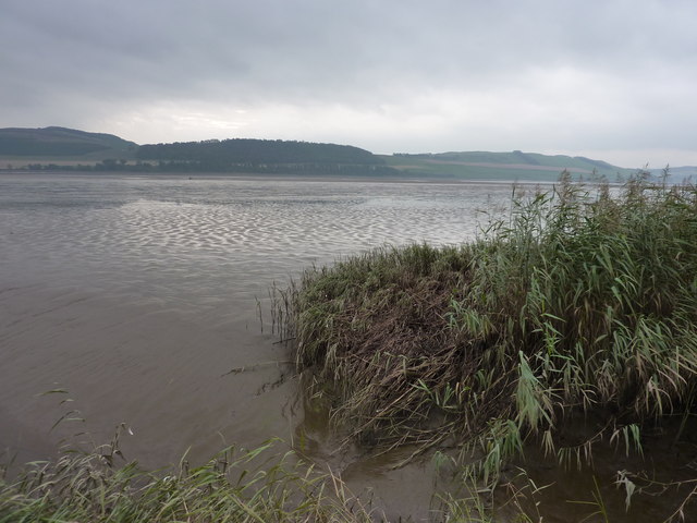
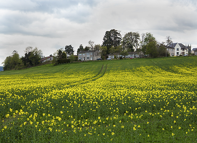
Bank Clump is a picturesque woodland area located in Perthshire, Scotland. Nestled amidst the stunning natural beauty of the region, this forested area is a popular destination for nature lovers and outdoor enthusiasts.

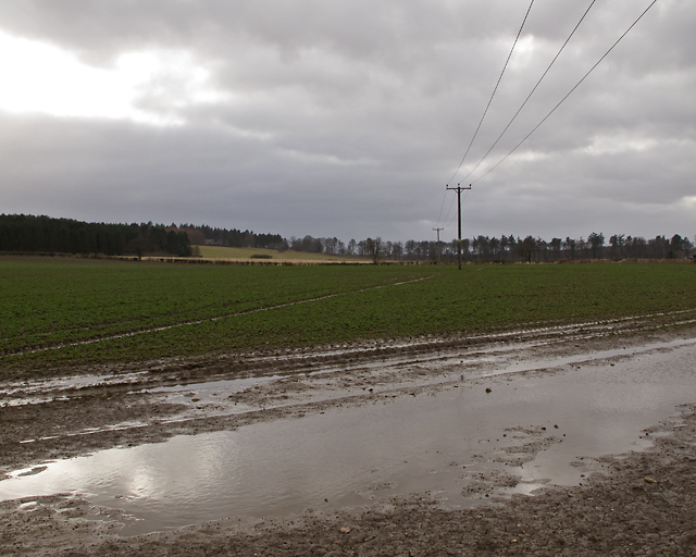
Stretching across a vast expanse, Bank Clump is characterized by its dense and diverse tree cover. The woodland is predominantly composed of native species such as oak, birch, and pine, creating a rich and vibrant ecosystem. The trees provide a haven for a wide variety of flora and fauna, making it a haven for birdwatchers and wildlife enthusiasts.

Visitors to Bank Clump can explore the forest through a network of well-maintained trails and paths, suitable for both leisurely walks and more challenging hikes. The peaceful ambiance of the woodland makes it an ideal spot for relaxation and contemplation, away from the hustle and bustle of city life.

In addition to its natural beauty, Bank Clump also offers various recreational activities. The forest is equipped with picnic areas, allowing visitors to enjoy a delightful outdoor meal amidst the tranquil surroundings. Camping facilities are also available, offering the opportunity to spend a night under the starry sky in the heart of nature.

Bank Clump is easily accessible, with ample parking facilities and well-signposted entrances. The forest is open to the public year-round, and admission is free. Whether it's a leisurely walk, birdwatching, or simply soaking in the serenity of the woodland, Bank Clump is a must-visit destination for those seeking to connect with nature in Perthshire.

If you have any feedback on the listing, please let us know in the comments section below.
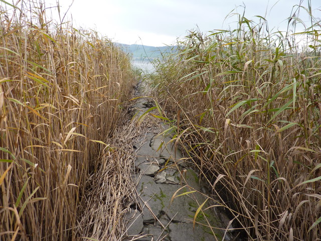
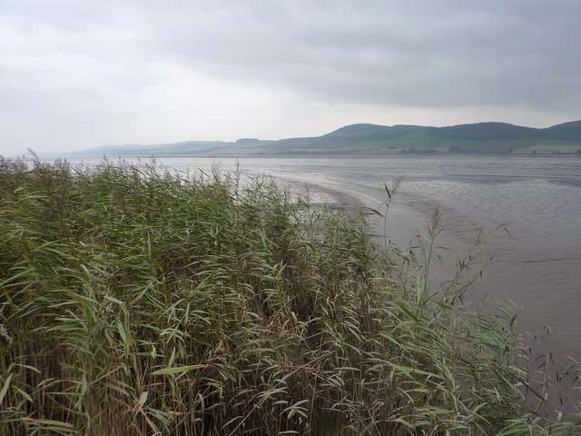
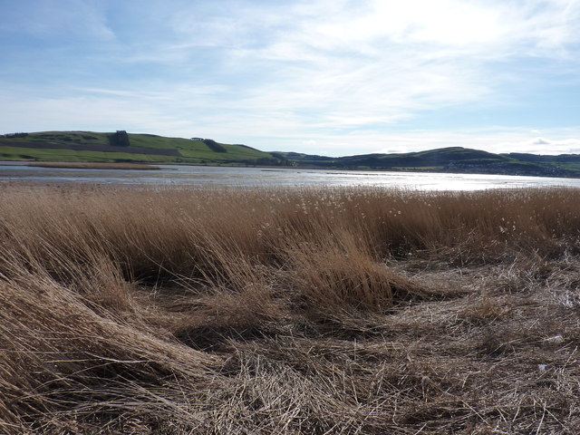
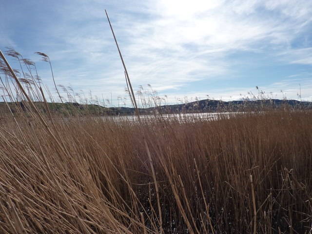
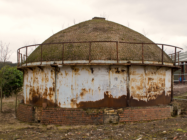
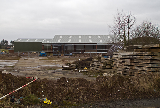
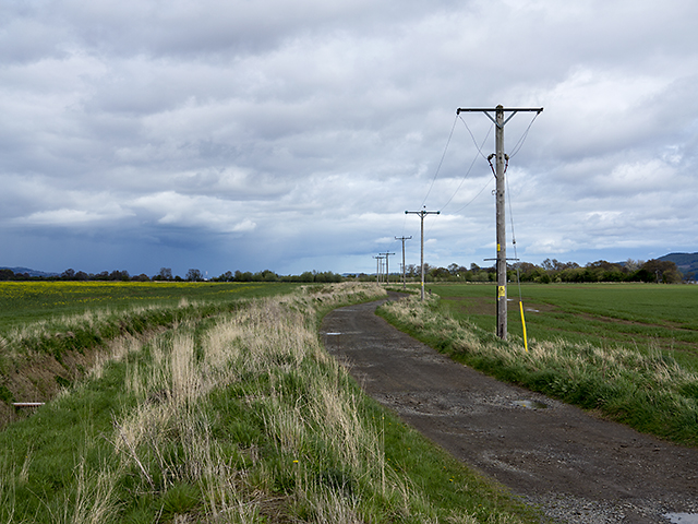
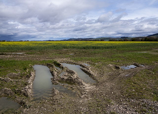
Bank Clump Images

Images are sourced within 2km of 56.387226/-3.2153418 or Grid Reference NO2522. Thanks to Geograph Open Source API. All images are credited.

Reedbeds at Port Allen
Reedbeds at Port Allen The stone bridge crosses a small creek.
Reedbeds at Port Allen
The stone bridge crosses a small creek.
Fields at Port Allen
Mud banks in the Tay Estuary This mud bank is the Sure as Death Bank. It gave its name to the net fishing  station of that name (or was it the other way round ?) I am standing on the end of an old sewage pipe encased in stones and concrete, marked on the map as "breakwater", having struggled through several hundred yards of a jungle of 8 foot high reeds.

From Fife place name data <span class="nowrap"><a title="http://fife-placenames.glasgow.ac.uk/placename/?id=2818" rel="nofollow ugc noopener" href="http://fife-placenames.glasgow.ac.uk/placename/?id=2818">Link</a><img style="margin-left:2px;" alt="External link" title="External link - shift click to open in new window" src="https://s1.geograph.org.uk/img/external.png" width="10" height="10"/></span> : "While it might be reasonable to suppose that this ominously named sand-bank in the Tay posed a deadly danger to shipping, the explanation given in OS Name Book (39, 4) is humorous and benign: ‘ A small sand bank visible at low water; and is insulated. It is so called from the fisherman who first fished on it having asserted that he caught fish on it; and then confirmed it by the common phrase “Sure as death, I have.”’"
Mud banks in the Tay Estuary
This mud bank is the Sure as Death Bank. It gave its name to the net fishing station of that name (or was it the other way round ?) I am standing on the end of an old sewage pipe encased in stones and concrete, marked on the map as "breakwater", having struggled through several hundred yards of a jungle of 8 foot high reeds. From Fife place name data LinkExternal link : "While it might be reasonable to suppose that this ominously named sand-bank in the Tay posed a deadly danger to shipping, the explanation given in OS Name Book (39, 4) is humorous and benign: ‘ A small sand bank visible at low water; and is insulated. It is so called from the fisherman who first fished on it having asserted that he caught fish on it; and then confirmed it by the common phrase “Sure as death, I have.”’"
Getting to the end of the sewage pipe marked "breakwater" on the map Tay estuary coming into sight.
Getting to the end of the sewage pipe marked "breakwater" on the map
Tay estuary coming into sight.
Reed beds and mud banks in the Tay Estuary
Reed beds and mudbanks in the Tay Estuary A supplemental image taken when standing on the stone and earth embankment which would have formed the "harbour" of Port Allen. The reeds are last year's growth partly flattened by the Winter, and the mudbanks are showing up well as it is a particularly low tide.
Reed beds and mudbanks in the Tay Estuary
A supplemental image taken when standing on the stone and earth embankment which would have formed the "harbour" of Port Allen. The reeds are last year's growth partly flattened by the Winter, and the mudbanks are showing up well as it is a particularly low tide.
In the reed beds of the Tay I'm standing on the matted remains of some of last year's reeds ( holding me above water ) with my camera held above my head, to give you as best a view of the Tay mudbanks as I can from that position.
In the reed beds of the Tay
I'm standing on the matted remains of some of last year's reeds ( holding me above water ) with my camera held above my head, to give you as best a view of the Tay mudbanks as I can from that position.
The reed beds at eye level
Masonic Lodge, Errol Lodge The Carse of Gowrie No.871, Errol, Perthshire, Scotland.
Masonic Lodge, Errol
Lodge The Carse of Gowrie No.871, Errol, Perthshire, Scotland.
Entrance gates to Errol Park At Errol in Perthshire
Entrance gates to Errol Park
At Errol in Perthshire
High Street, Errol The High Street in Errol, with a number of buildings constructed of brick - a brickworks once operated nearby at Inchcoonins - see Geograph image <a href="https://www.geograph.org.uk/photo/143633">NO2323 : Brick and Tile Works</a>.
High Street, Errol
The High Street in Errol, with a number of buildings constructed of brick - a brickworks once operated nearby at Inchcoonins - see Geograph image NO2323 : Brick and Tile Works.
Farmland near Inchcoonans Farmland near Inchcoonans, waterlogged in places after several days of wet weather.
Farmland near Inchcoonans
Farmland near Inchcoonans, waterlogged in places after several days of wet weather.
Beehive kiln, Inchcoonans One of two beehive kilns at the disused brickworks in Inchcoonans - now listed buildings(*). These were capable of firing up to 100,000 bricks simultaneously. A number of brickworks were situated in this area - an example of the relationship between geology and land use - local deposits of alluvial clay can be seen on the Geology of Britain viewer: <span class="nowrap"><a title="http://mapapps.bgs.ac.uk/geologyofbritain/home.html" rel="nofollow ugc noopener" href="http://mapapps.bgs.ac.uk/geologyofbritain/home.html">Link</a><img style="margin-left:2px;" alt="External link" title="External link - shift click to open in new window" src="https://s1.geograph.org.uk/img/external.png" width="10" height="10"/></span>

* Reference: British Listed Buildings; Inchcoonans Road, Errol Brick Company Brick Stacks and Kilns, Errol. <span class="nowrap"><a title="http://www.britishlistedbuildings.co.uk/sc-48180-inchcoonans-road-errol-brick-company-bric" rel="nofollow ugc noopener" href="http://www.britishlistedbuildings.co.uk/sc-48180-inchcoonans-road-errol-brick-company-bric">Link</a><img style="margin-left:2px;" alt="External link" title="External link - shift click to open in new window" src="https://s1.geograph.org.uk/img/external.png" width="10" height="10"/></span>
Beehive kiln, Inchcoonans
One of two beehive kilns at the disused brickworks in Inchcoonans - now listed buildings(*). These were capable of firing up to 100,000 bricks simultaneously. A number of brickworks were situated in this area - an example of the relationship between geology and land use - local deposits of alluvial clay can be seen on the Geology of Britain viewer: LinkExternal link * Reference: British Listed Buildings; Inchcoonans Road, Errol Brick Company Brick Stacks and Kilns, Errol. LinkExternal link
Inchcoonans brickworks site The former brickworks at Inchcoonans - with new building work in progress in March 2013.
Inchcoonans brickworks site
The former brickworks at Inchcoonans - with new building work in progress in March 2013.
Track near New Farm A track running through farmland towards the north bank of the River Tay - now part of a footpath around the village of Errol.
Track near New Farm
A track running through farmland towards the north bank of the River Tay - now part of a footpath around the village of Errol.
Agricultural land near New Farm Farmland north of the River Tay, with oilseed rape just coming into flower in May 2013.
Agricultural land near New Farm
Farmland north of the River Tay, with oilseed rape just coming into flower in May 2013.
View towards Errol Housing in the village of Errol, viewed over the fields of New Farm, with oilseed rape coming into flower.
View towards Errol
Housing in the village of Errol, viewed over the fields of New Farm, with oilseed rape coming into flower.
Show me another place!

Bank Clump is located at Grid Ref: NO2522 (Lat: 56.387226, Lng: -3.2153418)

Unitary Authority: Perth and Kinross

Police Authority: Tayside

What 3 Words

///lists.tailed.direction. Near Errol, Perth & Kinross

Nearby Locations

Bank Clump Errol

Related Wikis

Errol, Perth and Kinross

Errol is a village in Perth and Kinross, Scotland about halfway between Dundee and Perth. It is one of the principal settlements of the Carse of Gowrie...

Errol railway station

Errol railway station served the village of Errol, Perth and Kinross, Scotland, from 1847 to 1985 on the Dundee and Perth Railway. == History == The station...

Megginch Castle

Megginch Castle is a 15th-century castle in Perth and Kinross, in central Scotland. It was the family home of Cherry, 16th Baroness Strange. It is now...

RAF Errol

Royal Air Force Errol or more simply RAF Errol is a former Royal Air Force station located near the village of Errol in Perth & Kinross, Scotland, on the...

Nearby Amenities

Located within 500m of 56.387226,-3.2153418
Errol
Is In: Perthshire
Place: village
Population: 1500
Wikidata: Q5395549
Wikipedia: en:Errol, Perth and Kinross
Lat/Long: 56.3913112/-3.2152506
Restaurant
Rattrays
Lat/Long: 56.391171/-3.2151441
Toilets
Lat/Long: 56.3912007/-3.2151119
Well
Designation: Well
Man Made: water_tank
Source: OS 1861
Lat/Long: 56.3911819/-3.2122197
Well
Man Made: water_tank
Lat/Long: 56.3914535/-3.2147168
Well
Man Made: water_tank
Source: OS 1861
Lat/Long: 56.3914565/-3.2173239
Spar
Addr Postcode: PH2 7QW
Brand: Spar
Brand Wikidata: Q610492
Brand Wikipedia: en:Spar (retailer)
Shop: convenience
Website: https://www.spar.co.uk/store-locator/lan16050-spar-errol/
Lat/Long: 56.3911387/-3.2153623
Alan Dobbie Butcher
Addr City: Errol
Addr Postcode: PH2 7QW
Shop: butcher
Lat/Long: 56.3911492/-3.2154777
Well
Designation: Well
Man Made: water_tank
Source: 1898 OS 25"
Lat/Long: 56.3895372/-3.2107207
Well
Designation: Well
Man Made: water_tank
Source: 1898 OS 25"
Lat/Long: 56.3893695/-3.2102701
Bench
Lat/Long: 56.3899792/-3.2152022
Tourism: viewpoint
Lat/Long: 56.3900089/-3.215524
Cistern Green viewpoint to the estuary
Tourism: viewpoint
Lat/Long: 56.3895086/-3.210837
Cafe
The Lass O'Gowrie
Lat/Long: 56.3910715/-3.2159847
The Cross and Old Drinking Trough
Historic: memorial
Memorial: mercat_cross
Lat/Long: 56.3912865/-3.2153328
Post Box
Collection Times: Mo-Fr 09:00; Sa 07:00
Manufacturer: W T Allen & Co. London
Operator: Royal Mail
Post Box Mounting: brick_wall
Post Box Type: wall
Ref: PH2 35D
Royal Cypher: VR
Royal Cypher Wikidata: Q33102356
Source: survey;local knowledge
Lat/Long: 56.391076/-3.2160752
Well
Designation: Well
Man Made: water_tank
Source: OS 25" 2nd ed 1898
Lat/Long: 56.3909042/-3.2117342
Well
Designation: Well
Man Made: water_tank
Source: OS 25" 2nd ed 1898
Lat/Long: 56.3902688/-3.2139497
Well
Designation: Well
Man Made: water_tank
Source: OS 25" nd ed 1898
Lat/Long: 56.3906696/-3.2126569
Bus Stop
Bench: yes
Naptan AtcoCode: 64801738
Naptan NaptanCode: 73725687
Shelter: yes
Lat/Long: 56.3910423/-3.2162586
Building: terrace
Lat/Long: 56.3912227/-3.2179571
Bus Stop
Cross
Bench: no
Bus: yes
Naptan AtcoCode: 64801737
Naptan NaptanCode: 73723565
Public Transport: platform
Shelter: no
Lat/Long: 56.3910815/-3.2164194
Bench
Lat/Long: 56.3903824/-3.2119332
Atm
Opening Hours: 24/7
Lat/Long: 56.3911564/-3.2154
Power: pole
Lat/Long: 56.3837464/-3.2106002
Power: pole
Lat/Long: 56.3838555/-3.2115112
Public Bookcase
Booth: K6
Disused Amenity: telephone
Man Made: telephone_box
Public Bookcase Type: phone_box
Lat/Long: 56.3912485/-3.2150786
Information: board
Tourism: information
Lat/Long: 56.3912568/-3.2151149
The data included in this document is from www.openstreetmap.org. The data is made available under ODbL.

Have you been to Bank Clump?

Leave your review of Bank Clump below (or comments, questions and feedback).