Maille Knowe Plantation
Wood, Forest in Dumfriesshire
Scotland
Maille Knowe Plantation

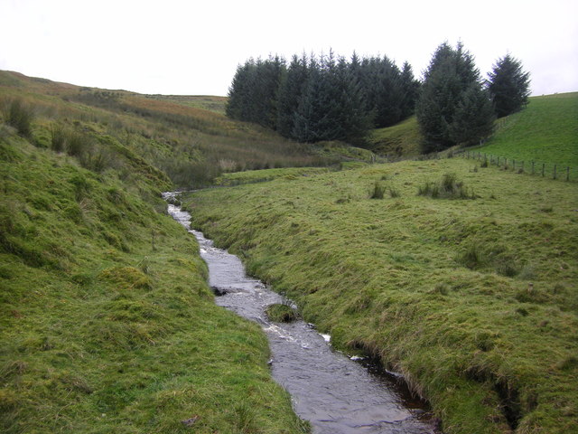
Maille Knowe Plantation is a picturesque woodland located in Dumfriesshire, Scotland. Covering an area of approximately 100 acres, it is renowned for its natural beauty and diverse ecosystem. The plantation is situated near the small village of Moniaive, offering visitors a tranquil and serene environment.
The woodland is predominantly composed of native Scottish tree species, including oak, birch, and beech. These tall, majestic trees create a dense canopy, providing a habitat for a wide variety of wildlife. The undergrowth is rich and diverse, with a carpet of ferns, mosses, and wildflowers, adding to the enchanting atmosphere.
Walking trails weave through the plantation, allowing visitors to explore its hidden treasures. The paths are well-maintained and suitable for all abilities, making it an ideal destination for nature enthusiasts, hikers, and families. Along the trails, there are informative signs highlighting the different tree species and wildlife that can be found in the area.
The plantation is home to a myriad of wildlife, including red squirrels, badgers, and a variety of bird species. Birdwatchers can spot woodpeckers, owls, and a range of woodland songbirds. The peaceful surroundings and absence of urban noise make it an ideal location for birdwatching and wildlife photography.
Overall, Maille Knowe Plantation offers a captivating woodland experience that showcases the natural beauty of Dumfriesshire. Its well-maintained trails, diverse wildlife, and stunning tree canopy make it a popular destination for nature lovers seeking an escape into the Scottish wilderness.
If you have any feedback on the listing, please let us know in the comments section below.
Maille Knowe Plantation Images
Images are sourced within 2km of 55.286665/-3.190409 or Grid Reference NY2499. Thanks to Geograph Open Source API. All images are credited.


Maille Knowe Plantation is located at Grid Ref: NY2499 (Lat: 55.286665, Lng: -3.190409)
Unitary Authority: Dumfries and Galloway
Police Authority: Dumfries and Galloway
What 3 Words
///exhales.necks.interacts. Near Bentpath, Dumfries & Galloway
Nearby Locations
Related Wikis

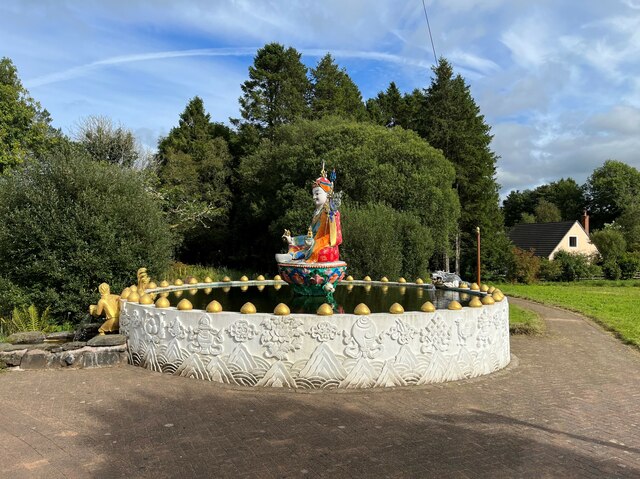
Kagyu Samye Ling Monastery and Tibetan Centre
Kagyu Samye Ling Monastery and Tibetan Centre is a Tibetan Buddhist complex associated with the Karma Kagyu school located at Eskdalemuir, Scotland....
Eskdalemuir
Eskdalemuir is a civil parish and small village in Dumfries and Galloway, Scotland, with a population of 265. It is around 10 miles (16 km) north-west...

Holm, Inverness
Holm is a small residential area in the south of the city of Inverness, Scotland. The area lies east of the River Ness. The most prominent structure in...

Eskdalemuir Observatory
The Eskdalemuir Observatory is a UK national environmental observatory located near Eskdalemuir, Dumfries and Galloway, Scotland. Along with Lerwick and...

Eskdalemuir Forest
Eskdalemuir Forest is a forest north of Eskdalemuir, Dumfries and Galloway, in southern Scotland. It was created as a private enterprise by the Economic...

Loupin Stanes
The Loupin Stanes (grid reference NY25709663) is a stone circle near Eskdalemuir, Dumfries and Galloway. Oval in shape, it consists of twelve stones set...

Girdle Stanes
The Girdle Stanes (grid reference NY 25351 96153) is a stone circle near Eskdalemuir, Dumfries and Galloway. The western portion of the circle has been...

Castle O'er Forest
Castle O'er Forest is a forest south of Eskdalemuir, Dumfries and Galloway, in southern Scotland.It is bisected by the River Esk. Eskdalemuir Forest adjoins...
Nearby Amenities
Located within 500m of 55.286665,-3.190409Have you been to Maille Knowe Plantation?
Leave your review of Maille Knowe Plantation below (or comments, questions and feedback).