Deepsyke Forest

Wood, Forest in Peeblesshire

Scotland

Deepsyke Forest

Pyramidal Obelisk near West Linton Well, it probably can't officially be called an obelisk, due to having such sloping sides, but its only description on a map is 'pillar' (this only shows up on very detailed online mapping, which is a bit odd considering the size of the structure) which is probably even less accurate a term.
The real conundrum with this thing regards what it is doing here in the first place! Investigations weren't that straightforward, but OS maps from around 1910 show the route of a pipeline, or 'conduit' as they put it, right at the spot of the obelisk. The pipeline runs underground (apart from occasional aqueducts) so it seems a little odd for it to get plotted on maps. It takes water from the two mile long Talla Reservoir, a good way south of here, to southern Edinburgh, and its overall length is around 35 miles.
Although online information is a bit sketchy there are mentions of similar structures along the pipe's route. Apparently they are surveying towers. As the water gets to its destination solely by gravity accuracy was obviously required, but this still doesn't really explain why it is so grand. My best guess is that because the money required to convert a small water body into a massive reservoir was so huge, the money spent on these was just a drop in the ocean. Plus railway lines had to be constructed from various places to transport materials for the building of the reservoir at the turn of the 20th century. As with everything railway-related, there is a colossal amount of online information regarding them.
Thinking information about the structure would be readily available online I didn't bother measuring it, but I reckon it's around 20 feet high with a four foot square base. There were no obvious markings.
Pyramidal Obelisk near West Linton Credit: Ian Dodds

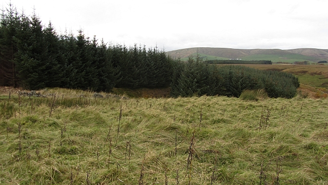
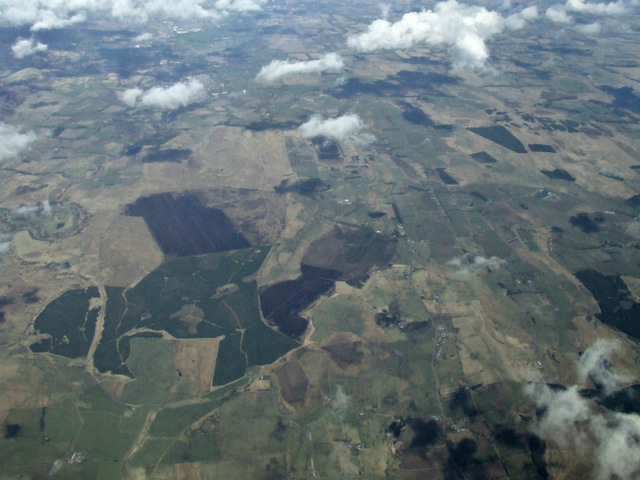
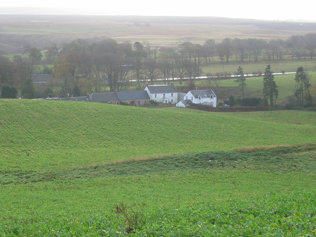
Deepsyke Forest is a picturesque woodland located in Peeblesshire, Scotland. Covering an expansive area, the forest is a haven for nature enthusiasts and outdoor adventurers. With its diverse range of flora and fauna, Deepsyke Forest offers a serene escape from the hustle and bustle of daily life.

The forest is predominantly made up of dense woodlands, with towering trees creating a canopy that filters sunlight and creates a mystical ambiance. The lush undergrowth is home to a variety of plant species, including ferns, bluebells, and wild mushrooms. The forest floor is carpeted with a thick layer of moss, adding to its enchanting appeal.

Deepsyke Forest is home to numerous animal species, making it a popular spot for wildlife enthusiasts. Visitors may have the chance to spot red squirrels, roe deer, and various bird species, including woodpeckers and owls. With its abundance of wildlife, the forest offers a unique opportunity for nature lovers to observe and appreciate the area's biodiversity.

The forest is crisscrossed by a network of well-maintained trails, making it ideal for hiking and walking. These pathways lead visitors through the heart of the forest, offering breathtaking views and ample opportunities for exploration. Additionally, the forest is intersected by a tranquil stream, adding to the tranquility of the surroundings.

Deepsyke Forest is a true gem in Peeblesshire, offering visitors a chance to immerse themselves in nature's beauty. Whether it's a leisurely stroll, birdwatching, or simply taking in the peaceful atmosphere, this woodland sanctuary has something to offer everyone seeking solace in the great outdoors.

If you have any feedback on the listing, please let us know in the comments section below.

Deepsyke Forest Images

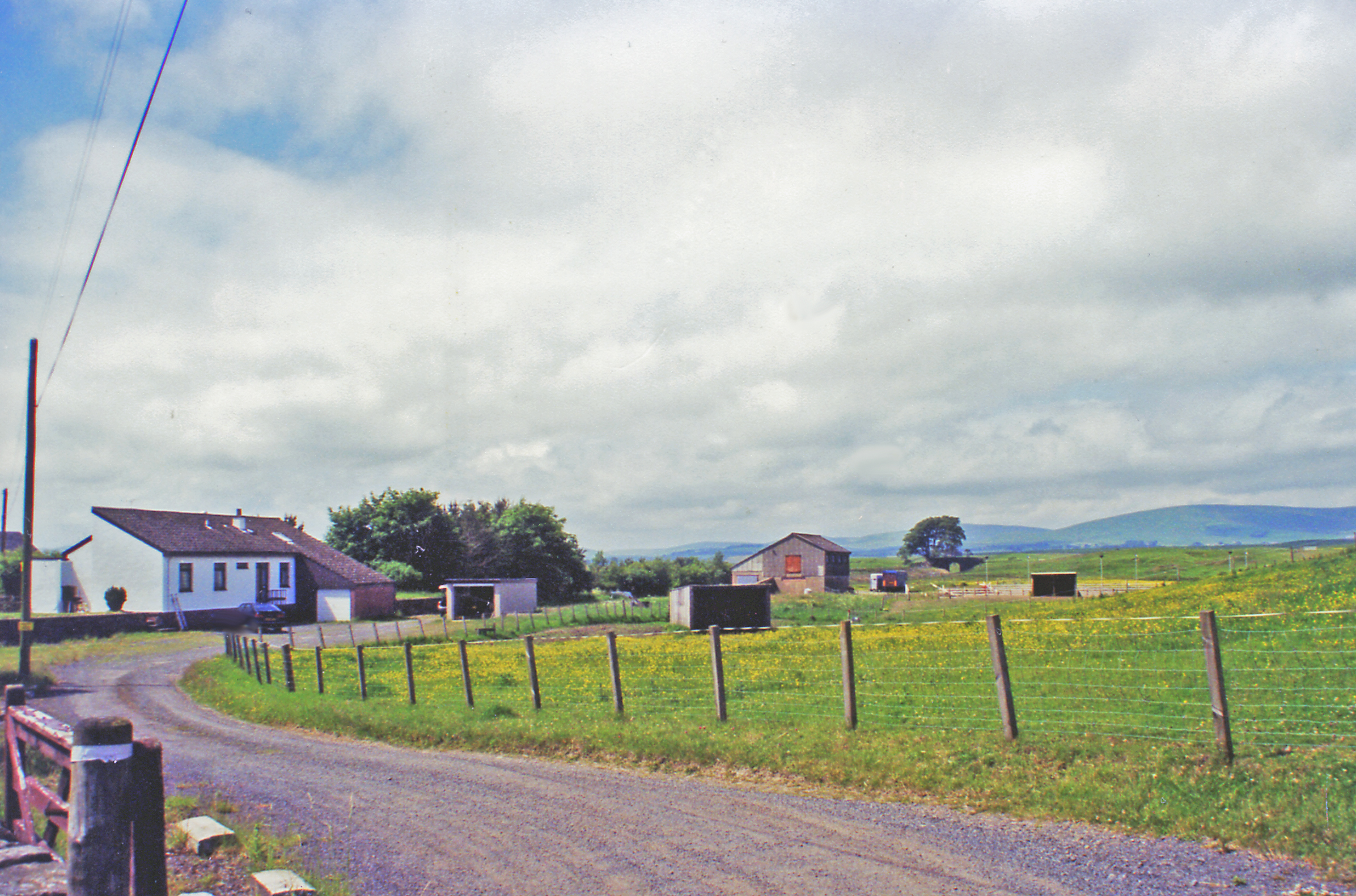
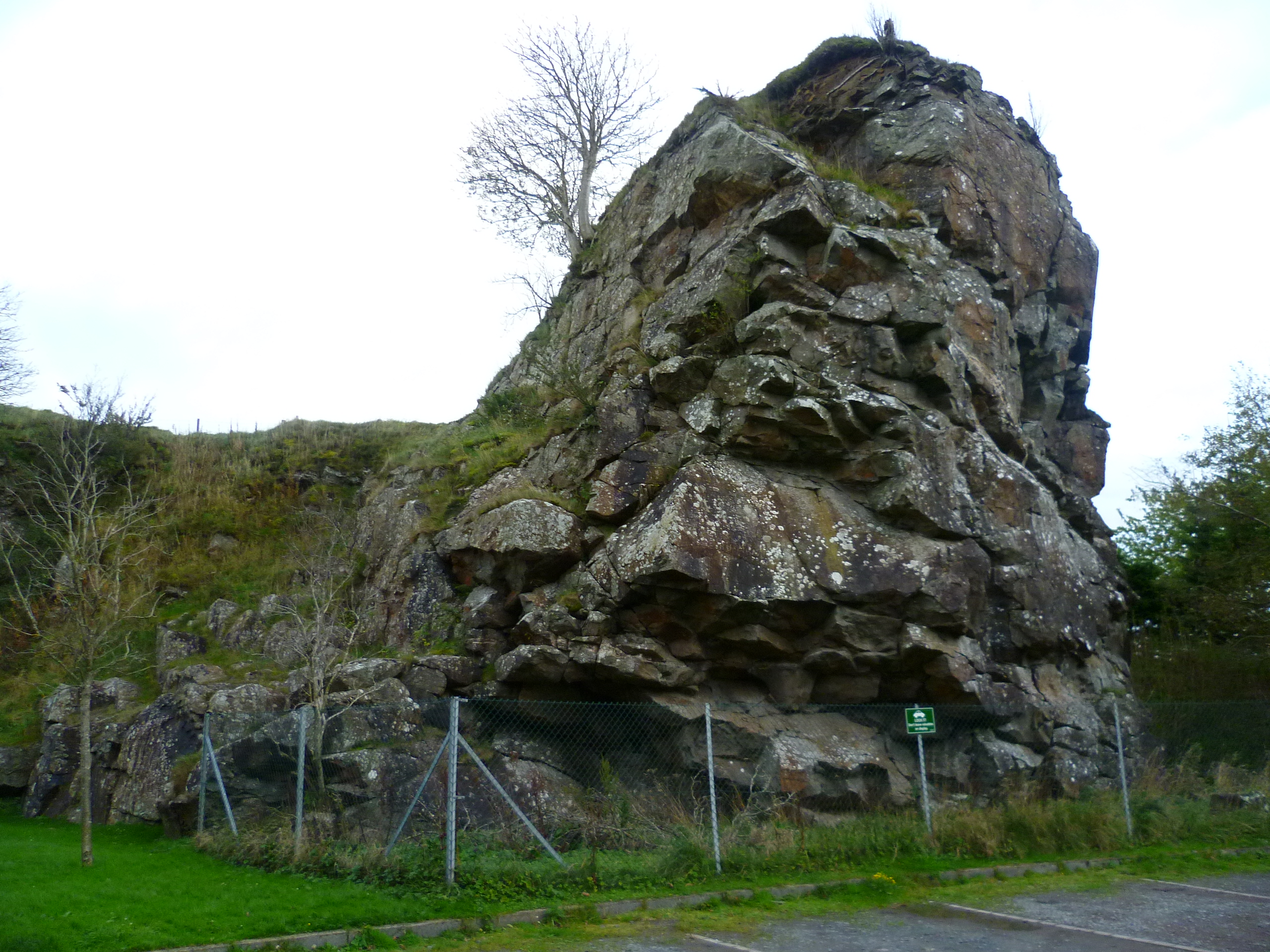
Images are sourced within 2km of 55.771761/-3.301103 or Grid Reference NT1853. Thanks to Geograph Open Source API. All images are credited.

Pyramidal Obelisk near West Linton Well, it probably can't officially be called an obelisk, due to having such sloping sides, but its only description on a map is 'pillar' (this only shows up on very detailed online mapping, which is a bit odd considering the size of the structure) which is probably even less accurate a term.
The real conundrum with this thing regards what it is doing here in the first place! Investigations weren't that straightforward, but OS maps from around 1910 show the route of a pipeline, or 'conduit' as they put it, right at the spot of the obelisk. The pipeline runs underground (apart from occasional aqueducts) so it seems a little odd for it to get plotted on maps. It takes water from the two mile long Talla Reservoir, a good way south of here, to southern Edinburgh, and its overall length is around 35 miles.
Although online information is a bit sketchy there are mentions of similar structures along the pipe's route. Apparently they are surveying towers. As the water gets to its destination solely by gravity accuracy was obviously required, but this still doesn't really explain why it is so grand. My best guess is that because the money required to convert a small water body into a massive reservoir was so huge, the money spent on these was just a drop in the ocean. Plus railway lines had to be constructed from various places to transport materials for the building of the reservoir at the turn of the 20th century. As with everything railway-related, there is a colossal amount of online information regarding them.
Thinking information about the structure would be readily available online I didn't bother measuring it, but I reckon it's around 20 feet high with a four foot square base. There were no obvious markings.
Pyramidal Obelisk near West Linton
Well, it probably can't officially be called an obelisk, due to having such sloping sides, but its only description on a map is 'pillar' (this only shows up on very detailed online mapping, which is a bit odd considering the size of the structure) which is probably even less accurate a term. The real conundrum with this thing regards what it is doing here in the first place! Investigations weren't that straightforward, but OS maps from around 1910 show the route of a pipeline, or 'conduit' as they put it, right at the spot of the obelisk. The pipeline runs underground (apart from occasional aqueducts) so it seems a little odd for it to get plotted on maps. It takes water from the two mile long Talla Reservoir, a good way south of here, to southern Edinburgh, and its overall length is around 35 miles. Although online information is a bit sketchy there are mentions of similar structures along the pipe's route. Apparently they are surveying towers. As the water gets to its destination solely by gravity accuracy was obviously required, but this still doesn't really explain why it is so grand. My best guess is that because the money required to convert a small water body into a massive reservoir was so huge, the money spent on these was just a drop in the ocean. Plus railway lines had to be constructed from various places to transport materials for the building of the reservoir at the turn of the 20th century. As with everything railway-related, there is a colossal amount of online information regarding them. Thinking information about the structure would be readily available online I didn't bother measuring it, but I reckon it's around 20 feet high with a four foot square base. There were no obvious markings.
Cows and bumps The picture was taken from the North wall of the 'Macbiehill' road. The bumps are a scheduled monument. Whilst there are numerous areas in this part of the Scottish Borders altered by early quarrying activity, this one has been singled out. So if you're prepared to mix it up with the cows there are traces of rare old limekilns somewhere out here. According to Historic Environment Scotland, the quarry was once one of the most profitable in Southern Scotland, and 'unusually' was worked by the owner - so there's a timeless business message there for us all.
The quarry was 'Bents Quarry' and the nearest hamlet is/was 'Lamancha'. In the deep distant past I used to deliver parcels round here. After mispronouncing the name several times I was informed that the 'ch' was silent: "like the 'ch' in 'chianti'."
Cows and bumps
The picture was taken from the North wall of the 'Macbiehill' road. The bumps are a scheduled monument. Whilst there are numerous areas in this part of the Scottish Borders altered by early quarrying activity, this one has been singled out. So if you're prepared to mix it up with the cows there are traces of rare old limekilns somewhere out here. According to Historic Environment Scotland, the quarry was once one of the most profitable in Southern Scotland, and 'unusually' was worked by the owner - so there's a timeless business message there for us all. The quarry was 'Bents Quarry' and the nearest hamlet is/was 'Lamancha'. In the deep distant past I used to deliver parcels round here. After mispronouncing the name several times I was informed that the 'ch' was silent: "like the 'ch' in 'chianti'."
Grassland off Deanfoot Road Grassland beneath the Pentland Hills.
Grassland off Deanfoot Road
Grassland beneath the Pentland Hills.
Deepsyke Forest The ride carrying the Penicuik road has been widened recently. There are plans for opencast coal mining in the area.
Deepsyke Forest
The ride carrying the Penicuik road has been widened recently. There are plans for opencast coal mining in the area.
Road in Deepsyke Forest A road between Penicuik and West Linton runs through the 1980s planted woodland on Harlaw Moss.
Road in Deepsyke Forest
A road between Penicuik and West Linton runs through the 1980s planted woodland on Harlaw Moss.
Edge of Deepsyke Forest The woodland edge on Harlaw Moor.
Edge of Deepsyke Forest
The woodland edge on Harlaw Moor.
Whitfield from Deanfoot Road With Deepsyke Forest in the distance.
Whitfield from Deanfoot Road
With Deepsyke Forest in the distance.
Mount Maw from Deanfoot Road Part of the Pentland Hills seen from the southeast after snow.
Mount Maw from Deanfoot Road
Part of the Pentland Hills seen from the southeast after snow.
The Pentland Hills from near West Linton Looking north from Deanfoot Road towards Paties and Spittal Hills and Green Law in the Pentlands.
The Pentland Hills from near West Linton
Looking north from Deanfoot Road towards Paties and Spittal Hills and Green Law in the Pentlands.
Deanfoot Road Between Whitfield and Upper Whitfield, heading towards Deepsyke Forest.
Deanfoot Road
Between Whitfield and Upper Whitfield, heading towards Deepsyke Forest.
Deepsyke Forest from the air Viewed from a Prague bound flight from Edinburgh. Auchencorth Moss peat works <a href="https://www.geograph.org.uk/photo/83363">NT1952 : Auchencorth Moss peat works.</a> can be seen adjoining the top of the forest.
Deepsyke Forest from the air
Viewed from a Prague bound flight from Edinburgh. Auchencorth Moss peat works NT1952 : Auchencorth Moss peat works. can be seen adjoining the top of the forest.
Deepsyke Forest from the air Viewed from a Prague bound flight from Edinburgh. Auchencorth Moss peat works <a href="https://www.geograph.org.uk/photo/83363">NT1952 : Auchencorth Moss peat works.</a> can be seen adjoining the forest.
Deepsyke Forest from the air
Viewed from a Prague bound flight from Edinburgh. Auchencorth Moss peat works NT1952 : Auchencorth Moss peat works. can be seen adjoining the forest.
The Cairn burn and meter house A tributary of the Lyne Water - not sure why this part is canalised and has a water meter house, but the whole area was heavily quarried and it may have something to do with that industrial history.
The Cairn burn and meter house
A tributary of the Lyne Water - not sure why this part is canalised and has a water meter house, but the whole area was heavily quarried and it may have something to do with that industrial history.
Collapsed shed near Cleaves Close to the canalised Cairn Burn.
Collapsed shed near Cleaves
Close to the canalised Cairn Burn.
Coaly Burn near Cleaves A tributary of the Cairn Burn, which in turn flows into the Lyne Water.
Coaly Burn near Cleaves
A tributary of the Cairn Burn, which in turn flows into the Lyne Water.
Cairn Burn Looking towards its source in Deepsyke Forest.
Cairn Burn
Looking towards its source in Deepsyke Forest.
An unassuming modern house near Lamancha But see it from the other side <a href="https://www.geograph.org.uk/photo/3856450">NT1852 : House, lost in a landscape</a>!
An unassuming modern house near Lamancha
But see it from the other side NT1852 : House, lost in a landscape!
House, lost in a landscape A reciprocal view to <a href="https://www.geograph.org.uk/photo/3856444">NT1852 : An unassuming modern house near Lamancha</a>.
House, lost in a landscape
Show me another place!

Deepsyke Forest is located at Grid Ref: NT1853 (Lat: 55.771761, Lng: -3.301103)

Unitary Authority: The Scottish Borders

Police Authority: The Lothians and Scottish Borders

What 3 Words

///stroke.spectacle.gems. Near West Linton, Scottish Borders

Nearby Locations

Deepsyke Forest

Related Wikis

Macbie Hill railway station

Macbie Hill railway station served the hamlet of Coalyburn, Peeblesshire, Scotland, from 1864 to 1933 on the Leadburn, Linton and Dolphinton Railway....

Lamancha railway station

Lamancha railway station served the hamlet of Lamancha, Peeblesshire, Scotland, from 1864 to 1933 on the Leadburn, Linton and Dolphinton Railway. ��2...

Carlops

Carlops (Scottish Gaelic: Leum na Caillich) is a small village in the Pentland Hills, within the Scottish Borders area of Scotland, close to the boundary...

Nine Mile Burn

Nine Mile Burn is a hamlet in Midlothian, Scotland, the last in Midlothian when heading south on the A702 road. It is located at the foot of the Pentland...

Nearby Amenities

Located within 500m of 55.771761,-3.301103
Deepsyke Forest
Place: locality
Lat/Long: 55.7738294/-3.3018586
The data included in this document is from www.openstreetmap.org. The data is made available under ODbL.

Have you been to Deepsyke Forest?

Leave your review of Deepsyke Forest below (or comments, questions and feedback).