Black Park Wood

Wood, Forest in Perthshire

Scotland

Black Park Wood

Middle Drimmie Farm Home to the Glenericht herd of Charolais cattle.  Glen Ericht lies beyond.
Middle Drimmie Farm Credit: Oliver Dixon

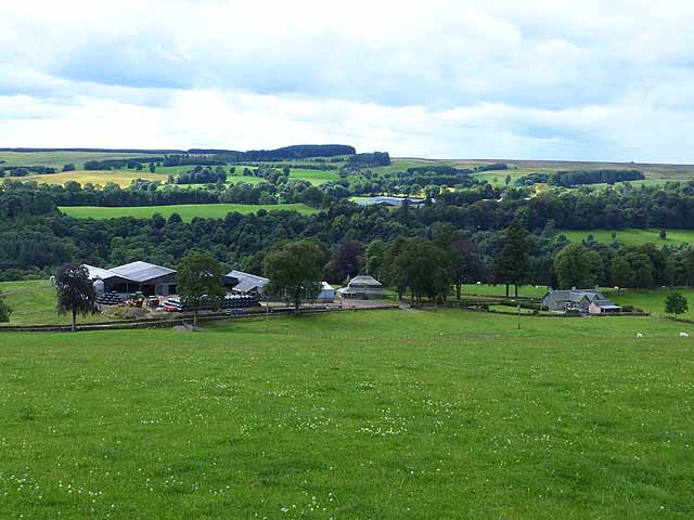
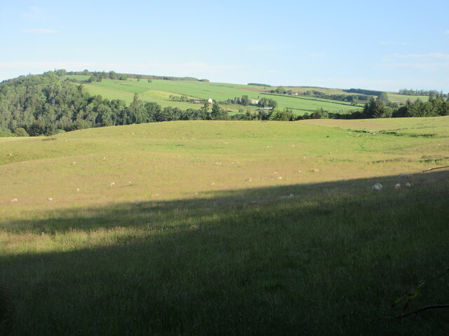
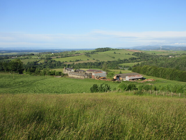
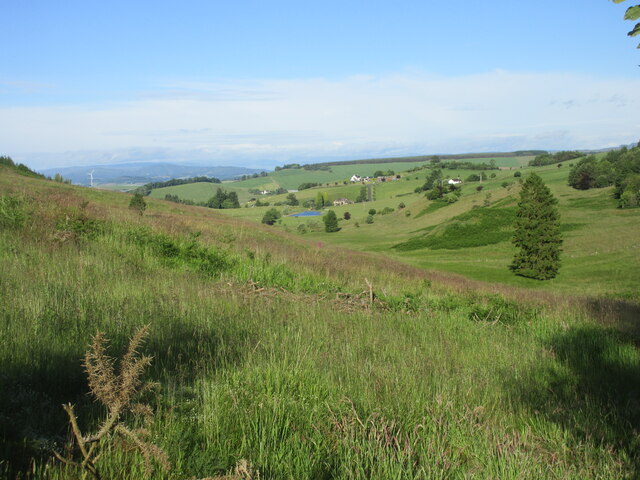
Black Park Wood is a stunning forest area located in Perthshire, Scotland. Spanning across an area of approximately 50 hectares, this wood is a haven for nature lovers and outdoor enthusiasts.

The wood is predominantly composed of native tree species, including oak, birch, and pine, which create a rich and diverse ecosystem. The dense canopy formed by these trees provides a cool and shaded environment, making it a perfect retreat during the hot summer months.

Walking through Black Park Wood, visitors can enjoy a network of well-maintained paths that meander through the forest, allowing for easy exploration of the area. Along these paths, one can find an abundance of wildlife, including various species of birds, squirrels, and deer. Birdwatchers can delight in spotting woodland birds such as woodpeckers, owls, and thrushes.

For those seeking a more adventurous experience, there are designated mountain biking trails that offer thrilling rides with challenging terrains. These trails have varying levels of difficulty to cater to riders of different abilities.

Black Park Wood is also home to a diverse range of plant species, including wildflowers and fungi, adding to the overall beauty and biodiversity of the area.

Overall, Black Park Wood offers visitors a serene escape from the hustle and bustle of urban life. With its stunning natural landscapes, diverse flora and fauna, and recreational opportunities, it is a must-visit destination for nature enthusiasts and outdoor adventurers alike.

If you have any feedback on the listing, please let us know in the comments section below.

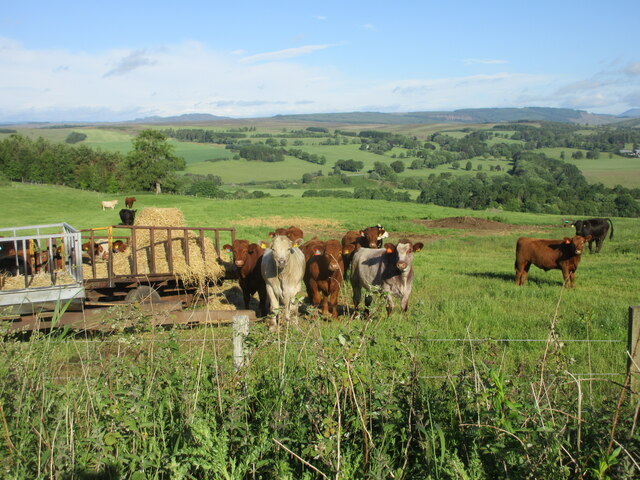
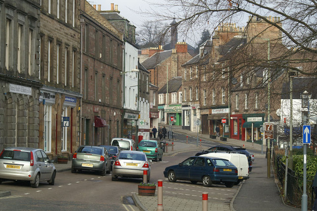
Black Park Wood Images

Images are sourced within 2km of 56.621599/-3.3364587 or Grid Reference NO1848. Thanks to Geograph Open Source API. All images are credited.

Middle Drimmie Farm Home to the Glenericht herd of Charolais cattle.  Glen Ericht lies beyond.
Middle Drimmie Farm
Home to the Glenericht herd of Charolais cattle. Glen Ericht lies beyond.
Middle Drimmie Farm Home to the Glenericht herd of Charolais cattle.  Glen Ericht lies beyond.
Middle Drimmie Farm
Home to the Glenericht herd of Charolais cattle. Glen Ericht lies beyond.
Western slopes of the Hill of Drimmie
Field in the sun Field dotted with sheep in the early morning sunshine, looking north-westwards from the Bonnington Road
Field in the sun
Field dotted with sheep in the early morning sunshine, looking north-westwards from the Bonnington Road
Looking down on Bonnington Bonnington Farm from the hillside above to the north-east.
Looking down on Bonnington
Bonnington Farm from the hillside above to the north-east.
Broad Moss Trig Pillar The triangulation pillar on Broad Moss, looking south-west.
Broad Moss Trig Pillar
The triangulation pillar on Broad Moss, looking south-west.
Mill Burn Valley Looking westwards along the small valley of the Mill Burn.
Mill Burn Valley
Looking westwards along the small valley of the Mill Burn.
Cattle near Kynballoch Cattle at a feeder on the roadside north of Kynballoch.
Cattle near Kynballoch
Cattle at a feeder on the roadside north of Kynballoch.
Roadside near East Drimmie Wild raspberries in abundance on the roadside near East Drimmie.
Roadside near East Drimmie
Wild raspberries in abundance on the roadside near East Drimmie.
Middle Drimmie Looking down on Middle Drimmie from the road to the north-east.
Middle Drimmie
Looking down on Middle Drimmie from the road to the north-east.
Hill of Drimmie The road only touches the corner of the square lightly and to get a representative image you have to go into rough ground or hold your camera up from the sunken lane.  Much of the ground around here is wooded, this bit is slowly being colonised by trees.
Hill of Drimmie
The road only touches the corner of the square lightly and to get a representative image you have to go into rough ground or hold your camera up from the sunken lane. Much of the ground around here is wooded, this bit is slowly being colonised by trees.
Minor road near to East Drimmie Looking north-westward.
Minor road near to East Drimmie
Looking north-westward.
Farm track leading to Hill of Drimmie Looking eastward.
Farm track leading to Hill of Drimmie
Looking eastward.
Middle Drimmie The gorge of the River Ericht is in the trees.
Middle Drimmie
The gorge of the River Ericht is in the trees.
West slopes of the Hill of Drimmie Damp rushy fields and scrub.
West slopes of the Hill of Drimmie
Damp rushy fields and scrub.
Woodland on Hill of Drimmie Mixed birch and conifer woodland. The Drumderg windfarm is in the distance.
Woodland on Hill of Drimmie
Mixed birch and conifer woodland. The Drumderg windfarm is in the distance.
Polytunnels, Rattray Between the Ericht and A93.  The hill is Mount Blair.
Polytunnels, Rattray
Between the Ericht and A93. The hill is Mount Blair.
A93, Mains of Mause A long tree lined section of the A93. There was not much traffic, but what there was was fast.
A93, Mains of Mause
A long tree lined section of the A93. There was not much traffic, but what there was was fast.
Show me another place!

Black Park Wood is located at Grid Ref: NO1848 (Lat: 56.621599, Lng: -3.3364587)

Unitary Authority: Perth and Kinross

Police Authority: Tayside

What 3 Words

///swerves.instincts.informs. Near Blairgowrie, Perth & Kinross

Related Wikis

Blairgowrie and Rattray

Blairgowrie and Rattray ( ) is a twin burgh in Perth and Kinross, Scotland. Locals refer to the town as "Blair". Blairgowrie is the larger of the two former...

Newton Castle

Newton Castle stands in its grounds near the town of Blairgowrie in Perth and Kinross, Scotland. It is a Category A listed building dating to the mid-16th...

Blairgowrie railway station

Blairgowrie railway station served the burgh of Blairgowrie and Rattray, Perth and Kinross, Scotland from 1855 to 1955 on the Scottish Midland Junction...

Blairgowrie F.C.

Blairgowrie Junior Football Club is a Scottish Junior football club based in Blairgowrie and Rattray, Perth and Kinross. Their home ground is Davie Park...

Blairgowrie Community Hospital

Blairgowrie Community Hospital is a health facility in Perth Road, Blairgowrie and Rattray, Scotland. It is managed by NHS Tayside. == History == The first...

River Ardle

The River Ardle (Scottish Gaelic: Abhainn Àrdail) is a tributary of the River Ericht. It runs for 10 miles (16 km) through Strathardle in Perthshire, Scotland...

Blairgowrie High School

Blairgowrie High School is a high school in Blairgowrie, Scotland. Blairgowrie High School has 719 students (as of September census) from Blairgowrie and...

Ardblair Castle

Ardblair Castle is an L-plan castle (with an added wing), dating from the 16th century, around 0.75 miles (1.21 km) west of Blairgowrie in Perth and Kinross...

Nearby Amenities

Located within 500m of 56.621599,-3.3364587
Power: pole
Lat/Long: 56.6222513/-3.3284476
Power: pole
Lat/Long: 56.619016/-3.330169
Power: pole
Lat/Long: 56.6221193/-3.3292161
Power: pole
Lat/Long: 56.6218465/-3.3294139
Power: pole
Lat/Long: 56.6215112/-3.3296345
The data included in this document is from www.openstreetmap.org. The data is made available under ODbL.

Have you been to Black Park Wood?

Leave your review of Black Park Wood below (or comments, questions and feedback).