Wilderness Wood

Wood, Forest in West Lothian

Scotland

Wilderness Wood

New estate, Dunfermline College Dunfermline College of Physical Education is still marked on the OS maps, it is now part of the University of Edinburgh and in new buildings at Holyrood. The site is being developed for housing.
New estate, Dunfermline College Credit: Richard Webb

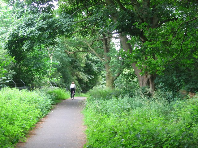
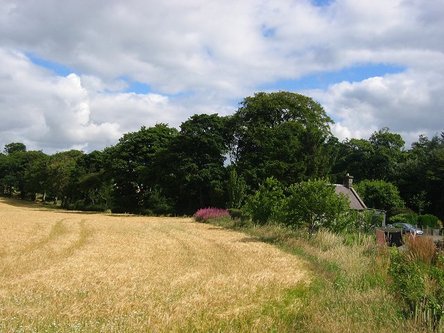
Wilderness Wood is a captivating forest located in West Lothian, Scotland. Spanning over a vast area, it offers a serene and unspoiled natural environment that is truly awe-inspiring. The wood is characterized by its dense vegetation, towering trees, and diverse wildlife, making it a haven for nature enthusiasts and outdoor adventurers.

As visitors explore the wood, they are greeted with a symphony of sounds from the chirping of birds to the rustling of leaves underfoot. The wood is home to a wide variety of flora and fauna, including native Scottish species such as oak, birch, and rowan trees. These trees provide a sheltered habitat for numerous animal species, including red squirrels, deer, and a plethora of bird species.

Walking through the wood, visitors can find themselves immersed in a peaceful and tranquil atmosphere, surrounded by the beauty of nature. The wood offers a network of well-maintained trails and pathways, allowing visitors to explore its hidden treasures, from enchanting glens to picturesque viewpoints.

In addition to its natural beauty, Wilderness Wood also plays a significant role in conservation efforts. The wood is managed sustainably, ensuring the preservation of its precious ecosystem for generations to come. It also serves as an educational resource, hosting workshops and events that promote environmental awareness and appreciation for the natural world.

Whether one seeks solitude and tranquility or an adventure-filled day exploring the outdoors, Wilderness Wood in West Lothian is a captivating destination that offers a truly immersive experience in nature's embrace.

If you have any feedback on the listing, please let us know in the comments section below.

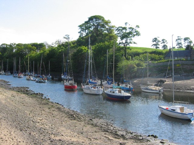
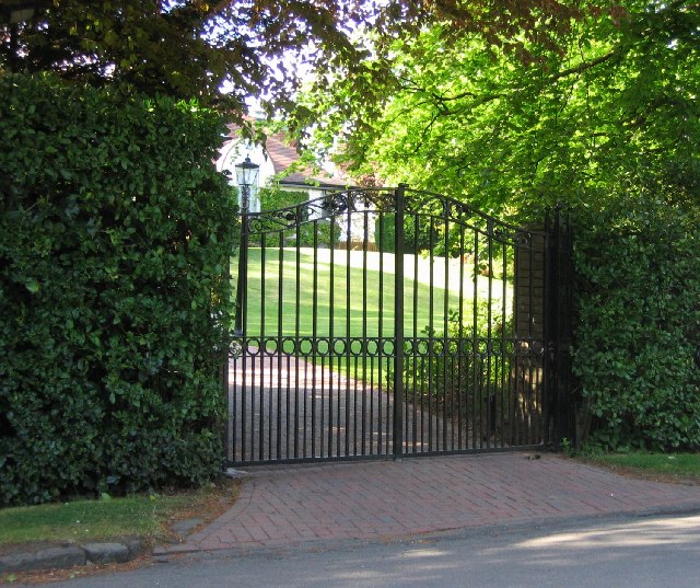
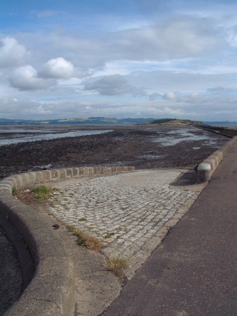
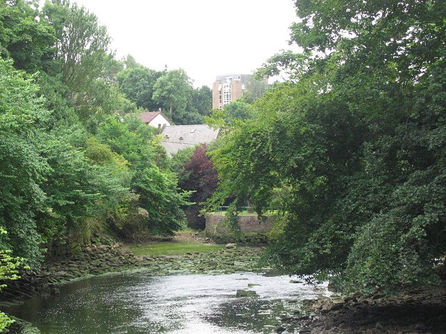
Wilderness Wood Images

Images are sourced within 2km of 55.978798/-3.3149223 or Grid Reference NT1876. Thanks to Geograph Open Source API. All images are credited.

New estate, Dunfermline College Dunfermline College of Physical Education is still marked on the OS maps, it is now part of the University of Edinburgh and in new buildings at Holyrood. The site is being developed for housing.
New estate, Dunfermline College
Dunfermline College of Physical Education is still marked on the OS maps, it is now part of the University of Edinburgh and in new buildings at Holyrood. The site is being developed for housing.
Old pipeline to Cramond Island Cramond island was fortified during WW2. A pipeline supplied water to the troops manning the guns protecting Rosyth Docks. This is now the line of a causeway to the island.
Old pipeline to Cramond Island
Cramond island was fortified during WW2. A pipeline supplied water to the troops manning the guns protecting Rosyth Docks. This is now the line of a causeway to the island.
River Almond, Cramond This is the estuary of the Almond, the river that divides the counties of Midlothian and West Lothian (Modern local authority areas differ). 
Cramond is popular tourist hangout in Edinburgh. Until 2001 there was a ferry here allowing you to walk to Queensferry, but the access hostile estate opposite closed it during the foot and mouth and quietly did not reopen it again.
River Almond, Cramond
This is the estuary of the Almond, the river that divides the counties of Midlothian and West Lothian (Modern local authority areas differ). Cramond is popular tourist hangout in Edinburgh. Until 2001 there was a ferry here allowing you to walk to Queensferry, but the access hostile estate opposite closed it during the foot and mouth and quietly did not reopen it again.
Electric gate country, Barnton Barnton is one of Edinburgh's most expensive housing areas. Big houses hidden behind gates set amongst golf courses.
Electric gate country, Barnton
Barnton is one of Edinburgh's most expensive housing areas. Big houses hidden behind gates set amongst golf courses.
River Almond at Cramond The slipway for the Cramond Boat Club leads down to the river.  Steps for the former passenger ferry can be seen in the middle distance.
River Almond at Cramond
The slipway for the Cramond Boat Club leads down to the river. Steps for the former passenger ferry can be seen in the middle distance.
Towards Cramond Island The River Almond at low tide, with Cramond Island at the end of the causeway
Towards Cramond Island
The River Almond at low tide, with Cramond Island at the end of the causeway
River Almond, Cramond Running through  deep banks a few hundred metres from its mouth at Cramond. There is a walkway up the East/Edinburgh bank.
River Almond, Cramond
Running through deep banks a few hundred metres from its mouth at Cramond. There is a walkway up the East/Edinburgh bank.
Cycle path, Barnton. Path between two well defended golf courses, now part of NCN1 up the east coast of Great Britain.  A useful way in and out of Edinburgh from the north and west.
The Barnton area contains many old trees especially oaks and this path runs through them. It also links two very expensive housing areas.
Cycle path, Barnton.
Path between two well defended golf courses, now part of NCN1 up the east coast of Great Britain. A useful way in and out of Edinburgh from the north and west. The Barnton area contains many old trees especially oaks and this path runs through them. It also links two very expensive housing areas.
New Burnshot Dalmeny Estate, a mixture of farmland and woods.
New Burnshot
Dalmeny Estate, a mixture of farmland and woods.
Burnshot Sheep grazing on the Dalmeny Estate
Burnshot
Sheep grazing on the Dalmeny Estate
A90, Craigie. Very busy road linking Edinburgh with the Forth Road Bridge and places north.
A90, Craigie.
Very busy road linking Edinburgh with the Forth Road Bridge and places north.
Estate road, Dalmeny. Track running through summer woodland growth between Dalmeny Home Farm and Dalmeny Village.
Estate road, Dalmeny.
Track running through summer woodland growth between Dalmeny Home Farm and Dalmeny Village.
Stubble field, Dalmeny. Field amongst the Dalmeny woodlands. It appears that there was not  a crop on here this year, and some limited ploughing has been done recently.
Stubble field, Dalmeny.
Field amongst the Dalmeny woodlands. It appears that there was not a crop on here this year, and some limited ploughing has been done recently.
Cramond from the west. Across harvested fields on the Dalmeny Estate to Cramond.
Cramond from the west.
Across harvested fields on the Dalmeny Estate to Cramond.
Eagle Rock Just across the Almond, this is reputed to be a Roman carving.  Shame about the plaque right by it, and BOLTED to the living rock. Vandals come in all shapes and sizes.
Eagle Rock
Just across the Almond, this is reputed to be a Roman carving. Shame about the plaque right by it, and BOLTED to the living rock. Vandals come in all shapes and sizes.
Black and White Beach near Snab Point. The white are shells, and the black, lumps of sea coal. Is the coal weathered naturally  (it does outcrop beneath the Forth) or washed from human activities?
Black and White
Beach near Snab Point. The white are shells, and the black, lumps of sea coal. Is the coal weathered naturally (it does outcrop beneath the Forth) or washed from human activities?
Woodland, Dalmeny Near Long Green, and suffering as a lot of Forth coastal woods from too many sycamores. Folk are walking the coastal path, which is still popular despite the closure of the ferry at Cramond and the intimidating signage at the alternative start (NT277756)
Woodland, Dalmeny
Near Long Green, and suffering as a lot of Forth coastal woods from too many sycamores. Folk are walking the coastal path, which is still popular despite the closure of the ferry at Cramond and the intimidating signage at the alternative start (NT277756)
Cockle Burn Aptly named given the shell strewn beaches here. The Cockle Burn meets the sea.
Cockle Burn
Aptly named given the shell strewn beaches here. The Cockle Burn meets the sea.
Show me another place!

Wilderness Wood is located at Grid Ref: NT1876 (Lat: 55.978798, Lng: -3.3149223)

Unitary Authority: City of Edinburgh

Police Authority: Edinburgh

What 3 Words

///fits.zoom.ready. Near Queensferry, Edinburgh

Nearby Locations

Cramond Wilderness Wood

Related Wikis

River Almond, Lothian

The River Almond (Scottish Gaelic: Abhainn Amain) is a river in Lothian, Scotland. It is approximately 28 miles (45 km) long, rising at Hirst Hill in...

Cramond

Cramond Village (; Scottish Gaelic: Cair Amain) is a village and suburb in the north-west of Edinburgh, Scotland, at the mouth of the River Almond where...

Cramond Kirk

Cramond Kirk is a church situated in the middle area Cramond parish, in the north west of Edinburgh, Scotland. Built on the site of an old Roman fort,...

Cramond Tower

Cramond Tower is a fifteenth-century tower house in the village of Cramond to the north-west of Edinburgh, Scotland. == History == The area around the...

Nearby Amenities

Located within 500m of 55.978798,-3.3149223
Pipeline: marker
Lat/Long: 55.9759714/-3.3200008
Pipeline: marker
Lat/Long: 55.9759354/-3.318598
Power: pole
Lat/Long: 55.9787487/-3.3085397
Power: pole
Lat/Long: 55.9778893/-3.3093913
Power: pole
Lat/Long: 55.9771721/-3.3101149
Power: pole
Lat/Long: 55.9764688/-3.3108349
Power: pole
Lat/Long: 55.9757556/-3.3115584
Power: pole
Lat/Long: 55.9750413/-3.3122766
The data included in this document is from www.openstreetmap.org. The data is made available under ODbL.

Have you been to Wilderness Wood?

Leave your review of Wilderness Wood below (or comments, questions and feedback).