Moss Plantation

Wood, Forest in Fife

Scotland

Moss Plantation

A921 eastbound in Aberdour, Fife
A921 eastbound in Aberdour, Fife Credit: Alpin Stewart

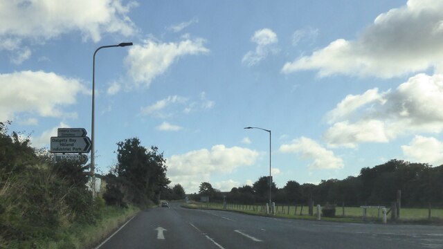
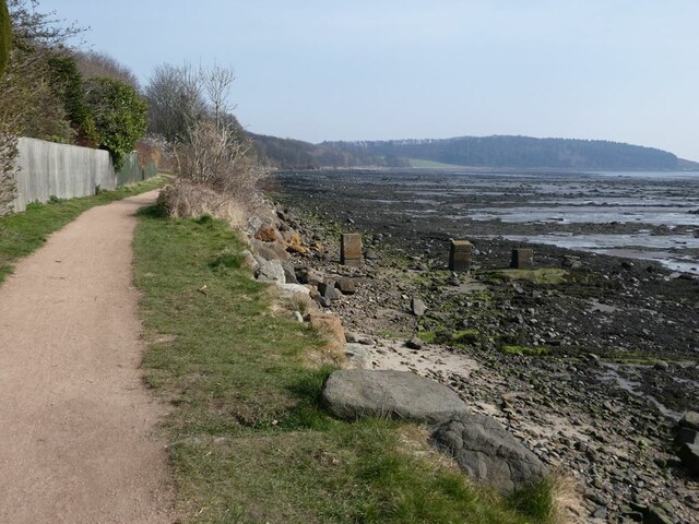
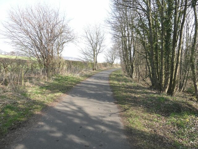
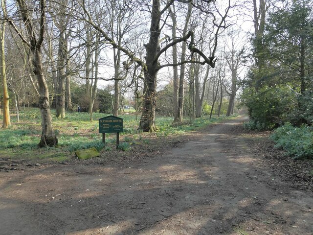
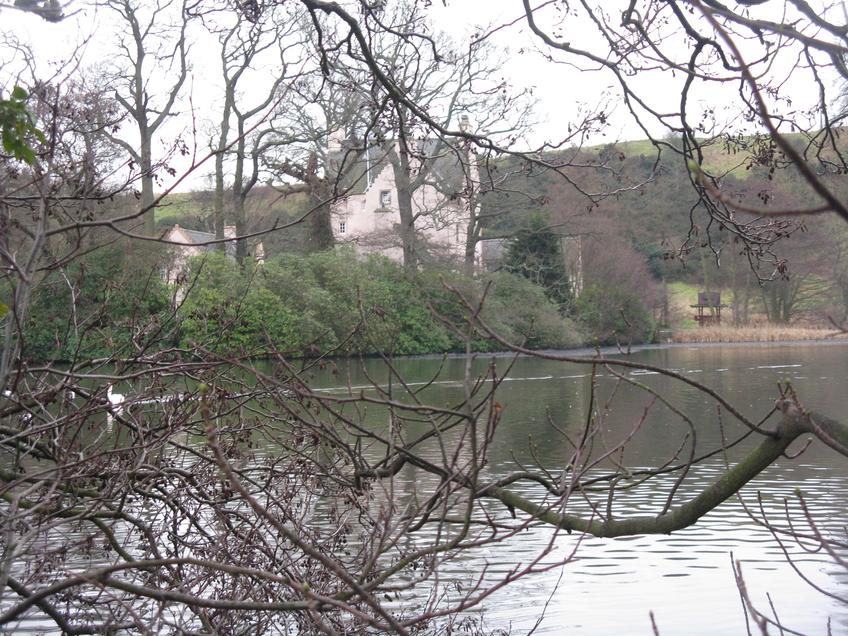
Moss Plantation is a large forested area located in Fife, Scotland. It covers approximately 500 acres of land and is known for its dense growth of mosses, ferns, and other plant species. The plantation is home to a variety of wildlife, including deer, birds, and small mammals.

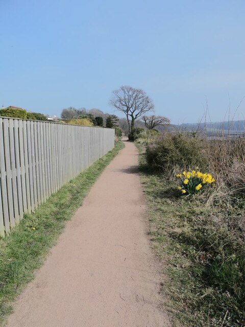
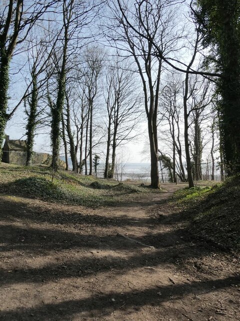
The forest is characterized by its tall, mature trees, including oak, beech, and pine. The canopy of the forest provides shade and shelter for the plants and animals that call Moss Plantation home. There are also several walking trails and paths throughout the forest, allowing visitors to explore the natural beauty of the area.

Moss Plantation is a popular destination for hikers, nature enthusiasts, and birdwatchers. The tranquil surroundings and diverse ecosystem make it a peaceful retreat for those looking to escape the hustle and bustle of city life.

Overall, Moss Plantation is a beautiful and diverse forested area in Fife, offering a peaceful and scenic setting for visitors to enjoy the wonders of nature.

If you have any feedback on the listing, please let us know in the comments section below.

Moss Plantation Images

Images are sourced within 2km of 56.048471/-3.3276156 or Grid Reference NT1784. Thanks to Geograph Open Source API. All images are credited.

A921 eastbound in Aberdour, Fife
Junction on A921 at Dalgety Bay
Warning notice at Dalgety Bay beach There are warnings all along the shore of Dalgety Bay warning of some radioactive contamination.
Warning notice at Dalgety Bay beach
There are warnings all along the shore of Dalgety Bay warning of some radioactive contamination.
Dalgety Bay The term "Dalgety Bay" applies both to this one bay, and to the much more larger town which extends westwards to include a number of other bays on the north shore of the Firth of Forth.
Dalgety Bay
The term "Dalgety Bay" applies both to this one bay, and to the much more larger town which extends westwards to include a number of other bays on the north shore of the Firth of Forth.
Fife Coastal Path at Dalgety Bay The Fife Coastal Path runs at this point in common with National Cycle Network route 76.
Fife Coastal Path at Dalgety Bay
The Fife Coastal Path runs at this point in common with National Cycle Network route 76.
Fife Coastal Path at Dalgety Bay The Fife Coastal Path runs at this point in common with National Cycle Network route 76. The headland of Braefoot Point in the distance.
Fife Coastal Path at Dalgety Bay
The Fife Coastal Path runs at this point in common with National Cycle Network route 76. The headland of Braefoot Point in the distance.
Woodland above the shore of Dalgety Bay
St Bridget's Kirk Closed to visitors because of the dangerous state of the buildings.
St Bridget's Kirk
Closed to visitors because of the dangerous state of the buildings.
Junction on the private road from St Bridget's Kirk to Four Lums The road to the right is Beech Avenue which carries the Fife Coastal Path through to Aberdour.
Junction on the private road from St Bridget's Kirk to Four Lums
The road to the right is Beech Avenue which carries the Fife Coastal Path through to Aberdour.
Private road to Braefoot Point The road carries the status of public right of way.
Private road to Braefoot Point
The road carries the status of public right of way.
Daffodils on Beech Avenue In spring, at least, it is daffodils rather than beech trees which characterise this private farm road which runs between Dalgety Bay and Aberdour. The road carries the Fife Coastal Path and National Cycle Network route 76.
Daffodils on Beech Avenue
In spring, at least, it is daffodils rather than beech trees which characterise this private farm road which runs between Dalgety Bay and Aberdour. The road carries the Fife Coastal Path and National Cycle Network route 76.
Horse riders on Beech Avenue In spring, at least, it is daffodils rather than beech trees which characterise this private farm road which runs between Dalgety Bay and Aberdour. The road carries the Fife Coastal Path and National Cycle Network route 76.
Horse riders on Beech Avenue
In spring, at least, it is daffodils rather than beech trees which characterise this private farm road which runs between Dalgety Bay and Aberdour. The road carries the Fife Coastal Path and National Cycle Network route 76.
Cyclists on Beech Avenue In spring, at least, it is daffodils rather than beech trees which characterise this private farm road which runs between Dalgety Bay and Aberdour. The road carries the Fife Coastal Path and National Cycle Network route 76.
Cyclists on Beech Avenue
In spring, at least, it is daffodils rather than beech trees which characterise this private farm road which runs between Dalgety Bay and Aberdour. The road carries the Fife Coastal Path and National Cycle Network route 76.
Path from Beech Avenue to Braefoot Point With status of public right of way.
Path from Beech Avenue to Braefoot Point
With status of public right of way.
Subway under the access road to Braefoot Terminal This subway carries the Fife Coastal Path and National Cycle Network route 76 under the access road to the Braefoot Terminal which is a terminal for the export of liquefied Petroleum Natural Gas.
Subway under the access road to Braefoot Terminal
This subway carries the Fife Coastal Path and National Cycle Network route 76 under the access road to the Braefoot Terminal which is a terminal for the export of liquefied Petroleum Natural Gas.
Driveway through the trees to St Colme House
Book box Book exchange box beside the driveway to St Colme House.
Book box
Book exchange box beside the driveway to St Colme House.
Aberdour Golf Club and Bell Rock Parkland golf course founded in 1896. Beyond is the prominent headland of Bell Rock <a href="https://www.geograph.org.uk/gridref/NT1984">NT1984</a> and more distant still the lighthouse beacon on Hawkscraig Point <a href="https://www.geograph.org.uk/gridref/NT2084">NT2084</a>. On the far horizon, the dreaming spires of Kirkcaldy.
Aberdour Golf Club and Bell Rock
Parkland golf course founded in 1896. Beyond is the prominent headland of Bell Rock NT1984 and more distant still the lighthouse beacon on Hawkscraig Point NT2084. On the far horizon, the dreaming spires of Kirkcaldy.
Show me another place!

Moss Plantation is located at Grid Ref: NT1784 (Lat: 56.048471, Lng: -3.3276156)

Unitary Authority: Fife

Police Authority: Fife

What 3 Words

///wasps.glaze.skid. Near Aberdour, Fife

Related Wikis

Couston Castle

Couston Castle is an L-plan tower house dating from the late sixteenth or early seventeenth centuries, just north east of Dalgety Bay, at the edge of Otterston...
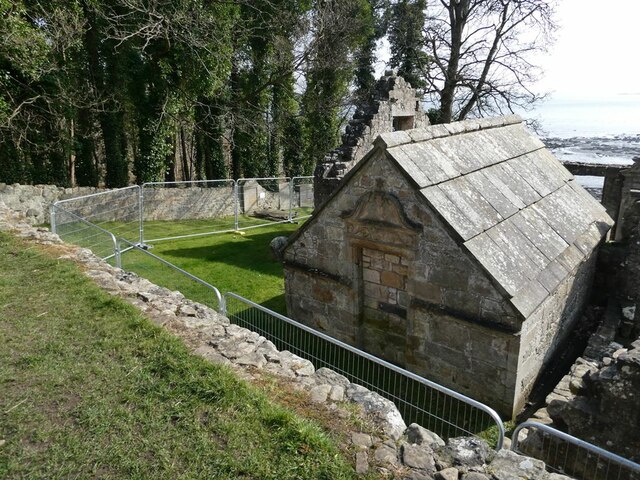
St Bridget's Kirk

St. Bridget's Kirk is a ruined church on the outskirts of Dalgety Bay, Fife, Scotland. It is a shell of a medieval church, dating back at least as far...

RNAS Donibristle (HMS Merlin)

Royal Naval Air Station Donibristle or more simply RNAS Donibristle was a former Fleet Air Arm base located 2.7 miles (4.3 km) east of Rosyth, Fife, and...

Aberdour

Aberdour ( ; Scots: , Scottish Gaelic: Obar Dobhair) is a scenic and historic village on the south coast of Fife, Scotland. It is on the north shore of...

Nearby Amenities

Located within 500m of 56.048471,-3.3276156
Man Made: mast
Lat/Long: 56.0505517/-3.3279085
Power: pole
Lat/Long: 56.045282/-3.3219342
Railway: signal
Railway Signal Direction: forward
Railway Signal Main: GB-NR:main
Ref: EV436
Lat/Long: 56.049769/-3.3311041
Railway: signal
Railway Signal Direction: forward
Railway Signal Main: GB-NR:main
Ref: EV435
Lat/Long: 56.0493688/-3.3342514
The data included in this document is from www.openstreetmap.org. The data is made available under ODbL.

Have you been to Moss Plantation?

Leave your review of Moss Plantation below (or comments, questions and feedback).