Drake Knowe Wood

Wood, Forest in Peeblesshire

Scotland

Drake Knowe Wood

Broomlee Hill Trig Point Flush Bracket S3137
Broomlee Hill Trig Point Flush Bracket S3137 Credit: thejackrustles

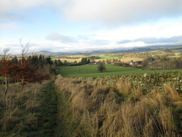
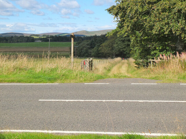
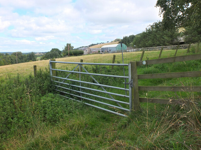
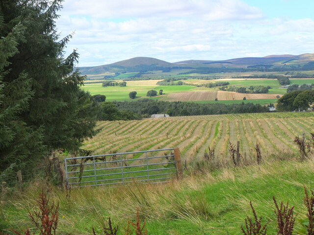
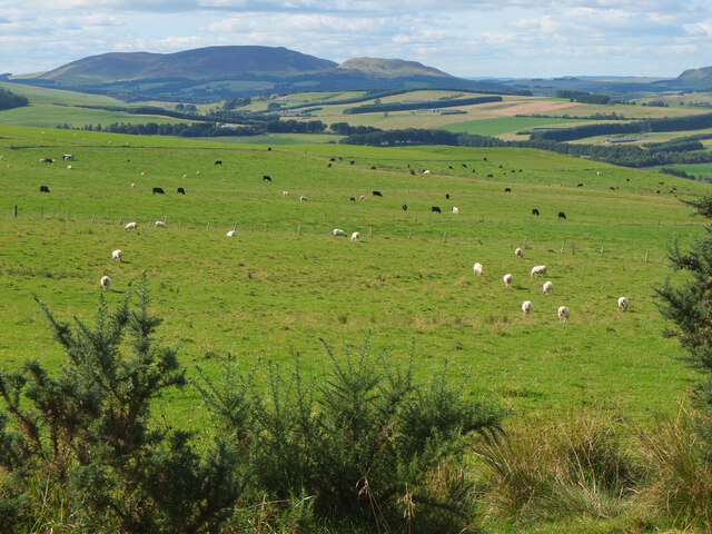
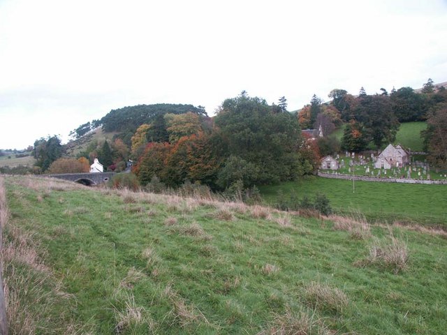
Drake Knowe Wood is a picturesque woodland located in Peeblesshire, Scotland. Covering an area of approximately 40 acres, this enchanting forest is nestled in the rolling hills and lush countryside of the Scottish Borders.

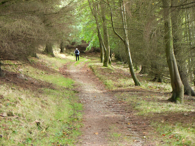
The wood is primarily composed of native broadleaf trees, including oak, ash, beech, and birch, creating a diverse and vibrant ecosystem. The canopy of the trees provides a cool and shaded environment, perfect for leisurely walks and nature exploration.

The wood is crisscrossed with a network of well-maintained trails, allowing visitors to easily navigate through the forest and admire its natural beauty. These trails offer stunning views of the surrounding landscape, with glimpses of the nearby River Tweed and the majestic hills in the distance.

Drake Knowe Wood is home to a rich variety of wildlife, including roe deer, red squirrels, and a plethora of bird species. Nature enthusiasts will delight in the opportunity to observe and photograph these creatures in their natural habitat.

The wood also boasts an abundance of wildflowers, adding bursts of color to the woodland floor during spring and summer. Bluebells, primroses, and wood anemones are just a few of the floral treasures that can be found here.

Whether it's a peaceful stroll, a bird-watching expedition, or simply a chance to reconnect with nature, Drake Knowe Wood offers a tranquil and idyllic setting for visitors of all ages. Its natural charm and serene atmosphere make it a must-visit destination for those seeking solace in the beauty of the Scottish countryside.

If you have any feedback on the listing, please let us know in the comments section below.

Drake Knowe Wood Images

Images are sourced within 2km of 55.727845/-3.3355647 or Grid Reference NT1649. Thanks to Geograph Open Source API. All images are credited.

Broomlee Hill Trig Point Flush Bracket S3137
Gatepost with - OS Cut Mark - Kaimes <span class="nowrap"><a title="https://www.bench-marks.org.uk/bm30104" rel="nofollow ugc noopener" href="https://www.bench-marks.org.uk/bm30104">Link</a><img style="margin-left:2px;" alt="External link" title="External link - shift click to open in new window" src="https://s1.geograph.org.uk/img/external.png" width="10" height="10"/></span>
Gatepost with - OS Cut Mark - Kaimes
OS Cut Mark - Kaimes <span class="nowrap"><a title="https://www.bench-marks.org.uk/bm30104" rel="nofollow ugc noopener" href="https://www.bench-marks.org.uk/bm30104">Link</a><img style="margin-left:2px;" alt="External link" title="External link - shift click to open in new window" src="https://s1.geograph.org.uk/img/external.png" width="10" height="10"/></span>
OS Cut Mark - Kaimes
Entrance to Kaimes
Entrance to Kaimes
Old drove road above Romannobridge This forms part of the Cross Borders Drove Road, a long distance walking route from Harperrig, south-west of Edinburgh, to Hawick.
Old drove road above Romannobridge
This forms part of the Cross Borders Drove Road, a long distance walking route from Harperrig, south-west of Edinburgh, to Hawick.
Broomlee Hill A short detour from the large mobile phone mast, which is passed on the poorly waymarked (along this wiggly bit anyway) Cross Borders Drove Road, brings you to the trig point. This medium-length Long Distance Path runs from the Western side of the Pentland Hills to Hawick. It is based on the route said to have been used long ago by cattle drovers to get their animals to English markets. 'Based' is certainly the operative word round here as it seems highly unlikely that such an odd circuitous route would have been used for any length of time, even if there were access problems with some of the surrounding land.
I was surprised to read that the route has been designed with horse riders in mind. They would certainly be advised to skip this section, and stay on the road until reaching the A701.
Broomlee Hill
A short detour from the large mobile phone mast, which is passed on the poorly waymarked (along this wiggly bit anyway) Cross Borders Drove Road, brings you to the trig point. This medium-length Long Distance Path runs from the Western side of the Pentland Hills to Hawick. It is based on the route said to have been used long ago by cattle drovers to get their animals to English markets. 'Based' is certainly the operative word round here as it seems highly unlikely that such an odd circuitous route would have been used for any length of time, even if there were access problems with some of the surrounding land. I was surprised to read that the route has been designed with horse riders in mind. They would certainly be advised to skip this section, and stay on the road until reaching the A701.
Track on Broomlee Hill A good view opens up from the track on the Cross Borders Drove Road.
Track on Broomlee Hill
A good view opens up from the track on the Cross Borders Drove Road.
Path near Woodend Quarry The path down from Broomlee Hill has been re-routed through a new tree plantation east of the quarry.
Path near Woodend Quarry
The path down from Broomlee Hill has been re-routed through a new tree plantation east of the quarry.
New deer fence, Woodend A fence with a pedestrian gate enclosing new tree plantation east of Woodend Quarry.
New deer fence, Woodend
A fence with a pedestrian gate enclosing new tree plantation east of Woodend Quarry.
Path junction near Kaimes A signpost for the Cross Borders Drove Road taking a field edge route to the A701 and Romannobridge.
Path junction near Kaimes
A signpost for the Cross Borders Drove Road taking a field edge route to the A701 and Romannobridge.
Farmland near Halmyre House The Cross Borders Drove Road follows field edges southwest to reach the A701 and Romannobridge.
Farmland near Halmyre House
The Cross Borders Drove Road follows field edges southwest to reach the A701 and Romannobridge.
Drove Road crossing the A701 at Halmyre Vigilance needed here where the Cross Borders Drove Road from West Linton crosses a fast stretch on the A701.
Drove Road crossing the A701 at Halmyre
Vigilance needed here where the Cross Borders Drove Road from West Linton crosses a fast stretch on the A701.
Romanno Mains A hill farm seen from the Cross Borders Drove Road.
Romanno Mains
A hill farm seen from the Cross Borders Drove Road.
Farmland above Romannobridge Looking from the Cross Borders Drove Road towards Mendick Hill (451m).
Farmland above Romannobridge
Looking from the Cross Borders Drove Road towards Mendick Hill (451m).
Path from Romannobridge The Cross Borders Drove Road follows this path to cross the col between Drum Maw and Hag Law.
Path from Romannobridge
The Cross Borders Drove Road follows this path to cross the col between Drum Maw and Hag Law.
Sheep and cattle, Drum Maw Pasture on the lower slopes of Drum Maw with Black Mount (516m) on the skyline.
Sheep and cattle, Drum Maw
Pasture on the lower slopes of Drum Maw with Black Mount (516m) on the skyline.
Ruined steading, Halmyre Mains A conversion abandoned in 2008 shortly after the removal of the roof.  An attempt at revival of the project in 2011: <a href="https://www.geograph.org.uk/photo/2261220">NT1749 : Halmyre Mains</a>
Ruined steading, Halmyre Mains
A conversion abandoned in 2008 shortly after the removal of the roof. An attempt at revival of the project in 2011: NT1749 : Halmyre Mains
Show me another place!

Drake Knowe Wood is located at Grid Ref: NT1649 (Lat: 55.727845, Lng: -3.3355647)

Unitary Authority: The Scottish Borders

Police Authority: The Lothians and Scottish Borders

What 3 Words

///feathers.timed.stale. Near West Linton, Scottish Borders

Related Wikis

Romannobridge

Romanno Bridge is a village on the Lyne Water, on the A701, in the Scottish Borders area of Scotland. Settlements nearby include West Linton, Halmyre,...

Broomlee railway station

Broomlee railway station served the village of West Linton, Peeblesshire, Scotland, from 1864 to 1933 on the Leadburn, Linton and Dolphinton Railway....

Newlands, Scottish Borders

Newlands is a parish in the Tweeddale committee area of the Scottish Borders council area, in southeastern Scotland. == Geography == Newlands is on the...

Bordlands

Bordlands is a village in the Parish of Newlands in the Scottish Borders area of Scotland. The former name of Bordlands was Boreland. == See also == List...

Nearby Amenities

Located within 500m of 55.727845,-3.3355647
Power: pole
Lat/Long: 55.724223/-3.3379692
Power: pole
Lat/Long: 55.7251358/-3.3381816
Power: pole
Lat/Long: 55.7260025/-3.338396
Power: pole
Lat/Long: 55.7267058/-3.3385474
Power: pole
Lat/Long: 55.7274339/-3.3387324
Power: pole
Lat/Long: 55.7281537/-3.3388754
Power: pole
Lat/Long: 55.7289492/-3.3390415
Power: pole
Lat/Long: 55.7294394/-3.339197
Power: pole
Lat/Long: 55.730287/-3.3393736
Power: pole
Lat/Long: 55.7309357/-3.3392117
Power: pole
Lat/Long: 55.7315146/-3.3391255
Power: pole
Lat/Long: 55.7240607/-3.3368108
Power: pole
Lat/Long: 55.7239104/-3.3356755
Power: pole
Lat/Long: 55.7237541/-3.3344919
Power: pole
Lat/Long: 55.7236049/-3.3334239
The data included in this document is from www.openstreetmap.org. The data is made available under ODbL.

Have you been to Drake Knowe Wood?

Leave your review of Drake Knowe Wood below (or comments, questions and feedback).