Crow Wood

Wood, Forest in Midlothian

Scotland

Crow Wood

Juniper House Scottish Water's laboratory complex on Research Avenue North.
Juniper House Credit: Patrick Mackie

Crow Wood is a picturesque forest located in Midlothian, Scotland. Spread over an expansive area, this woodland is a haven for nature enthusiasts and outdoor adventurers alike. The wood is situated in close proximity to the village of Roslin, offering easy accessibility for visitors.

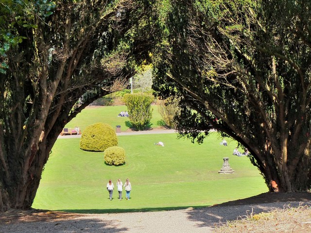
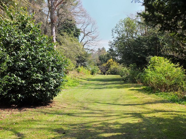
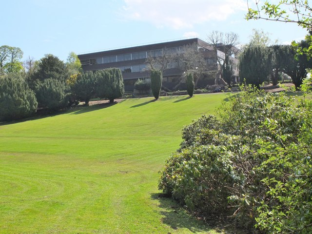
Covering a diverse landscape, Crow Wood boasts a mixture of ancient deciduous and coniferous trees. The lush greenery and vibrant colors make it a visually stunning destination throughout the year. Walking through the forest, visitors can expect to encounter a variety of native wildlife, including deer, foxes, and a wide array of bird species.

The wood offers a network of well-maintained footpaths and trails, catering to individuals of various fitness levels. These paths wind through the forest, leading visitors to hidden gems such as tranquil streams, charming clearings, and secret viewpoints. The peaceful atmosphere and abundance of natural beauty make Crow Wood an ideal location for leisurely walks, picnics, and photography.

In addition to its recreational offerings, Crow Wood holds historical significance as well. It is said to have played a role in the construction of Rosslyn Chapel, a nearby medieval masterpiece. The forest's history can be felt in its ancient trees, some of which are several hundred years old.

Overall, Crow Wood is a captivating destination that combines natural beauty, wildlife, and history. Whether it's a peaceful walk, a family outing, or an exploration of the area's heritage, this Midlothian forest offers something for everyone.

If you have any feedback on the listing, please let us know in the comments section below.

Crow Wood Images

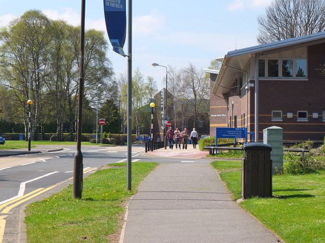
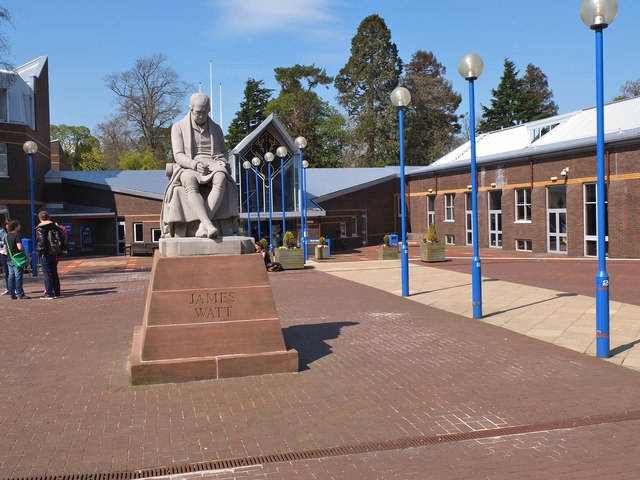
Images are sourced within 2km of 55.911244/-3.3506467 or Grid Reference NT1569. Thanks to Geograph Open Source API. All images are credited.

Juniper House Scottish Water's laboratory complex on Research Avenue North.
Juniper House
Scottish Water's laboratory complex on Research Avenue North.
George Heriot Wing, Heriot-Watt University The Edinburgh Campus occupies the parkland that once surrounded Riccarton House, demolished in 1956. The University acquired the site in the late 1960s and the first departments moved out of Edinburgh city centre in 1973. George Heriot (1563-1634) was jeweller and financier to the Royal Family, and the trust established in his name helped to fund the transition in 1885 from the original Watt Institution and School of Arts to Heriot Watt College. The College became a university in 1966.

The George Heriot Wing houses university administration, plus the Health Centre in the part of the building nearest the camera. In the background is the Lord Balerno Building, also home to university administration.
George Heriot Wing, Heriot-Watt University
The Edinburgh Campus occupies the parkland that once surrounded Riccarton House, demolished in 1956. The University acquired the site in the late 1960s and the first departments moved out of Edinburgh city centre in 1973. George Heriot (1563-1634) was jeweller and financier to the Royal Family, and the trust established in his name helped to fund the transition in 1885 from the original Watt Institution and School of Arts to Heriot Watt College. The College became a university in 1966. The George Heriot Wing houses university administration, plus the Health Centre in the part of the building nearest the camera. In the background is the Lord Balerno Building, also home to university administration.
Main entrance, Heriot-Watt University The statue of James Watt used to stand outside the university's Chambers Street building in central Edinburgh.
Main entrance, Heriot-Watt University
The statue of James Watt used to stand outside the university's Chambers Street building in central Edinburgh.
The Lawn, Heriot-Watt University A view down to the lawn between two yew trees, part of the formal gardens laid out in 1755 for Riccarton House which used to stand not far from this point. The gardens include a collection of trees and shrubs planted in the 19th century by the owners of the estate, the Gibson-Craig family. The centre of the lawn was once used as a curling green, flooded and frozen in winter. (Source: the nearby information board.)
The Lawn, Heriot-Watt University
A view down to the lawn between two yew trees, part of the formal gardens laid out in 1755 for Riccarton House which used to stand not far from this point. The gardens include a collection of trees and shrubs planted in the 19th century by the owners of the estate, the Gibson-Craig family. The centre of the lawn was once used as a curling green, flooded and frozen in winter. (Source: the nearby information board.)
The Velvet Walk, Heriot-Watt University A grassy level walk between shrubs and trees in the formal gardens laid out in 1755 for the estate around Riccarton House.
The Velvet Walk, Heriot-Watt University
A grassy level walk between shrubs and trees in the formal gardens laid out in 1755 for the estate around Riccarton House.
Cameron Smail Library, Heriot-Watt University The library occupies the site of Riccarton House, which was requisitioned as a  military headquarters in the Second World War. Post-war the house fell into disrepair and was demolished in 1956. The Riccarton Estate was chosen as suitable for relocation of the university from its central Edinburgh buildings, which began in the early 1970s.

The library is named after James Cameron Smail, principal of the then Heriot Watt College from 1928 to 1950.
Cameron Smail Library, Heriot-Watt University
The library occupies the site of Riccarton House, which was requisitioned as a military headquarters in the Second World War. Post-war the house fell into disrepair and was demolished in 1956. The Riccarton Estate was chosen as suitable for relocation of the university from its central Edinburgh buildings, which began in the early 1970s. The library is named after James Cameron Smail, principal of the then Heriot Watt College from 1928 to 1950.
Demolition site, Heriot-Watt University Behind the hoarding, some of the older student residences are being demolished as newer accommodation has been opened on the SW corner of the Riccarton site.
Demolition site, Heriot-Watt University
Behind the hoarding, some of the older student residences are being demolished as newer accommodation has been opened on the SW corner of the Riccarton site.
Heriot-Watt University, Edinburgh Campus The footpath and cycleway leading towards the Hugh Nisbet Building, a central part of the university complex with lecture theatres, shops and refectory. To the right is the John Muir Building (Life Sciences) and the William Perkin Building (Chemistry).
Heriot-Watt University, Edinburgh Campus
The footpath and cycleway leading towards the Hugh Nisbet Building, a central part of the university complex with lecture theatres, shops and refectory. To the right is the John Muir Building (Life Sciences) and the William Perkin Building (Chemistry).
Scotch Whisky Research Institute The Institute is on the Heriot-Watt University Research Park, Riccarton, seen here from the university across land that is still farmed.
Scotch Whisky Research Institute
The Institute is on the Heriot-Watt University Research Park, Riccarton, seen here from the university across land that is still farmed.
St Mary's Episcopal Church Dalmahoy Stained glass made and installed by the parishioners.
St Mary's Episcopal Church Dalmahoy
Stained glass made and installed by the parishioners.
St Mary's Episcopal Church Dalmahoy The Church viewed from the Churchyard looking east.
St Mary's Episcopal Church Dalmahoy
The Church viewed from the Churchyard looking east.
St Mary's Episcopal Church Dalmahoy St Mary's churchyard.
St Mary's Episcopal Church Dalmahoy
St Mary's churchyard.
The Gatehouse Dalmahoy Estate The Gatehouse at the entrance to the Dalmahoy estate.
The Gatehouse Dalmahoy Estate
The Gatehouse at the entrance to the Dalmahoy estate.
Dalmahoy Country Estate Entrance and sign to the Dalmahoy Country Club and Hotel.
Dalmahoy Country Estate
Entrance and sign to the Dalmahoy Country Club and Hotel.
Dalmahoy Country Estate Entrance road to the Hotel and the golf courses.
Dalmahoy Country Estate
Entrance road to the Hotel and the golf courses.
Dalmahoy Country Club Flags outside the Hotel.
Dalmahoy Country Club
Flags outside the Hotel.
Dalmahoy Country Club Lovely double staircase to the rear of the Hotel.
Dalmahoy Country Club
Lovely double staircase to the rear of the Hotel.
Dalmahoy Country Club Statue of James Braid at the putting greens with the Hotel in the background.
Dalmahoy Country Club
Statue of James Braid at the putting greens with the Hotel in the background.
Show me another place!

Crow Wood is located at Grid Ref: NT1569 (Lat: 55.911244, Lng: -3.3506467)

Unitary Authority: City of Edinburgh

Police Authority: Edinburgh

What 3 Words

///meanders.provoking.ruler. Near Ratho, Edinburgh

Nearby Locations

Kierhill Pond Crow Wood

Related Wikis

1992 Solheim Cup

The second Solheim Cup golf match took place from 2 October to 4 October 1992 at Dalmahoy Country Club, Edinburgh, Scotland. The European team beat the...
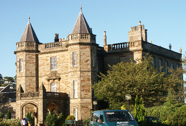
Dalmahoy

Dalmahoy (Scottish Gaelic: Dail MoThua) is a hotel and former country house near Edinburgh, Scotland. It is located off the A71 road, 3.5 kilometres (2...

SASA (Scottish Government)

SASA (formerly the Scottish Agricultural Science Agency) is a division of the Scottish Government Agriculture and Rural Delivery Directorate. It provides...

Riccarton, Edinburgh

Riccarton is an area in Edinburgh's Green Belt, in Scotland. It is mainly undeveloped, with much farmland and few houses. Riccarton is to the west of the...

Nearby Amenities

Located within 500m of 55.911244,-3.3506467
Bus Stop
Addiston Mains
Naptan AtcoCode: 6200200300
Naptan Bearing: E
Naptan CommonName: Addiston Mains
Naptan Indicator: Opp Addistoun House
Naptan Landmark: Heriot Watt Research Park
Naptan NaptanCode: 36247352
Naptan PlusbusZoneRef: EDINBUR
Naptan Street: A71
Naptan Verified: no
Public Transport: platform
Source: naptan_import
Lat/Long: 55.9119985/-3.3559041
Bus Stop
Addiston Mains
Naptan AtcoCode: 6200249730
Naptan Bearing: W
Naptan CommonName: Addiston Mains
Naptan Indicator: At Addistoun House
Naptan Landmark: Heriot Watt Research Park
Naptan NaptanCode: 36247464
Naptan PlusbusZoneRef: EDINBUR
Naptan Street: A71
Naptan Verified: no
Public Transport: platform
Source: naptan_import
Lat/Long: 55.9120572/-3.3546582
Barrier: stile
Lat/Long: 55.9131289/-3.3438092
Power: pole
Lat/Long: 55.9110197/-3.3580031
Power: pole
Lat/Long: 55.9114378/-3.3569696
Power: pole
Lat/Long: 55.9118045/-3.3560987
Power: pole
Lat/Long: 55.912128/-3.3553298
Power: pole
Lat/Long: 55.9125087/-3.3545296
Power: pole
Lat/Long: 55.9129513/-3.3534586
Power: pole
Lat/Long: 55.9133799/-3.3523501
Power: pole
Lat/Long: 55.9138237/-3.3511833
Power: pole
Lat/Long: 55.9142663/-3.3500831
Power: pole
Lat/Long: 55.9146995/-3.3489996
Power: pole
Lat/Long: 55.9140981/-3.3512854
Power: pole
Lat/Long: 55.9149821/-3.3515375
Power: pole
Lat/Long: 55.9156675/-3.3517417
Addiston Mains helipad
Aeroway: helipad
Surface: concrete
Lat/Long: 55.9153556/-3.3490514
The data included in this document is from www.openstreetmap.org. The data is made available under ODbL.

Have you been to Crow Wood?

Leave your review of Crow Wood below (or comments, questions and feedback).