Samuel's Wood

Wood, Forest in Peeblesshire

Scotland

Samuel's Wood

Broomlee Hill Trig Point Flush Bracket S3137
Broomlee Hill Trig Point Flush Bracket S3137 Credit: thejackrustles

Samuel's Wood is a picturesque forest located in Peeblesshire, Scotland. Covering an area of approximately 500 acres, this woodland is known for its stunning natural beauty and diverse range of flora and fauna. The wood is named after Samuel, a local landowner who dedicated his efforts to preserving and maintaining this pristine forest.

The wood is primarily composed of native Scottish tree species such as oak, birch, and rowan, creating a dense and lush canopy that provides a sanctuary for various wildlife. Visitors can explore the wood through a network of well-maintained walking trails that wind through the forest, allowing them to immerse themselves in the tranquil ambiance of nature.

Samuel's Wood is home to a rich array of wildlife, including red squirrels, roe deer, and a wide variety of bird species, making it a popular destination for birdwatching enthusiasts. The forest also boasts a diverse ecosystem of plants and wildflowers, adding vibrant colors and fragrances to the natural landscape.

For those seeking a peaceful retreat, Samuel's Wood offers numerous picnic spots and resting areas where visitors can relax and enjoy the peaceful surroundings. The wood is also a favorite destination for nature photographers, with its stunning vistas and abundant wildlife providing countless opportunities for capturing captivating images.

Overall, Samuel's Wood in Peeblesshire is a haven for nature lovers and outdoor enthusiasts, offering a serene and enchanting experience amidst the beauty of the Scottish countryside.

If you have any feedback on the listing, please let us know in the comments section below.

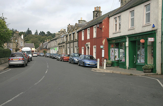
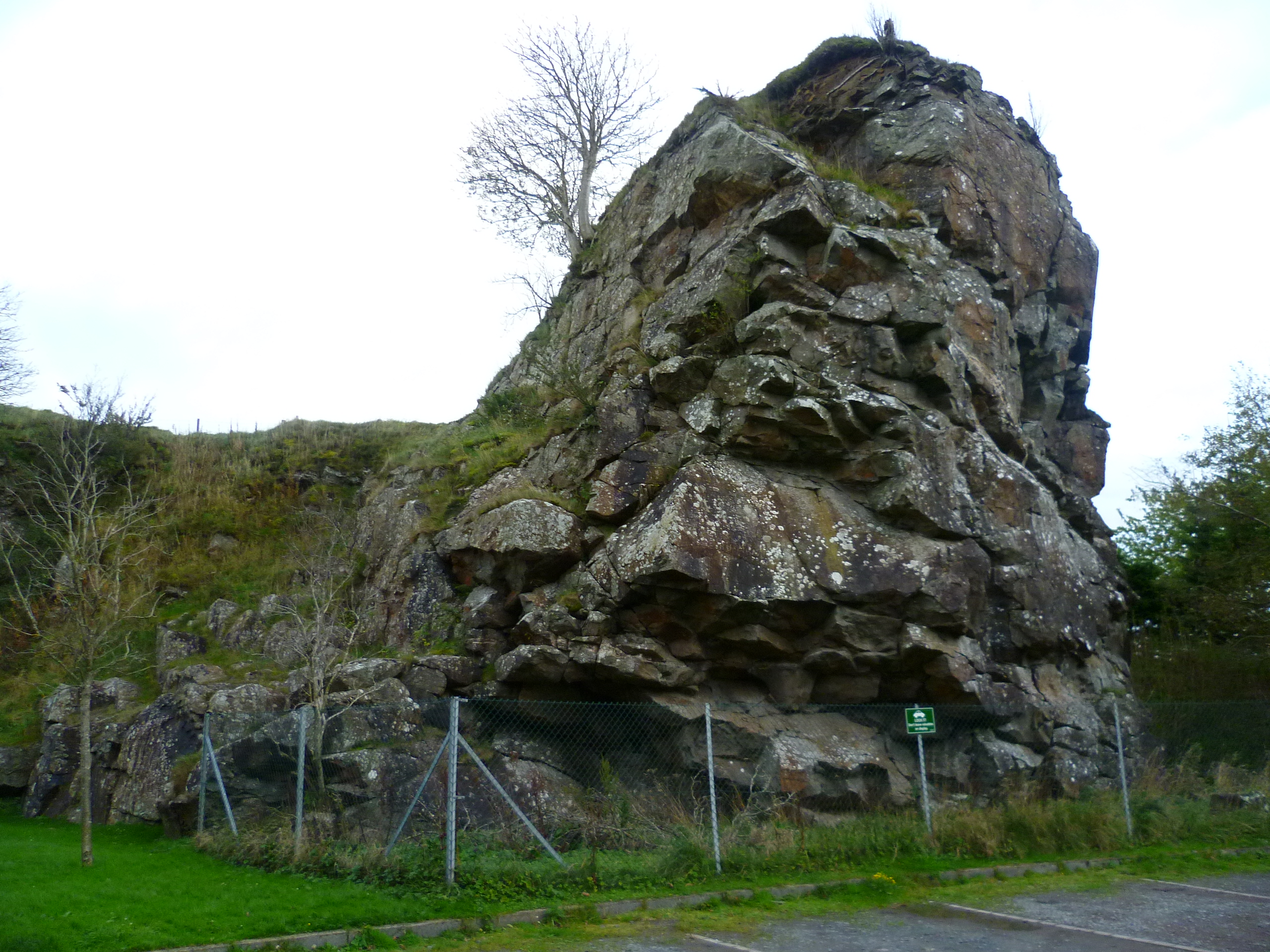
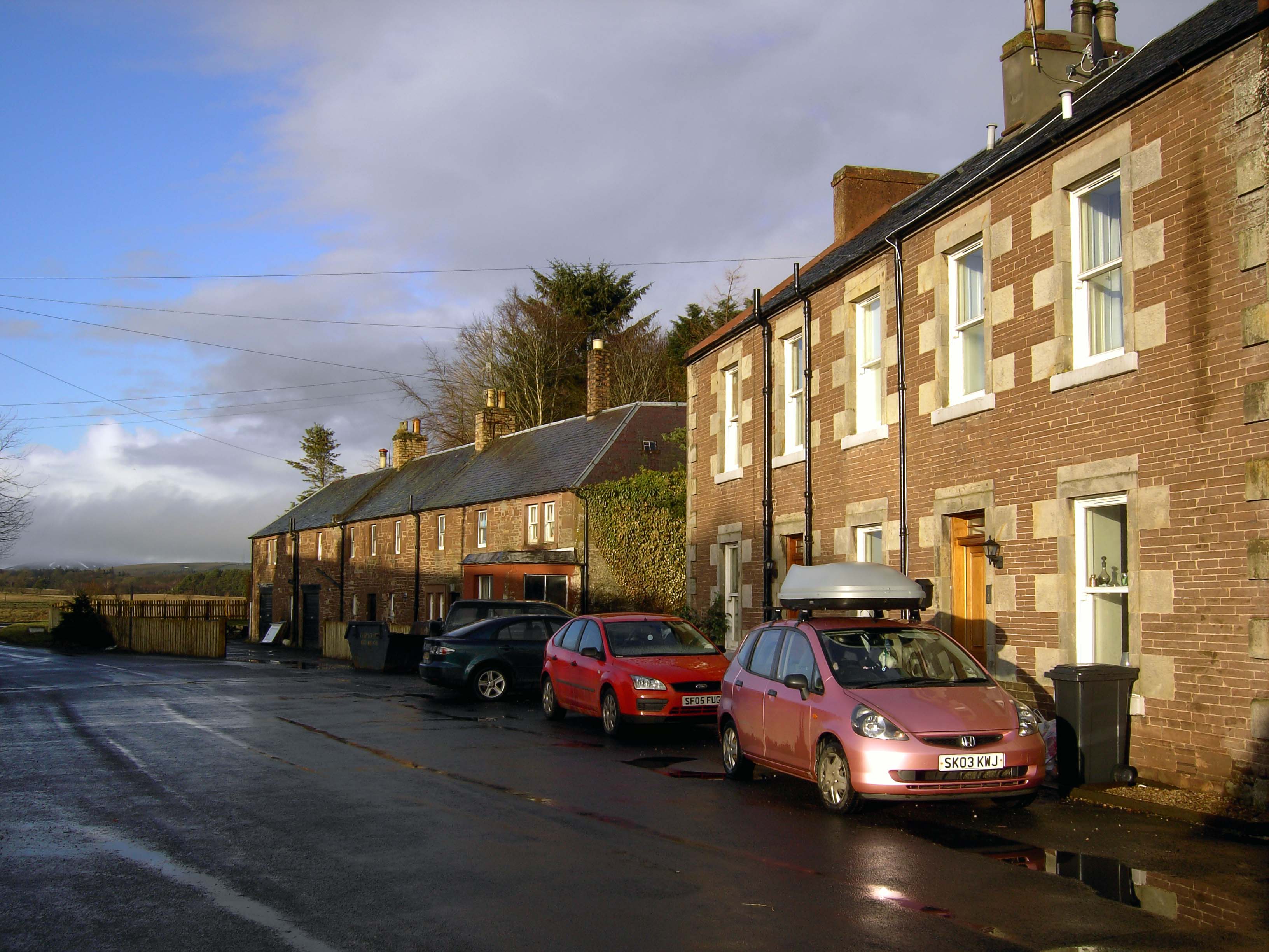
Samuel's Wood Images

Images are sourced within 2km of 55.756986/-3.3520656 or Grid Reference NT1552. Thanks to Geograph Open Source API. All images are credited.

Broomlee Hill Trig Point Flush Bracket S3137
Main Street, West Linton Outside Bank House with a fine engraved gatepost.
Main Street, West Linton
Outside Bank House with a fine engraved gatepost.
St Andrew New Church Hall A former school building, now used for pre school learning, West Linton
St Andrew New Church Hall
A former school building, now used for pre school learning, West Linton
St Andrew New Church Hall A former school building, now used for pre school learning, West Linton
St Andrew New Church Hall
A former school building, now used for pre school learning, West Linton
Fields and Mendick Hill, West Linton
Medwyn Road, West Linton
Bridge and ford, West Linton Foot of Chapel Brae
Bridge and ford, West Linton
Foot of Chapel Brae
Lyne Water, West Linton
Broomlee Hill A short detour from the large mobile phone mast, which is passed on the poorly waymarked (along this wiggly bit anyway) Cross Borders Drove Road, brings you to the trig point. This medium-length Long Distance Path runs from the Western side of the Pentland Hills to Hawick. It is based on the route said to have been used long ago by cattle drovers to get their animals to English markets. 'Based' is certainly the operative word round here as it seems highly unlikely that such an odd circuitous route would have been used for any length of time, even if there were access problems with some of the surrounding land.
I was surprised to read that the route has been designed with horse riders in mind. They would certainly be advised to skip this section, and stay on the road until reaching the A701.
Broomlee Hill
A short detour from the large mobile phone mast, which is passed on the poorly waymarked (along this wiggly bit anyway) Cross Borders Drove Road, brings you to the trig point. This medium-length Long Distance Path runs from the Western side of the Pentland Hills to Hawick. It is based on the route said to have been used long ago by cattle drovers to get their animals to English markets. 'Based' is certainly the operative word round here as it seems highly unlikely that such an odd circuitous route would have been used for any length of time, even if there were access problems with some of the surrounding land. I was surprised to read that the route has been designed with horse riders in mind. They would certainly be advised to skip this section, and stay on the road until reaching the A701.
West Water Bridge There's some sort of work going on here, but the obstinately red traffic light offered the opportunity for a quick shot of the road crossing the West Water.
West Water Bridge
There's some sort of work going on here, but the obstinately red traffic light offered the opportunity for a quick shot of the road crossing the West Water.
Mendick Hill from South Slipperfield Mendick Hill (451m) rises boldly above the farmland southwest of West Linton.
Mendick Hill from South Slipperfield
Mendick Hill (451m) rises boldly above the farmland southwest of West Linton.
West Water and bridge The West Water meets the Lyne water south of West Linton. The bridge was originally 17th century and was restored in 1899 - see the bridge plaque at <a href="https://www.geograph.org.uk/photo/2090613">NT1351 : Plaque on the bridge, West Water</a>.
West Water and bridge
The West Water meets the Lyne water south of West Linton. The bridge was originally 17th century and was restored in 1899 - see the bridge plaque at NT1351 : Plaque on the bridge, West Water.
A gravestone at St Andrew’s Old Kirkyard at West Linton This unusual stone is for Robert Sanderson. The inscription reads:

ROBERT SANDERSON
POET and PATRIOT
Born in Linton 10th
November 1836 where
he lived till he died
20th September 1902

Erected by many Friends
as a token of Affection
and Admiration 1920
A gravestone at St Andrew’s Old Kirkyard at West Linton
This unusual stone is for Robert Sanderson. The inscription reads: ROBERT SANDERSON POET and PATRIOT Born in Linton 10th November 1836 where he lived till he died 20th September 1902 Erected by many Friends as a token of Affection and Admiration 1920
A symbolic gravestone at St Andrew’s Old Kirkyard, West Linton This plain stone has a simplistic skull and crossed bones which are symbols of mortality. The carving memento mori means remember you must die.
A symbolic gravestone at St Andrew’s Old Kirkyard, West Linton
This plain stone has a simplistic skull and crossed bones which are symbols of mortality. The carving memento mori means remember you must die.
A symbolic gravestone at St Andrew’s Old Kirkyard, West Linton This stone commemorates John Allan Leat, Coal Master at Collie Burn. The lower circular panel shows a grouping of miner’s tools – two picks, a shovel, a hammer and a couple of wedges. The panel in the moulded pediment takes the form of a compass.
A symbolic gravestone at St Andrew’s Old Kirkyard, West Linton
This stone commemorates John Allan Leat, Coal Master at Collie Burn. The lower circular panel shows a grouping of miner’s tools – two picks, a shovel, a hammer and a couple of wedges. The panel in the moulded pediment takes the form of a compass.
St Andrew's church, West Linton On the Main Street (B7059) at the junction with Bogsbank Rd on the left.
St Andrew's church, West Linton
On the Main Street (B7059) at the junction with Bogsbank Rd on the left.
Main Street, West Linton Looking towards the junction with Deanfoot Road.
Main Street, West Linton
Looking towards the junction with Deanfoot Road.
Autumn colours on the Drove Road, West Linton A fine display of colour on the track heading NW from the village.
Autumn colours on the Drove Road, West Linton
A fine display of colour on the track heading NW from the village.
Show me another place!

Samuel's Wood is located at Grid Ref: NT1552 (Lat: 55.756986, Lng: -3.3520656)

Unitary Authority: The Scottish Borders

Police Authority: The Lothians and Scottish Borders

What 3 Words

///standards.sleeps.warping. Near West Linton, Scottish Borders

Nearby Locations

Samuel's Wood

Related Wikis

West Linton

West Linton (Scottish Gaelic: Liontan Ruairidh) is a village and civil parish in southern Scotland, on the A702. It was formerly in the county of Peeblesshire...

Broomlee railway station

Broomlee railway station served the village of West Linton, Peeblesshire, Scotland, from 1864 to 1933 on the Leadburn, Linton and Dolphinton Railway....

Macbie Hill railway station

Macbie Hill railway station served the hamlet of Coalyburn, Peeblesshire, Scotland, from 1864 to 1933 on the Leadburn, Linton and Dolphinton Railway....

West Water Reservoir

West Water Reservoir (sometimes Westwater Reservoir) is an artificial reservoir in the Pentland Hills, Scottish Borders, 3 kilometres (1.9 mi) west of...

Carlops

Carlops (Scottish Gaelic: Leum na Caillich) is a small village in the Pentland Hills, within the Scottish Borders area of Scotland, close to the boundary...

Baddinsgill

Baddinsgill is a hamlet in the Scottish Borders area of Scotland. The Baddinsgill Reservoir is a few hundred metres north of the hamlet. == See also... ==

Baddinsgill Reservoir

Baddinsgill Reservoir is a small reservoir in the Scottish Borders area of Scotland close to Carlops, West Linton, and the boundary with Midlothian. It...

Romannobridge

Romanno Bridge is a village on the Lyne Water, on the A701, in the Scottish Borders area of Scotland. Settlements nearby include West Linton, Halmyre,...

Nearby Amenities

Located within 500m of 55.756986,-3.3520656
Bus Stop
Health Centre
Naptan AtcoCode: 69001410
Naptan Bearing: N
Naptan BusStopType: CUS
Naptan CommonName: Health Centre
Naptan Indicator: Entrance
Naptan Landmark: Health Centre
Naptan NaptanCode: 72726829
Naptan Street: Health Centre Car Park
Naptan Verified: no
Source: naptan_import
Lat/Long: 55.7532646/-3.353645
Bus Stop
Gordon Arms Hotel
Bus: yes
Naptan AtcoCode: 6900828
Naptan Bearing: N
Naptan CommonName: Gordon Arms Hotel
Naptan Indicator: opp
Naptan Landmark: Hotel
Naptan NaptanCode: 72724868
Naptan Notes: reposition
Naptan Street: A702
Operator: Scottish Borders Council
Public Transport: platform
Ref: 6900828
Source: NaPTAN
Lat/Long: 55.7537609/-3.3570667
Bus Stop
Gordon Arms Hotel
Bus: yes
Local Ref: AT
Naptan AtcoCode: 6900829
Naptan Bearing: S
Naptan CommonName: Gordon Arms Hotel
Naptan Indicator: at
Naptan Landmark: Hotel
Naptan NaptanCode: 72724869
Naptan Notes: reposition
Naptan Street: A702
Operator: Scottish Borders Council
Public Transport: platform
Ref: 6900829
Source: NaPTAN
Lat/Long: 55.7541993/-3.3561924
Give Way
Lat/Long: 55.7569485/-3.3506834
Post Box
Brand: Royal Mail
Brand Wikidata: Q638098
Mapillary: 1952209531656140
Operator: Royal Mail
Operator Wikidata: Q638098
Post Box Mounting: pier
Post Box Type: lamp
Ref: EH46 60
Royal Cypher: scottish_crown
Survey Date: 2020-07-19
Lat/Long: 55.7537414/-3.3571079
Post Box
Operator: Royal Mail
Post Box Design: type_m
Post Box Type: lamp
Ref: EH46 21
Lat/Long: 55.7535995/-3.3536533
The Meadows
Addr City: West Linton
Addr Housenumber: 4
Addr Postcode: EH46 7JD
Addr Street: Robinsland Drive
Fhrs Id: 46133
Phone: +44 19 68 66 17 98
Tourism: guest_house
Website: http://www.themeadowsbandb.co.uk
Lat/Long: 55.7544603/-3.3486298
Noexit: yes
Lat/Long: 55.7549834/-3.348251
Noexit: yes
Lat/Long: 55.7549541/-3.3483589
Restaurant
The Old Bakehouse
Lat/Long: 55.7529821/-3.3557005
Give Way
Direction: backward
Lat/Long: 55.7544094/-3.3558046
Power: pole
Lat/Long: 55.7552294/-3.3451005
Power: pole
Lat/Long: 55.7547763/-3.3463199
Power: pole
Lat/Long: 55.7610645/-3.3530444
Traffic Calming: table
Lat/Long: 55.7537997/-3.3530522
Give Way
Direction: forward
Lat/Long: 55.7550026/-3.3489662
Give Way
Direction: backward
Lat/Long: 55.7553779/-3.3488942
Addr City: West Linton
Addr Housenumber: 25
Addr Street: Dryburn Brae
Lat/Long: 55.7558131/-3.3484322
Addr City: West Linton
Addr Housenumber: 19
Addr Street: Dryburn Brae
Lat/Long: 55.7560063/-3.3482793
Addr City: West Linton
Addr Housenumber: 18
Addr Street: Dryburn Brae
Lat/Long: 55.7563218/-3.3486548
Addr City: West Linton
Addr Housenumber: 6
Addr Street: Dryburn Brae
Lat/Long: 55.7564727/-3.3485462
Grit Bin
Lat/Long: 55.7563972/-3.3481438
Addr City: West Linton
Addr Housenumber: 5
Addr Street: Dryburn Brae
Lat/Long: 55.7571977/-3.3491827
Addr City: West Linton
Addr Housenumber: 4
Addr Street: Dryburn Brae
Lat/Long: 55.7573744/-3.3494175
Addr City: West Linton
Addr Housenumber: 3
Addr Street: Dryburn Brae
Lat/Long: 55.7572441/-3.3497546
Addr City: West Linton
Addr Housenumber: 2
Addr Street: Dryburn Brae
Lat/Long: 55.7571356/-3.349951
Addr City: West Linton
Addr Housenumber: 1
Addr Street: Dryburn Brae
Lat/Long: 55.756969/-3.3497386
Give Way
Lat/Long: 55.7567568/-3.351111
Give Way
Direction: backward
Lat/Long: 55.7537551/-3.3562709
Give Way
Direction: forward
Lat/Long: 55.7537249/-3.356912
Location: outdoor
Power: substation
Substation: minor_distribution
Lat/Long: 55.7542434/-3.3560041
Power: substation
Substation: minor_distribution
Lat/Long: 55.7552605/-3.3540578
Location: indoor
Power: substation
Substation: minor_distribution
Lat/Long: 55.7530177/-3.3494192
Location: indoor
Power: substation
Substation: minor_distribution
Lat/Long: 55.7529906/-3.3494809
The data included in this document is from www.openstreetmap.org. The data is made available under ODbL.

Have you been to Samuel's Wood?

Leave your review of Samuel's Wood below (or comments, questions and feedback).