Castletump

Settlement in Gloucestershire Forest of Dean

England

Castletump

Covered area at the garden centre Three Shires Garden Centre in late January.
The bulk of the colour comes from primroses.
Covered area at the garden centre Credit: Jonathan Billinger

Castletump is a charming village nestled in the picturesque county of Gloucestershire, England. Situated in the heart of the Cotswolds, it offers a quintessential English countryside experience. With a population of around 500 residents, Castletump exudes a warm and welcoming atmosphere.

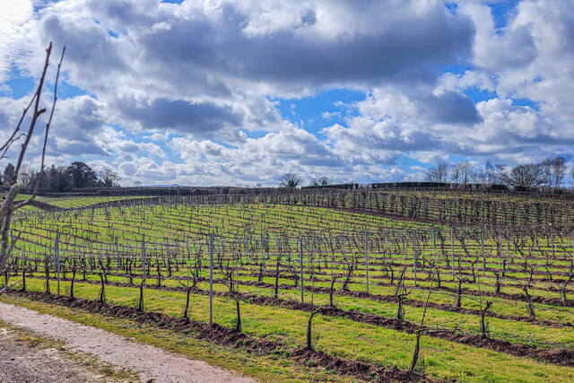
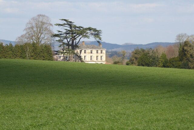
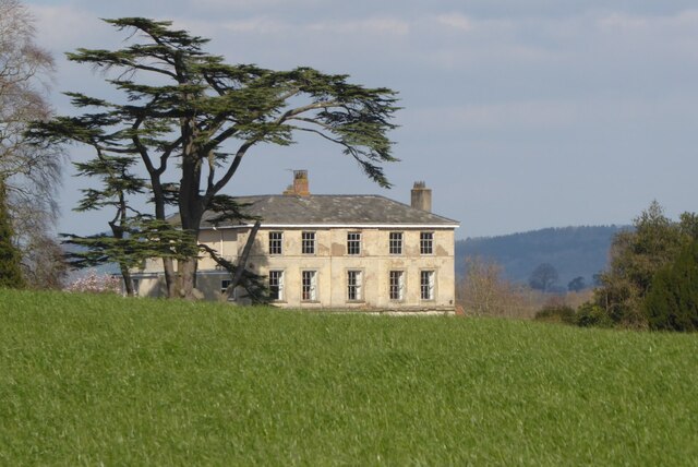
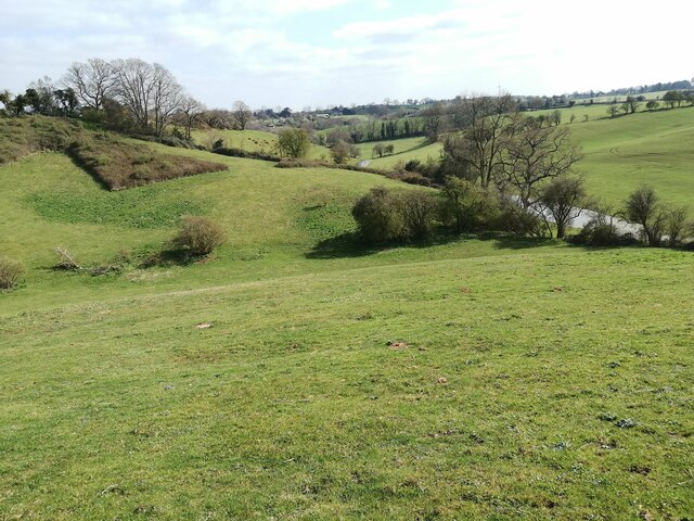
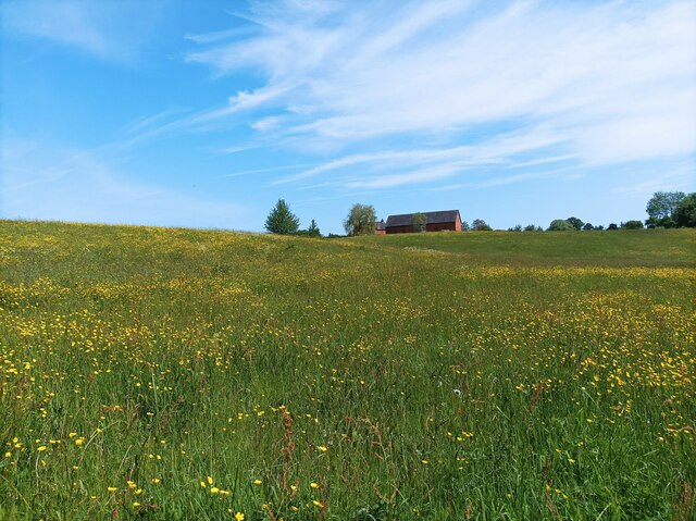
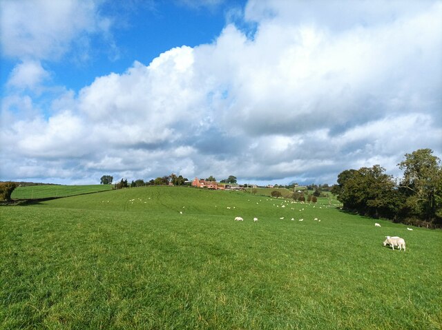
The village is renowned for its stunning natural beauty, surrounded by rolling hills and lush green fields. It boasts an abundance of traditional Cotswold stone cottages, giving it a timeless and idyllic appeal. The local architecture is a captivating blend of medieval and Georgian styles, showcasing the village's rich history.

One of the main attractions in Castletump is its historic parish church, St. Mary's. Dating back to the 12th century, this magnificent structure features intricate stained glass windows and a towering spire, making it a prominent landmark in the village.

Castletump is also home to several charming pubs and tearooms, where visitors can indulge in traditional British fare and enjoy a relaxing afternoon tea. The local shops offer an array of handmade crafts and locally sourced produce, allowing visitors to take a piece of Castletump home with them.

For outdoor enthusiasts, the village provides ample opportunities for hiking, cycling, and exploring the surrounding countryside. There are numerous footpaths and bridleways that wind through the rolling hills, offering breathtaking views of the Cotswold landscape.

Overall, Castletump offers a tranquil and enchanting escape from the hustle and bustle of city life. Its natural beauty, rich history, and warm community spirit make it a truly captivating destination for locals and tourists alike.

If you have any feedback on the listing, please let us know in the comments section below.
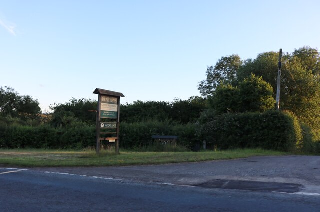
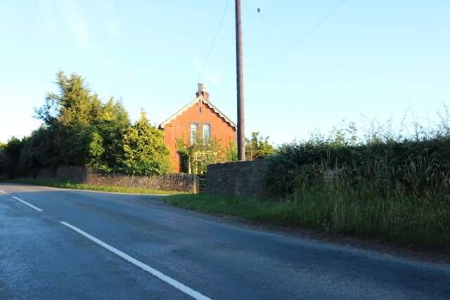
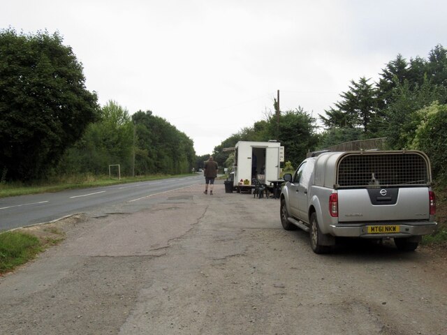
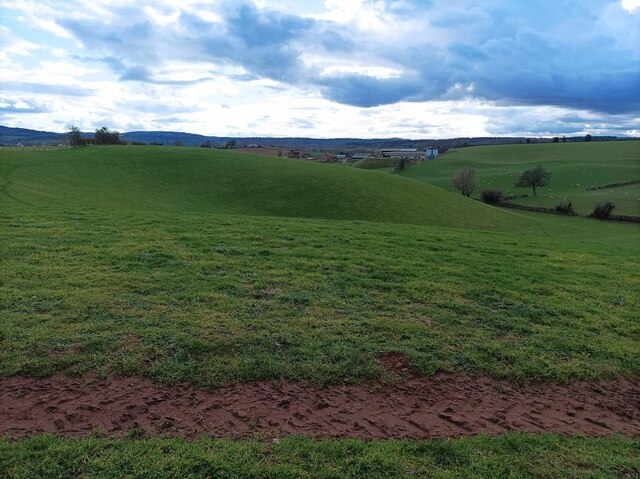
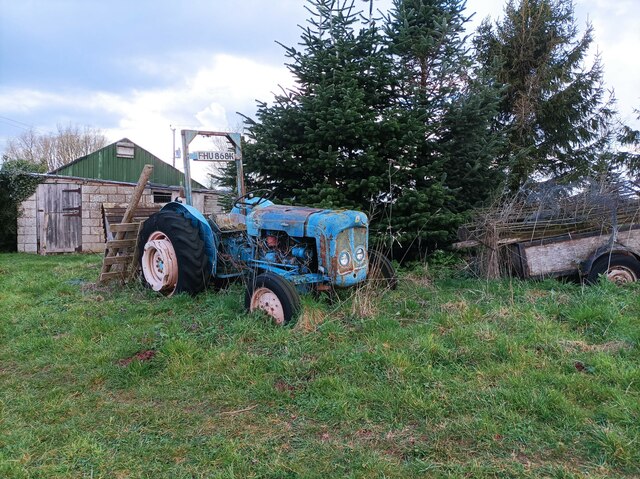
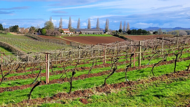
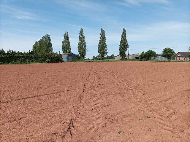
Castletump Images

Images are sourced within 2km of 51.961934/-2.421644 or Grid Reference SO7129. Thanks to Geograph Open Source API. All images are credited.

Covered area at the garden centre Three Shires Garden Centre in late January.
The bulk of the colour comes from primroses.
Covered area at the garden centre
Three Shires Garden Centre in late January. The bulk of the colour comes from primroses.
Three Choirs Vineyard The March clouds crowd the sky above the source of Three Choirs fortune.
Three Choirs Vineyard
The March clouds crowd the sky above the source of Three Choirs fortune.
Boyce Court Boyce Court viewed from the Daffodil Way.  The house was built in 1835 for Drummond family.  A fine looking Grade II listed early 19th century house beside a cedar tree.
Boyce Court
Boyce Court viewed from the Daffodil Way. The house was built in 1835 for Drummond family. A fine looking Grade II listed early 19th century house beside a cedar tree.
Oxenhall Canal Tunnel Southern Portal, 1979 A photograph taken in what looks to be fairly wintry conditions sometime in 1978/79.

It was in a pretty sorry state back then; work was undertaken to renovate it in the 90s (see David Stowell's picture here: <a title="https://www.geograph.org.uk/photo/3682" href="https://www.geograph.org.uk/photo/3682">Link</a> )  but it has, sadly, since fallen back into disrepair (John Winder's picture of 2011: <span class="nowrap"><a title="https://m.geograph.org.uk/photo/5997716" rel="nofollow ugc noopener" href="https://m.geograph.org.uk/photo/5997716">Link</a><img style="margin-left:2px;" alt="External link" title="External link - shift click to open in new window" src="https://s1.geograph.org.uk/img/external.png" width="10" height="10"/></span> )
Oxenhall Canal Tunnel Southern Portal, 1979
A photograph taken in what looks to be fairly wintry conditions sometime in 1978/79. It was in a pretty sorry state back then; work was undertaken to renovate it in the 90s (see David Stowell's picture here: Link ) but it has, sadly, since fallen back into disrepair (John Winder's picture of 2011: LinkExternal link )
The entrance to Bentleys Castle Farm on Dymock Road
Dymock Road south of Dymock
Tea trailer near Newent On the B4215
Tea trailer near Newent
On the B4215
Plant area at Three Shires Garden Centre Some very colourful Heucheras in the foreground.
Plant area at Three Shires Garden Centre
Some very colourful Heucheras in the foreground.
Rolling hills A field with grassy rolling hills.
Rolling hills
A field with grassy rolling hills.
Old tractor A rusty blue tractor on the edge of a field.
Old tractor
A rusty blue tractor on the edge of a field.
Three Choirs vineyard The main buildings in the centre and a distant view of the Malvern Hills.
Three Choirs vineyard
The main buildings in the centre and a distant view of the Malvern Hills.
Fields near Welsh House Lane Grassy fields and rolling hills near Welsh House Lane.
Fields near Welsh House Lane
Grassy fields and rolling hills near Welsh House Lane.
Footpath towards vineyard A footpath through a muddy field leading towards Three Choirs Vineyard.
Footpath towards vineyard
A footpath through a muddy field leading towards Three Choirs Vineyard.
Field of buttercups A large field of buttercups and other wildflowers.
Field of buttercups
A large field of buttercups and other wildflowers.
Holder's Farm and sheep field Holder's Farm, seen from the footpath through a sheep field.
Holder's Farm and sheep field
Holder's Farm, seen from the footpath through a sheep field.
Abandoned barn A seemingly abandoned, rusty barn in a field near the M50.
Abandoned barn
A seemingly abandoned, rusty barn in a field near the M50.
M50 underpass footpath A small tunnel leading under the M50, defaced with graffiti.
M50 underpass footpath
A small tunnel leading under the M50, defaced with graffiti.
Show me another place!

Castletump is located at Grid Ref: SO7129 (Lat: 51.961934, Lng: -2.421644)

Administrative County: Gloucestershire

District: Forest of Dean

Police Authority: Gloucestershire

What 3 Words

///prowling.consented.deny. Near Newent, Gloucestershire

Nearby Locations

Castletump

Related Wikis

Castle Tump, Dymock

Castle Tump was a castle in the village of Dymock in Gloucestershire, England. The castle was built in either the 11th or more probably the early 12th...

Pauntley

Pauntley is a village and civil parish in the district of Forest of Dean, Gloucestershire, England. In 2019 it had a population of 304. == School == Pauntley...

Four Oaks Halt railway station

Four Oaks Halt was a request stop on the former Ledbury and Gloucester Railway. It was located 2 miles north of Newent. The station opened on 16 October...

Ketford Bank

Ketford Bank (grid reference SO723308) is a 0.69-hectare (1.7-acre) nature reserve in Gloucestershire.The site is owned and managed by the Gloucestershire...

Nearby Amenities

Located within 500m of 51.961934,-2.421644
Castle Tump
Historic: archaeological_site
Source: NPE
Wikidata: Q5050319
Lat/Long: 51.961676/-2.4201131
Bus Stop
Castletump
Naptan AtcoCode: 1600GLN057
Naptan Bearing: N
Naptan CommonName: Castletump
Naptan NaptanCode: gloampjd
Naptan Street: B4215
Naptan Verified: no
Source: naptan_import
Lat/Long: 51.9610356/-2.4215539
Bus Stop
Castletump
Naptan AtcoCode: 1600GLN058
Naptan Bearing: S
Naptan CommonName: Castletump
Naptan NaptanCode: gloampjg
Naptan Street: B4215
Naptan Verified: no
Source: naptan_import
Lat/Long: 51.9608569/-2.4212466
Bus Stop
Baldwin's Oak
Naptan AtcoCode: 1600GLN059
Naptan Bearing: NW
Naptan CommonName: Baldwin's Oak
Naptan NaptanCode: gloampjw
Naptan Street: B4215
Naptan Verified: no
Source: naptan_import
Lat/Long: 51.9581039/-2.4192125
Post Box
Collection Times: Mo-Fr 17:10; Sa 09:20
Post Box Type: lamp
Ref: GL18 133
Royal Cypher: EIIR
Royal Cypher Wikidata: Q33102113
Lat/Long: 51.957883/-2.4188898
Power: pole
Lat/Long: 51.9587742/-2.4215352
Power: pole
Lat/Long: 51.9588622/-2.4206724
Power: pole
Lat/Long: 51.9589493/-2.4199164
Power: pole
Lat/Long: 51.9589779/-2.4196194
Power: pole
Lat/Long: 51.9591379/-2.4181226
Power: pole
Lat/Long: 51.9591958/-2.417373
Power: pole
Lat/Long: 51.959294/-2.4162466
Power: pole
Lat/Long: 51.9583759/-2.4259996
Power: pole
Lat/Long: 51.9584697/-2.4248066
Power: pole
Lat/Long: 51.9585804/-2.4233047
Power: pole
Lat/Long: 51.958671/-2.4224377
Man Made: windmill
Lat/Long: 51.9599117/-2.4247647
Cell 9575
Power: pole
Transformer: distribution
Voltage Primary: 11000
Lat/Long: 51.9656935/-2.4251461
Power: pole
Lat/Long: 51.9632104/-2.4250174
Power: pole
Lat/Long: 51.9612957/-2.4252386
Nansfield Farm
Power: pole
Transformer: distribution
Voltage Primary: 11000
Lat/Long: 51.964806/-2.4250643
Power: pole
Lat/Long: 51.9644325/-2.4250174
Power: pole
Lat/Long: 51.9640739/-2.424949
Power: pole
Lat/Long: 51.9627476/-2.4250965
Power: pole
Lat/Long: 51.9621047/-2.4251971
Castle Farm Dymock
Power: pole
Transformer: distribution
Voltage Primary: 11000
Lat/Long: 51.9604313/-2.4252789
Power: pole
Lat/Long: 51.9597279/-2.4263592
Power: pole
Lat/Long: 51.9594816/-2.4267374
Power: pole
Lat/Long: 51.9591195/-2.4272935
The data included in this document is from www.openstreetmap.org. The data is made available under ODbL.

Have you been to Castletump?

Leave your review of Castletump below (or comments, questions and feedback).