Blairmuir Wood

Wood, Forest in Perthshire

Scotland

Blairmuir Wood

Potato field, Blackfaulds Awaiting lifting after defoliation.
Potato field, Blackfaulds Credit: Richard Webb

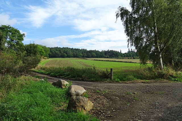
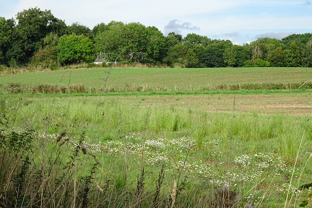
Blairmuir Wood is a picturesque woodland located in Perthshire, Scotland. Covering an area of approximately 50 hectares, the wood is renowned for its natural beauty and diverse ecosystem. It is situated near the village of Blairingone, and is easily accessible for visitors.

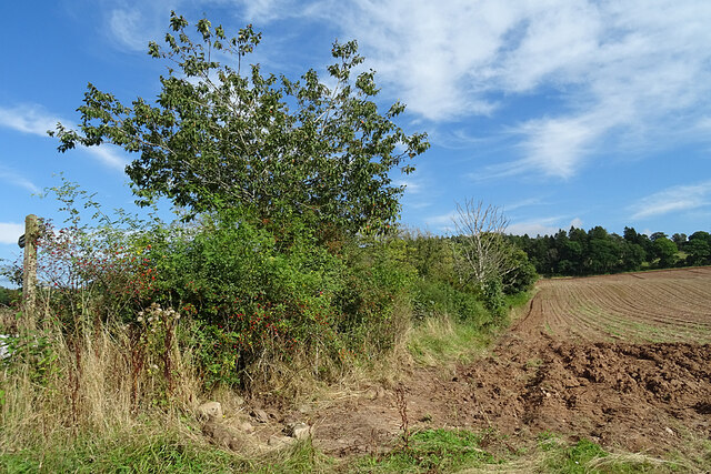
The wood consists predominantly of native deciduous trees, such as oak, birch, and beech, which create a stunning canopy during the spring and summer months. These trees provide a habitat for a wide range of bird species, including woodpeckers, thrushes, and owls, making it a popular spot for birdwatching enthusiasts.

Blairmuir Wood is also home to an array of wildlife, including red squirrels, badgers, and roe deer. Visitors may be lucky enough to spot these creatures during a peaceful walk through the woodland. The wood is crisscrossed with well-maintained trails, allowing visitors to explore its beauty at their own pace.

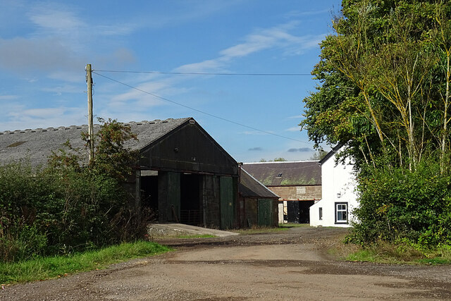
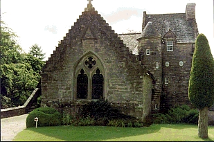
In addition to its natural beauty, Blairmuir Wood also has historical significance. The wood was once part of the estate of Blairingone House, a grand mansion that was unfortunately demolished in the 1950s. However, remnants of the estate can still be found within the wood, such as old stone walls and the remains of a walled garden.

Overall, Blairmuir Wood offers a tranquil and enchanting experience for nature lovers and history enthusiasts alike. Its stunning landscape, diverse wildlife, and historical remnants make it a must-visit destination for those exploring Perthshire.

If you have any feedback on the listing, please let us know in the comments section below.

Blairmuir Wood Images

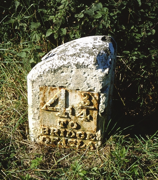
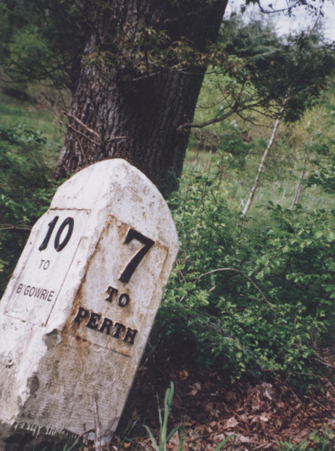
Images are sourced within 2km of 56.48107/-3.3950351 or Grid Reference NO1432. Thanks to Geograph Open Source API. All images are credited.

Potato field, Blackfaulds Awaiting lifting after defoliation.
Potato field, Blackfaulds
Awaiting lifting after defoliation.
Stone circle, Blackfaulds Now in woodland, but easily visible from the road.
Stone circle, Blackfaulds
Now in woodland, but easily visible from the road.
Blackfaulds stone circle The moss covered stones merge into the woodland background.
Blackfaulds stone circle
The moss covered stones merge into the woodland background.
Bus stop outside the Anglers Inn, Guildtown
Old Milestone by the A93, Main Road, north of Guildtown By the A93, in parish of St Martins (Perth & Kinross District), North of Guildtown, on verge, West side of road.

Inscription reads:- : 4¾ / TO / BRIDGE / OF ISLA : : 6 / TO / PERTH :
 
Surveyed

Milestone Society National ID: PK_PTBG06.
Old Milestone by the A93, Main Road, north of Guildtown
By the A93, in parish of St Martins (Perth & Kinross District), North of Guildtown, on verge, West side of road. Inscription reads:- : 4¾ / TO / BRIDGE / OF ISLA : : 6 / TO / PERTH : Surveyed Milestone Society National ID: PK_PTBG06.
Old Milestone by the A93, north of Campsie Hill, Cargill parish Stone post with plates by the A93, in parish of Cargill (Perth & Kinross District), North of Campsie Hill, on verge.

Inscription reads:-
: 10 / TO / B'GOWRIE : : 7 / TO / PERTH :

Surveyed

Milestone Society National ID: PK_PTBG07
Old Milestone by the A93, north of Campsie Hill, Cargill parish
Stone post with plates by the A93, in parish of Cargill (Perth & Kinross District), North of Campsie Hill, on verge. Inscription reads:- : 10 / TO / B'GOWRIE : : 7 / TO / PERTH : Surveyed Milestone Society National ID: PK_PTBG07
Minor road from Cambusmichael heading towards the A93 at Byers Looking north-eastward
Minor road from Cambusmichael heading towards the A93 at Byers
Looking north-eastward
Fields near Campsie Although it's only mid-September, it looks as if next year's cereal crop has already got a start.
Fields near Campsie
Although it's only mid-September, it looks as if next year's cereal crop has already got a start.
Fields at Campsie The farmer has left a wide uncultivated margin, which has been colonised by Mayweed among other wild plants.
Fields at Campsie
The farmer has left a wide uncultivated margin, which has been colonised by Mayweed among other wild plants.
Field Margin A burgeoning hedge alongside an arable field at Campsie.
Field Margin
A burgeoning hedge alongside an arable field at Campsie.
Campsie Farm A glimpse into the farm yard from the path to Campsie Linn.
Campsie Farm
A glimpse into the farm yard from the path to Campsie Linn.
C434 (Perth and Kinross) Road The C434 heading through a wood on the way to the A93 near Guildtown.
C434 (Perth and Kinross) Road
The C434 heading through a wood on the way to the A93 near Guildtown.
A93 approaching Guildtown The A93 northbound on the approach to the village of Guildtown.
A93 approaching Guildtown
The A93 northbound on the approach to the village of Guildtown.
Tree north of Guildtown Fully-leafed tree by the A91 north of Guildtown.
Tree north of Guildtown
Fully-leafed tree by the A91 north of Guildtown.
Oil-seed rape field on a misty morning Looking south over a field of oil-seed rape between St Martins and Wolfhill.
Oil-seed rape field on a misty morning
Looking south over a field of oil-seed rape between St Martins and Wolfhill.
Track heading south from Wolfhill The track from Wolfhill to St Martins, heading through a tree-lined section near Newlands.
Track heading south from Wolfhill
The track from Wolfhill to St Martins, heading through a tree-lined section near Newlands.
Monkey puzzle in Wolfhill Monkey puzzle tree on the north side of Dunsinnan Road in Wolfhill.
Monkey puzzle in Wolfhill
Monkey puzzle tree on the north side of Dunsinnan Road in Wolfhill.
Ploughed field near Guildtown The trees by the field cast chequered shadows over a newly ploughed field north of Guildtown.
Ploughed field near Guildtown
The trees by the field cast chequered shadows over a newly ploughed field north of Guildtown.
Show me another place!

Blairmuir Wood is located at Grid Ref: NO1432 (Lat: 56.48107, Lng: -3.3950351)

Unitary Authority: Perth and Kinross

Police Authority: Tayside

What 3 Words

///concerned.clusters.skims. Near Stanley, Perth & Kinross

Nearby Locations

Blairmuir Wood

Related Wikis

Wolfhill

Wolfhill is a village in Perthshire, Scotland, with a population of 316 (2001 census). Formerly known as Carolina, it was given the nickname of "Snipetown...

Guildtown

Guildtown is a village in Perth and Kinross, Scotland, founded in the year 1818 by the Guildry Incorporation of Perth. It is located roughly 6 miles (9...

Stobhall

Stobhall (or Stobhall Castle) is a country house and estate in Perthshire in Scotland, 8 miles (13 km) from Perth. The 17th-century dower house and several...

Witches' Stone

Witches' Stone is an historic stone in the Scottish parish of St Martins, Perth and Kinross. It marks the location where Macbeth meets with two witches...

Nearby Amenities

Located within 500m of 56.48107,-3.3950351
Power: tower
Source: Bing
Lat/Long: 56.4777039/-3.3898237
Power: tower
Source: Bing
Lat/Long: 56.4834044/-3.388817
Power: tower
Source: Bing
Lat/Long: 56.4794142/-3.3895217
Power: tower
Source: Bing
Lat/Long: 56.4814937/-3.3891544
Power: pole
Lat/Long: 56.4769807/-3.3917137
Power: pole
Lat/Long: 56.4771105/-3.3917673
Power: pole
Lat/Long: 56.4775137/-3.3925632
Power: pole
Lat/Long: 56.4778485/-3.3928107
Power: pole
Lat/Long: 56.4847561/-3.3936973
Power: pole
Lat/Long: 56.4852047/-3.3941592
The data included in this document is from www.openstreetmap.org. The data is made available under ODbL.

Have you been to Blairmuir Wood?

Leave your review of Blairmuir Wood below (or comments, questions and feedback).