Colin's Rig Plantation
Wood, Forest in Peeblesshire
Scotland
Colin's Rig Plantation

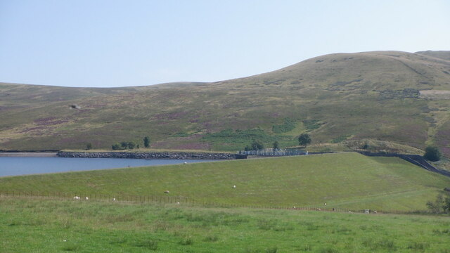
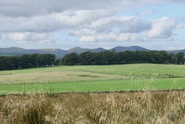
Colin's Rig Plantation is a picturesque woodland located in Peeblesshire, Scotland. Situated in the southern part of the country, the plantation covers a vast area and is renowned for its natural beauty and rich biodiversity.
The woodland is predominantly composed of a variety of trees, including oak, birch, beech, and pine. These tall, majestic trees create a dense canopy that provides a sheltered habitat for numerous wildlife species. The plantation is home to a diverse range of fauna, including red squirrels, deer, birds, and various small mammals.
Colin's Rig Plantation offers a tranquil and serene setting for nature enthusiasts and outdoor enthusiasts alike. The well-maintained walking trails meander through the woodland, providing visitors with an opportunity to explore and appreciate the surrounding natural beauty. These paths are suitable for hikers of all levels, from leisurely strolls to more challenging treks.
The plantation also serves as an important ecological site, contributing to the conservation of the local ecosystem. It acts as a carbon sink, absorbing carbon dioxide and mitigating the effects of climate change. Additionally, the woodland plays a crucial role in maintaining water quality, preventing soil erosion, and supporting the overall health of the surrounding environment.
Visitors to Colin's Rig Plantation can enjoy a range of recreational activities, including picnicking, bird-watching, photography, and nature study. The plantation is easily accessible, with ample parking facilities and well-marked trails. Whether seeking solace in nature or seeking adventure, Colin's Rig Plantation offers a truly immersive and enchanting experience for all who visit.
If you have any feedback on the listing, please let us know in the comments section below.
Colin's Rig Plantation Images
Images are sourced within 2km of 55.782644/-3.3864881 or Grid Reference NT1355. Thanks to Geograph Open Source API. All images are credited.


Colin's Rig Plantation is located at Grid Ref: NT1355 (Lat: 55.782644, Lng: -3.3864881)
Unitary Authority: The Scottish Borders
Police Authority: The Lothians and Scottish Borders
What 3 Words
///evolution.probably.liquid. Near West Linton, Scottish Borders
Nearby Locations
Related Wikis

Baddinsgill
Baddinsgill is a hamlet in the Scottish Borders area of Scotland. The Baddinsgill Reservoir is a few hundred metres north of the hamlet. == See also... ==

Baddinsgill Reservoir
Baddinsgill Reservoir is a small reservoir in the Scottish Borders area of Scotland close to Carlops, West Linton, and the boundary with Midlothian. It...
Pentland Hills
The Pentland Hills are a range of hills southwest of Edinburgh, Scotland. The range is around twenty miles (thirty kilometres) in length, and runs southwest...
Carlops
Carlops (Scottish Gaelic: Leum na Caillich) is a small village in the Pentland Hills, within the Scottish Borders area of Scotland, close to the boundary...
Nearby Amenities
Located within 500m of 55.782644,-3.3864881Have you been to Colin's Rig Plantation?
Leave your review of Colin's Rig Plantation below (or comments, questions and feedback).