Castleton

Settlement in Perthshire

Scotland

Castleton

Speed cameras, A9 The A9 is a strategic link between the Highlands of Scotland and the Central Belt. It runs 279 miles from junction 5 of the M9 at Polmont to Scrabster. Originally it ran from Edinburgh.
<span class="nowrap"><a title="https://www.sabre-roads.org.uk/wiki/index.php?title=A9" rel="nofollow ugc noopener" href="https://www.sabre-roads.org.uk/wiki/index.php?title=A9">Link</a><img style="margin-left:2px;" alt="External link" title="External link - shift click to open in new window" src="https://s1.geograph.org.uk/img/external.png" width="10" height="10"/></span>
Speed cameras, A9 Credit: N Chadwick

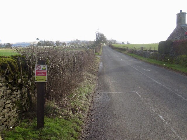
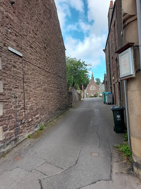
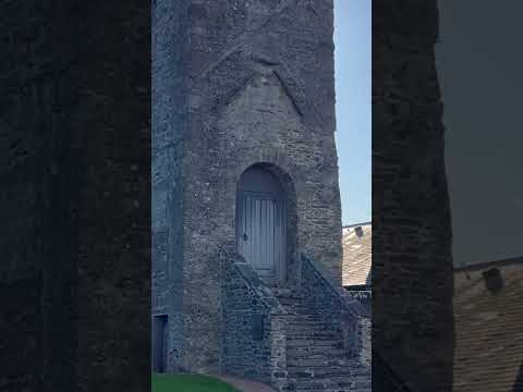
Castleton is a small village located in Perthshire, Scotland. It is situated along the River Tay, surrounded by picturesque countryside and rolling hills. The village is known for its charming stone cottages and historic buildings, including the 12th-century Castleton Castle ruins. The area is popular with hikers and outdoor enthusiasts, with numerous walking trails and cycling routes nearby.

Castleton is a peaceful and idyllic destination, offering a tranquil escape from the hustle and bustle of city life. The village has a close-knit community and a friendly atmosphere, making it a welcoming place for visitors to explore.

In addition to its natural beauty, Castleton also has a rich history and is home to several notable landmarks, such as the nearby Dunkeld Cathedral and the Birnam Oak, made famous in Shakespeare's Macbeth. The village also hosts a number of events and festivals throughout the year, celebrating local culture and heritage.

Overall, Castleton is a charming and picturesque village that offers visitors a glimpse into Scotland's rural beauty and history.

If you have any feedback on the listing, please let us know in the comments section below.

Castleton Images

Images are sourced within 2km of 56.298487/-3.7171587 or Grid Reference NN9313. Thanks to Geograph Open Source API. All images are credited.

Speed cameras, A9 The A9 is a strategic link between the Highlands of Scotland and the Central Belt. It runs 279 miles from junction 5 of the M9 at Polmont to Scrabster. Originally it ran from Edinburgh.
<span class="nowrap"><a title="https://www.sabre-roads.org.uk/wiki/index.php?title=A9" rel="nofollow ugc noopener" href="https://www.sabre-roads.org.uk/wiki/index.php?title=A9">Link</a><img style="margin-left:2px;" alt="External link" title="External link - shift click to open in new window" src="https://s1.geograph.org.uk/img/external.png" width="10" height="10"/></span>
Speed cameras, A9
The A9 is a strategic link between the Highlands of Scotland and the Central Belt. It runs 279 miles from junction 5 of the M9 at Polmont to Scrabster. Originally it ran from Edinburgh. LinkExternal link
Abbey Road Bridge, A9 The A9 is a strategic link between the Highlands of Scotland and the Central Belt. It runs 279 miles from junction 5 of the M9 at Polmont to Scrabster. Originally it ran from Edinburgh.
<span class="nowrap"><a title="https://www.sabre-roads.org.uk/wiki/index.php?title=A9" rel="nofollow ugc noopener" href="https://www.sabre-roads.org.uk/wiki/index.php?title=A9">Link</a><img style="margin-left:2px;" alt="External link" title="External link - shift click to open in new window" src="https://s1.geograph.org.uk/img/external.png" width="10" height="10"/></span>
Abbey Road Bridge, A9
The A9 is a strategic link between the Highlands of Scotland and the Central Belt. It runs 279 miles from junction 5 of the M9 at Polmont to Scrabster. Originally it ran from Edinburgh. LinkExternal link
Layby - A9 northbound
Abbey Road bridge - A9 northbound
Another inappropriate forestry sign, B8062 A stupid person placed, or ordered the placement of a forestry keep out sign on the B8062.  This is not the usual road closure sign, you will see those just about every time you go out, just unthinking following of instructions.  Needless to say there was no forestry work anywhere near although some trees were cut down on land to the left at one time - you can see the Tuley tubes of the new plantings.
Another inappropriate forestry sign, B8062
A stupid person placed, or ordered the placement of a forestry keep out sign on the B8062. This is not the usual road closure sign, you will see those just about every time you go out, just unthinking following of instructions. Needless to say there was no forestry work anywhere near although some trees were cut down on land to the left at one time - you can see the Tuley tubes of the new plantings.
Auto & Plant, Auchterarder Closed and fenced off along with an office of Stuart Milne on the site.  More houses coming?
Auto & Plant, Auchterarder
Closed and fenced off along with an office of Stuart Milne on the site. More houses coming?
Stuart Milne, former office in Auchterarder
High Street, Auchterarder
Shop, Auchterarder High Street A health food shop.
Shop, Auchterarder High Street
A health food shop.
High Street, Auchterarder
A9 passing Auchterarder
Auchterarder seen from Black Maller
Feus, Auchterarder Eastern end of Auchterarder's long street (former A9).
Feus, Auchterarder
Eastern end of Auchterarder's long street (former A9).
High Street
High Street
North Crofts
North Crofts
St Kessog's Place
St Kessog's Place
Castleton Road
Castleton Road
Show me another place!

Castleton is located at Grid Ref: NN9313 (Lat: 56.298487, Lng: -3.7171587)

Unitary Authority: Perth and Kinross

Police Authority: Tayside

What 3 Words

///sprinter.harvest.share. Near Auchterarder, Perth & Kinross

Related Wikis

St Margaret's Hospital, Auchterarder

St Margaret's Hospital is a health facility in Western Road, Auchterarder, Scotland. It is managed by NHS Tayside. It is a Category B listed building....

Aytoun Hall

Aytoun Hall, also referred to as Auchterarder Town Hall, is a municipal building in the High Street, Auchterarder, Perth and Kinross, Scotland. The structure...

Community School of Auchterarder

The Community School of Auchterarder (TCSoA) (formerly Auchterarder High School) is a small to medium-sized school with a nursery, primary and secondary...

Auchterarder

Auchterarder ( ; Scottish Gaelic: Uachdar Àrdair, meaning Upper Highland) is a town north of the Ochil Hills in Perth and Kinross, Scotland, and home to...

Related Videos

Gleneagles Hotel, Scotland - Health Travel

The Gleneagles Hotel may be famed for its world-class golf courses, but a visit to this charismatic country estate reveals so much ...

Amazing Scotland countryside walking experience

I have come to Scotland from India. Thought of going to some villages and see farms and jungle. I found some best place around ...

IDILIQ SCOTLAND

An easy journey from the buzzing cities of Edinburgh and Glasgow, Perthshire is home to the sublime Wyndham Duchally Country ...

Nearby Amenities

Located within 500m of 56.298487,-3.7171587
Noexit: yes
Lat/Long: 56.2952116/-3.719117
Post Box
Collection Times: Mo-Fr 09:00; Sa 07:00
Manufacturer: Machan Scotland
Operator: Royal Mail
Post Box Mounting: pier
Post Box Type: lamp
Ref: PH3 42D
Royal Cypher: scottish_crown
Source: survey;local knowledge
Lat/Long: 56.2996186/-3.7182994
Power: pole
Lat/Long: 56.2965765/-3.7235504
Power: pole
Lat/Long: 56.2969145/-3.7223778
Power: pole
Lat/Long: 56.2969675/-3.7209266
Power: pole
Lat/Long: 56.2972894/-3.7198309
Power: pole
Lat/Long: 56.2975801/-3.7187872
Power: pole
Lat/Long: 56.2978766/-3.7177393
Power: pole
Lat/Long: 56.2980658/-3.7170657
Power: pole
Lat/Long: 56.295402/-3.7215753
Power: pole
Lat/Long: 56.2957239/-3.7202779
Power: pole
Lat/Long: 56.2960515/-3.718862
Power: pole
Lat/Long: 56.2963042/-3.7177144
Power: pole
Lat/Long: 56.2965245/-3.7167081
Power: pole
Lat/Long: 56.296723/-3.7157745
Power: pole
Lat/Long: 56.2967426/-3.7157038
Power: pole
Lat/Long: 56.3000316/-3.7189088
Power: pole
Lat/Long: 56.2994975/-3.7183308
Power: pole
Lat/Long: 56.2989299/-3.7177341
Power: pole
Lat/Long: 56.2983958/-3.7171644
Power: pole
Lat/Long: 56.2979032/-3.7166114
Power: pole
Lat/Long: 56.2973586/-3.7160251
Power: pole
Lat/Long: 56.2967357/-3.7153556
The data included in this document is from www.openstreetmap.org. The data is made available under ODbL.

Have you been to Castleton?

Leave your review of Castleton below (or comments, questions and feedback).