Bellwood Riverside Park
Wood, Forest in Perthshire
Scotland
Bellwood Riverside Park

Bellwood Riverside Park is a stunning wooded area located in Perthshire, Scotland. This enchanting park covers an expansive area, with its boundaries stretching along the banks of the River Tay. The park's rich woodland boasts a variety of native tree species, creating a picturesque and tranquil setting for visitors to enjoy.
The park offers a range of activities and amenities for both locals and tourists alike. There are well-maintained trails that wind through the forest, providing opportunities for leisurely walks and hikes. These pathways are also popular among cyclists and joggers, offering a chance to embrace the natural beauty of the area while staying active.
For those seeking a more relaxed experience, Bellwood Riverside Park provides numerous picnic spots and benches where visitors can sit and soak in the peaceful surroundings. The park is also home to a charming riverside café, where guests can indulge in delicious refreshments while taking in the breathtaking views of the River Tay.
Nature enthusiasts will be delighted by the diverse wildlife that calls Bellwood Riverside Park home. The park is a haven for birdwatchers, as it attracts a wide array of species throughout the year. Additionally, the tranquil river provides a habitat for various fish species, making it a popular spot for anglers.
Overall, Bellwood Riverside Park is a true gem in Perthshire, offering an idyllic escape from the hustle and bustle of everyday life. Its enchanting woodland, scenic trails, and abundant wildlife make it a must-visit destination for nature lovers and outdoor enthusiasts.
If you have any feedback on the listing, please let us know in the comments section below.
Bellwood Riverside Park Images
Images are sourced within 2km of 56.392539/-3.421263 or Grid Reference NO1223. Thanks to Geograph Open Source API. All images are credited.


Bellwood Riverside Park is located at Grid Ref: NO1223 (Lat: 56.392539, Lng: -3.421263)
Unitary Authority: Perth and Kinross
Police Authority: Tayside
What 3 Words
///player.highs.visits. Near Perth, Perth & Kinross
Nearby Locations
Related Wikis
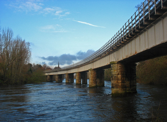
Tay Viaduct
The Tay Viaduct, also known as the West Railway Bridge, is a single-track railway viaduct in Perth, Perth and Kinross, Scotland. It is around 440 m (1...

Rodney Gardens
Rodney Gardens is an urban garden in the Kinnoull area of the Scottish city of Perth, on the eastern banks of the River Tay. Named for Admiral George Rodney...

Queen's Bridge, Perth
Queen's Bridge is a toll-free bridge in the city of Perth, Scotland. It spans the River Tay, connecting Perth, on the western side of the river, to Bridgend...

62–72 Tay Street
62–72 Tay Street (also known as the County Buildings) is an historic row of buildings in Perth, Scotland. Designed by local architect John Young, the building...
Nearby Amenities
Located within 500m of 56.392539,-3.421263Have you been to Bellwood Riverside Park?
Leave your review of Bellwood Riverside Park below (or comments, questions and feedback).