Back Braes

Wood, Forest in West Lothian

Scotland

Back Braes

Shrinking Niddry Bing
Shrinking Niddry Bing Credit: Richard Webb

Back Braes is a picturesque woodland area located in West Lothian, Scotland. Situated just outside the town of Linlithgow, this enchanting forest is a popular destination for nature lovers and outdoor enthusiasts. Covering a vast area, Back Braes is characterized by its dense canopies of native trees, creating a serene and peaceful environment.

The woodland is predominantly made up of deciduous trees such as oak, birch, and beech, which provide a vibrant display of colors during the autumn months. These trees also support a diverse range of wildlife, including various bird species, small mammals, and insect life. Visitors to Back Braes may have the chance to spot woodland creatures such as squirrels and roe deer, adding to the area's natural charm.

The forest features several walking trails that wind through the trees, allowing visitors to explore and immerse themselves in the natural beauty of the surroundings. These paths offer stunning views of the surrounding countryside and are suitable for walkers of all abilities. Whether it's a leisurely stroll or a more challenging hike, Back Braes caters to all preferences.

Additionally, the area is home to a variety of wildflowers and plants, creating a colorful tapestry that adds to the visual appeal. This makes it an ideal spot for nature photography and botany enthusiasts.

Overall, Back Braes in West Lothian offers a tranquil escape from the bustling urban life, providing a haven for those seeking solace in nature's embrace.

If you have any feedback on the listing, please let us know in the comments section below.

Back Braes Images

Images are sourced within 2km of 55.954419/-3.414806 or Grid Reference NT1174. Thanks to Geograph Open Source API. All images are credited.

Shrinking Niddry Bing
Minor road by Newliston A bend in the road with an oil bing in the background on an afternoon of frequent wet snow showers.
Minor road by Newliston
A bend in the road with an oil bing in the background on an afternoon of frequent wet snow showers.
Winter wheat near Niddry Castle
Shale bing near Niddry Castle Part of West Lothian's industrial landscape - the remains of the 19C oil industry.
Shale bing near Niddry Castle
Part of West Lothian's industrial landscape - the remains of the 19C oil industry.
Niddry Bing outside Winchburgh A huge relic of the 19th century shale oil industry. Niddry Castle can be seen just to the left of the bing. <span class="nowrap"><a title="http://www.geos.ed.ac.uk/homes/harvieb/bing.html" rel="nofollow ugc noopener" href="http://www.geos.ed.ac.uk/homes/harvieb/bing.html">Link</a><img style="margin-left:2px;" alt="External link" title="External link - shift click to open in new window" src="https://s1.geograph.org.uk/img/external.png" width="10" height="10"/></span>
Niddry Bing outside Winchburgh
A huge relic of the 19th century shale oil industry. Niddry Castle can be seen just to the left of the bing. LinkExternal link
Niddry Bing Beyond a golf course. The bing is being quarried, a lot of it has ended up in the new road bridge over the Forth at Queensferry.
Niddry Bing
Beyond a golf course. The bing is being quarried, a lot of it has ended up in the new road bridge over the Forth at Queensferry.
Trig pillar, Humbie In the middle of an arable area.
Trig pillar, Humbie
In the middle of an arable area.
Newbridge Roundabout. Originally the M8 and M9 met at a roundabout here, a legendary hitch-hiking spot. Now the M9 goes underneath. Fortunately there is a cycle path/footbridge over all this mayhem.
Newbridge Roundabout.
Originally the M8 and M9 met at a roundabout here, a legendary hitch-hiking spot. Now the M9 goes underneath. Fortunately there is a cycle path/footbridge over all this mayhem.
Disused railway, Newbridge. Now a cycle/footpath, an overgrown former railway to  Queensferry. Kirkliston in the distance.
Disused railway, Newbridge.
Now a cycle/footpath, an overgrown former railway to Queensferry. Kirkliston in the distance.
Crash gates, Edinburgh Airport. On a former minor road severed by the building of the airport. The new control tower can be seen with Arthur's Seat.
Crash gates, Edinburgh Airport.
On a former minor road severed by the building of the airport. The new control tower can be seen with Arthur's Seat.
Kirkliston Kirkliston takes up most of this square. The centre is this crossroads on the old A9 (severed by the airport).
Kirkliston
Kirkliston takes up most of this square. The centre is this crossroads on the old A9 (severed by the airport).
Craigend NW towards Dundas Castle. Just off A8000.
Craigend
NW towards Dundas Castle. Just off A8000.
Carmelhill Reservoir. Managed by a fly fishing club. Beside the Edinburgh-Glasgow railway.
Carmelhill Reservoir.
Managed by a fly fishing club. Beside the Edinburgh-Glasgow railway.
Kirkliston Leisure Centre. A checkpoint for a big sponsored bike ride - sports hall backed by the spur of the M9 that spectacularly fails to meet the Forth Bridge.
Kirkliston Leisure Centre.
A checkpoint for a big sponsored bike ride - sports hall backed by the spur of the M9 that spectacularly fails to meet the Forth Bridge.
New housing, Kirkliston West side of town, expanding to take in more refugees from the Edinburgh housing market.
New housing, Kirkliston
West side of town, expanding to take in more refugees from the Edinburgh housing market.
Shale bing, Niddry. The eastern end of this shale bing stretches into the square, which also contains: some arable land, a small wood and the M9.  View north from NT102741.  The shale is baked oilshales, the remnants after the oil has been removed.
Shale bing, Niddry.
The eastern end of this shale bing stretches into the square, which also contains: some arable land, a small wood and the M9. View north from NT102741. The shale is baked oilshales, the remnants after the oil has been removed.
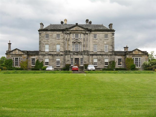
Newliston Big house with a famous garden, set in parkland.  Caught a glimpse when trying to do something interesting with a field of rape stubble not involving a shale bing.  A landscaped ride ending in a ha-ha, probably had a view to the Ochils, now they will see the bings instead.
Newliston
Big house with a famous garden, set in parkland. Caught a glimpse when trying to do something interesting with a field of rape stubble not involving a shale bing. A landscaped ride ending in a ha-ha, probably had a view to the Ochils, now they will see the bings instead.
Lodge, Newliston. Entrance to the park and house at Newliston, an ornate lodge by Millrig Farm.
Lodge, Newliston.
Entrance to the park and house at Newliston, an ornate lodge by Millrig Farm.
Show me another place!

Back Braes is located at Grid Ref: NT1174 (Lat: 55.954419, Lng: -3.414806)

Unitary Authority: City of Edinburgh

Police Authority: Edinburgh

What 3 Words

///lump.prancing.clubbing. Near Kirkliston, Edinburgh

Nearby Locations

Back Braes

Related Wikis

Kirkliston

Kirkliston is a small town and parish to the west of Edinburgh, Scotland, historically within the county of West Lothian but now within the City of Edinburgh...

Kirkliston railway station

Kirkliston railway station served the village of Kirkliston, historically in the county of West Lothian, Scotland from 1866 to 1966 on the North British...

Newliston

Newliston is a country house near Edinburgh, Scotland. It is located 1 mile (1.6 km) south-west of Kirkliston, and 8 miles (13 km) west of the city centre...

Newbridge, Edinburgh

Newbridge (Scottish Gaelic: An Drochaid Nuadh) is a village within the parish of Kirkliston, to the west of Edinburgh, Scotland. It originally lay on the...

Nearby Amenities

Located within 500m of 55.954419,-3.414806
Motorway Junction
Kirkliston
Ref: 1A
Lat/Long: 55.9531594/-3.4147571
Traffic Calming: hump
Lat/Long: 55.9541294/-3.4085004
Traffic Calming: hump
Lat/Long: 55.9541192/-3.4076963
Traffic Calming: cushion
Lat/Long: 55.9559965/-3.4080053
Bicycle Parking
Capacity: 8
Lat/Long: 55.9581549/-3.414632
Bus Stop
Kirklands Park
Naptan AtcoCode: 6200202110
Naptan Bearing: N
Naptan CommonName: Kirklands Park Street
Naptan Indicator: Kirklands Park Gdns
Naptan Landmark: Kirklands Park Street
Naptan NaptanCode: 36238539
Naptan PlusbusZoneRef: EDINBUR
Naptan Street: Stirling Road
Naptan Verified: no
Public Transport: platform
Source: naptan_import;survey
Lat/Long: 55.9565716/-3.4124666
Bus Stop
Kirklands Park
Naptan AtcoCode: 6200247790
Naptan Bearing: S
Naptan CommonName: Kirklands Park Street
Naptan Indicator: At The Dram Housing Scheme
Naptan Landmark: Kirklands Park Street
Naptan NaptanCode: 36238538
Naptan PlusbusZoneRef: EDINBUR
Naptan Street: Stirling Road
Naptan Verified: no
Public Transport: platform
Source: naptan_import;survey
Lat/Long: 55.9565314/-3.4128336
Motorway Junction
Kirkliston
Ref: 1A
Lat/Long: 55.9583253/-3.4165348
Traffic Calming: cushion
Lat/Long: 55.9559816/-3.4090851
Traffic Calming: cushion
Lat/Long: 55.9552247/-3.4074992
Traffic Calming: cushion
Lat/Long: 55.9552068/-3.408959
Traffic Calming: cushion
Lat/Long: 55.9564351/-3.4090422
Traffic Calming: cushion
Lat/Long: 55.9558071/-3.4090975
Traffic Calming: cushion
Lat/Long: 55.9550834/-3.4087057
Traffic Calming: cushion
Lat/Long: 55.9566243/-3.4080283
Crossing
Crossing: traffic_signals
Crossing Ref: pelican
Source: survey
Lat/Long: 55.9564274/-3.4113967
Traffic Calming: cushion
Lat/Long: 55.9558342/-3.4074142
Traffic Calming: cushion
Lat/Long: 55.9565264/-3.408872
Traffic Calming: cushion
Lat/Long: 55.9553612/-3.4081075
Post Box
Ref: EH29 367
Lat/Long: 55.9566651/-3.4114271
Addr City: Kirkliston
Addr Housenumber: 49
Addr Street: Pikes Pool Drive
Lat/Long: 55.9526536/-3.4074782
Addr City: Kirkliston
Addr Housenumber: 22
Addr Street: Manse Road
Lat/Long: 55.9543944/-3.406894
Traffic Calming: hump
Lat/Long: 55.9537738/-3.407595
Stone Arch
Historic: monument
Lat/Long: 55.9551033/-3.4154194
Gateside
Place: neighbourhood
Lat/Long: 55.951936/-3.4091485
Fixme: continue
Lat/Long: 55.9581698/-3.4161068
Generator Method: photovoltaic
Generator Output Electricity: yes
Generator Source: solar
Generator Type: solar_photovoltaic_panel
Power: generator
Lat/Long: 55.9580808/-3.4119126
Generator Method: photovoltaic
Generator Output Electricity: yes
Generator Source: solar
Generator Type: solar_photovoltaic_panel
Power: generator
Lat/Long: 55.9579327/-3.410895
Generator Method: photovoltaic
Generator Output Electricity: yes
Generator Source: solar
Generator Type: solar_photovoltaic_panel
Power: generator
Lat/Long: 55.9579361/-3.4105678
Generator Method: photovoltaic
Generator Output Electricity: yes
Generator Source: solar
Generator Type: solar_photovoltaic_panel
Power: generator
Lat/Long: 55.9572393/-3.4097258
The data included in this document is from www.openstreetmap.org. The data is made available under ODbL.

Have you been to Back Braes?

Leave your review of Back Braes below (or comments, questions and feedback).