Milton Plantation

Wood, Forest in Dumfriesshire

Scotland

Milton Plantation

Cattle grazing, Newfarm
Cattle grazing, Newfarm Credit: JThomas

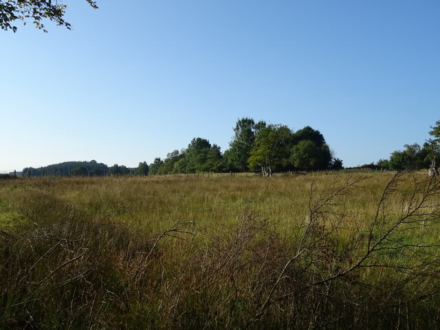
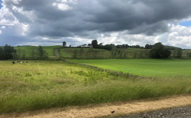
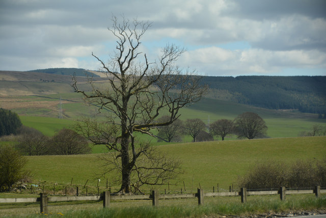
Milton Plantation, located in Dumfriesshire, Scotland, is a picturesque woodland area renowned for its natural beauty and rich history. Covering a vast expanse of approximately 500 acres, it is a haven for nature enthusiasts and a popular destination for outdoor activities.

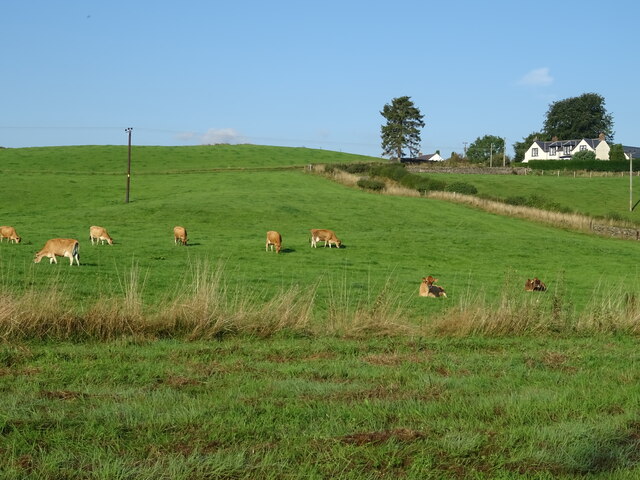
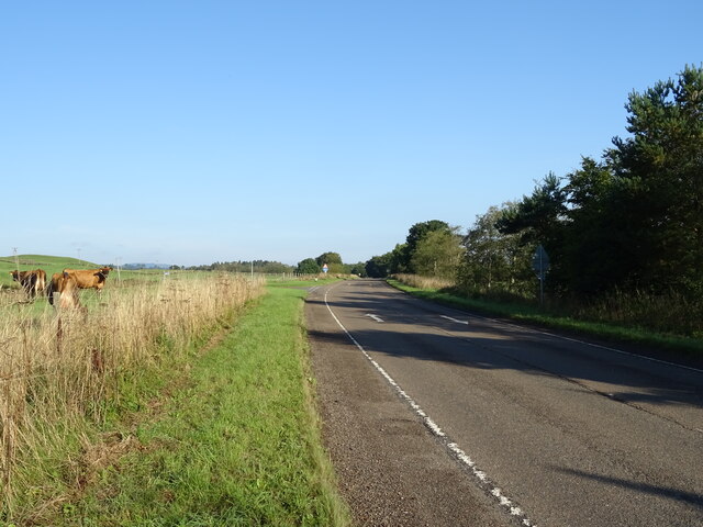
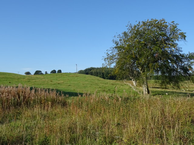
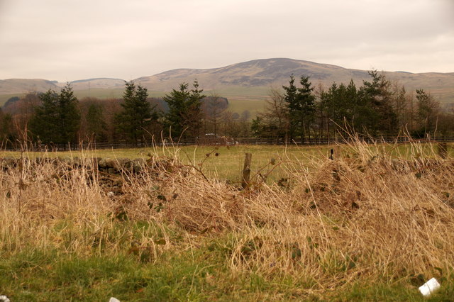
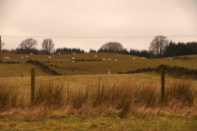
The plantation is predominantly made up of dense forests, comprising a variety of tree species such as oak, beech, and pine. This diverse ecosystem provides habitat for a wide array of wildlife, including red deer, roe deer, and numerous bird species. With its scenic trails and paths, Milton Plantation offers a perfect setting for hiking, walking, and birdwatching.

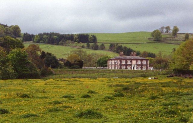
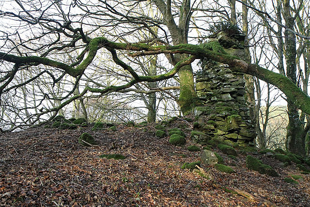
Steeped in history, the area has evidence of human activity dating back to ancient times. Ruins of Iron Age forts and medieval settlements can be found within the plantation, adding an element of intrigue to the natural surroundings. Additionally, the plantation's name is believed to have originated from the Milton family, who were prominent landowners in the area during the 16th and 17th centuries.

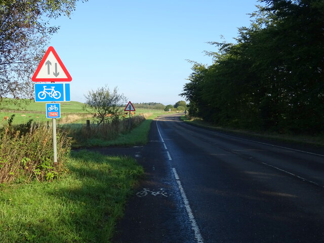
Visitors to Milton Plantation can also explore nearby attractions, such as the charming village of Thornhill, which offers quaint shops, cozy cafes, and historical landmarks. The plantation's close proximity to the River Nith provides opportunities for fishing and boating activities as well.

Overall, Milton Plantation offers a serene and captivating experience, where visitors can immerse themselves in the beauty of nature and uncover the secrets of the past.

If you have any feedback on the listing, please let us know in the comments section below.

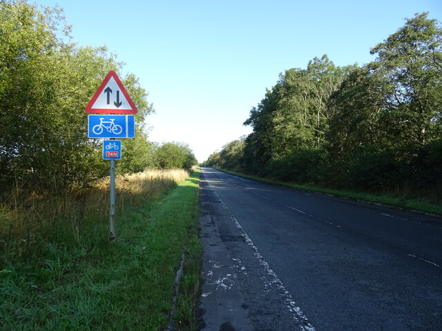
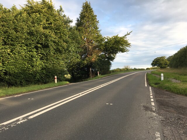
Milton Plantation Images

Images are sourced within 2km of 55.287872/-3.4311949 or Grid Reference NT0900. Thanks to Geograph Open Source API. All images are credited.

Cattle grazing, Newfarm
National Cycle Route 74 towards Beattock B7076 heading north.
National Cycle Route 74 towards Beattock
B7076 heading north.
B7076, Newfarm Towards Beattock.
B7076, Newfarm
Towards Beattock.
Hillside grazing, Mid Murthat
National Cycle Route 74 towards Beattock On the B7076.
National Cycle Route 74 towards Beattock
On the B7076.
Grassland, Buck Rigg
Newfarm on Blackrig Hill Under an ominous sky
Newfarm on Blackrig Hill
Under an ominous sky
A701 towards Dumfries
A74(M), southbound The A74(M) & M74  run over 80 miles from the M6 at the Scottish border near Gretna to the M8 at Glasgow. This is one of the two most important routeways into Scotland from the south. The last stretch of the M74 opened in 2011 (see <a title="https://www.geograph.org.uk/snippet/590" href="https://www.geograph.org.uk/snippet/590">Link</a> ).
Wikipedia: <span class="nowrap"><a title="http://en.wikipedia.org/wiki/A74(M)_and_M74_motorways" rel="nofollow ugc noopener" href="http://en.wikipedia.org/wiki/A74(M)_and_M74_motorways">Link</a><img style="margin-left:2px;" alt="External link" title="External link - shift click to open in new window" src="https://s1.geograph.org.uk/img/external.png" width="10" height="10"/></span>
A74(M), southbound
The A74(M) & M74 run over 80 miles from the M6 at the Scottish border near Gretna to the M8 at Glasgow. This is one of the two most important routeways into Scotland from the south. The last stretch of the M74 opened in 2011 (see Link ). Wikipedia: LinkExternal link
Farm road to Breconside
Gas Distribution Station at Beattock An aerial view. In front are the Beattock-Dumfries [A701] and Beattock-Lochmaben [B7020] roads. Beyond are the A74(M) and B7076 running parallel.
Gas Distribution Station at Beattock
An aerial view. In front are the Beattock-Dumfries [A701] and Beattock-Lochmaben [B7020] roads. Beyond are the A74(M) and B7076 running parallel.
Fields south of Beattock Looking across the A74(M) towards Craig Hill.
Fields south of Beattock
Looking across the A74(M) towards Craig Hill.
Fields south of Beattock
Dumfries and Galloway : Grassy Field A grassy field and Newfarm seen in Dumfries and Galloway.
Dumfries and Galloway : Grassy Field
A grassy field and Newfarm seen in Dumfries and Galloway.
Dumfries and Galloway : The A74(M) Motorway Heading along the A74(M) through Dumfries and Galloway.
Dumfries and Galloway : The A74(M) Motorway
Heading along the A74(M) through Dumfries and Galloway.
Dumfries And Galloway : Countryside Scenery Looking out across the grassy countryside.
Dumfries And Galloway : Countryside Scenery
Looking out across the grassy countryside.
Dumfries And Galloway : The A74(M) Looking along the A74(M).
Dumfries And Galloway : The A74(M)
Looking along the A74(M).
Dumfries And Galloway : The A74(M) Looking along the A74(M) motorway.
Dumfries And Galloway : The A74(M)
Looking along the A74(M) motorway.
Show me another place!

Milton Plantation is located at Grid Ref: NT0900 (Lat: 55.287872, Lng: -3.4311949)

Unitary Authority: Dumfries and Galloway

Police Authority: Dumfries and Galloway

What 3 Words

///punters.relegate.scouted. Near Beattock, Dumfries & Galloway

Nearby Locations

Milton Plantation

Related Wikis

Kirkpatrick-Juxta

Kirkpatrick-Juxta is a parish in Dumfries and Galloway on the A701, between Biggar, Moffat and Lockerbie. The parish straddles the main road A74 (M). It...

Beattock railway station

Beattock railway station was a station which served the village of Beattock, in the parish of Kirkpatrick-Juxta in the Scottish county of Dumfries and...

Beattock

Beattock is a village in Dumfries and Galloway, Scotland, approximately 1⁄2 mile (800 metres) southwest of Moffat and 19 miles (31 kilometres) north of...

Lochwood Tower

Lochwood Tower, also known as Lochwood Castle, is a ruined 16th-century L-plan tower house situated in Annandale (Valley of the River Annan) about 6 miles...

Cornal Tower

Cornal Tower is the ruins of a tower house located near Moffat, Dumfries-shire, Scotland. Alternative names are Polcornare, Cornal Burn, or Logan. The...

Moffat Academy

Moffat Academy is a school in Moffat, Dumfries and Galloway, Scotland. It educates children from nursery to Secondary 6. == History == Moffat Academy traces...

Moffat railway station

Moffat railway station was a station and the terminus of a short branch line which served Moffat, in the Scottish county of Dumfries and Galloway. It was...

Auchencastle railway station

Auchencastle railway station was a private station which served Auchencastle, near Beattock, in the Scottish county of Dumfries and Galloway. It was used...

Nearby Amenities

Located within 500m of 55.287872,-3.4311949
Bus Stop
Upper Murthat
Naptan AtcoCode: 680000518111
Naptan Bearing: NW
Naptan CommonName: Upper Murthat
Naptan Indicator: at Cottages
Naptan Landmark: Murthat
Naptan NaptanCode: 34232958
Naptan Notes: none
Naptan Street: B7076
Naptan Verified: no
Source: naptan_import
Lat/Long: 55.2871815/-3.4360265
Bus Stop
Upper Murthat
Naptan AtcoCode: 680000518222
Naptan Bearing: SE
Naptan CommonName: Upper Murthat
Naptan Indicator: opp Cottages
Naptan Landmark: Murthat
Naptan NaptanCode: 34232957
Naptan Notes: none
Naptan Street: B7076
Naptan Verified: no
Source: naptan_import
Lat/Long: 55.2872472/-3.4357926
Power: pole
Lat/Long: 55.2871713/-3.4379042
Power: pole
Lat/Long: 55.2874075/-3.4372448
Power: pole
Lat/Long: 55.2919136/-3.4277318
Power: pole
Lat/Long: 55.2919899/-3.4282804
Power: pole
Lat/Long: 55.2918094/-3.429607
Power: pole
Lat/Long: 55.2916085/-3.4309646
Power: pole
Lat/Long: 55.2914296/-3.4322113
Power: pole
Lat/Long: 55.2912183/-3.4336307
Power: pole
Lat/Long: 55.291563/-3.4332494
Power: pole
Lat/Long: 55.291698/-3.4344447
Power: pole
Lat/Long: 55.2920221/-3.4317374
Power: pole
Lat/Long: 55.2895711/-3.4254211
Power: pole
Lat/Long: 55.2893042/-3.4243186
Power: pole
Lat/Long: 55.2859582/-3.425197
Power: pole
Lat/Long: 55.2867577/-3.4257483
Power: pole
Lat/Long: 55.2875249/-3.4262712
Power: pole
Lat/Long: 55.2883096/-3.4268302
Power: pole
Lat/Long: 55.2890079/-3.4273505
Power: pole
Lat/Long: 55.2894465/-3.4280718
Power: pole
Lat/Long: 55.2898997/-3.4288858
Power: pole
Lat/Long: 55.2903852/-3.4297461
Power: pole
Lat/Long: 55.2908971/-3.4306426
Power: pole
Lat/Long: 55.2914369/-3.4315957
Railway: signal
Railway Signal Direction: forward
Railway Signal Main: GB-NR:main
Railway Signal Main Form: light
Ref: GMC734
Lat/Long: 55.2894029/-3.4330328
The data included in this document is from www.openstreetmap.org. The data is made available under ODbL.

Have you been to Milton Plantation?

Leave your review of Milton Plantation below (or comments, questions and feedback).