Bankend Wood

Wood, Forest in Dumfriesshire

Scotland

Bankend Wood

Grassland, Buck Rigg
Grassland, Buck Rigg Credit: JThomas

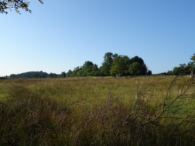
Bankend Wood is a picturesque forest located in Dumfriesshire, Scotland. Covering an area of approximately 40 hectares, the wood is known for its diverse range of flora and fauna, providing a habitat for various species of birds, mammals, and insects.

The wood is primarily made up of mature oak, beech, and birch trees, creating a dense canopy that provides shade and shelter for wildlife. There are also areas of open grassland within the wood, adding to its biodiversity.

Visitors to Bankend Wood can enjoy a network of well-maintained walking trails that wind through the forest, offering opportunities to observe the natural beauty of the surroundings. There are also picnic areas and benches scattered throughout the wood, providing spots for visitors to relax and take in the peaceful atmosphere.

Bankend Wood is a popular destination for nature lovers and outdoor enthusiasts, offering a tranquil escape from the hustle and bustle of everyday life. Whether exploring the woodland paths, birdwatching, or simply enjoying a leisurely stroll, visitors to Bankend Wood are sure to be captivated by its beauty and serenity.

If you have any feedback on the listing, please let us know in the comments section below.
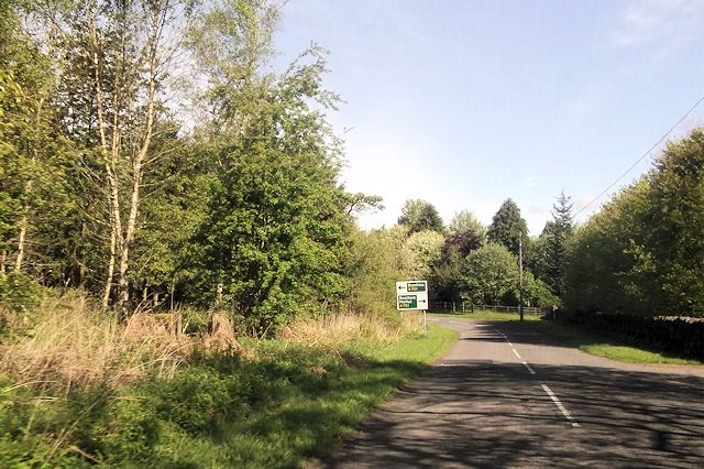
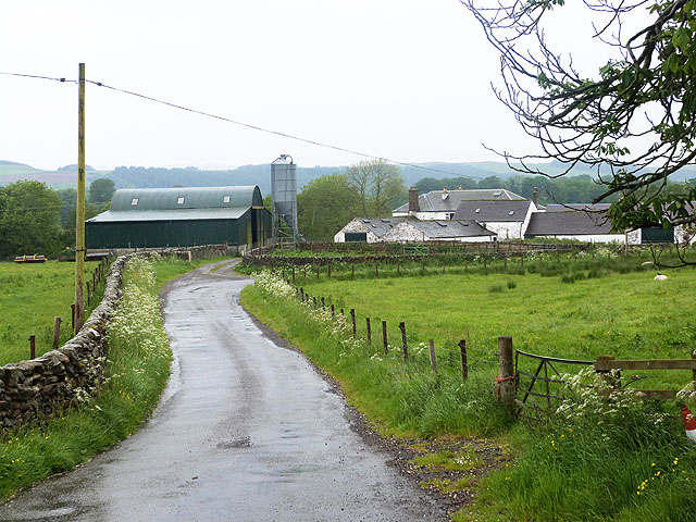
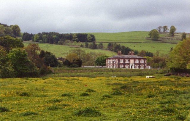
Bankend Wood Images

Images are sourced within 2km of 55.301431/-3.4389922 or Grid Reference NT0801. Thanks to Geograph Open Source API. All images are credited.

Grassland, Buck Rigg
A74(M), southbound The A74(M) & M74  run over 80 miles from the M6 at the Scottish border near Gretna to the M8 at Glasgow. This is one of the two most important routeways into Scotland from the south. The last stretch of the M74 opened in 2011 (see <a title="https://www.geograph.org.uk/snippet/590" href="https://www.geograph.org.uk/snippet/590">Link</a> ).
Wikipedia: <span class="nowrap"><a title="http://en.wikipedia.org/wiki/A74(M)_and_M74_motorways" rel="nofollow ugc noopener" href="http://en.wikipedia.org/wiki/A74(M)_and_M74_motorways">Link</a><img style="margin-left:2px;" alt="External link" title="External link - shift click to open in new window" src="https://s1.geograph.org.uk/img/external.png" width="10" height="10"/></span>
A74(M), southbound
The A74(M) & M74 run over 80 miles from the M6 at the Scottish border near Gretna to the M8 at Glasgow. This is one of the two most important routeways into Scotland from the south. The last stretch of the M74 opened in 2011 (see Link ). Wikipedia: LinkExternal link
Gate between fields near Woodhead Farm
Farm road to Breconside
Dumfries And Galloway : Countryside Scenery Looking out across the grassy countryside.
Dumfries And Galloway : Countryside Scenery
Looking out across the grassy countryside.
Dumfries And Galloway : The A74(M) Looking along the A74(M).
Dumfries And Galloway : The A74(M)
Looking along the A74(M).
Moffatdale from the air Looking up the dale from above the A74(M), Threewaterfoot is visible in the foreground.
Moffatdale from the air
Looking up the dale from above the A74(M), Threewaterfoot is visible in the foreground.
A lane north of Poldean Heading for Moffat.
A lane north of Poldean
Heading for Moffat.
Murthat Plantation Smallholding by the B7076, adjacent to the Upper Murthat Moor plantation.
Murthat Plantation
Smallholding by the B7076, adjacent to the Upper Murthat Moor plantation.
Buckrig House south of Beattock.
Buckrig
House south of Beattock.
Minor road near Buckrig In Dumfries and Galloway.
Minor road near Buckrig
In Dumfries and Galloway.
Poldean Bridge
Poldean Bridge
Minor road near Woodfoot Farm
Approaching A701 at Buckrigg
Woodfoot Farm The River Annan flows immediately beyond the farm.
Woodfoot Farm
The River Annan flows immediately beyond the farm.
Woodfoot Farm The River Annan flows immediately beyond the farm.
Woodfoot Farm
The River Annan flows immediately beyond the farm.
Pylon in a buttercup meadow, Annandale
Damp pasture, Buck Rig The slightly higher ground west of the old A74 must be a surface exposure of a different rock to most of Annandale. The quality of the grassland is poor and often the ground does not drain well. View from behind the site of Upper Murthat Cottage.
Damp pasture, Buck Rig
The slightly higher ground west of the old A74 must be a surface exposure of a different rock to most of Annandale. The quality of the grassland is poor and often the ground does not drain well. View from behind the site of Upper Murthat Cottage.
Show me another place!

Bankend Wood is located at Grid Ref: NT0801 (Lat: 55.301431, Lng: -3.4389922)

Unitary Authority: Dumfries and Galloway

Police Authority: Dumfries and Galloway

What 3 Words

///trappings.mull.twig. Near Beattock, Dumfries & Galloway

Nearby Locations

Bankend Wood

Related Wikis

Kirkpatrick-Juxta

Kirkpatrick-Juxta is a parish in Dumfries and Galloway on the A701, between Biggar, Moffat and Lockerbie. The parish straddles the main road A74 (M). It...

Beattock railway station

Beattock railway station was a station which served the village of Beattock, in the parish of Kirkpatrick-Juxta in the Scottish county of Dumfries and...

Beattock

Beattock is a village in Dumfries and Galloway, Scotland, approximately 1⁄2 mile (800 metres) southwest of Moffat and 19 miles (31 kilometres) north of...

Moffat Academy

Moffat Academy is a school in Moffat, Dumfries and Galloway, Scotland. It educates children from nursery to Secondary 6. == History == Moffat Academy traces...

Nearby Amenities

Located within 500m of 55.301431,-3.4389922
Power: pole
Lat/Long: 55.3049771/-3.4342283
Power: pole
Lat/Long: 55.2983095/-3.4344138
Power: pole
Lat/Long: 55.2990281/-3.4345941
Power: pole
Lat/Long: 55.2998038/-3.4347332
Power: pole
Lat/Long: 55.3005605/-3.43488
Power: pole
Lat/Long: 55.301367/-3.4350578
Power: pole
Lat/Long: 55.3017732/-3.4430561
Power: pole
Lat/Long: 55.3023481/-3.4421365
Power: pole
Lat/Long: 55.302851/-3.4413225
Power: pole
Lat/Long: 55.3033921/-3.4404286
Power: pole
Lat/Long: 55.3039449/-3.4395708
Power: pole
Lat/Long: 55.3042323/-3.4381077
Power: pole
Lat/Long: 55.3045255/-3.436593
Power: pole
Lat/Long: 55.3048246/-3.4350603
Communication Mobile Phone: yes
Man Made: mast
Tower Type: communication
Lat/Long: 55.3004705/-3.4427005
The data included in this document is from www.openstreetmap.org. The data is made available under ODbL.

Have you been to Bankend Wood?

Leave your review of Bankend Wood below (or comments, questions and feedback).