Lady Wood

Wood, Forest in West Lothian

Scotland

Lady Wood

Duntarvie Castle The long slow restoration continues, with the roof making an appearance in 2015.
Duntarvie Castle Credit: Richard Webb

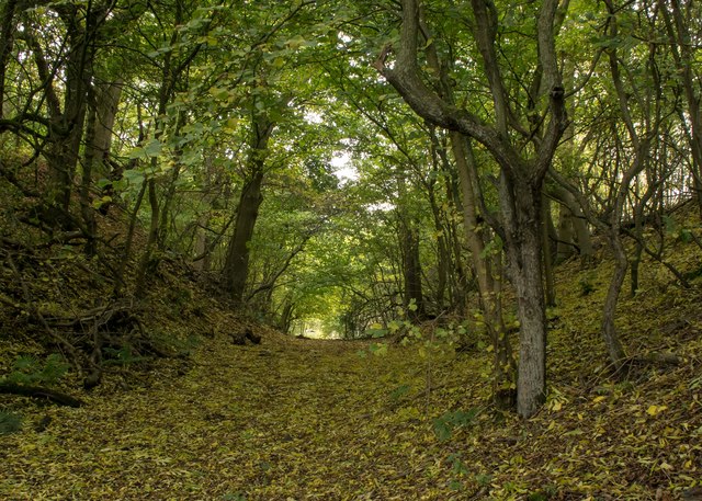
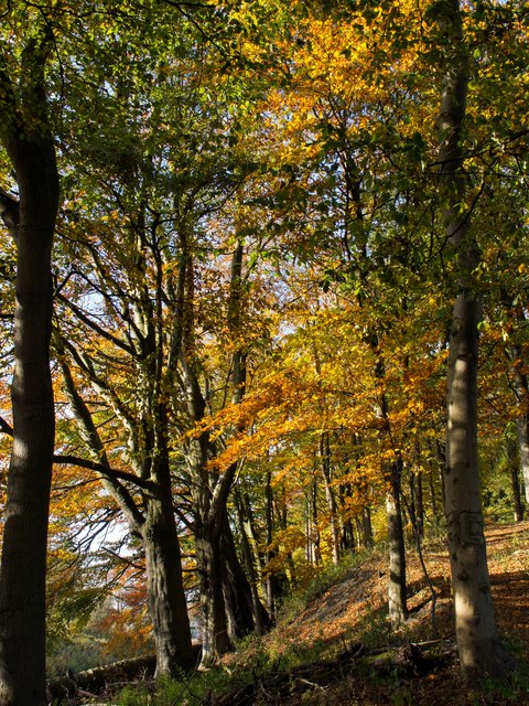
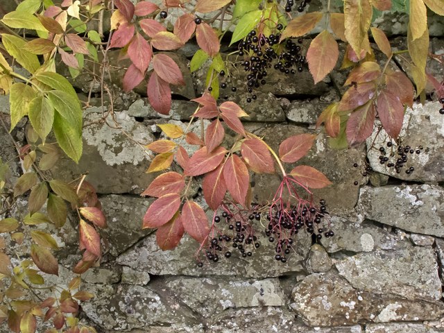
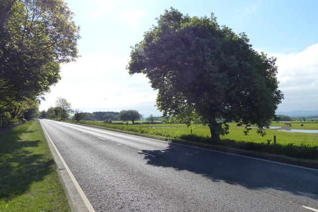
Lady Wood is a small woodland area located in West Lothian, Scotland. Situated near the town of Wood, it is known for its picturesque landscapes and abundant wildlife. The wood is primarily composed of a mixture of deciduous and coniferous trees, creating a diverse and vibrant ecosystem.

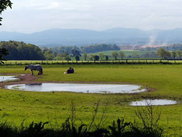
Covering an area of approximately 100 acres, Lady Wood offers a tranquil escape from the hustle and bustle of urban life. It is a popular destination for nature enthusiasts, hikers, and birdwatchers. The wood is home to a variety of bird species, including woodpeckers, owls, and various songbirds.

The wood features well-maintained footpaths that wind through the trees, providing visitors with an opportunity to explore the area and enjoy the natural beauty. Along these paths, one can find benches and picnic areas, offering a perfect spot for relaxation and contemplation.

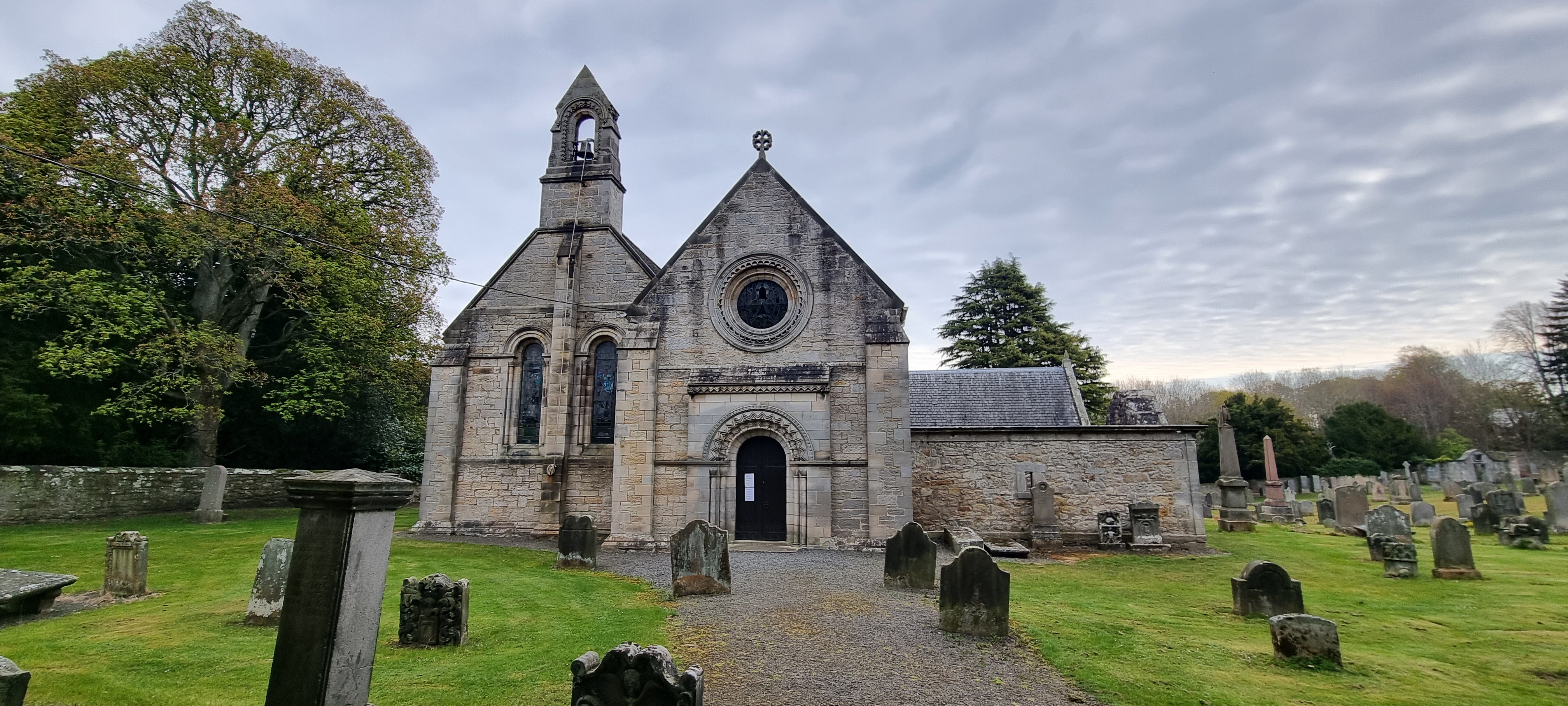
Lady Wood also holds historical significance. It is believed to have been named after Lady Susan Wood, a prominent local figure from the 19th century. The wood has been preserved and protected by local conservation efforts, ensuring its continued existence for future generations to enjoy.

Overall, Lady Wood is a tranquil haven for nature lovers, offering a peaceful retreat in the heart of West Lothian. With its diverse wildlife, well-maintained paths, and rich history, it is a must-visit destination for anyone seeking a connection with nature and a glimpse into the region's past.

If you have any feedback on the listing, please let us know in the comments section below.

Lady Wood Images

Images are sourced within 2km of 55.969376/-3.4749082 or Grid Reference NT0876. Thanks to Geograph Open Source API. All images are credited.

Duntarvie Castle The long slow restoration continues, with the roof making an appearance in 2015.
Duntarvie Castle
The long slow restoration continues, with the roof making an appearance in 2015.
Oilseed rape, Winchburgh The new Forth road bridge towers are making an appearance.
Oilseed rape, Winchburgh
The new Forth road bridge towers are making an appearance.
A leafy track at Priestinch This farm track crosses over Edinburgh-Glasgow Queen Street main railway  line at Priestinch before cutting through a low, but steep sided and wooded ridge  to cross the Union Canal at Bridge No.34, just visible ahead. The track is carpeted with leaf litter, predominately of the Ash, which is one of the earliest of our trees to shed its leaves.
A leafy track at Priestinch
This farm track crosses over Edinburgh-Glasgow Queen Street main railway line at Priestinch before cutting through a low, but steep sided and wooded ridge to cross the Union Canal at Bridge No.34, just visible ahead. The track is carpeted with leaf litter, predominately of the Ash, which is one of the earliest of our trees to shed its leaves.
Beech trees on a steep bank It has been a fine autumn in West Lothian with few gales and the tree colours are exceptional. These Beech overlook a deep cutting of the Edinburgh to Glasgow Queen Street railway line.
Beech trees on a steep bank
It has been a fine autumn in West Lothian with few gales and the tree colours are exceptional. These Beech overlook a deep cutting of the Edinburgh to Glasgow Queen Street railway line.
Elderberries overhanging a stone wall Colourful autumn leaves and ripe fruit of the Elder seen growing by the tall old garden wall of Craigton House.
Elderberries overhanging a stone wall
Colourful autumn leaves and ripe fruit of the Elder seen growing by the tall old garden wall of Craigton House.
Sunset at Duntarvie One of the best sunsets I've seen in recent years. The colour is exactly as recorded by the camera.
Sunset at Duntarvie
One of the best sunsets I've seen in recent years. The colour is exactly as recorded by the camera.
Duntarvie Castle At last, there is some progress on the renovations. Compare with <a href="https://www.geograph.org.uk/photo/2458403">NT0976 : Duntarvie Castle</a>.
Duntarvie Castle
At last, there is some progress on the renovations. Compare with NT0976 : Duntarvie Castle.
Entrance to Hopetoun Farm Shop And next door is New Hopetoun Gardens Garden Centre - quite the best garden centre I have ever visited.  Yes, it has a decent tearoom and gift shop, but its huge range of plants available make it supreme and above all other such centres.  I speak as a happy customer and not as an owner!
Entrance to Hopetoun Farm Shop
And next door is New Hopetoun Gardens Garden Centre - quite the best garden centre I have ever visited. Yes, it has a decent tearoom and gift shop, but its huge range of plants available make it supreme and above all other such centres. I speak as a happy customer and not as an owner!
Auldcathie Bridge No 34 on the Union Canal
A904 towards Queensferry
Field and horses near Duntarvie On the horizon are the Pentland Hills.
Field and horses near Duntarvie
On the horizon are the Pentland Hills.
Niddry Road Bridge No 31 Crossing the Union Canal in Winchburgh.
Niddry Road Bridge No 31
Crossing the Union Canal in Winchburgh.
Bridge No 32 crossing the Union Canal in Winchburgh
Myre Bridge No 33 An accommodation bridge crossing the Union Canal near Winchburgh.
Myre Bridge No 33
An accommodation bridge crossing the Union Canal near Winchburgh.
Union Canal towpath north of Winchburgh Following the completion and opening of the Forth and Clyde Canal in 1790, it was not long before the idea arose of a canal to link Edinburgh to the west, and in particular to the coal mining areas in the west of Scotland, to enable coal to be supplied more cheaply to the capital. Other commodities suited for canal transport included building stone and lime. 

It took another two decades, however, before a survey was undertaken of a route that would link the proposed canal to the Forth and Clyde Canal at Falkirk. The necessary Act of Parliament authorising construction was passed in 1817, and work started at the Edinburgh end, at Port Hopetoun, the following year.

The canal was designed by Hugh Baird <span class="nowrap"><a title="http://en.wikipedia.org/wiki/Hugh_Baird_%28engineer%29" rel="nofollow ugc noopener" href="http://en.wikipedia.org/wiki/Hugh_Baird_%28engineer%29">Link</a><img style="margin-left:2px;" alt="External link" title="External link - shift click to open in new window" src="https://s1.geograph.org.uk/img/external.png" width="10" height="10"/></span> and Thomas Telford <span class="nowrap"><a title="http://en.wikipedia.org/wiki/Thomas_Telford" rel="nofollow ugc noopener" href="http://en.wikipedia.org/wiki/Thomas_Telford">Link</a><img style="margin-left:2px;" alt="External link" title="External link - shift click to open in new window" src="https://s1.geograph.org.uk/img/external.png" width="10" height="10"/></span> and <a title="https://www.geograph.org.uk/discuss/?action=vthread&forum=6&topic=5666" href="https://www.geograph.org.uk/discuss/?action=vthread&forum=6&topic=5666">Link</a> on behalf of the Edinburgh and Glasgow Union Canal Company, whose 384 shareholders included the Lord Provost of Edinburgh and a number of titled persons. 

The canal was originally 32 miles in length and 5 feet deep, and it is a contour canal, that is, it follows the 241 foot (73 metre) contour, except for three river valleys where major aqueducts had to be built to carry the canal across at this height. These are the Slateford Aqueduct over the Water of Leith, the Almond Aqueduct 75 feet (23 metres) above the River Almond at Lin's Mill, and the longest of all at 810 feet (250 metres), the Avon Aqueduct, 86 feet (36 metres) above  the River Avon near Linlithgow. 

Most of the 60-odd bridges are fixed, so neither locks nor opening bridges delayed navigation most of the way, though the aqueducts were only wide enough for boats and barges to travel in one direction at a time; oncoming vessels had to wait until the way was clear. 

A tunnel 690 yards (636 metres) in length was required near Falkirk because the owner of Callendar House, William Forbes,  refused to allow the canal to pass through his land, and this undertaking contributed to the final cost being almost double the original estimate of £240,500. The final bill of over £460,000 equates to anything between £2000 million and £380,000 million at 2014 prices, depending on how it is calculated. 

The water level is maintained from a reservoir in the Pentland Hills, a three-mile channel from the River Almond, and other feeders. 

At Falkirk the Union Canal was 110 feet (33 metres) above the level of the Forth and Clyde Canal, and a flight of eleven locks was built to link the two canals. 

Construction took just four years, and the canal opened for traffic in 1822. Tolls were charged for the carriage of goods, and fares for passengers. There was also income from wharfage. Maximum charges were laid down in the enabling Act of Parliament. The Company was required to pay duties on goods carried to the Burgh of Linlithgow and the City of Edinburgh because the canal took trade away from the turnpike roads maintained by the respective councils.

Early trade was brisk, but unfortunately its heyday lasted only about 20 years, until the Edinburgh and Glasgow Railway superseded it in 1842, and in 1849 the canal was acquired by the railway company. Its use declined steadily over the years, and in the 1930s the flight of eleven locks at Falkirk was filled in and built on. Other stretches of the canal in Edinburgh were also built on, including the Edinburgh terminus. The City Bypass cut the route west of Edinburgh, and the M8 motorway blocked it near Broxburn. The canal was officially closed in 1965, though various stretches were used recreationally, for example for rowing and angling.

Towards the end of the 20th century there was a revival of interest in canals, mainly for recreational use, and the restoration of the Forth and Clyde Canal and the Union Canal was mooted. The project was adopted as one of the major undertakings to mark the millennium, and obtained funding from the European Union and the Millennium Commission among others. A new terminus with associated new retail, residential and commercial buildings was created in Edinburgh and a new stretch of canal dug to replace the section built on at Wester Hailes. The Scott Russell Aqueduct (named after John Scott Russell, who first observed a soliton wave on the canal in 1834) now carries the canal over the City Bypass, and a diversion was built to pass beneath the M8 motorway. The final piece of the restoration was the unique Falkirk Wheel, at the end of an extension to the original canal at Falkirk, which lifts and lowers boats between the Union Canal and the Forth and Clyde Canal. 

The Millennium Link restoration cost some £84 million and the restored canal was opened in 2001. The Falkirk Wheel was opened by Her Majesty Queen Elizabeth the following year.
Union Canal towpath north of Winchburgh
Following the completion and opening of the Forth and Clyde Canal in 1790, it was not long before the idea arose of a canal to link Edinburgh to the west, and in particular to the coal mining areas in the west of Scotland, to enable coal to be supplied more cheaply to the capital. Other commodities suited for canal transport included building stone and lime. It took another two decades, however, before a survey was undertaken of a route that would link the proposed canal to the Forth and Clyde Canal at Falkirk. The necessary Act of Parliament authorising construction was passed in 1817, and work started at the Edinburgh end, at Port Hopetoun, the following year. The canal was designed by Hugh Baird LinkExternal link and Thomas Telford LinkExternal link and Link on behalf of the Edinburgh and Glasgow Union Canal Company, whose 384 shareholders included the Lord Provost of Edinburgh and a number of titled persons. The canal was originally 32 miles in length and 5 feet deep, and it is a contour canal, that is, it follows the 241 foot (73 metre) contour, except for three river valleys where major aqueducts had to be built to carry the canal across at this height. These are the Slateford Aqueduct over the Water of Leith, the Almond Aqueduct 75 feet (23 metres) above the River Almond at Lin's Mill, and the longest of all at 810 feet (250 metres), the Avon Aqueduct, 86 feet (36 metres) above the River Avon near Linlithgow. Most of the 60-odd bridges are fixed, so neither locks nor opening bridges delayed navigation most of the way, though the aqueducts were only wide enough for boats and barges to travel in one direction at a time; oncoming vessels had to wait until the way was clear. A tunnel 690 yards (636 metres) in length was required near Falkirk because the owner of Callendar House, William Forbes, refused to allow the canal to pass through his land, and this undertaking contributed to the final cost being almost double the original estimate of £240,500. The final bill of over £460,000 equates to anything between £2000 million and £380,000 million at 2014 prices, depending on how it is calculated. The water level is maintained from a reservoir in the Pentland Hills, a three-mile channel from the River Almond, and other feeders. At Falkirk the Union Canal was 110 feet (33 metres) above the level of the Forth and Clyde Canal, and a flight of eleven locks was built to link the two canals. Construction took just four years, and the canal opened for traffic in 1822. Tolls were charged for the carriage of goods, and fares for passengers. There was also income from wharfage. Maximum charges were laid down in the enabling Act of Parliament. The Company was required to pay duties on goods carried to the Burgh of Linlithgow and the City of Edinburgh because the canal took trade away from the turnpike roads maintained by the respective councils. Early trade was brisk, but unfortunately its heyday lasted only about 20 years, until the Edinburgh and Glasgow Railway superseded it in 1842, and in 1849 the canal was acquired by the railway company. Its use declined steadily over the years, and in the 1930s the flight of eleven locks at Falkirk was filled in and built on. Other stretches of the canal in Edinburgh were also built on, including the Edinburgh terminus. The City Bypass cut the route west of Edinburgh, and the M8 motorway blocked it near Broxburn. The canal was officially closed in 1965, though various stretches were used recreationally, for example for rowing and angling. Towards the end of the 20th century there was a revival of interest in canals, mainly for recreational use, and the restoration of the Forth and Clyde Canal and the Union Canal was mooted. The project was adopted as one of the major undertakings to mark the millennium, and obtained funding from the European Union and the Millennium Commission among others. A new terminus with associated new retail, residential and commercial buildings was created in Edinburgh and a new stretch of canal dug to replace the section built on at Wester Hailes. The Scott Russell Aqueduct (named after John Scott Russell, who first observed a soliton wave on the canal in 1834) now carries the canal over the City Bypass, and a diversion was built to pass beneath the M8 motorway. The final piece of the restoration was the unique Falkirk Wheel, at the end of an extension to the original canal at Falkirk, which lifts and lowers boats between the Union Canal and the Forth and Clyde Canal. The Millennium Link restoration cost some £84 million and the restored canal was opened in 2001. The Falkirk Wheel was opened by Her Majesty Queen Elizabeth the following year.
Auldcathie Bridge No 34 on the Union Canal Following the completion and opening of the Forth and Clyde Canal in 1790, it was not long before the idea arose of a canal to link Edinburgh to the west, and in particular to the coal mining areas in the west of Scotland, to enable coal to be supplied more cheaply to the capital. Other commodities suited for canal transport included building stone and lime. 

It took another two decades, however, before a survey was undertaken of a route that would link the proposed canal to the Forth and Clyde Canal at Falkirk. The necessary Act of Parliament authorising construction was passed in 1817, and work started at the Edinburgh end, at Port Hopetoun, the following year.

The canal was designed by Hugh Baird <span class="nowrap"><a title="http://en.wikipedia.org/wiki/Hugh_Baird_%28engineer%29" rel="nofollow ugc noopener" href="http://en.wikipedia.org/wiki/Hugh_Baird_%28engineer%29">Link</a><img style="margin-left:2px;" alt="External link" title="External link - shift click to open in new window" src="https://s1.geograph.org.uk/img/external.png" width="10" height="10"/></span> and Thomas Telford <span class="nowrap"><a title="http://en.wikipedia.org/wiki/Thomas_Telford" rel="nofollow ugc noopener" href="http://en.wikipedia.org/wiki/Thomas_Telford">Link</a><img style="margin-left:2px;" alt="External link" title="External link - shift click to open in new window" src="https://s1.geograph.org.uk/img/external.png" width="10" height="10"/></span> and <a title="https://www.geograph.org.uk/discuss/?action=vthread&forum=6&topic=5666" href="https://www.geograph.org.uk/discuss/?action=vthread&forum=6&topic=5666">Link</a> on behalf of the Edinburgh and Glasgow Union Canal Company, whose 384 shareholders included the Lord Provost of Edinburgh and a number of titled persons. 

The canal was originally 32 miles in length and 5 feet deep, and it is a contour canal, that is, it follows the 241 foot (73 metre) contour, except for three river valleys where major aqueducts had to be built to carry the canal across at this height. These are the Slateford Aqueduct over the Water of Leith, the Almond Aqueduct 75 feet (23 metres) above the River Almond at Lin's Mill, and the longest of all at 810 feet (250 metres), the Avon Aqueduct, 86 feet (36 metres) above  the River Avon near Linlithgow. 

Most of the 60-odd bridges are fixed, so neither locks nor opening bridges delayed navigation most of the way, though the aqueducts were only wide enough for boats and barges to travel in one direction at a time; oncoming vessels had to wait until the way was clear. 

A tunnel 690 yards (636 metres) in length was required near Falkirk because the owner of Callendar House, William Forbes,  refused to allow the canal to pass through his land, and this undertaking contributed to the final cost being almost double the original estimate of £240,500. The final bill of over £460,000 equates to anything between £2000 million and £380,000 million at 2014 prices, depending on how it is calculated. 

The water level is maintained from a reservoir in the Pentland Hills, a three-mile channel from the River Almond, and other feeders. 

At Falkirk the Union Canal was 110 feet (33 metres) above the level of the Forth and Clyde Canal, and a flight of eleven locks was built to link the two canals. 

Construction took just four years, and the canal opened for traffic in 1822. Tolls were charged for the carriage of goods, and fares for passengers. There was also income from wharfage. Maximum charges were laid down in the enabling Act of Parliament. The Company was required to pay duties on goods carried to the Burgh of Linlithgow and the City of Edinburgh because the canal took trade away from the turnpike roads maintained by the respective councils.

Early trade was brisk, but unfortunately its heyday lasted only about 20 years, until the Edinburgh and Glasgow Railway superseded it in 1842, and in 1849 the canal was acquired by the railway company. Its use declined steadily over the years, and in the 1930s the flight of eleven locks at Falkirk was filled in and built on. Other stretches of the canal in Edinburgh were also built on, including the Edinburgh terminus. The City Bypass cut the route west of Edinburgh, and the M8 motorway blocked it near Broxburn. The canal was officially closed in 1965, though various stretches were used recreationally, for example for rowing and angling.

Towards the end of the 20th century there was a revival of interest in canals, mainly for recreational use, and the restoration of the Forth and Clyde Canal and the Union Canal was mooted. The project was adopted as one of the major undertakings to mark the millennium, and obtained funding from the European Union and the Millennium Commission among others. A new terminus with associated new retail, residential and commercial buildings was created in Edinburgh and a new stretch of canal dug to replace the section built on at Wester Hailes. The Scott Russell Aqueduct (named after John Scott Russell, who first observed a soliton wave on the canal in 1834) now carries the canal over the City Bypass, and a diversion was built to pass beneath the M8 motorway. The final piece of the restoration was the unique Falkirk Wheel, at the end of an extension to the original canal at Falkirk, which lifts and lowers boats between the Union Canal and the Forth and Clyde Canal. 

The Millennium Link restoration cost some £84 million and the restored canal was opened in 2001. The Falkirk Wheel was opened by Her Majesty Queen Elizabeth the following year.
Auldcathie Bridge No 34 on the Union Canal
Following the completion and opening of the Forth and Clyde Canal in 1790, it was not long before the idea arose of a canal to link Edinburgh to the west, and in particular to the coal mining areas in the west of Scotland, to enable coal to be supplied more cheaply to the capital. Other commodities suited for canal transport included building stone and lime. It took another two decades, however, before a survey was undertaken of a route that would link the proposed canal to the Forth and Clyde Canal at Falkirk. The necessary Act of Parliament authorising construction was passed in 1817, and work started at the Edinburgh end, at Port Hopetoun, the following year. The canal was designed by Hugh Baird LinkExternal link and Thomas Telford LinkExternal link and Link on behalf of the Edinburgh and Glasgow Union Canal Company, whose 384 shareholders included the Lord Provost of Edinburgh and a number of titled persons. The canal was originally 32 miles in length and 5 feet deep, and it is a contour canal, that is, it follows the 241 foot (73 metre) contour, except for three river valleys where major aqueducts had to be built to carry the canal across at this height. These are the Slateford Aqueduct over the Water of Leith, the Almond Aqueduct 75 feet (23 metres) above the River Almond at Lin's Mill, and the longest of all at 810 feet (250 metres), the Avon Aqueduct, 86 feet (36 metres) above the River Avon near Linlithgow. Most of the 60-odd bridges are fixed, so neither locks nor opening bridges delayed navigation most of the way, though the aqueducts were only wide enough for boats and barges to travel in one direction at a time; oncoming vessels had to wait until the way was clear. A tunnel 690 yards (636 metres) in length was required near Falkirk because the owner of Callendar House, William Forbes, refused to allow the canal to pass through his land, and this undertaking contributed to the final cost being almost double the original estimate of £240,500. The final bill of over £460,000 equates to anything between £2000 million and £380,000 million at 2014 prices, depending on how it is calculated. The water level is maintained from a reservoir in the Pentland Hills, a three-mile channel from the River Almond, and other feeders. At Falkirk the Union Canal was 110 feet (33 metres) above the level of the Forth and Clyde Canal, and a flight of eleven locks was built to link the two canals. Construction took just four years, and the canal opened for traffic in 1822. Tolls were charged for the carriage of goods, and fares for passengers. There was also income from wharfage. Maximum charges were laid down in the enabling Act of Parliament. The Company was required to pay duties on goods carried to the Burgh of Linlithgow and the City of Edinburgh because the canal took trade away from the turnpike roads maintained by the respective councils. Early trade was brisk, but unfortunately its heyday lasted only about 20 years, until the Edinburgh and Glasgow Railway superseded it in 1842, and in 1849 the canal was acquired by the railway company. Its use declined steadily over the years, and in the 1930s the flight of eleven locks at Falkirk was filled in and built on. Other stretches of the canal in Edinburgh were also built on, including the Edinburgh terminus. The City Bypass cut the route west of Edinburgh, and the M8 motorway blocked it near Broxburn. The canal was officially closed in 1965, though various stretches were used recreationally, for example for rowing and angling. Towards the end of the 20th century there was a revival of interest in canals, mainly for recreational use, and the restoration of the Forth and Clyde Canal and the Union Canal was mooted. The project was adopted as one of the major undertakings to mark the millennium, and obtained funding from the European Union and the Millennium Commission among others. A new terminus with associated new retail, residential and commercial buildings was created in Edinburgh and a new stretch of canal dug to replace the section built on at Wester Hailes. The Scott Russell Aqueduct (named after John Scott Russell, who first observed a soliton wave on the canal in 1834) now carries the canal over the City Bypass, and a diversion was built to pass beneath the M8 motorway. The final piece of the restoration was the unique Falkirk Wheel, at the end of an extension to the original canal at Falkirk, which lifts and lowers boats between the Union Canal and the Forth and Clyde Canal. The Millennium Link restoration cost some £84 million and the restored canal was opened in 2001. The Falkirk Wheel was opened by Her Majesty Queen Elizabeth the following year.
Craigton Bridge No 35 Crossing the Union Canal near Craigton.
Craigton Bridge No 35
Crossing the Union Canal near Craigton.
Craigton Bridge No 35 Crossing the Union Canal near Craigton.
Craigton Bridge No 35
Crossing the Union Canal near Craigton.
Show me another place!

Lady Wood is located at Grid Ref: NT0876 (Lat: 55.969376, Lng: -3.4749082)

Unitary Authority: West Lothian

Police Authority: The Lothians and Scottish Borders

What 3 Words

///verb.moats.conquests. Near Winchburgh, West Lothian

Nearby Locations

Bailies Muir Lady Wood

Related Wikis

Winchburgh Academy

Winchburgh Academy is a secondary level school, in Winchburgh, West Lothian, Scotland. The school is adjacent to B9080 road which is to the west of Winchburgh...

Duntarvie Castle

Duntarvie Castle is a ruined Scots Renaissance house in West Lothian, Scotland. It is located 1.5 kilometres (0.93 mi) north of Winchburgh and 9 kilometres...

Winchburgh railway station

Winchburgh railway station served the village of Winchburgh, West Lothian, Scotland from 1842 to 1930 on the Edinburgh and Glasgow Railway. == History... ==

Winchburgh rail crash

The Winchburgh rail crash was a multi-train rail crash that occurred on Monday 13 October 1862, 1+1⁄2 miles (2.4 km) northwest of Winchburgh in Linlithgowshire...

Winchburgh

Winchburgh is a village in the council area of West Lothian, Scotland. It is located approximately 10 miles (16 km) west of the city-centre of Edinburgh...

Newton, West Lothian

Newton or (The Newton) is a small village in the county of West Lothian, Scotland. It lies on the A904 trunk road 2.6 miles (4.2 km) west of South Queensferry...
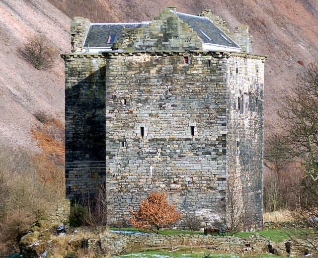
Niddry Castle

Niddry Castle is a sixteenth-century tower house near Winchburgh, West Lothian, Scotland. It is situated near the Union Canal, and between two large oil...

Abercorn

Abercorn (Gaelic: Obar Chùirnidh, Old English: Æbbercurnig) is a village and civil parish in West Lothian, Scotland. Close to the south coast of the Firth...

Nearby Amenities

Located within 500m of 55.969376,-3.4749082
Winchburgh Junction
Railway: switch
Lat/Long: 55.9691407/-3.4693351
Railway: switch
Lat/Long: 55.9690243/-3.4689337
Winchburgh Junction
Railway: junction
Lat/Long: 55.9688029/-3.4684083
Auldcathie Church
Historic: ruins
Wikidata: Q56668035
Lat/Long: 55.968336/-3.4776206
Power: pole
Lat/Long: 55.9701917/-3.467105
Material: wood
Power: pole
Lat/Long: 55.9694027/-3.4669639
Access: yes
Leisure: playground
Playground Theme: playground
Surface: woodchips
Lat/Long: 55.9655775/-3.4778811
Railway: signal
Railway Signal Direction: backward
Railway Signal Shunting: GB-NR:shunting
Railway Signal Shunting Form: light
Ref: EW947
Lat/Long: 55.9685713/-3.4674249
Railway: signal
Railway Signal Direction: forward
Railway Signal Main: GB-NR:main
Railway Signal Main Form: light
Ref: EW606
Lat/Long: 55.970874/-3.4751237
Railway: signal
Railway Signal Direction: backward
Railway Signal Shunting: GB-NR:shunting
Railway Signal Shunting Form: light
Ref: EW948
Lat/Long: 55.9701777/-3.4726543
The data included in this document is from www.openstreetmap.org. The data is made available under ODbL.

Have you been to Lady Wood?

Leave your review of Lady Wood below (or comments, questions and feedback).