Castle Rising

Settlement in Norfolk King's Lynn and West Norfolk

England

Castle Rising

Castle Rising village and church from the Inner Bailey earthworks
Castle Rising village and church from the Inner Bailey earthworks Credit: SK53

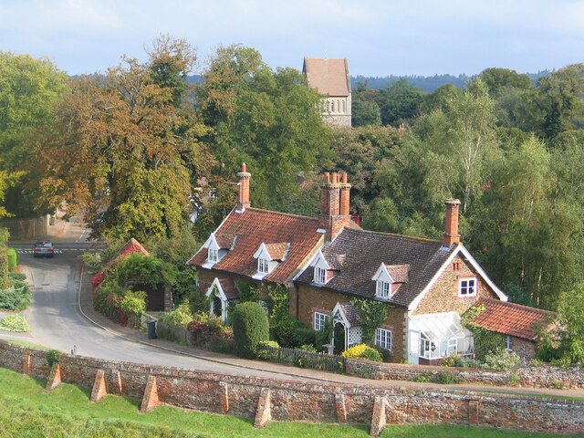
Castle Rising is a small village located in the county of Norfolk, England. Situated approximately 8 miles north-east of the town of King's Lynn, Castle Rising is known for its well-preserved medieval castle and picturesque surroundings.

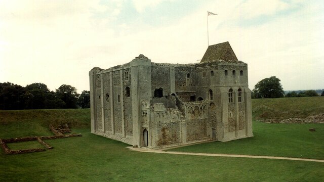
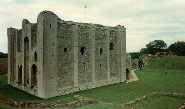
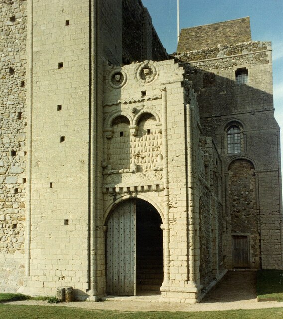
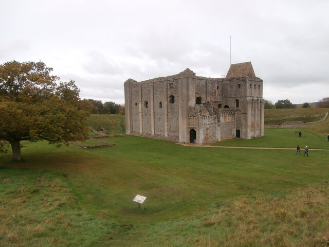
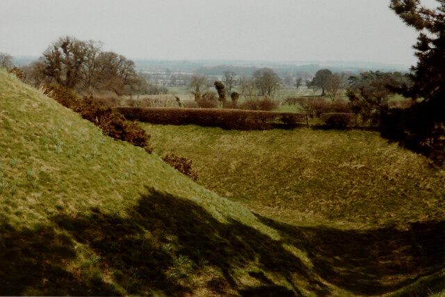
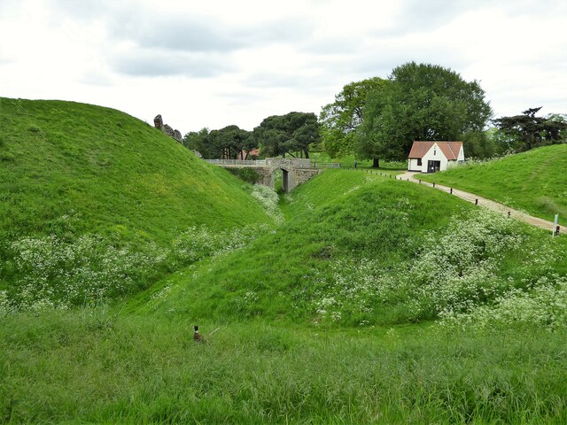
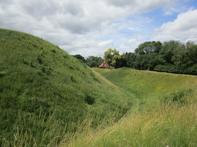
The village takes its name from the imposing Castle Rising, which is its most prominent feature. Built in the 12th century, the castle was originally a residence for the powerful Norman family, the de Montforts. It later became the property of Queen Isabella, the wife of Edward II, and served as her residence in the 14th century. The castle's architecture is a remarkable example of Norman fortification, with its massive stone walls, towers, and a well-preserved keep.

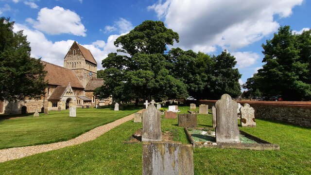
The village itself is characterized by its quaint charm and historical significance. It features a mix of different architectural styles, from traditional thatched cottages to Georgian and Victorian houses. The village also boasts a beautiful parish church, St. Lawrence, which dates back to the 12th century and showcases stunning gothic architecture.

Castle Rising is surrounded by idyllic countryside, making it a popular destination for nature lovers and walkers. The village is located near the Sandringham Estate, the royal residence of the British monarch, and the nearby North Norfolk Coast, which offers breathtaking coastal views and opportunities for birdwatching.

With its rich history, stunning castle, and picturesque setting, Castle Rising is a must-visit destination for those seeking to immerse themselves in Norfolk's medieval past and enjoy the beauty of the English countryside.

If you have any feedback on the listing, please let us know in the comments section below.

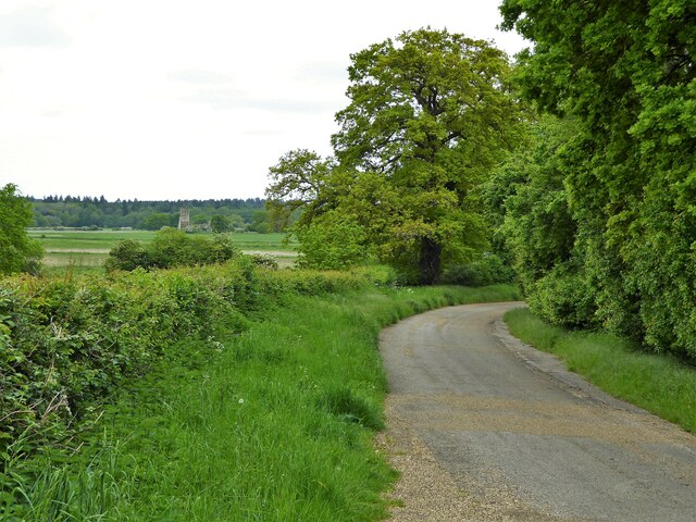
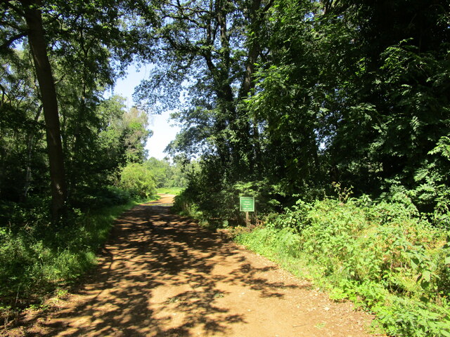
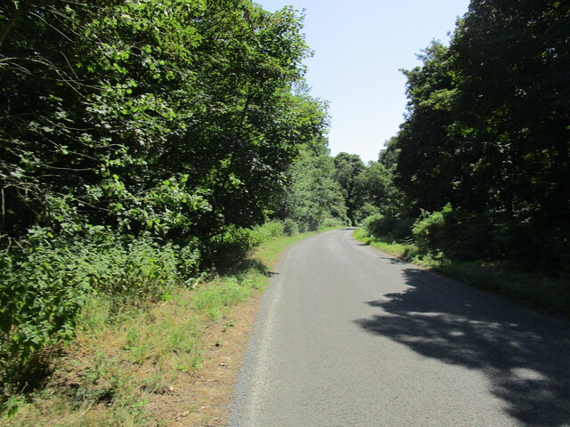
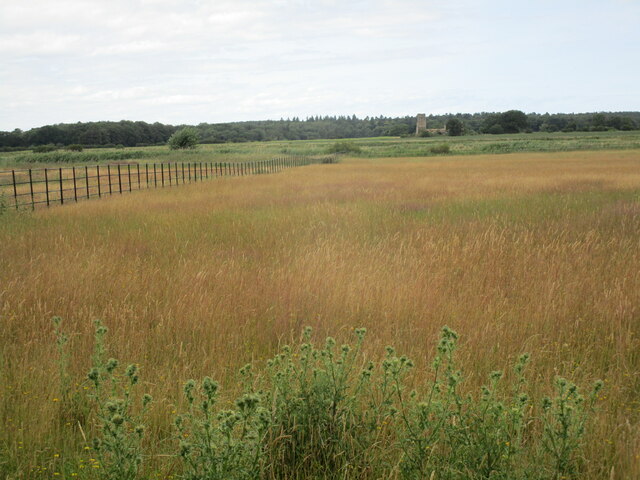
Castle Rising Images

Images are sourced within 2km of 52.793782/0.463017 or Grid Reference TF6624. Thanks to Geograph Open Source API. All images are credited.

Castle Rising village and church from the Inner Bailey earthworks
Castle Rising Castle <span class="nowrap"><a title="https://historicengland.org.uk/listing/the-list/list-entry/1008356?section=official-listing" rel="nofollow ugc noopener" href="https://historicengland.org.uk/listing/the-list/list-entry/1008356?section=official-listing">Link</a><img style="margin-left:2px;" alt="External link" title="External link - shift click to open in new window" src="https://s1.geograph.org.uk/img/external.png" width="10" height="10"/></span>
Castle Rising Castle
Castle Rising Castle Door <span class="nowrap"><a title="https://historicengland.org.uk/listing/the-list/list-entry/1008356?section=official-listing" rel="nofollow ugc noopener" href="https://historicengland.org.uk/listing/the-list/list-entry/1008356?section=official-listing">Link</a><img style="margin-left:2px;" alt="External link" title="External link - shift click to open in new window" src="https://s1.geograph.org.uk/img/external.png" width="10" height="10"/></span>
Castle Rising Castle Door
The keep, Castle Rising Castle Rising is now in the care of English Heritage <span class="nowrap"><a title="https://www.english-heritage.org.uk/visit/places/castle-rising-castle/" rel="nofollow ugc noopener" href="https://www.english-heritage.org.uk/visit/places/castle-rising-castle/">Link</a><img style="margin-left:2px;" alt="External link" title="External link - shift click to open in new window" src="https://s1.geograph.org.uk/img/external.png" width="10" height="10"/></span> but has had various royal and aristocratic owners over the centuries, including a spell as part of the Duchy of Cornwall.  Although it has been restored, its relatively remote location will have helped to ensure that it was not used as a source of stone.
The keep, Castle Rising
Castle Rising is now in the care of English Heritage LinkExternal link but has had various royal and aristocratic owners over the centuries, including a spell as part of the Duchy of Cornwall. Although it has been restored, its relatively remote location will have helped to ensure that it was not used as a source of stone.
St Lawrence's Churchyard
Outer earthworks Viewed from a footpath linking <a href="https://www.geograph.org.uk/photo/2814798">TF6624 : The castle at Castle Rising</a> with the visitors’ car park.
Outer earthworks
Viewed from a footpath linking TF6624 : The castle at Castle Rising with the visitors’ car park.
Earthworks at Castle Rising Enjoyed by a pheasant
Earthworks at Castle Rising
Enjoyed by a pheasant
Old Hunstanton Road On the now private road on the Castle Rising Estate with a view far across the fields to the ruined church of St Felix
Old Hunstanton Road
On the now private road on the Castle Rising Estate with a view far across the fields to the ruined church of St Felix
Farm track off Ling Common Road
Potato field off Lodge Lane
Road through Old Fen Old Fen is now entirely wooded.
Road through Old Fen
Old Fen is now entirely wooded.
Night Marsh Looking towards the remains of St Felix's church, Babingley.
Night Marsh
Looking towards the remains of St Felix's church, Babingley.
Defensive earthworks, Castle Rising Date from the mid twelfth century <span class="nowrap"><a title="https://historicengland.org.uk/listing/the-list/list-entry/1077599?section=official-list-entry" rel="nofollow ugc noopener" href="https://historicengland.org.uk/listing/the-list/list-entry/1077599?section=official-list-entry">Link</a><img style="margin-left:2px;" alt="External link" title="External link - shift click to open in new window" src="https://s1.geograph.org.uk/img/external.png" width="10" height="10"/></span>
Defensive earthworks, Castle Rising
Date from the mid twelfth century LinkExternal link
The House on the Green, North Wootton Derelict public house.
The House on the Green, North Wootton
Derelict public house.
Ling Common Road
Ling Common Road
Barley field, Castle Rising
The Old Hall, Castle Rising
Show me another place!

Castle Rising is located at Grid Ref: TF6624 (Lat: 52.793782, Lng: 0.463017)

Administrative County: Norfolk

District: King's Lynn and West Norfolk

Police Authority: Norfolk

What 3 Words

///growth.retaliate.satin. Near Grimston, Norfolk

Related Wikis

Castle Rising

Castle Rising is a village and civil parish in the English county of Norfolk. The village is situated some 8 kilometres (5 mi) north-east of the town of...

Castle Rising Castle

Castle Rising is a ruined medieval fortification in the village of Castle Rising, Norfolk, England. It was built soon after 1138 by William d'Aubigny II...

South Wootton

South Wootton is a village and civil parish in the English county of Norfolk, approximately 2 miles (3.2 km) north-east of King's Lynn. It covers an area...

Babingley

Babingley is a village and former civil parish, now in the parish of Sandringham, in the King's Lynn and West Norfolk district, in the county of Norfolk...

North Wootton, Norfolk

North Wootton is a village, civil parish and electoral ward near the town of King's Lynn in Norfolk, England. It covers an area of 32.33 km2 (12.48 sq...

North Wootton railway station

North Wootton was a railway station on the King's Lynn to Hunstanton line which opened in 1862 to serve the village of North Wootton on the outskirts of...

Grimston Warren Pit

Grimston Warren Pit is a 6.6-hectare (16-acre) geological Site of Special Scientific Interest east of King's Lynn in Norfolk. It is a Geological Conservation...
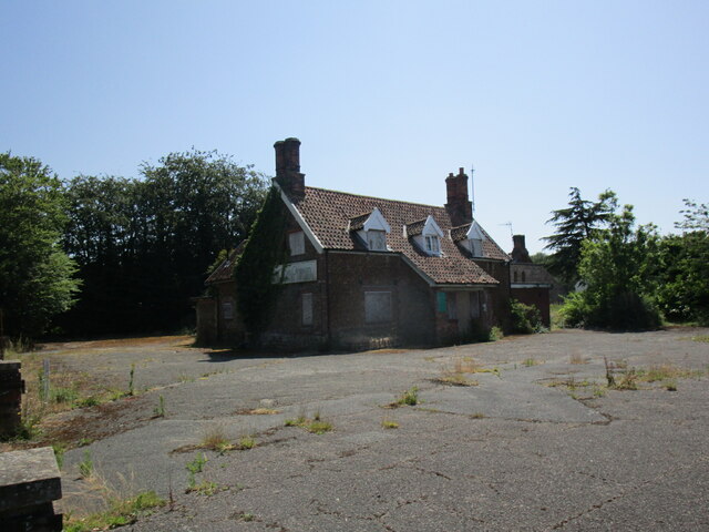
Wood Farm

Wood Farm is a farmhouse on the British Royal Family's Sandringham Estate in Norfolk, England. Historically occupied by members of the Royal Family and...

Nearby Amenities

Located within 500m of 52.793782,0.463017
Castle Rising
Place: village
Wikidata: Q4218940
Wikipedia: en:Castle Rising
Lat/Long: 52.7969167/0.4673371
Toilets
Check Date: 2024-04-13
Fee: no
Lat/Long: 52.7919459/0.4691614
Bus Stop
Saffrons
Naptan AtcoCode: 2900C101
Naptan Bearing: E
Naptan CommonName: Black Horse
Naptan Indicator: adj
Naptan Locality: Castle Rising
Naptan NaptanCode: nfoajdmp
Naptan Street: Lynn Road
Shelter: no
Source: naptan_import;survey
Lat/Long: 52.7945064/0.4687465
Bus Stop
Saffrons
Alt Name: Castle Rising- opp Black Horse (round corner)
Naptan AltCommonName: Castle Rising- opp Black Horse (round corner)
Naptan AtcoCode: 2900C104
Naptan Bearing: W
Naptan BusStopType: CUS
Naptan CommonName: Black Horse
Naptan Indicator: opp
Naptan Latitude: 52.7944262
Naptan Locality: Castle Rising
Naptan Longitude: 0.4686909
Naptan NaptanCode: nfoajdpa
Naptan Street: Lynn Road
Shelter: no
Source: naptan_import;survey
Lat/Long: 52.7944082/0.4689243
Pub
The Black Horse Inn
Addr City: King's Lynn
Addr Country: GB
Addr Postcode: PE31 6AG
Addr Street: Lynn Road
Addr Suburb: Castle Rising
Fhrs Id: 1084643
Phone: +44 1553 631225
Source: Bing
Website: https://www.pe30.com/black_horse.htm
Lat/Long: 52.7948264/0.4701242
Barrier: lych_gate
Foot: yes
Lat/Long: 52.7953939/0.4695234
Historic: memorial
Lat/Long: 52.7956486/0.4686048
Cafe
Unique Tea Rooms
Addr City: King's Lynn
Addr Housename: Castle Farm Barn
Addr Postcode: PE31 6AG
Addr Street: Lynn Road
Addr Village: Castle Rising
Fhrs Id: 41921
Phone: +441553631211
Source Addr: FHRS Open Data
Lat/Long: 52.7948076/0.4696772
Post Box
Collection Times: Mo-Fr 16:00; Sa 11:00
Operator: Royal Mail
Operator Wikidata: Q638098
Post Box Mounting: building
Post Box Type: wall
Ref: PE31 202
Royal Cypher: EIIR
Royal Cypher Wikidata: Q33102113
Lat/Long: 52.794772/0.4695591
Unique Gifts and Interiors
Addr City: King's Lynn
Addr Country: GB
Addr Postcode: PE31 6AG
Addr Suburb: Castle Rising
Shop: gift
Url: http://www.uniquegiftsandinteriors.co.uk/
Lat/Long: 52.7942497/0.4701949
Public Bookcase
Booth: K6
Colour: red
Covered: booth
Disused Amenity: telephone
Listed Status: Grade II
Man Made: telephone_box
Public Bookcase Type: phone_box
Lat/Long: 52.7946009/0.469916
Give Way
Lat/Long: 52.7924836/0.4593511
Barrier: kissing_gate
Material: wood
Maxwidth: 0.75
Wheelchair: no
Lat/Long: 52.795335/0.4612775
Bench
Lat/Long: 52.7955834/0.4689839
The data included in this document is from www.openstreetmap.org. The data is made available under ODbL.

Have you been to Castle Rising?

Leave your review of Castle Rising below (or comments, questions and feedback).