Bothy Wood

Wood, Forest in Perthshire

Scotland

Bothy Wood

Overgrown path/road in Cosnakie Wood There is a path shown at this point on the 1:50000 OS map and a road on the 1:25000 map, but it is now completely overgrown and practically impassable.
Overgrown path/road in Cosnakie Wood Credit: AllanKnaik

The requested URL returned error: 429 Too Many Requests

If you have any feedback on the listing, please let us know in the comments section below.
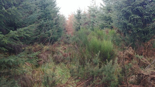
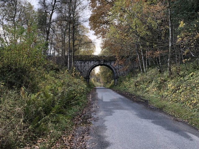
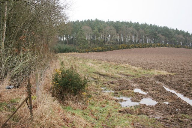
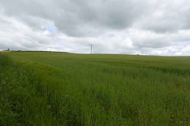
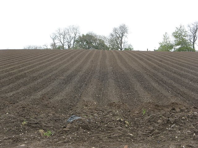
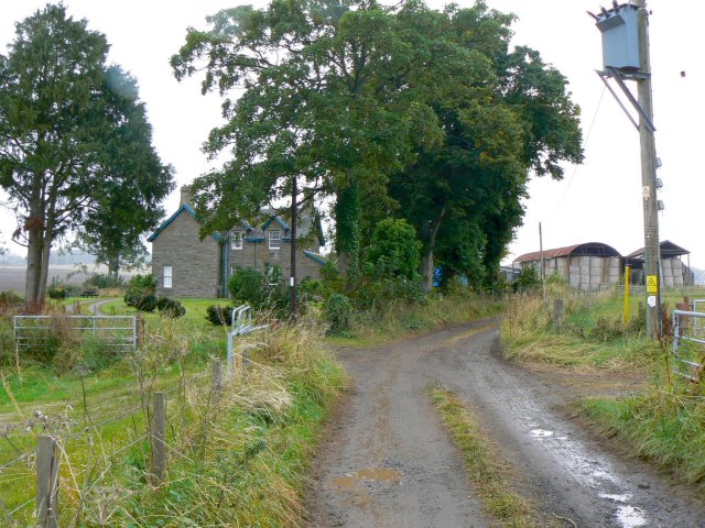
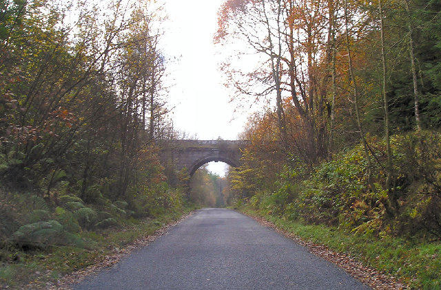
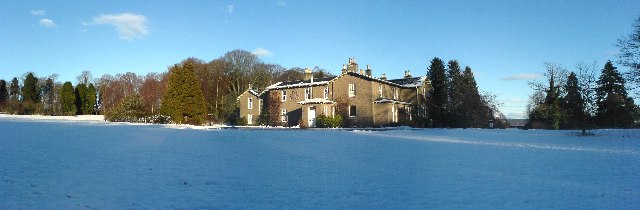
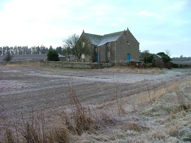
Bothy Wood Images

Images are sourced within 2km of 56.443685/-3.5092935 or Grid Reference NO0728. Thanks to Geograph Open Source API. All images are credited.

Overgrown path/road in Cosnakie Wood There is a path shown at this point on the 1:50000 OS map and a road on the 1:25000 map, but it is now completely overgrown and practically impassable.
Overgrown path/road in Cosnakie Wood
There is a path shown at this point on the 1:50000 OS map and a road on the 1:25000 map, but it is now completely overgrown and practically impassable.
Dry Arch The Cosnakie Wood side has been felled.
Dry Arch
The Cosnakie Wood side has been felled.
Road junction The road on the right leads to Blackhill, Craighead and Ardgaith.
Road junction
The road on the right leads to Blackhill, Craighead and Ardgaith.
Field beside Pitlandie Wood
Road to Blackhill, Craighead and Ardgaith
Barley, Pitendynie
Barley, Pitendynie
Track entering Saddlebae Wood Looking north-eastward.
Track entering Saddlebae Wood
Looking north-eastward.
Road (B8063) near to Pitendynie Farm Cottages Looking north-westward.
Road (B8063) near to Pitendynie Farm Cottages
Looking north-westward.
Undulating field Undulating ploughed field backed by Pitlandie Wood
Undulating field
Undulating ploughed field backed by Pitlandie Wood
Tree-lined road Road between Moneydie and Bankfoot beside Saddlebrae Wood
Tree-lined road
Road between Moneydie and Bankfoot beside Saddlebrae Wood
Tattie rigs, Pitendynie The brown potato fields contrast with the spring greenery elsewhere.
Tattie rigs, Pitendynie
The brown potato fields contrast with the spring greenery elsewhere.
Pitlandie Farm An isolated farm, the only buildings in the entire square.
Pitlandie Farm
An isolated farm, the only buildings in the entire square.
Cramflat Farm With a stubble field being ploughed over in the foreground.
Cramflat Farm
With a stubble field being ploughed over in the foreground.
Saddlebrae Wood One of the many large woodlands in lowland Perthshire.
Saddlebrae Wood
One of the many large woodlands in lowland Perthshire.
Saddlebrae Wood A minor road passing Saaddlebrae Wood.
Saddlebrae Wood
A minor road passing Saaddlebrae Wood.
Dry Arch, Dalcrue, Perthshire. The "Dry Arch" is part of a road system that connected Lynedoch House with Scone Palace allowing the gentry to travel between their big houses without coming into contact with the common people.
Dry Arch, Dalcrue, Perthshire.
The "Dry Arch" is part of a road system that connected Lynedoch House with Scone Palace allowing the gentry to travel between their big houses without coming into contact with the common people.
Battleby Situated just off the A9 north of Perth, Battleby is the local offices for SNH (Scottish Natural Heritage)
Battleby
Situated just off the A9 north of Perth, Battleby is the local offices for SNH (Scottish Natural Heritage)
Show me another place!

Bothy Wood is located at Grid Ref: NO0728 (Lat: 56.443685, Lng: -3.5092935)

Unitary Authority: Perth and Kinross

Police Authority: Tayside

What 3 Words

///chilled.chatters.deriving. Near Luncarty, Perth & Kinross

Nearby Locations

Bothy Wood

Related Wikis

Moneydie

Moneydie {/ˌmʌnˈiːˌɗiː/} is a small hamlet and former parish in Perth and Kinross. It is about 6 miles (10 kilometres) northwest of Perth. == Parish... ==
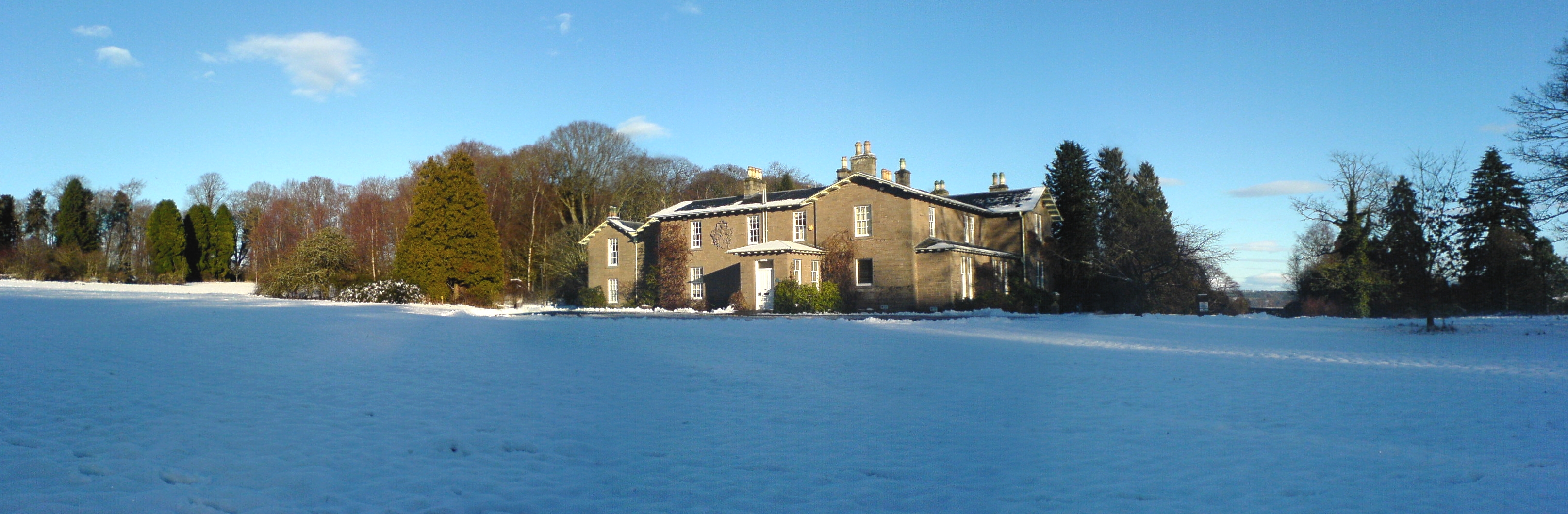
Battleby

Battleby is a country house in Perth and Kinross, Scotland. It is in the parish of Redgorton, 1 kilometre (0.62 mi) west of Luncarty and 6 kilometres...

Redgorton

Redgorton is a settlement in Gowrie, Perth and Kinross, Scotland. It lies a few miles from the River Tay and the A9 road, across the latter from Luncarty...

Pitcairngreen

Pitcairngreen (pronounced 'Pit-cairn Green') is a hamlet in the Scottish council area of Perth and Kinross which is more or less adjoined to the much larger...

Nearby Amenities

Located within 500m of 56.443685,-3.5092935
Power: pole
Lat/Long: 56.4449525/-3.5160646
Power: pole
Lat/Long: 56.4451745/-3.5151608
Power: pole
Lat/Long: 56.4452711/-3.5140339
Power: pole
Lat/Long: 56.4453564/-3.5128103
Power: pole
Lat/Long: 56.44512/-3.5116871
Power: pole
Lat/Long: 56.444898/-3.5103594
Power: pole
Lat/Long: 56.4446842/-3.5090056
Power: pole
Lat/Long: 56.4444971/-3.5076667
Power: pole
Lat/Long: 56.4442854/-3.5063129
Power: pole
Lat/Long: 56.4440798/-3.5049703
Power: pole
Lat/Long: 56.4438742/-3.5036388
Power: pole
Lat/Long: 56.443681/-3.5022776
Power: pole
Lat/Long: 56.4395875/-3.5121525
Power: pole
Lat/Long: 56.4403648/-3.5121234
Power: pole
Lat/Long: 56.4410192/-3.5120979
Power: pole
Lat/Long: 56.4412558/-3.5107446
Power: pole
Lat/Long: 56.4413565/-3.509253
Power: pole
Lat/Long: 56.4410494/-3.5072732
Power: pole
Lat/Long: 56.4412508/-3.5060802
Power: pole
Lat/Long: 56.4414451/-3.5048873
Power: pole
Lat/Long: 56.4416364/-3.5037399
Power: pole
Lat/Long: 56.4418609/-3.5023648
Power: pole
Lat/Long: 56.4394154/-3.5074444
Power: pole
Lat/Long: 56.4398302/-3.5062259
Power: pole
Lat/Long: 56.4403165/-3.5052388
Power: pole
Lat/Long: 56.4407887/-3.5042699
Power: pole
Lat/Long: 56.4412357/-3.5033574
Power: pole
Lat/Long: 56.4416898/-3.5024576
Power: pole
Lat/Long: 56.4400587/-3.5051568
Power: pole
Lat/Long: 56.4405883/-3.5041588
Power: pole
Lat/Long: 56.4410958/-3.5032098
Power: pole
Lat/Long: 56.441579/-3.5023247
Power: pole
Lat/Long: 56.4477809/-3.5080617
Power: pole
Lat/Long: 56.4473031/-3.5070603
Power: pole
Lat/Long: 56.4468241/-3.5061129
Power: pole
Lat/Long: 56.4463256/-3.505068
Power: pole
Lat/Long: 56.4458421/-3.504079
Power: pole
Lat/Long: 56.4453642/-3.5031191
Power: pole
Lat/Long: 56.4449093/-3.5021572
Power: pole
Lat/Long: 56.4445712/-3.5014999
The data included in this document is from www.openstreetmap.org. The data is made available under ODbL.

Have you been to Bothy Wood?

Leave your review of Bothy Wood below (or comments, questions and feedback).