Ballinlagg Wood
Wood, Forest in Morayshire
Scotland
Ballinlagg Wood

Ballinlagg Wood is a picturesque forest located in Morayshire, Scotland. Spanning approximately 100 hectares, this woodland is a haven for nature enthusiasts and outdoor adventurers alike. The wood is nestled in a rural area, surrounded by rolling hills and tranquil farmland, making it an idyllic retreat from the hustle and bustle of everyday life.
The wood is predominantly made up of native Scottish species, including oak, birch, and rowan trees. These towering giants create a dense canopy that blankets the forest floor, providing shade and shelter for a diverse array of wildlife. Visitors can expect to encounter a range of bird species, such as robins, thrushes, and woodpeckers, as well as small mammals like red squirrels and voles.
A network of well-maintained trails weaves its way through Ballinlagg Wood, offering visitors the opportunity to explore its beauty at their own pace. The paths vary in difficulty, catering to both leisurely strolls and more challenging hikes. Along the way, walkers will be treated to breathtaking views of the surrounding countryside, with glimpses of distant hills and meandering streams.
The wood is also home to a variety of plants and wildflowers, adding bursts of color to the landscape throughout the seasons. Bluebells carpet the forest floor in spring, while heather blooms in vibrant shades of purple during the summer months.
Ballinlagg Wood is not only a natural gem but also serves as an important habitat for many species. Its peaceful ambiance and scenic vistas make it a popular destination for both locals and tourists seeking solace in nature's embrace.
If you have any feedback on the listing, please let us know in the comments section below.
Ballinlagg Wood Images
Images are sourced within 2km of 57.379292/-3.5496481 or Grid Reference NJ0633. Thanks to Geograph Open Source API. All images are credited.


Ballinlagg Wood is located at Grid Ref: NJ0633 (Lat: 57.379292, Lng: -3.5496481)
Unitary Authority: Highland
Police Authority: Highlands and Islands
What 3 Words
///material.claps.novelists. Near Grantown-on-Spey, Highland
Nearby Locations
Related Wikis

Castle Grant
Castle Grant stands a mile north of Grantown-on-Spey and was the former seat of the Clan Grant chiefs of Strathspey in Highlands, Scotland. It was originally...

Dalvey Farm Halt railway station
Dalvey Farm Halt railway station was one of four halts, Imperial Cottages, Gibley's Cottages, Dalvey Farm, and Ballifurth Farm, opened on the Speyside...
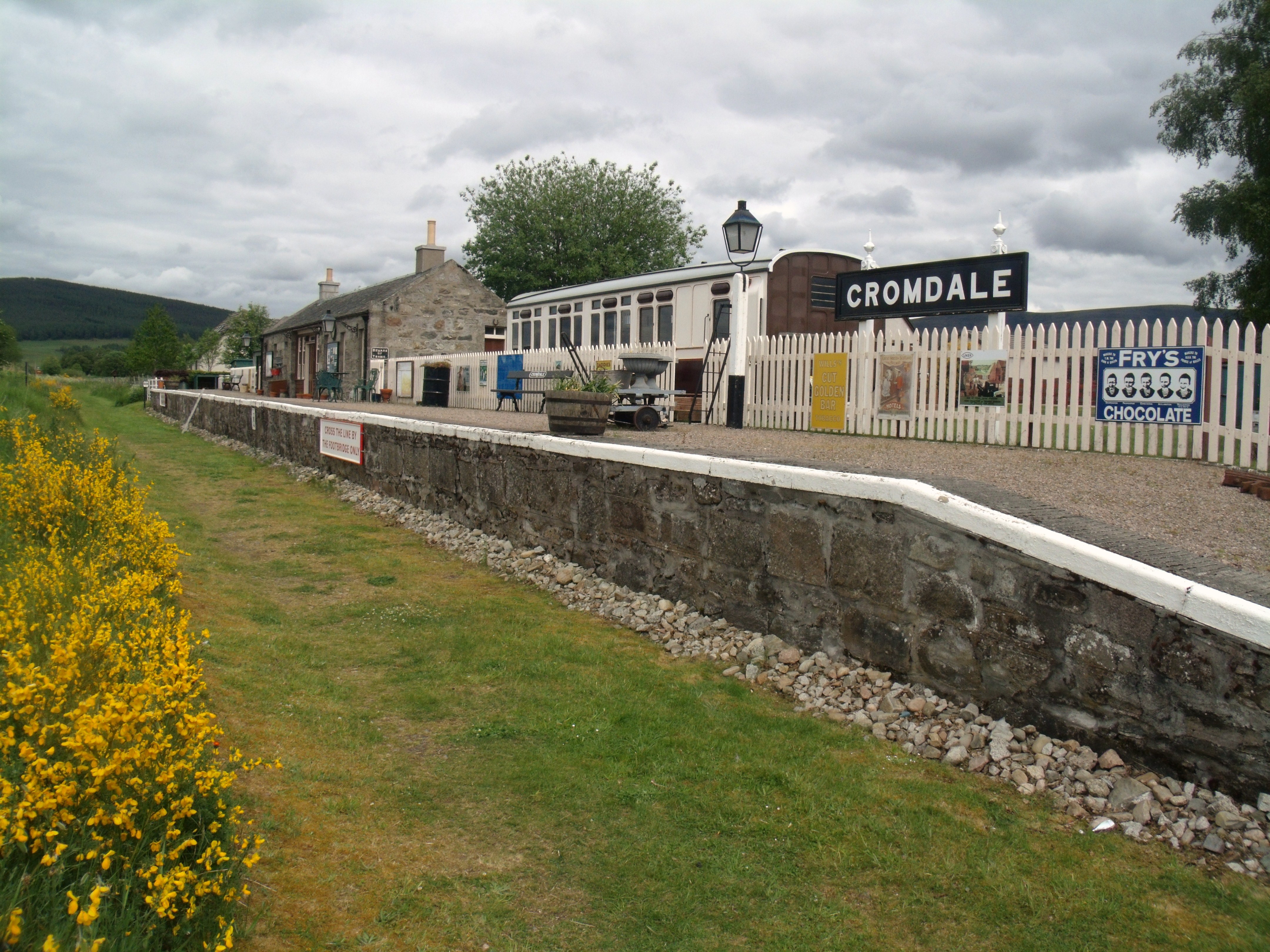
Cromdale railway station
Cromdale railway station served the village of Cromdale, Highland, in Scotland. == History == The station was opened by the Strathspey Railway (GNoSR)...

Castle Grant platform railway station
Castle Grant platform railway station was a railway station serving Castle Grant, in Strathspey in Scotland. == History == This station was opened with...
Nearby Amenities
Located within 500m of 57.379292,-3.5496481Have you been to Ballinlagg Wood?
Leave your review of Ballinlagg Wood below (or comments, questions and feedback).