Craigs Strip

Wood, Forest in Midlothian

Scotland

Craigs Strip

Remnants of Pumpherston No. 6 mine The mine here, which was situated less than a mile South of the once sprawling Pumpherston Oilworks, had a very brief existence. So brief, in fact, that it doesn't appear on any old maps of the area; it was operational for just five years, between 1907 and 1912, when West Lothian's shale mining boom was nearing its peak.
According to ScottishShale, the online authority on these matters, the two thick brick walls are most likely to be the base of the engine house - the engine was used to haul the shale to the surface. The walls are each about 5 feet thick (measured) and about 25 feet long (estimated). There are two decent-sized square holes halfway up the interior of each wall - these would no doubt have been there to house the big beams that supported the engine. The only other evidence of the mine's former existence is a small but noticeable spoil heap, just to the Southeast of this shot.
Remnants of Pumpherston No. 6 mine Credit: Ian Dodds

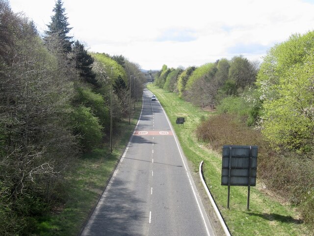
Craig's Strip is a small woodland area located in Midlothian, Scotland. Situated near the town of Wood, Forest, this strip of land spans approximately 1 kilometer in length and is surrounded by lush greenery and diverse wildlife.

The woodland is characterized by its dense canopy of trees, predominantly consisting of native species such as oak, beech, and birch. These trees provide a habitat for a variety of wildlife, including numerous bird species, small mammals, and insects. The undergrowth is filled with ferns, mosses, and wildflowers, adding to the overall natural beauty of the area.

Craig's Strip is a popular destination for nature enthusiasts and those seeking tranquility amidst the hustle and bustle of urban life. It offers several well-marked walking trails, allowing visitors to explore the woodland at their own pace. The trails wind through the trees, offering glimpses of the surrounding countryside and providing opportunities for birdwatching and wildlife spotting.

This woodland also holds historical significance, as it was once part of an ancient Celtic settlement. Archaeological remains, including stone circles and burial sites, have been discovered in the vicinity, adding an extra layer of interest and intrigue to the area.

Overall, Craig's Strip in Midlothian is a beautiful and serene woodland, offering a peaceful escape for nature lovers and a chance to connect with the natural world.

If you have any feedback on the listing, please let us know in the comments section below.

Craigs Strip Images

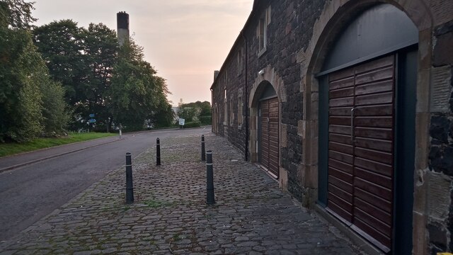
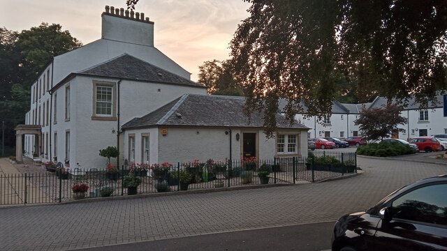
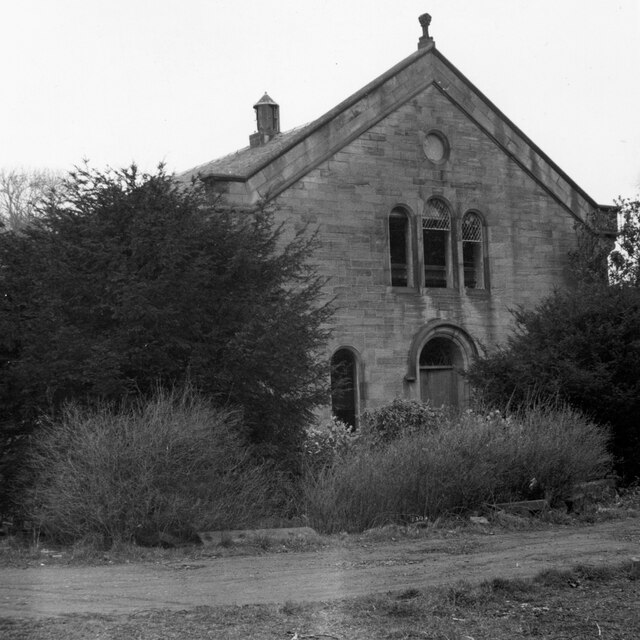
Images are sourced within 2km of 55.902921/-3.5027758 or Grid Reference NT0668. Thanks to Geograph Open Source API. All images are credited.

Remnants of Pumpherston No. 6 mine The mine here, which was situated less than a mile South of the once sprawling Pumpherston Oilworks, had a very brief existence. So brief, in fact, that it doesn't appear on any old maps of the area; it was operational for just five years, between 1907 and 1912, when West Lothian's shale mining boom was nearing its peak.
According to ScottishShale, the online authority on these matters, the two thick brick walls are most likely to be the base of the engine house - the engine was used to haul the shale to the surface. The walls are each about 5 feet thick (measured) and about 25 feet long (estimated). There are two decent-sized square holes halfway up the interior of each wall - these would no doubt have been there to house the big beams that supported the engine. The only other evidence of the mine's former existence is a small but noticeable spoil heap, just to the Southeast of this shot.
Remnants of Pumpherston No. 6 mine
The mine here, which was situated less than a mile South of the once sprawling Pumpherston Oilworks, had a very brief existence. So brief, in fact, that it doesn't appear on any old maps of the area; it was operational for just five years, between 1907 and 1912, when West Lothian's shale mining boom was nearing its peak. According to ScottishShale, the online authority on these matters, the two thick brick walls are most likely to be the base of the engine house - the engine was used to haul the shale to the surface. The walls are each about 5 feet thick (measured) and about 25 feet long (estimated). There are two decent-sized square holes halfway up the interior of each wall - these would no doubt have been there to house the big beams that supported the engine. The only other evidence of the mine's former existence is a small but noticeable spoil heap, just to the Southeast of this shot.
An Old Bit of Howden Park Centre Howden Park Centre is Livingston's only proper arts centre. This provides food for thought. Livingston is a newtown and therefore a micromanaged inorganic council affair. It has a population of about 60,000, higher than both Perth and Inverness. Organic settlements have only been micromanaged after things have sprung up naturally, and their ruling councils are probably used to there being lots of things there anyway.
In Livingston's defence, at least it has local shops situated at sensible regular distances from people's houses. But it was designed 50 years ago and things have deteriorated since. New suburbia generally arrives with no amenities other than a playground. If sufficiently big - ie huge - they are bestowed with a sterile square, generally located close to the school and surgery, containing a small supermarket chain store, a couple of takeaways, and a hairdressers. Whilst I do see the arguments against people setting up shops in their front rooms, which is how things used to develop, I think the house builders these days are missing a trick. Instead of bunging all their legally required 'affordable homes'  in a far-flung corner of the development, just spread them throughout the new scheme, located next to premises earmarked for shops and pubs which would have naturally sprung up before things got so regulated.
The centre is essentially an art gallery and a 300 seat auditorium. I had a quick flick through their website and upcoming events include lots of music tribute acts, a Moulin Rouge tribute, some folk music, a couple of plays, and a magician. The site is built around the former stables and coach house of the nearby recently renovated Howden House.
On a sombre note, this is the site of the first mainland Scottish deaths in World War Two. In 1940 a bomb hit the coach house, which I'm pretty sure is the central bit of this block, in between the arches, killing a woman and her granddaughter. These were the only deaths in the whole of the war in West Lothian.
An Old Bit of Howden Park Centre
Howden Park Centre is Livingston's only proper arts centre. This provides food for thought. Livingston is a newtown and therefore a micromanaged inorganic council affair. It has a population of about 60,000, higher than both Perth and Inverness. Organic settlements have only been micromanaged after things have sprung up naturally, and their ruling councils are probably used to there being lots of things there anyway. In Livingston's defence, at least it has local shops situated at sensible regular distances from people's houses. But it was designed 50 years ago and things have deteriorated since. New suburbia generally arrives with no amenities other than a playground. If sufficiently big - ie huge - they are bestowed with a sterile square, generally located close to the school and surgery, containing a small supermarket chain store, a couple of takeaways, and a hairdressers. Whilst I do see the arguments against people setting up shops in their front rooms, which is how things used to develop, I think the house builders these days are missing a trick. Instead of bunging all their legally required 'affordable homes' in a far-flung corner of the development, just spread them throughout the new scheme, located next to premises earmarked for shops and pubs which would have naturally sprung up before things got so regulated. The centre is essentially an art gallery and a 300 seat auditorium. I had a quick flick through their website and upcoming events include lots of music tribute acts, a Moulin Rouge tribute, some folk music, a couple of plays, and a magician. The site is built around the former stables and coach house of the nearby recently renovated Howden House. On a sombre note, this is the site of the first mainland Scottish deaths in World War Two. In 1940 a bomb hit the coach house, which I'm pretty sure is the central bit of this block, in between the arches, killing a woman and her granddaughter. These were the only deaths in the whole of the war in West Lothian.
Howden House and Steadings Very few people are aware this hidden gem, tucked away at the top of Howden Park, actually exists. It was completed at some unspecified date in the late 1700s - though it was important enough to be marked on Roy's Military Map, surveyed in the 1750s - and was occupied by a succession of wealthy people until the Ministry of Agriculture took it over, along with the grounds, immediately after the Second World War to test farm machinery.
It passed to the council (or Livingston Development Corporation as they were then officially called) in the 1960s. It isn't clear how long it was used for but eventually it sat idle and fell into a very sorry state - it is fairly easy to find pictures of this online. A private developer bought it about 10 years ago, and as can be seen, did a very good job. The house is now split into four separate properties.
The steadings fooled me, being so in keeping with the house. They were, though, only built at the same time the house was getting refurbished.
Howden House and Steadings
Very few people are aware this hidden gem, tucked away at the top of Howden Park, actually exists. It was completed at some unspecified date in the late 1700s - though it was important enough to be marked on Roy's Military Map, surveyed in the 1750s - and was occupied by a succession of wealthy people until the Ministry of Agriculture took it over, along with the grounds, immediately after the Second World War to test farm machinery. It passed to the council (or Livingston Development Corporation as they were then officially called) in the 1960s. It isn't clear how long it was used for but eventually it sat idle and fell into a very sorry state - it is fairly easy to find pictures of this online. A private developer bought it about 10 years ago, and as can be seen, did a very good job. The house is now split into four separate properties. The steadings fooled me, being so in keeping with the house. They were, though, only built at the same time the house was getting refurbished.
United Presbyterian Church, Midcalder As seen in Winter 1973/4 when it was disused and semi-derelict. In May 1854 it replaced the original 1765 church on the site, which was becoming unsafe. It was subsequently demolished and the stone used to build a new house that incorporated a cottage on Pumpherston Road, which had been a post-medieval Toll House.
United Presbyterian Church, Midcalder
As seen in Winter 1973/4 when it was disused and semi-derelict. In May 1854 it replaced the original 1765 church on the site, which was becoming unsafe. It was subsequently demolished and the stone used to build a new house that incorporated a cottage on Pumpherston Road, which had been a post-medieval Toll House.
East Woods, Craigshill, Livingston I don't think it would cause much argument to describe Craigshill as an unglamorous area of an unglamorous town. However, as with all of Livingston, it is close to a good network of leafy paths, and due to the town sloping down from North to South, has stunning views of the Pentland Hills from certain spots, including an open section on this linear woodland route.
There is easy access to the wood via a tarmac path leading from Nasmyth Square, a dead-end road leading to lots of small industrial units with lots of parking space. Presumably the name arises from the woods being on the East side of Livingston, and the main mostly tarmacked path swings round Craigshill's NorthEastern corner, with access from various residential streets and the Mid Calder to Pumpherston road.
Like most of Livingston's many small woodlands it is managed by the Woodland Trust, who  have enormous exhaustive files available online about all of their sites. The only gripe I have with these reports is that they generally split up these suburban woodlands into 'compartments', with no accompanying map to determine where these compartments are on the ground. This time though it was easy enough to figure them out. This Northern section is mixed, and was originally planted in the mid 1800s. The Southernmost section though, in the neighbouring grid-square, is thought to have been planted during the building of Livingston, which mostly started with Craigshill in the 1960s. I mention this because the Woodland Trust report mentions problems there with various species of conifer having got too tall and therefore blowing over a lot. I wonder if they aren't present in the older section because these tree types weren't readily available at that time, they have already all blown over and/or been felled, or whether it is just a case of humanity becoming increasingly more stupid over time?!
East Woods, Craigshill, Livingston
I don't think it would cause much argument to describe Craigshill as an unglamorous area of an unglamorous town. However, as with all of Livingston, it is close to a good network of leafy paths, and due to the town sloping down from North to South, has stunning views of the Pentland Hills from certain spots, including an open section on this linear woodland route. There is easy access to the wood via a tarmac path leading from Nasmyth Square, a dead-end road leading to lots of small industrial units with lots of parking space. Presumably the name arises from the woods being on the East side of Livingston, and the main mostly tarmacked path swings round Craigshill's NorthEastern corner, with access from various residential streets and the Mid Calder to Pumpherston road. Like most of Livingston's many small woodlands it is managed by the Woodland Trust, who have enormous exhaustive files available online about all of their sites. The only gripe I have with these reports is that they generally split up these suburban woodlands into 'compartments', with no accompanying map to determine where these compartments are on the ground. This time though it was easy enough to figure them out. This Northern section is mixed, and was originally planted in the mid 1800s. The Southernmost section though, in the neighbouring grid-square, is thought to have been planted during the building of Livingston, which mostly started with Craigshill in the 1960s. I mention this because the Woodland Trust report mentions problems there with various species of conifer having got too tall and therefore blowing over a lot. I wonder if they aren't present in the older section because these tree types weren't readily available at that time, they have already all blown over and/or been felled, or whether it is just a case of humanity becoming increasingly more stupid over time?!
Pond Outflow joining Caw Burn This muddy burn looks man-made to me, though it has followed the same course for at least 200 years, judging by old maps. The 1850s OS naming book says that it was "formed by the drainage of several fields," which kind of validates my theory that it is, in effect, a large drainage ditch, in its early stages at least. It eventually reaches the Brox Burn, which drains into the River Almond. It used to start somewhere in what is now Livingston, though it is hard to say exactly where, as it used to form some kind of administrative boundary, which always makes the old maps harder to decode. Today, though, it flows underground from an indeterminate point and only appears overground about a hundred yards from here. There is a Cawburn Inn in Pumpherston (which seems to have changed from a normal pub to a major darts and pool venue at some point in the twenty years or so since I was last there) just West of here - an indication of the burn's original course
The water joining it on the left comes from a smallish pond that must be the result of some remedial works to part of the vast former mining land around here, as it is not shown on any of the older maps available online (which stop in the late 1960s at present).  The pond is shown on modern mapping, but the water leading from it to this spot is not.
Pond Outflow joining Caw Burn
This muddy burn looks man-made to me, though it has followed the same course for at least 200 years, judging by old maps. The 1850s OS naming book says that it was "formed by the drainage of several fields," which kind of validates my theory that it is, in effect, a large drainage ditch, in its early stages at least. It eventually reaches the Brox Burn, which drains into the River Almond. It used to start somewhere in what is now Livingston, though it is hard to say exactly where, as it used to form some kind of administrative boundary, which always makes the old maps harder to decode. Today, though, it flows underground from an indeterminate point and only appears overground about a hundred yards from here. There is a Cawburn Inn in Pumpherston (which seems to have changed from a normal pub to a major darts and pool venue at some point in the twenty years or so since I was last there) just West of here - an indication of the burn's original course The water joining it on the left comes from a smallish pond that must be the result of some remedial works to part of the vast former mining land around here, as it is not shown on any of the older maps available online (which stop in the late 1960s at present). The pond is shown on modern mapping, but the water leading from it to this spot is not.
Old Tracks from Pumpherston Oil Works The photograph only shows three tracks but a fourth, off to the right, was visible on the ground, though it may only have been obvious when further along from the camera position. A large-scale OS map, surveyed in 1962, shows five tramlines here, but these surviving ones definitely match up with them from the grid references.
Pumpherston Oil Works was a mainstay of West Lothian's shale mining industry throughout, and was the last man standing - it diversified into detergents after the last of the mines closed and outlasted the industry by around 30 years. The diversification may or may not have something to do with the fact that the tramlines only appeared on maps just before it stopped being a proper refinery in 1964. There is no sign of them on a 1948 map. They start near a railway line leading from the main part of the operation, which is also not present on the 1948 map, and disappear into one of numerous buildings unhelpfully just titled 'Works'. It seems very likely that waste was taken here; this was always the dumping ground for the oilworks, and the 1962 map shows a 'refuse tip' at the far end of the building. It seems odd, though,  that the waste needed to go through a building to get there. Spent shale was just taken as far as it could be mechanically, then usually tipped by men, so there may have been some non-shale dumping happening here.
After the works did finally close this site was a 'quarry' for the masses of spent shale dumped here over the years, probably for use in road foundations.
Old Tracks from Pumpherston Oil Works
The photograph only shows three tracks but a fourth, off to the right, was visible on the ground, though it may only have been obvious when further along from the camera position. A large-scale OS map, surveyed in 1962, shows five tramlines here, but these surviving ones definitely match up with them from the grid references. Pumpherston Oil Works was a mainstay of West Lothian's shale mining industry throughout, and was the last man standing - it diversified into detergents after the last of the mines closed and outlasted the industry by around 30 years. The diversification may or may not have something to do with the fact that the tramlines only appeared on maps just before it stopped being a proper refinery in 1964. There is no sign of them on a 1948 map. They start near a railway line leading from the main part of the operation, which is also not present on the 1948 map, and disappear into one of numerous buildings unhelpfully just titled 'Works'. It seems very likely that waste was taken here; this was always the dumping ground for the oilworks, and the 1962 map shows a 'refuse tip' at the far end of the building. It seems odd, though, that the waste needed to go through a building to get there. Spent shale was just taken as far as it could be mechanically, then usually tipped by men, so there may have been some non-shale dumping happening here. After the works did finally close this site was a 'quarry' for the masses of spent shale dumped here over the years, probably for use in road foundations.
Old milestone On the B7015 near Almondvale Park is another of the typical Calder District Trust milestones.  This one has had its own paved area set around it.  The stone had a very deep slot in its top which has been repaired.
Old milestone
On the B7015 near Almondvale Park is another of the typical Calder District Trust milestones. This one has had its own paved area set around it. The stone had a very deep slot in its top which has been repaired.
Old milestone This shows how wide the slot was in the top of the milestone near Almondvale Park.  This has now been repaired with lime mortar to prevent further deterioration.
Old milestone
This shows how wide the slot was in the top of the milestone near Almondvale Park. This has now been repaired with lime mortar to prevent further deterioration.
Don't Dystopian vibes from the Covid posters along Howden Road West, outside St John's Hospital. At the time there was policy (especially marked in England) of pretending there was no dangerous respiratory virus while many hundreds of people died every day.
Don't
Dystopian vibes from the Covid posters along Howden Road West, outside St John's Hospital. At the time there was policy (especially marked in England) of pretending there was no dangerous respiratory virus while many hundreds of people died every day.
St John's Hospital, Livingston
Alderstone woodland A strip of woodland between the Alderstone Walk and Alderstone Road, Livingston.
Alderstone woodland
A strip of woodland between the Alderstone Walk and Alderstone Road, Livingston.
Cousland Road A705, future proofed with room for another carriageway.
Cousland Road
A705, future proofed with room for another carriageway.
Alderstone Road
Alderstone Road
Livingston Free Church Alderstone Road
Livingston Free Church
Alderstone Road
Under Alderstone Road The segregated walking route going under one of the distribution roads in Livingston.
Under Alderstone Road
The segregated walking route going under one of the distribution roads in Livingston.
Informal green space By Falcon Brae, Livingston
Informal green space
By Falcon Brae, Livingston
Informal green space There is some not so unusual fire damage visible.
Informal green space
There is some not so unusual fire damage visible.
Show me another place!

Craigs Strip is located at Grid Ref: NT0668 (Lat: 55.902921, Lng: -3.5027758)

Unitary Authority: West Lothian

Police Authority: The Lothians and Scottish Borders

What 3 Words

///thanks.harder.damp. Near Livingston, West Lothian

Related Wikis

Craigshill

Craigshill is a residential area in the east of Livingston, Scotland. To the west is the A899, with Howden, Ladywell and Knightsridge beyond it, to the...

Pumpherston

Pumpherston is a village in West Lothian, Scotland. Originally a small industrial village housing works for the nearby shale mine and works, it now forms...

Cedarbank School

Cedarbank School is a secondary school based in Dedrige, Livingston, Scotland for people with special needs, and it has up to 100 pupils at a time. It...

Inveralmond Community High School

Inveralmond Community High School is an 11–18, mixed comprehensive school in the Ladywell area of Livingston and serves a cluster of six primary schools...

Nearby Amenities

Located within 500m of 55.902921,-3.5027758
Mini Roundabout
Direction: clockwise
Lat/Long: 55.9006468/-3.5024662
Motorway Junction
Cousland Interchange
Lat/Long: 55.899066/-3.5056738
Post Box
Collection Times: Mo-Fr 18:00; Sa 11:00
Operator: Royal Mail
Post Box Type: pillar
Ref: EH54 14
Royal Cypher: scottish_crown
Lat/Long: 55.9056171/-3.5014232
Noexit: yes
Lat/Long: 55.8984912/-3.5024994
Crossing
Crossing: traffic_signals
Source: GPS
Lat/Long: 55.899856/-3.5038631
Man Made: tower
Lat/Long: 55.9010174/-3.4994618
Entrance: yes
Lat/Long: 55.9021404/-3.4954942
Addr Housenumber: 1-6
Addr Street: Linden Grove
Lat/Long: 55.9021817/-3.495364
Bus Stop
Naptan AtcoCode: 6290LC02
Naptan NaptanCode: 95624756
Lat/Long: 55.8993608/-3.5038554
Entrance: main
Lat/Long: 55.8993881/-3.502971
Post Box
Collection Times: Mo-Fr 09:00; Sa 07:00
Operator: Royal Mail
Post Box Type: pillar
Ref: EH54 16D
Royal Cypher: scottish_crown
Lat/Long: 55.8994053/-3.5025262
Operator: British Telecom
Payment Coins: yes
Payment Credit Cards: yes
Payment Telephone Cards: yes
Removed Amenity: telephone
Lat/Long: 55.8994177/-3.5025376
Bus Stop
Naptan AtcoCode: 6290LC01
Naptan NaptanCode: 95624754
Lat/Long: 55.8997818/-3.5031349
Bus Stop
Naptan AtcoCode: 6290LH09
Naptan NaptanCode: 95624843
Lat/Long: 55.902302/-3.5008895
Bus Stop
Lat/Long: 55.9016817/-3.501491
Man Made: tower
Operator: Everything Everywhere Limited
Tower Construction: freestanding
Tower Type: communication
Lat/Long: 55.8999809/-3.4996929
Addr Housenumber: 24
Addr Street: Harrysmuir Gardens
Lat/Long: 55.9056289/-3.4966827
Addr Housenumber: 14
Addr Street: Harrysmuir Gardens
Lat/Long: 55.90606/-3.4971553
Addr Housenumber: 2
Addr Street: Harrysmuir Gardens
Lat/Long: 55.9064172/-3.4977588
Addr Housenumber: 16
Addr Street: Ash Grove
Lat/Long: 55.9019341/-3.4967123
Addr Housenumber: 15
Addr Street: Ash Grove
Lat/Long: 55.9018725/-3.4966435
Addr Housenumber: 14
Addr Street: Ash Grove
Lat/Long: 55.9018081/-3.4965708
Addr Housenumber: 17
Addr Street: Ash Grove
Lat/Long: 55.9019979/-3.4967819
Addr City: Livingston
Addr Housenumber: 10
Addr Postcode: EH54 5JQ
Addr Street: Ash Grove
Lat/Long: 55.9018371/-3.4969725
Addr City: Livingston
Addr Housenumber: 11
Addr Postcode: EH54 5JQ
Addr Street: Ash Grove
Lat/Long: 55.9017755/-3.4969037
Addr Housenumber: 13
Addr Street: Ash Grove
Lat/Long: 55.9016371/-3.4967459
Addr Housenumber: 12
Addr Street: Ash Grove
Lat/Long: 55.9017009/-3.4968154
Addr City: Livingston
Addr Housenumber: 9
Addr Postcode: EH54 5JQ
Addr Street: Ash Grove
Lat/Long: 55.9019009/-3.4970421
Addr Housenumber: 5
Addr Street: Ash Grove
Lat/Long: 55.9014498/-3.497268
Addr Housenumber: 4
Addr Street: Ash Grove
Lat/Long: 55.9015136/-3.4973376
Addr Housenumber: 1
Addr Street: Ash Grove
Lat/Long: 55.9017136/-3.4975642
Addr Housenumber: 2
Addr Street: Ash Grove
Lat/Long: 55.9016498/-3.4974946
Addr Housenumber: 3
Addr Street: Ash Grove
Lat/Long: 55.9015882/-3.4974258
Addr Housenumber: 8
Addr Street: Ash Grove
Lat/Long: 55.9018106/-3.4973054
Addr Housenumber: 7
Addr Street: Ash Grove
Lat/Long: 55.9017467/-3.4972358
Addr Housenumber: 6
Addr Street: Ash Grove
Lat/Long: 55.9016852/-3.497167
Addr Housenumber: 18
Addr Street: Ash Grove
Lat/Long: 55.9020314/-3.4964409
Addr Housenumber: 19
Addr Street: Ash Grove
Lat/Long: 55.9019676/-3.4963713
Addr Housenumber: 20
Addr Street: Ash Grove
Lat/Long: 55.901906/-3.4963025
Addr Housenumber: 47
Addr Street: Ash Grove
Lat/Long: 55.9013275/-3.4962814
Addr Housenumber: 48
Addr Street: Ash Grove
Lat/Long: 55.9013666/-3.4961677
Addr Housenumber: 49
Addr Street: Ash Grove
Lat/Long: 55.9014052/-3.4960579
Addr Housenumber: 28
Addr Street: Ash Grove
Lat/Long: 55.901526/-3.4963469
Addr Housenumber: 27
Addr Street: Ash Grove
Lat/Long: 55.9015643/-3.4962367
Addr City: Livingston
Addr Housenumber: 29
Addr Postcode: EH54 5JH
Addr Street: Ash Grove
Lat/Long: 55.9014865/-3.4964602
Addr Housenumber: 31
Addr Street: Ash Grove
Lat/Long: 55.9014323/-3.4966735
Addr Housenumber: 30
Addr Street: Ash Grove
Lat/Long: 55.9014725/-3.4965579
Addr Housenumber: 32
Addr Street: Ash Grove
Lat/Long: 55.9013929/-3.4967869
Addr Housenumber: 33
Addr Street: Ash Grove
Lat/Long: 55.9013559/-3.4968933
Addr Housenumber: 35
Addr Street: Ash Grove
Lat/Long: 55.9012193/-3.4972065
Addr Housenumber: 34
Addr Street: Ash Grove
Lat/Long: 55.9012576/-3.4970963
Addr Housenumber: 36
Addr Street: Ash Grove
Lat/Long: 55.9011799/-3.4973199
Addr Housenumber: 38
Addr Street: Ash Grove
Lat/Long: 55.9010904/-3.4975775
Addr Housenumber: 37
Addr Street: Ash Grove
Lat/Long: 55.901141/-3.4974318
Addr Housenumber: 46
Addr Street: Ash Grove
Lat/Long: 55.9012019/-3.4966762
Addr Housenumber: 43
Addr Street: Ash Grove
Lat/Long: 55.9010727/-3.4970478
Addr Housenumber: 44
Addr Street: Ash Grove
Lat/Long: 55.901111/-3.4969377
Addr Housenumber: 39
Addr Street: Ash Grove
Lat/Long: 55.9009054/-3.4975289
Addr Housenumber: 42
Addr Street: Ash Grove
Lat/Long: 55.9010332/-3.4971612
Addr Housenumber: 40
Addr Street: Ash Grove
Lat/Long: 55.9009437/-3.4974187
Addr Housenumber: 41
Addr Street: Ash Grove
Lat/Long: 55.9009944/-3.4972731
Addr Housenumber: 45
Addr Street: Ash Grove
Lat/Long: 55.9011636/-3.4967863
Addr Housenumber: 10
Addr Street: Beech Grove
Lat/Long: 55.9011358/-3.4963043
Addr Housenumber: 6
Addr Street: Beech Grove
Lat/Long: 55.9009672/-3.4967902
Addr Housenumber: 1
Addr Street: Beech Grove
Lat/Long: 55.9007616/-3.4973814
Addr Housenumber: 4
Addr Street: Beech Grove
Lat/Long: 55.9008895/-3.4970137
Addr Housenumber: 2
Addr Street: Beech Grove
Lat/Long: 55.9007999/-3.4972712
Addr Housenumber: 3
Addr Street: Beech Grove
Lat/Long: 55.9008506/-3.4971256
Addr Housenumber: 9
Addr Street: Beech Grove
Lat/Long: 55.9010963/-3.4964187
Addr Housenumber: 7
Addr Street: Beech Grove
Lat/Long: 55.9010198/-3.4966388
Addr Housenumber: 8
Addr Street: Beech Grove
Lat/Long: 55.9010581/-3.4965287
Addr Housenumber: 5
Addr Street: Beech Grove
Lat/Long: 55.9009289/-3.4969003
Addr Housenumber: 12
Addr Street: Beech Grove
Lat/Long: 55.9012206/-3.4960058
Addr Housenumber: 13
Addr Street: Beech Grove
Lat/Long: 55.9012589/-3.4958956
Addr City: Livingston
Addr Housenumber: 11
Addr Postcode: EH54 5JJ
Addr Street: Beech Grove
Lat/Long: 55.9011811/-3.4961192
Addr Housenumber: 18
Addr Street: Beech Grove
Lat/Long: 55.9014787/-3.4952632
Addr Housenumber: 19
Addr Street: Beech Grove
Lat/Long: 55.901517/-3.4951531
Addr Housenumber: 16
Addr Street: Beech Grove
Lat/Long: 55.9013878/-3.4955247
Addr Housenumber: 17
Addr Street: Beech Grove
Lat/Long: 55.9014261/-3.4954146
Addr Housenumber: 15
Addr Street: Beech Grove
Lat/Long: 55.9013484/-3.4956381
Addr Housenumber: 14
Addr Street: Beech Grove
Lat/Long: 55.9013095/-3.49575
Addr Housenumber: 54
Addr Street: Ash Grove
Lat/Long: 55.9016229/-3.4954321
Addr Housenumber: 55
Addr Street: Ash Grove
Lat/Long: 55.9016606/-3.4953214
Addr Housenumber: 22
Addr Street: Ash Grove
Lat/Long: 55.9017851/-3.4956117
Addr Housenumber: 21
Addr Street: Ash Grove
Lat/Long: 55.9018241/-3.4955023
Addr Housenumber: 24
Addr Street: Ash Grove
Lat/Long: 55.9016992/-3.4958553
Addr Housenumber: 23
Addr Street: Ash Grove
Lat/Long: 55.9017378/-3.4957456
Addr Housenumber: 25
Addr Street: Ash Grove
Lat/Long: 55.9016601/-3.4959691
Addr Housenumber: 26
Addr Street: Ash Grove
Lat/Long: 55.9016202/-3.4960799
Addr Housenumber: 52
Addr Street: Ash Grove
Lat/Long: 55.9015331/-3.4956949
Addr Housenumber: 53
Addr Street: Ash Grove
Lat/Long: 55.9015709/-3.4955842
Addr Housenumber: 51
Addr Street: Ash Grove
Lat/Long: 55.9014941/-3.4958088
Addr Housenumber: 50
Addr Street: Ash Grove
Lat/Long: 55.9014557/-3.4959212
Addr City: Livingston
Addr Housenumber: 29
Addr Postcode: EH54 5FB
Addr Street: Lime Grove
Lat/Long: 55.9027835/-3.4954646
Addr City: Livingston
Addr Housenumber: 28
Addr Postcode: EH54 5FB
Addr Street: Lime Grove
Lat/Long: 55.9028723/-3.4955206
Addr City: Livingston
Addr Housenumber: 31
Addr Street: Perth Street
Lat/Long: 55.9019089/-3.5002816
Addr City: Livingston
Addr Housenumber: 32
Addr Street: Perth Street
Lat/Long: 55.9018726/-3.5003451
Addr City: Livingston
Addr Housenumber: 33
Addr Street: Perth Street
Lat/Long: 55.9017725/-3.5002503
Addr City: Livingston
Addr Housenumber: 34
Addr Street: Perth Street
Lat/Long: 55.9017818/-3.5001639
Addr City: Livingston
Addr Housenumber: 11
Addr Street: Perth Street
Lat/Long: 55.9013526/-3.5014068
Addr City: Livingston
Addr Housenumber: 14
Addr Street: Perth Street
Lat/Long: 55.9014659/-3.5015129
Addr City: Livingston
Addr Housenumber: 12
Addr Street: Perth Street
Lat/Long: 55.9013889/-3.5013351
Addr City: Livingston
Addr Housenumber: 13
Addr Street: Perth Street
Lat/Long: 55.9014792/-3.5014206
Addr City: Livingston
Addr Housenumber: 9
Addr Street: Perth Street
Lat/Long: 55.9012104/-3.5012013
Addr City: Livingston
Addr Housenumber: 10
Addr Street: Perth Street
Lat/Long: 55.9012971/-3.5012832
Addr City: Livingston
Addr Housenumber: 3
Addr Street: Perth Street
Lat/Long: 55.9015492/-3.5004316
Addr City: Livingston
Addr Housenumber: 4
Addr Street: Perth Street
Lat/Long: 55.9015407/-3.5004597
Addr City: Livingston
Addr Housenumber: 5
Addr Street: Perth Street
Lat/Long: 55.9014725/-3.5006891
Addr City: Livingston
Addr Housenumber: 6
Addr Street: Perth Street
Lat/Long: 55.901464/-3.5007172
Addr City: Livingston
Addr Housenumber: 7
Addr Street: Perth Street
Lat/Long: 55.9013939/-3.5009423
Addr City: Livingston
Addr Housenumber: 8
Addr Street: Perth Street
Lat/Long: 55.9013855/-3.5009704
Addr City: Livingston
Addr Housenumber: 40
Addr Street: Perth Street
Lat/Long: 55.9014759/-3.4995683
Addr City: Livingston
Addr Housenumber: 39
Addr Street: Perth Street
Lat/Long: 55.9014916/-3.4995833
Addr City: Livingston
Addr Housenumber: 2
Addr Street: Perth Street
Lat/Long: 55.9016174/-3.5002049
Addr City: Livingston
Addr Housenumber: 1
Addr Street: Perth Street
Lat/Long: 55.9016259/-3.5001768
Addr City: Livingston
Addr Housenumber: 38
Addr Street: Perth Street
Lat/Long: 55.9016338/-3.4997297
Addr City: Livingston
Addr Housenumber: 37
Addr Street: Perth Street
Lat/Long: 55.9016495/-3.4997447
Addr City: Livingston
Addr Housenumber: 36
Addr Street: Perth Street
Lat/Long: 55.901758/-3.4999102
Addr City: Livingston
Addr Housenumber: 35
Addr Street: Perth Street
Lat/Long: 55.9017679/-3.4999368
Addr City: Livingston
Addr Housenumber: 16
Addr Street: Perth Street
Lat/Long: 55.9015885/-3.5011644
Addr City: Livingston
Addr Housenumber: 17
Addr Street: Perth Street
Lat/Long: 55.9016038/-3.5011787
Addr City: Livingston
Addr Housenumber: 18
Addr Street: Perth Street
Lat/Long: 55.9016779/-3.5012475
Addr City: Livingston
Addr Housenumber: 19
Addr Street: Perth Street
Lat/Long: 55.9016914/-3.5012602
Addr City: Livingston
Addr Housenumber: 20
Addr Postcode: EH54 5DQ
Addr Street: Perth Street
Lat/Long: 55.9016449/-3.5006192
Addr City: Livingston
Addr Housenumber: 22
Addr Postcode: EH54 5DQ
Addr Street: Perth Street
Lat/Long: 55.901776/-3.5006192
Addr City: Livingston
Addr Housenumber: 21
Addr Postcode: EH54 5DQ
Addr Street: Perth Street
Lat/Long: 55.9016856/-3.5005336
Addr City: Livingston
Addr Housenumber: 22
Addr Postcode: EH54 5EP
Addr Street: Craigswood
Lat/Long: 55.9008768/-3.5033421
Addr City: Livingston
Addr Housenumber: 21
Addr Street: Craigswood
Lat/Long: 55.9008951/-3.5032297
Addr City: Livingston
Addr Housenumber: 20
Addr Street: Craigswood
Lat/Long: 55.9009099/-3.5031095
Addr City: Livingston
Addr Housenumber: 19
Addr Street: Craigswood
Lat/Long: 55.9009414/-3.5030056
Addr City: Livingston
Addr Housenumber: 18
Addr Street: Craigswood
Lat/Long: 55.9009894/-3.5029162
Addr City: Livingston
Addr Housenumber: 17
Addr Street: Craigswood
Lat/Long: 55.9010408/-3.5028228
Addr City: Livingston
Addr Housenumber: 16
Addr Street: Craigswood
Lat/Long: 55.9010886/-3.5027352
Addr City: Livingston
Addr Housenumber: 15
Addr Street: Craigswood
Lat/Long: 55.9011381/-3.5026425
Addr City: Livingston
Addr Housenumber: 14
Addr Street: Craigswood
Lat/Long: 55.9011862/-3.5025514
Addr City: Livingston
Addr Housenumber: 13
Addr Street: Craigswood
Lat/Long: 55.9012344/-3.5024661
Addr City: Livingston
Addr Housenumber: 12
Addr Street: Craigswood
Lat/Long: 55.9012896/-3.5023786
Addr City: Livingston
Addr Housenumber: 11
Addr Street: Craigswood
Lat/Long: 55.9014284/-3.5023927
Addr City: Livingston
Addr Housenumber: 10
Addr Street: Craigswood
Lat/Long: 55.9014555/-3.5023034
Addr City: Livingston
Addr Housenumber: 9
Addr Street: Craigswood
Lat/Long: 55.9014826/-3.5022141
Addr City: Livingston
Addr Housenumber: 8
Addr Street: Craigswood
Lat/Long: 55.901554/-3.5021696
Addr City: Livingston
Addr Housenumber: 7
Addr Street: Craigswood
Lat/Long: 55.9016243/-3.502125
Addr City: Livingston
Addr Housenumber: 6
Addr Street: Craigswood
Lat/Long: 55.9016958/-3.5020808
Addr City: Livingston
Addr Housenumber: 5
Addr Street: Craigswood
Lat/Long: 55.9017682/-3.502037
Addr City: Livingston
Addr Housenumber: 4
Addr Street: Craigswood
Lat/Long: 55.9018384/-3.5019902
Addr City: Livingston
Addr Housenumber: 3
Addr Street: Craigswood
Lat/Long: 55.9019108/-3.5019448
Addr City: Livingston
Addr Housenumber: 2
Addr Street: Craigswood
Lat/Long: 55.901938/-3.5018551
Addr City: Livingston
Addr Housenumber: 1
Addr Street: Craigswood
Lat/Long: 55.9019522/-3.5017521
Addr City: Livingston
Addr Housenumber: 100
Addr Street: Craigswood
Lat/Long: 55.900854/-3.5036494
Addr City: Livingston
Addr Housenumber: 99
Addr Street: Craigswood
Lat/Long: 55.9008267/-3.5037375
Addr City: Livingston
Addr Housenumber: 98
Addr Street: Craigswood
Lat/Long: 55.9007993/-3.5038257
Addr City: Livingston
Addr Housenumber: 97
Addr Street: Craigswood
Lat/Long: 55.900772/-3.5039139
Addr City: Livingston
Addr Housenumber: 96
Addr Street: Craigswood
Lat/Long: 55.9007446/-3.5040021
Addr City: Livingston
Addr Housenumber: 95
Addr Street: Craigswood
Lat/Long: 55.9007173/-3.5040902
Addr City: Livingston
Addr Housenumber: 94
Addr Street: Craigswood
Lat/Long: 55.9008975/-3.5043591
Addr City: Livingston
Addr Housenumber: 93
Addr Street: Craigswood
Lat/Long: 55.9009248/-3.5042708
Addr City: Livingston
Addr Housenumber: 92
Addr Street: Craigswood
Lat/Long: 55.9009522/-3.5041825
Addr City: Livingston
Addr Housenumber: 91
Addr Street: Craigswood
Lat/Long: 55.9009795/-3.5040941
Addr City: Livingston
Addr Housenumber: 90
Addr Street: Craigswood
Lat/Long: 55.9010069/-3.5040058
Addr City: Livingston
Addr Housenumber: 89
Addr Street: Craigswood
Lat/Long: 55.9010342/-3.5039175
Addr City: Livingston
Addr Housenumber: 88
Addr Street: Craigswood
Lat/Long: 55.9010476/-3.5038153
Addr City: Livingston
Addr Housenumber: 87
Addr Street: Craigswood
Lat/Long: 55.901075/-3.5037267
Addr City: Livingston
Addr Housenumber: 86
Addr Street: Craigswood
Lat/Long: 55.9011024/-3.503638
Addr City: Livingston
Addr Housenumber: 85
Addr Street: Craigswood
Lat/Long: 55.9011167/-3.5035345
Addr City: Livingston
Addr Housenumber: 84
Addr Street: Craigswood
Lat/Long: 55.901145/-3.5034429
Addr City: Livingston
Addr Housenumber: 83
Addr Street: Craigswood
Lat/Long: 55.9012599/-3.5031733
Addr City: Livingston
Addr Housenumber: 82
Addr Street: Craigswood
Lat/Long: 55.9013024/-3.5031014
Addr City: Livingston
Addr Housenumber: 81
Addr Street: Craigswood
Lat/Long: 55.901316/-3.5030044
Addr City: Livingston
Addr Housenumber: 80
Addr Street: Craigswood
Lat/Long: 55.9013433/-3.5029161
Addr City: Livingston
Addr Housenumber: 79
Addr Street: Craigswood
Lat/Long: 55.9013701/-3.5028294
Addr City: Livingston
Addr Housenumber: 78
Addr Street: Craigswood
Lat/Long: 55.9013982/-3.5027389
Addr City: Livingston
Addr Housenumber: 77
Addr Street: Craigswood
Lat/Long: 55.9018668/-3.5024784
Addr City: Livingston
Addr Housenumber: 76
Addr Street: Craigswood
Lat/Long: 55.9018199/-3.5025477
Addr City: Livingston
Addr Housenumber: 75
Addr Street: Craigswood
Lat/Long: 55.9017791/-3.5026207
Addr City: Livingston
Addr Housenumber: 74
Addr Street: Craigswood
Lat/Long: 55.9017345/-3.5026882
Addr City: Livingston
Addr Housenumber: 73
Addr Street: Craigswood
Lat/Long: 55.9017065/-3.5027806
Addr City: Livingston
Addr Housenumber: 72
Addr Street: Craigswood
Lat/Long: 55.9016944/-3.5028842
Addr City: Livingston
Addr Housenumber: 71
Addr Street: Craigswood
Lat/Long: 55.9016683/-3.5029704
Addr City: Livingston
Addr Housenumber: 70
Addr Street: Craigswood
Lat/Long: 55.90164/-3.5030638
Addr City: Livingston
Addr Housenumber: 69
Addr Street: Craigswood
Lat/Long: 55.9016126/-3.5031542
Addr City: Livingston
Addr Housenumber: 68
Addr Street: Craigswood
Lat/Long: 55.9015981/-3.5032506
Addr City: Livingston
Addr Housenumber: 67
Addr Street: Craigswood
Lat/Long: 55.9015698/-3.5033439
Addr City: Livingston
Addr Housenumber: 66
Addr Street: Craigswood
Lat/Long: 55.901543/-3.5034321
Addr City: Livingston
Addr Housenumber: 65
Addr Street: Craigswood
Lat/Long: 55.9014993/-3.5035044
Addr City: Livingston
Addr Housenumber: 64
Addr Postcode: EH54 5ER
Addr Street: Craigswood
Lat/Long: 55.9014328/-3.5037366
Addr City: Livingston
Addr Housenumber: 63
Addr Street: Craigswood
Lat/Long: 55.9014055/-3.5038262
Addr City: Livingston
Addr Housenumber: 62
Addr Street: Craigswood
Lat/Long: 55.9013781/-3.5039158
Addr City: Livingston
Addr Housenumber: 61
Addr Street: Craigswood
Lat/Long: 55.9013361/-3.5039889
Addr City: Livingston
Addr Housenumber: 60
Addr Street: Craigswood
Lat/Long: 55.9013226/-3.5040894
Addr City: Livingston
Addr Housenumber: 59
Addr Street: Craigswood
Lat/Long: 55.9012953/-3.5041788
Addr City: Livingston
Addr Housenumber: 58
Addr Street: Craigswood
Lat/Long: 55.901268/-3.5042682
Addr City: Livingston
Addr Housenumber: 57
Addr Street: Craigswood
Lat/Long: 55.9012408/-3.5043576
Addr City: Livingston
Addr Housenumber: 56
Addr Street: Craigswood
Lat/Long: 55.9012135/-3.504447
Addr City: Livingston
Addr Housenumber: 55
Addr Street: Craigswood
Lat/Long: 55.9011862/-3.5045364
Addr City: Livingston
Addr Housenumber: 54
Addr Street: Craigswood
Lat/Long: 55.9011421/-3.5046091
Addr City: Livingston
Addr Housenumber: 53
Addr Street: Craigswood
Lat/Long: 55.9010599/-3.5048726
Addr City: Livingston
Addr Housenumber: 52
Addr Street: Craigswood
Lat/Long: 55.9010326/-3.5049623
Addr City: Livingston
Addr Housenumber: 51
Addr Street: Craigswood
Lat/Long: 55.9010052/-3.5050519
Addr City: Livingston
Addr Housenumber: 50
Addr Street: Craigswood
Lat/Long: 55.9009616/-3.5051233
Addr City: Livingston
Addr Housenumber: 49
Addr Street: Craigswood
Lat/Long: 55.9009354/-3.5052093
Addr City: Livingston
Addr Housenumber: 48
Addr Street: Craigswood
Lat/Long: 55.9007739/-3.5050875
Addr City: Livingston
Addr Housenumber: 47
Addr Street: Craigswood
Lat/Long: 55.9008015/-3.504999
Addr City: Livingston
Addr Housenumber: 46
Addr Street: Craigswood
Lat/Long: 55.900829/-3.5049105
Addr City: Livingston
Addr Housenumber: 45
Addr Street: Craigswood
Lat/Long: 55.9008709/-3.5048356
Addr City: Livingston
Addr Housenumber: 44
Addr Street: Craigswood
Lat/Long: 55.9008987/-3.5047462
Addr City: Livingston
Addr Housenumber: 43
Addr Street: Craigswood
Lat/Long: 55.9006069/-3.5044508
Addr City: Livingston
Addr Housenumber: 42
Addr Street: Craigswood
Lat/Long: 55.9005794/-3.5045394
Addr City: Livingston
Addr Housenumber: 41
Addr Street: Craigswood
Lat/Long: 55.9005519/-3.5046279
Addr City: Livingston
Addr Housenumber: 40
Addr Street: Craigswood
Lat/Long: 55.9005384/-3.5047309
Addr City: Livingston
Addr Housenumber: 39
Addr Street: Craigswood
Lat/Long: 55.9005107/-3.5048204
Addr City: Livingston
Addr Housenumber: 38
Addr Street: Craigswood
Lat/Long: 55.9004631/-3.5048909
Addr City: Livingston
Addr Housenumber: 37
Addr Street: Craigswood
Lat/Long: 55.9001691/-3.5047916
Addr City: Livingston
Addr Housenumber: 36
Addr Street: Craigswood
Lat/Long: 55.9001887/-3.5046668
Addr City: Livingston
Addr Housenumber: 35
Addr Street: Craigswood
Lat/Long: 55.9002037/-3.5045436
Addr City: Livingston
Addr Housenumber: 34
Addr Street: Craigswood
Lat/Long: 55.9002191/-3.5044282
Addr City: Livingston
Addr Housenumber: 33
Addr Street: Craigswood
Lat/Long: 55.9002356/-3.5043036
Addr City: Livingston
Addr Housenumber: 32
Addr Street: Craigswood
Lat/Long: 55.9003208/-3.5042299
Addr City: Livingston
Addr Housenumber: 31
Addr Street: Craigswood
Lat/Long: 55.9003392/-3.5041002
Addr City: Livingston
Addr Housenumber: 30
Addr Street: Craigswood
Lat/Long: 55.9003709/-3.5039959
Addr City: Livingston
Addr Housenumber: 29
Addr Street: Craigswood
Lat/Long: 55.9004177/-3.5039094
Addr City: Livingston
Addr Housenumber: 28
Addr Street: Craigswood
Lat/Long: 55.9004649/-3.5038263
Addr City: Livingston
Addr Housenumber: 27
Addr Street: Craigswood
Lat/Long: 55.9005125/-3.5037416
Addr City: Livingston
Addr Housenumber: 26
Addr Street: Craigswood
Lat/Long: 55.9005612/-3.5036514
Addr City: Livingston
Addr Housenumber: 25
Addr Street: Craigswood
Lat/Long: 55.9006096/-3.5035593
Addr City: Livingston
Addr Housenumber: 24
Addr Street: Craigswood
Lat/Long: 55.9006587/-3.5034714
Addr City: Livingston
Addr Housenumber: 23
Addr Street: Craigswood
Lat/Long: 55.9007129/-3.5033869
Building: garages
Lat/Long: 55.899034/-3.5035079
Building: garages
Lat/Long: 55.8987663/-3.5032371
Addr City: Livingston
Addr Housenumber: 30
Addr Street: Perth Street
Lat/Long: 55.9020145/-3.5004767
Addr City: Livingston
Addr Housenumber: 29
Addr Street: Perth Street
Lat/Long: 55.9020323/-3.5004934
Addr City: Livingston
Addr Housenumber: 28
Addr Street: Perth Street
Lat/Long: 55.9020969/-3.5005528
Addr City: Livingston
Addr Housenumber: 27
Addr Street: Perth Street
Lat/Long: 55.9021127/-3.5005676
Addr City: Livingston
Addr Housenumber: 26
Addr Postcode: EH54 5DQ
Addr Street: Perth Street
Lat/Long: 55.9019734/-3.5008353
Addr City: Livingston
Addr Housenumber: 25
Addr Postcode: EH54 5DQ
Addr Street: Perth Street
Lat/Long: 55.9018973/-3.5007633
Addr City: Livingston
Addr Housenumber: 24
Addr Postcode: EH54 5DQ
Addr Street: Perth Street
Lat/Long: 55.9018389/-3.5007089
Addr City: Livingston
Addr Housenumber: 23
Addr Postcode: EH54 5DQ
Addr Street: Perth Street
Lat/Long: 55.9017616/-3.5007141
Addr City: Livingston
Addr Housenumber: 15
Addr Street: Perth Street
Lat/Long: 55.9015442/-3.5011226
Addr Housenumber: 68
Addr Street: Onslow Street
Lat/Long: 55.8984929/-3.5041199
Crown Decorating Centres
Addr City: Livingston
Addr Housenumber: 5
Addr Postcode: EH54 5DE
Addr Street: Grange Road
Shop: paint
Lat/Long: 55.9059534/-3.5020812
Capital Cleaning Service
Addr Housenumber: 4
Addr Street: Grange Road
Office: company
Lat/Long: 55.9060759/-3.5017177
Addr Housenumber: 3
Addr Street: Grange Road
Lat/Long: 55.9061654/-3.50142
Addr Housenumber: 2a
Addr Street: Grange Road
Lat/Long: 55.905903/-3.5013463
Addr Housenumber: 2
Addr Street: Grange Road
Lat/Long: 55.9058602/-3.5015018
Still Tools
Addr City: Livingston
Addr Housenumber: 1
Addr Postcode: EH54 5DE
Addr Street: Grange Road
Shop: hardware
Lat/Long: 55.9057948/-3.5017486
Polyframe
Addr City: Livingston
Addr Housenumber: 14
Addr Postcode: EH54 5DE
Addr Street: Grange Road
Craft: window_construction
Phone: +44 1506 534200
Website: www.polyframe.co.uk
Lat/Long: 55.9057271/-3.503437
Howdens Joinery Company
Addr Street: Grange Road
Craft: carpenter
Website: https://www.howdens.com/
Lat/Long: 55.9055708/-3.5012068
Livingston NDB (UW)
Airmark: beacon
Beacon Type: NDB
Communication Radio: yes
Frequency: 368 KHz
Man Made: mast
Operator: NATS
Tower Type: communication
Lat/Long: 55.9051643/-3.5025064
Bus Stop
Bench: no
Shelter: no
Lat/Long: 55.902108/-3.4966403
Addr Housenumber: 59
Addr Street: Beech Grove
Lat/Long: 55.9004956/-3.496776
Addr Housenumber: 58
Addr Street: Beech Grove
Lat/Long: 55.9005135/-3.4967255
Addr Housenumber: 57
Addr Street: Beech Grove
Lat/Long: 55.9005315/-3.496675
Addr Housenumber: 56
Addr Street: Beech Grove
Lat/Long: 55.9005494/-3.4966245
Addr Housenumber: 55
Addr Street: Beech Grove
Lat/Long: 55.9005674/-3.496574
Addr Housenumber: 54
Addr Street: Beech Grove
Lat/Long: 55.9005853/-3.4965235
Addr Housenumber: 53
Addr Street: Beech Grove
Lat/Long: 55.9006033/-3.496473
Addr Housenumber: 52
Addr Street: Beech Grove
Lat/Long: 55.9006212/-3.4964225
Addr Housenumber: 51
Addr Street: Beech Grove
Lat/Long: 55.9006391/-3.496372
Addr Housenumber: 50
Addr Street: Beech Grove
Lat/Long: 55.9006571/-3.4963215
Addr Housenumber: 49
Addr Street: Beech Grove
Lat/Long: 55.900675/-3.496271
Addr Housenumber: 48
Addr Street: Beech Grove
Lat/Long: 55.900693/-3.4962205
Addr Housenumber: 47
Addr Street: Beech Grove
Lat/Long: 55.9007109/-3.49617
Addr City: Livingston
Addr Housenumber: 46
Addr Postcode: EH54 5JL
Addr Street: Beech Grove
Lat/Long: 55.9007468/-3.4960786
Addr City: Livingston
Addr Housenumber: 45
Addr Postcode: EH54 5JL
Addr Street: Beech Grove
Lat/Long: 55.9007647/-3.4960281
Addr City: Livingston
Addr Housenumber: 44
Addr Postcode: EH54 5JL
Addr Street: Beech Grove
Lat/Long: 55.9007827/-3.4959776
Addr City: Livingston
Addr Housenumber: 43
Addr Postcode: EH54 5JL
Addr Street: Beech Grove
Lat/Long: 55.9008006/-3.4959271
Addr City: Livingston
Addr Housenumber: 42
Addr Postcode: EH54 5JL
Addr Street: Beech Grove
Lat/Long: 55.9008186/-3.4958766
Addr City: Livingston
Addr Housenumber: 41
Addr Postcode: EH54 5JL
Addr Street: Beech Grove
Lat/Long: 55.9008365/-3.4958261
Addr City: Livingston
Addr Housenumber: 40
Addr Postcode: EH54 5JL
Addr Street: Beech Grove
Lat/Long: 55.9008545/-3.4957756
Addr City: Livingston
Addr Housenumber: 39
Addr Postcode: EH54 5JL
Addr Street: Beech Grove
Lat/Long: 55.9008724/-3.4957251
Addr City: Livingston
Addr Housenumber: 38
Addr Postcode: EH54 5JL
Addr Street: Beech Grove
Lat/Long: 55.9008903/-3.4956746
Addr City: Livingston
Addr Housenumber: 37
Addr Postcode: EH54 5JL
Addr Street: Beech Grove
Lat/Long: 55.9009083/-3.4956241
Addr Housenumber: 7-12
Addr Street: Linden Grove
Lat/Long: 55.9019959/-3.4950994
Entrance: yes
Lat/Long: 55.90195/-3.4952222
Addr Housenumber: 38
Addr Street: Canberra Street
Lat/Long: 55.8991827/-3.4984907
Addr Housenumber: 37
Addr Street: Canberra Street
Lat/Long: 55.8992077/-3.4984124
Addr Housenumber: 36
Addr Street: Canberra Street
Lat/Long: 55.8992328/-3.498334
Addr Housenumber: 35
Addr Street: Canberra Street
Lat/Long: 55.8992579/-3.4982557
Addr Housenumber: 34
Addr Street: Canberra Street
Lat/Long: 55.8992829/-3.4981773
Addr Housenumber: 33
Addr Street: Canberra Street
Lat/Long: 55.899308/-3.4980989
Addr Housenumber: 32
Addr Street: Canberra Street
Lat/Long: 55.899333/-3.4980206
Addr Housenumber: 24
Addr Street: Canberra Street
Lat/Long: 55.8996165/-3.4975382
Addr Housenumber: 23
Addr Street: Canberra Street
Lat/Long: 55.899571/-3.4976831
Addr Housenumber: 22
Addr Street: Canberra Street
Lat/Long: 55.8995255/-3.4978279
Addr Housenumber: 21
Addr Street: Canberra Street
Lat/Long: 55.89948/-3.4979728
Addr City: Livingston
Addr Housenumber: 20
Addr Postcode: EH54 5HA
Addr Street: Canberra Street
Lat/Long: 55.8996106/-3.4981045
Addr City: Livingston
Addr Housenumber: 19
Addr Postcode: EH54 5HA
Addr Street: Canberra Street
Lat/Long: 55.8996561/-3.4979597
Addr City: Livingston
Addr Housenumber: 18
Addr Postcode: EH54 5HA
Addr Street: Canberra Street
Lat/Long: 55.8997016/-3.4978148
Addr City: Livingston
Addr Housenumber: 17
Addr Postcode: EH54 5HA
Addr Street: Canberra Street
Lat/Long: 55.8997471/-3.49767
Addr Housenumber: 16
Addr Street: Canberra Street
Lat/Long: 55.8999098/-3.4978246
Addr Housenumber: 15
Addr Street: Canberra Street
Lat/Long: 55.8998849/-3.4979024
Addr Housenumber: 14
Addr Street: Canberra Street
Lat/Long: 55.899858/-3.4979864
Addr Housenumber: 13
Addr Street: Canberra Street
Lat/Long: 55.8998343/-3.4980607
Addr Housenumber: 12
Addr Street: Canberra Street
Lat/Long: 55.8998082/-3.4981421
Addr Housenumber: 11
Addr Street: Canberra Street
Lat/Long: 55.8997842/-3.4982173
Addr Housenumber: 10
Addr Street: Canberra Street
Lat/Long: 55.8997593/-3.4982951
Addr Housenumber: 9
Addr Street: Canberra Street
Lat/Long: 55.899948/-3.4983852
Addr Housenumber: 8
Addr Street: Canberra Street
Lat/Long: 55.899923/-3.4984648
Addr Housenumber: 7
Addr Street: Canberra Street
Lat/Long: 55.8998981/-3.4985443
Addr Housenumber: 6
Addr Street: Canberra Street
Lat/Long: 55.8998731/-3.4986238
Addr Housenumber: 5
Addr Street: Canberra Street
Lat/Long: 55.8998481/-3.4987034
Addr Housenumber: 4
Addr Street: Canberra Street
Lat/Long: 55.8998161/-3.4988026
Addr Housenumber: 3
Addr Street: Canberra Street
Lat/Long: 55.89979/-3.4988857
Addr Housenumber: 2
Addr Street: Canberra Street
Lat/Long: 55.8997639/-3.4989688
Addr Housenumber: 1
Addr Street: Canberra Street
Lat/Long: 55.8997378/-3.4990519
Addr Housenumber: 25
Addr Street: Brisbane Street
Lat/Long: 55.8993263/-3.5015735
Addr Housenumber: 26
Addr Street: Brisbane Street
Lat/Long: 55.8992563/-3.5015038
Addr Housenumber: 27
Addr Street: Brisbane Street
Lat/Long: 55.8991832/-3.5014309
Addr Housenumber: 28
Addr Street: Brisbane Street
Lat/Long: 55.8990944/-3.5016555
Addr Housenumber: 29
Addr Street: Brisbane Street
Lat/Long: 55.8991581/-3.5017191
Addr Housenumber: 30
Addr Street: Brisbane Street
Lat/Long: 55.8992449/-3.5018057
Addr Housenumber: 31
Addr Street: Brisbane Street
Lat/Long: 55.8994875/-3.5017876
Addr Housenumber: 32
Addr Street: Brisbane Street
Lat/Long: 55.8994487/-3.5019114
Addr Housenumber: 33
Addr Street: Brisbane Street
Lat/Long: 55.8993972/-3.5020758
Addr Housenumber: 34
Addr Street: Brisbane Street
Lat/Long: 55.8993456/-3.5022403
Addr Housenumber: 35
Addr Street: Brisbane Street
Lat/Long: 55.8996369/-3.5018824
Addr Housenumber: 36
Addr Street: Brisbane Street
Lat/Long: 55.899585/-3.5020482
Addr Housenumber: 37
Addr Street: Brisbane Street
Lat/Long: 55.8995331/-3.5022139
Addr Housenumber: 38
Addr Street: Brisbane Street
Lat/Long: 55.8994812/-3.5023797
Addr Housenumber: 39
Addr Street: Brisbane Street
Lat/Long: 55.8997678/-3.5020182
Addr Housenumber: 40
Addr Street: Brisbane Street
Lat/Long: 55.8997161/-3.5021833
Addr Housenumber: 41
Addr Street: Brisbane Street
Lat/Long: 55.8996644/-3.5023485
Addr Housenumber: 42
Addr Street: Brisbane Street
Lat/Long: 55.8996127/-3.5025136
Addr Housenumber: 43
Addr Street: Brisbane Street
Lat/Long: 55.8997605/-3.5027155
Addr Housenumber: 44
Addr Street: Brisbane Street
Lat/Long: 55.899785/-3.5026373
Addr Housenumber: 45
Addr Street: Brisbane Street
Lat/Long: 55.8998095/-3.5025592
Addr Housenumber: 46
Addr Street: Brisbane Street
Lat/Long: 55.8998339/-3.502481
Addr Housenumber: 47
Addr Street: Brisbane Street
Lat/Long: 55.8998584/-3.5024028
Addr Housenumber: 48
Addr Street: Brisbane Street
Lat/Long: 55.8998829/-3.5023246
Addr Housenumber: 49
Addr Street: Brisbane Street
Lat/Long: 55.8999074/-3.5022465
Addr City: Livingston
Addr Housenumber: 96
Addr Postcode: EH54 5EU
Addr Street: Brisbane Street
Lat/Long: 55.900039/-3.5009763
Addr City: Livingston
Addr Housenumber: 95
Addr Postcode: EH54 5EU
Addr Street: Brisbane Street
Lat/Long: 55.9000137/-3.5010544
Addr City: Livingston
Addr Housenumber: 94
Addr Postcode: EH54 5EU
Addr Street: Brisbane Street
Lat/Long: 55.8999885/-3.5011325
Addr City: Livingston
Addr Housenumber: 93
Addr Postcode: EH54 5EU
Addr Street: Brisbane Street
Lat/Long: 55.8999632/-3.5012106
Addr City: Livingston
Addr Housenumber: 92
Addr Postcode: EH54 5EU
Addr Street: Brisbane Street
Lat/Long: 55.8999379/-3.5012887
Addr City: Livingston
Addr Housenumber: 91
Addr Postcode: EH54 5EU
Addr Street: Brisbane Street
Lat/Long: 55.8999126/-3.5013668
Addr City: Livingston
Addr Housenumber: 90
Addr Postcode: EH54 5EU
Addr Street: Brisbane Street
Lat/Long: 55.8998874/-3.5014449
Addr City: Livingston
Addr Housenumber: 89
Addr Postcode: EH54 5EU
Addr Street: Brisbane Street
Lat/Long: 55.8998621/-3.501523
Addr Housenumber: 88
Addr Street: Brisbane Street
Lat/Long: 55.9000245/-3.5014086
Addr Housenumber: 87
Addr Street: Brisbane Street
Lat/Long: 55.9000702/-3.5014555
Addr Housenumber: 86
Addr Street: Brisbane Street
Lat/Long: 55.9001158/-3.5015024
Addr Housenumber: 85
Addr Street: Brisbane Street
Lat/Long: 55.9002045/-3.5012154
Addr Housenumber: 84
Addr Street: Brisbane Street
Lat/Long: 55.9001589/-3.5011685
Addr Housenumber: 83
Addr Street: Brisbane Street
Lat/Long: 55.9001132/-3.5011216
Addr Housenumber: 82
Addr Street: Brisbane Street
Lat/Long: 55.9002062/-3.5008425
Addr Housenumber: 81
Addr Street: Brisbane Street
Lat/Long: 55.9002518/-3.5008894
Addr Housenumber: 80
Addr Street: Brisbane Street
Lat/Long: 55.9002974/-3.5009363
Addr Housenumber: 46
Addr Street: Onslow Street
Lat/Long: 55.8991941/-3.5030323
Addr Housenumber: 45
Addr Street: Onslow Street
Lat/Long: 55.899219/-3.5029543
Addr Housenumber: 44
Addr Street: Onslow Street
Lat/Long: 55.8992439/-3.5028763
Addr Housenumber: 43
Addr Street: Onslow Street
Lat/Long: 55.8992689/-3.5027983
Addr Housenumber: 42
Addr Street: Onslow Street
Lat/Long: 55.8992938/-3.5027203
Addr Housenumber: 41
Addr Street: Onslow Street
Lat/Long: 55.8993188/-3.5026424
Addr Housenumber: 40
Addr Street: Onslow Street
Lat/Long: 55.8993437/-3.5025644
Addr Housenumber: 39
Addr Street: Onslow Street
Lat/Long: 55.8993686/-3.5024864
Addr Housenumber: 38
Addr Street: Onslow Street
Lat/Long: 55.8990848/-3.5026955
Addr Housenumber: 37
Addr Street: Onslow Street
Lat/Long: 55.8991368/-3.5025294
Addr Housenumber: 36
Addr Street: Onslow Street
Lat/Long: 55.8991888/-3.5023634
Addr Housenumber: 35
Addr Street: Onslow Street
Lat/Long: 55.899085/-3.5021393
Addr Housenumber: 34
Addr Street: Onslow Street
Lat/Long: 55.8990398/-3.5022836
Addr Housenumber: 33
Addr Street: Onslow Street
Lat/Long: 55.8989946/-3.502428
Addr Housenumber: 32
Addr Street: Onslow Street
Lat/Long: 55.8989493/-3.5025724
Addr Housenumber: 31
Addr Street: Onslow Street
Lat/Long: 55.898816/-3.5024419
Addr Housenumber: 30
Addr Street: Onslow Street
Lat/Long: 55.8988612/-3.5022977
Addr Housenumber: 29
Addr Street: Onslow Street
Lat/Long: 55.8989064/-3.5021534
Addr Housenumber: 28
Addr Street: Onslow Street
Lat/Long: 55.8989515/-3.5020092
Addr Housenumber: 27
Addr Street: Onslow Street
Lat/Long: 55.8987886/-3.5019567
Addr Housenumber: 26
Addr Street: Onslow Street
Lat/Long: 55.8987364/-3.5021236
Addr Housenumber: 25
Addr Street: Onslow Street
Lat/Long: 55.8986841/-3.5022904
Addr Housenumber: 17
Addr Street: Onslow Street
Lat/Long: 55.8984645/-3.5029217
Addr City: Livingston
Addr Housenumber: 16
Addr Postcode: EH54 5HR
Addr Street: Onslow Street
Lat/Long: 55.8985322/-3.5026962
Addr Housenumber: 15
Addr Street: Onslow Street
Lat/Long: 55.8985778/-3.5025132
Addr City: Livingston
Addr Housenumber: 83
Addr Postcode: EH54 5HS
Addr Street: Onslow Street
Building: garages
Lat/Long: 55.8990117/-3.5034853
Addr City: Livingston
Addr Housenumber: 82
Addr Postcode: EH54 5HS
Addr Street: Onslow Street
Building: garages
Lat/Long: 55.8989671/-3.5034401
Addr City: Livingston
Addr Housenumber: 81
Addr Postcode: EH54 5HS
Addr Street: Onslow Street
Building: garages
Lat/Long: 55.8989225/-3.503395
Addr City: Livingston
Addr Housenumber: 80
Addr Postcode: EH54 5HS
Addr Street: Onslow Street
Building: garages
Lat/Long: 55.8988778/-3.5033499
Addr City: Livingston
Addr Housenumber: 79
Addr Postcode: EH54 5HS
Addr Street: Onslow Street
Building: garages
Lat/Long: 55.8988332/-3.5033048
Addr City: Livingston
Addr Housenumber: 78
Addr Postcode: EH54 5HS
Addr Street: Onslow Street
Building: garages
Lat/Long: 55.8987886/-3.5032596
Building: garages
Lat/Long: 55.8989894/-3.5034627
Building: garages
Lat/Long: 55.8989448/-3.5034176
Building: garages
Lat/Long: 55.8989002/-3.5033725
Building: garages
Lat/Long: 55.8988555/-3.5033273
Building: garages
Lat/Long: 55.8988109/-3.5032822
Addr City: Livingston
Addr Housenumber: 77
Addr Postcode: EH54 5HS
Addr Street: Onslow Street
Lat/Long: 55.8986504/-3.5034971
Addr City: Livingston
Addr Housenumber: 76
Addr Postcode: EH54 5HS
Addr Street: Onslow Street
Lat/Long: 55.8986954/-3.5035419
Addr City: Livingston
Addr Housenumber: 75
Addr Postcode: EH54 5HS
Addr Street: Onslow Street
Lat/Long: 55.8987405/-3.5035868
Addr City: Livingston
Addr Housenumber: 74
Addr Postcode: EH54 5HS
Addr Street: Onslow Street
Lat/Long: 55.8987855/-3.5036316
Addr City: Livingston
Addr Housenumber: 73
Addr Postcode: EH54 5HS
Addr Street: Onslow Street
Lat/Long: 55.8988305/-3.5036765
Addr City: Livingston
Addr Housenumber: 72
Addr Postcode: EH54 5HS
Addr Street: Onslow Street
Lat/Long: 55.8988755/-3.5037214
Addr City: Livingston
Addr Housenumber: 71
Addr Postcode: EH54 5HS
Addr Street: Onslow Street
Lat/Long: 55.8989205/-3.5037662
Addr Housenumber: 70
Addr Street: Onslow Street
Lat/Long: 55.8987564/-3.5043259
Addr Housenumber: 69
Addr Street: Onslow Street
Lat/Long: 55.8986412/-3.504244
Addr Housenumber: 48
Addr Street: Darwin Street
Lat/Long: 55.898832/-3.5016819
Addr Housenumber: 47
Addr Street: Darwin Street
Lat/Long: 55.8988566/-3.5016035
Addr Housenumber: 46
Addr Street: Darwin Street
Lat/Long: 55.8988812/-3.5015251
Addr Housenumber: 45
Addr Street: Darwin Street
Lat/Long: 55.8989058/-3.5014466
Addr Housenumber: 44
Addr Street: Darwin Street
Lat/Long: 55.8989303/-3.5013682
Addr Housenumber: 43
Addr Street: Darwin Street
Lat/Long: 55.8989549/-3.5012898
Addr Housenumber: 49
Addr Street: Darwin Street
Lat/Long: 55.8988075/-3.5017604
Addr Housenumber: 42
Addr Street: Darwin Street
Lat/Long: 55.8988126/-3.5010533
Addr Housenumber: 41
Addr Street: Darwin Street
Lat/Long: 55.8987609/-3.5012185
Addr Housenumber: 40
Addr Street: Darwin Street
Lat/Long: 55.8987091/-3.5013836
Addr Housenumber: 39
Addr Street: Darwin Street
Lat/Long: 55.8986574/-3.5015487
Addr Housenumber: 38
Addr Street: Darwin Street
Lat/Long: 55.898523/-3.5014183
Addr Housenumber: 37
Addr Street: Darwin Street
Lat/Long: 55.8985749/-3.5012527
Addr Housenumber: 36
Addr Street: Darwin Street
Lat/Long: 55.8986268/-3.5010871
Addr Housenumber: 35
Addr Street: Darwin Street
Lat/Long: 55.8986787/-3.5009215
Addr Housenumber: 97
Addr Street: Darwin Street
Lat/Long: 55.8989436/-3.5003136
Addr Housenumber: 96
Addr Street: Darwin Street
Lat/Long: 55.8989875/-3.5003579
Addr Housenumber: 95
Addr Street: Darwin Street
Lat/Long: 55.8990314/-3.5004023
Addr Housenumber: 94
Addr Street: Darwin Street
Lat/Long: 55.8990753/-3.5004466
Addr Housenumber: 93
Addr Street: Darwin Street
Lat/Long: 55.8991192/-3.5004909
Addr Housenumber: 92
Addr Street: Darwin Street
Lat/Long: 55.8991631/-3.5005353
Addr City: Livingston
Addr Housenumber: 91
Addr Postcode: EH54 5EY
Addr Street: Darwin Street
Lat/Long: 55.8992498/-3.5002524
Addr City: Livingston
Addr Housenumber: 90
Addr Postcode: EH54 5EY
Addr Street: Darwin Street
Lat/Long: 55.8992059/-3.5002081
Addr City: Livingston
Addr Housenumber: 89
Addr Postcode: EH54 5EY
Addr Street: Darwin Street
Lat/Long: 55.899162/-3.5001637
Addr City: Livingston
Addr Housenumber: 88
Addr Postcode: EH54 5EY
Addr Street: Darwin Street
Lat/Long: 55.8991181/-3.5001194
Addr City: Livingston
Addr Housenumber: 87
Addr Postcode: EH54 5EY
Addr Street: Darwin Street
Lat/Long: 55.8990742/-3.500075
Addr City: Livingston
Addr Housenumber: 86
Addr Postcode: EH54 5EY
Addr Street: Darwin Street
Lat/Long: 55.8990303/-3.5000307
Addr Housenumber: 85
Addr Street: Darwin Street
Lat/Long: 55.8991243/-3.4997451
Addr Housenumber: 84
Addr Street: Darwin Street
Lat/Long: 55.8991682/-3.4997894
Addr Housenumber: 83
Addr Street: Darwin Street
Lat/Long: 55.8992121/-3.4998337
Addr Housenumber: 82
Addr Street: Darwin Street
Lat/Long: 55.899256/-3.4998781
Addr Housenumber: 81
Addr Street: Darwin Street
Lat/Long: 55.8992999/-3.4999224
Addr Housenumber: 80
Addr Street: Darwin Street
Lat/Long: 55.8993438/-3.4999667
Addr City: Livingston
Addr Housenumber: 23
Addr Postcode: EH54 5ET
Addr Street: Brisbane Street
Lat/Long: 55.8994458/-3.5014298
Addr City: Livingston
Addr Housenumber: 22
Addr Postcode: EH54 5ET
Addr Street: Brisbane Street
Lat/Long: 55.8994867/-3.5013011
Addr City: Livingston
Addr Housenumber: 21
Addr Postcode: EH54 5ET
Addr Street: Brisbane Street
Lat/Long: 55.8995276/-3.5011723
Addr City: Livingston
Addr Housenumber: 20
Addr Postcode: EH54 5ET
Addr Street: Brisbane Street
Lat/Long: 55.8995685/-3.5010435
Addr City: Livingston
Addr Housenumber: 19
Addr Postcode: EH54 5ET
Addr Street: Brisbane Street
Lat/Long: 55.8996093/-3.5009148
Addr City: Livingston
Addr Housenumber: 18
Addr Postcode: EH54 5ET
Addr Street: Brisbane Street
Lat/Long: 55.8996502/-3.500786
Addr City: Livingston
Addr Housenumber: 17
Addr Postcode: EH54 5ET
Addr Street: Brisbane Street
Lat/Long: 55.8996911/-3.5006572
Addr City: Livingston
Addr Housenumber: 16
Addr Postcode: EH54 5ET
Addr Street: Brisbane Street
Lat/Long: 55.899732/-3.5005285
Addr Housenumber: 15
Addr Street: Brisbane Street
Lat/Long: 55.8991285/-3.5013215
Addr Housenumber: 14
Addr Street: Brisbane Street
Lat/Long: 55.8991572/-3.5012309
Addr Housenumber: 13
Addr Street: Brisbane Street
Lat/Long: 55.899186/-3.5011404
Addr Housenumber: 12
Addr Street: Brisbane Street
Lat/Long: 55.8992147/-3.5010499
Addr Housenumber: 11
Addr Street: Brisbane Street
Lat/Long: 55.8992435/-3.5009593
Addr Housenumber: 10
Addr Street: Brisbane Street
Lat/Long: 55.8992722/-3.5008688
Addr Housenumber: 9
Addr Street: Brisbane Street
Lat/Long: 55.899301/-3.5007783
Addr Housenumber: 8
Addr Street: Brisbane Street
Lat/Long: 55.8993297/-3.5006878
Addr Housenumber: 7
Addr Street: Brisbane Street
Lat/Long: 55.8993585/-3.5005972
Addr Housenumber: 6
Addr Street: Brisbane Street
Lat/Long: 55.8993872/-3.5005067
Addr Housenumber: 5
Addr Street: Brisbane Street
Lat/Long: 55.899416/-3.5004162
Addr Housenumber: 4
Addr Street: Brisbane Street
Lat/Long: 55.8994447/-3.5003256
Addr Housenumber: 3
Addr Street: Brisbane Street
Lat/Long: 55.8994735/-3.5002351
Addr Housenumber: 2
Addr Street: Brisbane Street
Lat/Long: 55.8995022/-3.5001446
Addr Housenumber: 1
Addr Street: Brisbane Street
Lat/Long: 55.899531/-3.500054
Waste Basket
Waste: trash
Lat/Long: 55.9001471/-3.4974289
Addr Housenumber: 36
Addr Street: Lime Grove
Lat/Long: 55.9027526/-3.4947694
Addr Housenumber: 33
Addr Street: Lime Grove
Lat/Long: 55.9025762/-3.494988
Addr Housenumber: 30
Addr Street: Lime Grove
Lat/Long: 55.902525/-3.4952924
Addr Housenumber: 32
Addr Street: Lime Grove
Lat/Long: 55.902572/-3.4951111
Addr Housenumber: 31
Addr Street: Lime Grove
Lat/Long: 55.9025581/-3.4951891
Addr Housenumber: 27
Addr Street: Lime Grove
Lat/Long: 55.9029234/-3.4950553
Addr Housenumber: 26
Addr Street: Lime Grove
Lat/Long: 55.9029308/-3.4949663
Addr Housenumber: 25
Addr Street: Lime Grove
Lat/Long: 55.9029622/-3.494839
Addr Housenumber: 23
Addr Street: Lime Grove
Lat/Long: 55.9031063/-3.4949357
Addr Housenumber: 22
Addr Street: Lime Grove
Lat/Long: 55.9030967/-3.4950509
Addr Housenumber: 21
Addr Street: Lime Grove
Lat/Long: 55.9030817/-3.4952333
Addr Housenumber: 20
Addr Street: Lime Grove
Lat/Long: 55.9030738/-3.4953273
Addr Housenumber: 19
Addr Street: Lime Grove
Lat/Long: 55.9030652/-3.4955049
Addr Housenumber: 18
Addr Street: Lime Grove
Lat/Long: 55.9030512/-3.4955968
Addr Housenumber: 17
Addr Street: Lime Grove
Lat/Long: 55.9030284/-3.4957501
Addr Housenumber: 16
Addr Street: Lime Grove
Lat/Long: 55.9030062/-3.4958336
Addr Housenumber: 15
Addr Street: Lime Grove
Lat/Long: 55.9029445/-3.4959645
Addr Housenumber: 14
Addr Street: Lime Grove
Lat/Long: 55.9029126/-3.4960446
Addr Housenumber: 13
Addr Street: Lime Grove
Lat/Long: 55.9028424/-3.4961765
Addr Housenumber: 12
Addr Street: Lime Grove
Lat/Long: 55.9028122/-3.4962521
Addr Housenumber: 11
Addr Street: Lime Grove
Lat/Long: 55.9027626/-3.4964357
Addr Housenumber: 10
Addr Street: Lime Grove
Lat/Long: 55.9027348/-3.4965442
Addr Housenumber: 9
Addr Street: Lime Grove
Lat/Long: 55.9026105/-3.4963134
Addr Housenumber: 8
Addr Street: Lime Grove
Lat/Long: 55.9026385/-3.4962136
Addr Housenumber: 7
Addr Street: Lime Grove
Lat/Long: 55.9027713/-3.4958165
Addr Housenumber: 6
Addr Street: Lime Grove
Lat/Long: 55.9027194/-3.4957846
Addr Housenumber: 5
Addr Street: Lime Grove
Lat/Long: 55.9026674/-3.4957527
Addr Housenumber: 4
Addr Street: Lime Grove
Lat/Long: 55.902441/-3.4956436
Addr Housenumber: 3
Addr Street: Lime Grove
Lat/Long: 55.902432/-3.4957641
Addr Housenumber: 2
Addr Street: Lime Grove
Lat/Long: 55.9024485/-3.4958582
Addr Housenumber: 1
Addr Street: Lime Grove
Lat/Long: 55.9024135/-3.4959659
Addr Housenumber: 47
Addr Street: Harrysmuir Gardens
Lat/Long: 55.9051149/-3.4957788
Addr Housenumber: 45
Addr Street: Harrysmuir Gardens
Lat/Long: 55.9051545/-3.4958216
Addr Housenumber: 32
Addr Street: Harrysmuir Gardens
Lat/Long: 55.9053533/-3.496329
Addr Housenumber: 30
Addr Street: Harrysmuir Gardens
Lat/Long: 55.905401/-3.496382
Addr Housenumber: 28
Addr Street: Harrysmuir Gardens
Lat/Long: 55.9054823/-3.4964855
Addr Housenumber: 26
Addr Street: Harrysmuir Gardens
Lat/Long: 55.9055536/-3.4965585
Addr Housenumber: 22
Addr Street: Harrysmuir Gardens
Lat/Long: 55.9057111/-3.4967348
Addr Housenumber: 20
Addr Street: Harrysmuir Gardens
Lat/Long: 55.9057864/-3.4968455
Addr Housenumber: 18
Addr Street: Harrysmuir Gardens
Lat/Long: 55.9058936/-3.4969548
Addr Housenumber: 16
Addr Street: Harrysmuir Gardens
Lat/Long: 55.9059889/-3.4970524
Addr Housenumber: 12
Addr Street: Harrysmuir Gardens
Lat/Long: 55.9061328/-3.4972397
Addr Housenumber: 10
Addr Street: Harrysmuir Gardens
Lat/Long: 55.9061733/-3.4972795
EDI 01 aircraft noise monitoring terminal
Man Made: mast
Tower Construction: lattice
Tower Type: monitoring
Lat/Long: 55.9052417/-3.5024334
Give Way
Lat/Long: 55.8990403/-3.5059127
Man Made: tower
Operator: Everything Everywhere Limited
Tower Construction: freestanding
Tower Type: communication
Lat/Long: 55.9000137/-3.4997202
Continental Spices
Shop: deli
Lat/Long: 55.9067495/-3.5010794
Continental Spices
Shop: deli
Lat/Long: 55.9067924/-3.5009399
The Artificial Lawn Company
Office: company
Lat/Long: 55.9068307/-3.5007924
Garden Rooms Lawn Company
Office: company
Lat/Long: 55.9068683/-3.5006502
Noexit: yes
Lat/Long: 55.9060887/-3.5022931
21CC Productions
Office: company
Lat/Long: 55.9058436/-3.5014898
Boxergy Ltd
Office: company
Phone: +44 1315747525
Website: https://boxergy.co.uk/
Lat/Long: 55.9053287/-3.500956
Cafe
Connells
Opening Hours: Mo-Fr 07:00-15:00
Takeaway: yes
Lat/Long: 55.9067706/-3.5012792
Noexit: yes
Lat/Long: 55.9060173/-3.4992273
The data included in this document is from www.openstreetmap.org. The data is made available under ODbL.

Have you been to Craigs Strip?

Leave your review of Craigs Strip below (or comments, questions and feedback).