Balnaclash Wood
Wood, Forest in Morayshire
Scotland
Balnaclash Wood

Balnaclash Wood is a picturesque forest located in Morayshire, Scotland. Covering an area of approximately 100 acres, it is a popular destination for nature enthusiasts and hikers seeking to immerse themselves in the beauty of the Scottish countryside.
The woodland is characterized by its diverse range of tree species, including oak, birch, and pine. These towering trees create a dense canopy, offering shelter and a tranquil atmosphere for visitors. The forest floor is adorned with a rich carpet of ferns, wildflowers, and mosses, adding to the enchanting ambiance.
Wandering through Balnaclash Wood, one can hear the gentle rustling of leaves and the melodious songs of various bird species, such as the chaffinch and blue tit. The presence of wildlife is also common, with sightings of red squirrels, roe deer, and even the elusive pine marten.
The wood is crisscrossed by a network of well-maintained trails, making it easily accessible for visitors of all ages and abilities. These paths lead explorers through the heart of the woodland, offering panoramic views of the surrounding countryside and the nearby River Spey.
In addition to its natural beauty, Balnaclash Wood holds historical significance. It is believed that the forest was once part of the ancient Caledonian Forest, which covered a vast area of Scotland thousands of years ago.
Overall, Balnaclash Wood is a serene and captivating destination, providing an escape from the hustle and bustle of everyday life and allowing visitors to connect with nature in all its splendor.
If you have any feedback on the listing, please let us know in the comments section below.
Balnaclash Wood Images
Images are sourced within 2km of 57.370614/-3.5727625 or Grid Reference NJ0532. Thanks to Geograph Open Source API. All images are credited.


Balnaclash Wood is located at Grid Ref: NJ0532 (Lat: 57.370614, Lng: -3.5727625)
Unitary Authority: Highland
Police Authority: Highlands and Islands
What 3 Words
///texts.plausible.human. Near Grantown-on-Spey, Highland
Nearby Locations
Related Wikis

Castle Grant
Castle Grant stands a mile north of Grantown-on-Spey and was the former seat of the Clan Grant chiefs of Strathspey in Highlands, Scotland. It was originally...

Castle Grant platform railway station
Castle Grant platform railway station was a railway station serving Castle Grant, in Strathspey in Scotland. == History == This station was opened with...
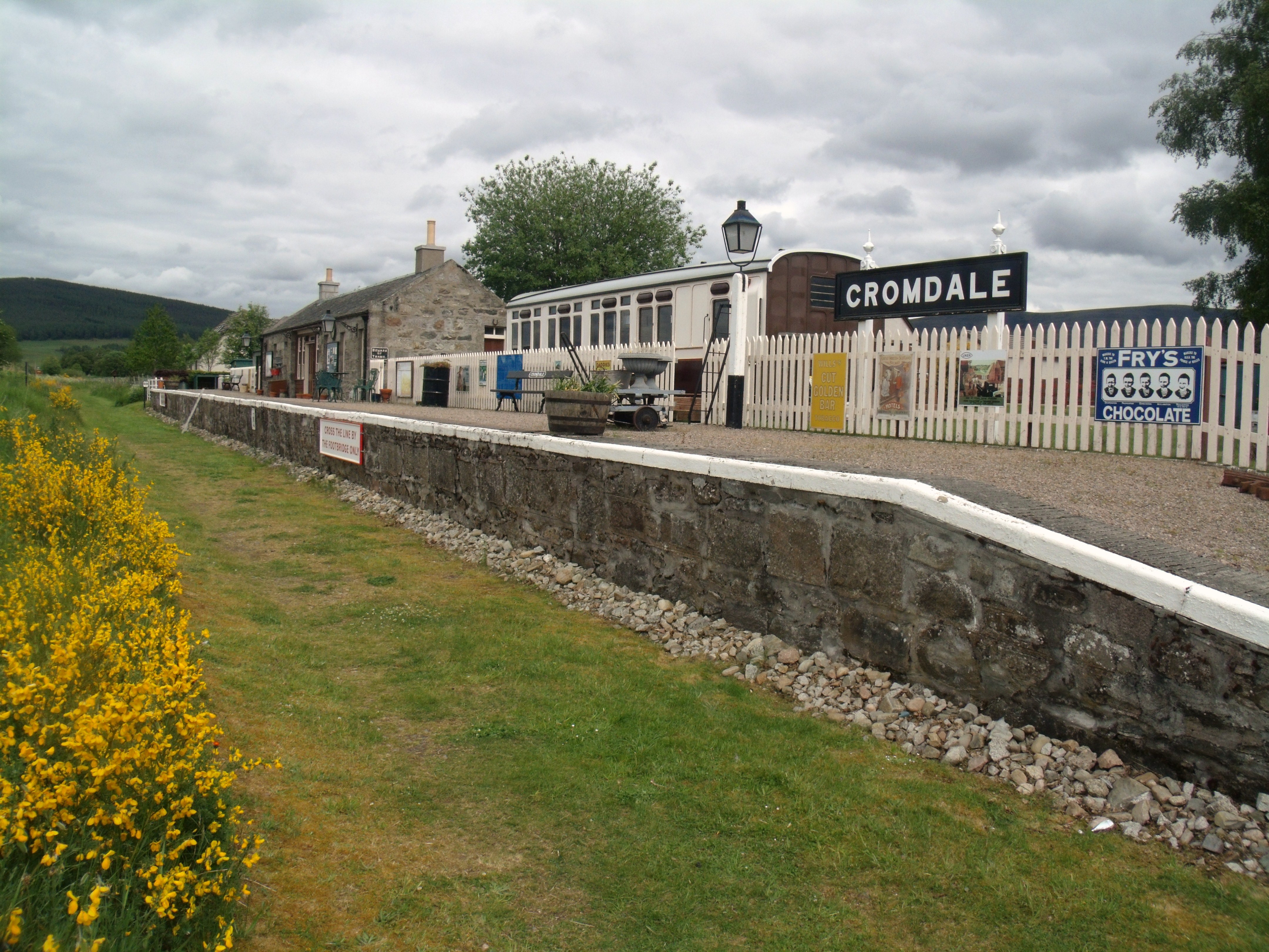
Cromdale railway station
Cromdale railway station served the village of Cromdale, Highland, in Scotland. == History == The station was opened by the Strathspey Railway (GNoSR)...

Ian Charles Community Hospital
Ian Charles Community Hospital is a health facility in Castle Road East, Grantown-on-Spey, Scotland. It is managed by NHS Highland. == History == The facility...
Nearby Amenities
Located within 500m of 57.370614,-3.5727625Have you been to Balnaclash Wood?
Leave your review of Balnaclash Wood below (or comments, questions and feedback).