Rennent Wood

Wood, Forest in Perthshire

Scotland

Rennent Wood

Historic Milestone South side of road.
Inscription: 
Dunkeld 4
Blairgowrie 8
Historic Milestone Credit: Karl Peet

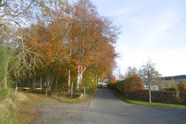
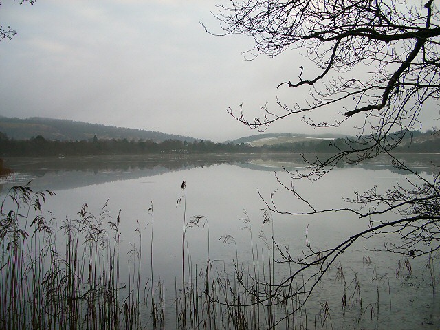
Rennent Wood is a picturesque woodland located in Perthshire, Scotland. Covering an area of approximately 200 hectares, this enchanting forest is a popular destination for nature lovers and outdoor enthusiasts. Situated near the village of Aberfeldy, Rennent Wood offers visitors a tranquil escape from the hustle and bustle of city life.

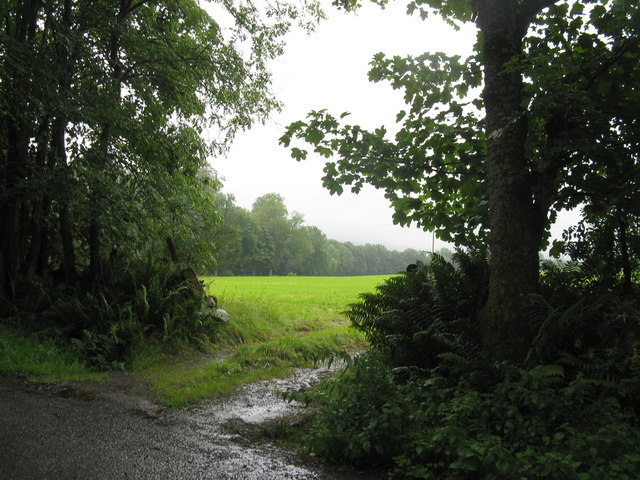
The woodland is characterized by its diverse range of tree species, including oak, birch, and Scots pine. The lush greenery provides a haven for wildlife, making it an ideal spot for birdwatching and animal spotting. Visitors may catch glimpses of red squirrels, roe deer, and various bird species such as woodpeckers and owls.

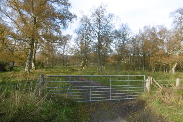
A network of well-maintained trails winds through Rennent Wood, allowing visitors to explore the area at their own pace. These paths cater to different abilities and offer stunning views of the surrounding countryside. Whether it's a leisurely stroll or a challenging hike, Rennent Wood has something to suit everyone.

In addition to its natural beauty, Rennent Wood also holds historical significance. The forest has remnants of ancient settlements and archaeological sites, providing a glimpse into the area's past. Visitors can learn about the rich cultural heritage through interpretive panels and guided tours.

Overall, Rennent Wood in Perthshire offers a peaceful and immersive experience in nature. With its captivating beauty, diverse wildlife, and historical significance, it is truly a gem worth exploring for anyone seeking a serene escape.

If you have any feedback on the listing, please let us know in the comments section below.

Rennent Wood Images

Images are sourced within 2km of 56.592486/-3.5416695 or Grid Reference NO0545. Thanks to Geograph Open Source API. All images are credited.
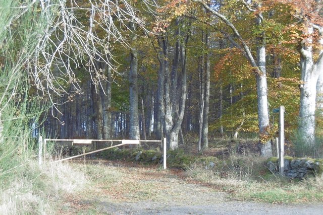
Historic Milestone South side of road.
Inscription: 
Dunkeld 4
Blairgowrie 8
Historic Milestone
South side of road. Inscription: Dunkeld 4 Blairgowrie 8
Cardney Cemetery Small cemetery in a rural setting.
Cardney Cemetery
Small cemetery in a rural setting.
Entrance to forestry beside Catchpenny The gate leads into a small area of forestry across the road from Catchpenny. Taken at a different time of year from an earlier view [<a title="https://www.geograph.org.uk/photo/78500" href="https://www.geograph.org.uk/photo/78500">Link</a>], with trees in full leaf.
Entrance to forestry beside Catchpenny
The gate leads into a small area of forestry across the road from Catchpenny. Taken at a different time of year from an earlier view [Link], with trees in full leaf.
Minor road, looking from Catchpenny Catchpenny is to the left of the photographer.
Minor road, looking from Catchpenny
Catchpenny is to the left of the photographer.
View from Fungarth Hill View of Loch of the Lowes from Fungarth Hill. Loch of Craiglush can be seen to the left and Loch of Butterstone to the right.
View from Fungarth Hill
View of Loch of the Lowes from Fungarth Hill. Loch of Craiglush can be seen to the left and Loch of Butterstone to the right.
Letter Farm
Letter Farm
Farmland below Letter Hill From the minor road by the Loch of the Lowes.
Farmland below Letter Hill
From the minor road by the Loch of the Lowes.
Loch of the Lowes Still anticyclonic conditions.  It is hard to get a clear view of the loch from the roadside due to the trees. There is an opportunity here.
Loch of the Lowes
Still anticyclonic conditions. It is hard to get a clear view of the loch from the roadside due to the trees. There is an opportunity here.
Autumnal beeches, Catchpenny A forest track leaves the road here.
Autumnal beeches, Catchpenny
A forest track leaves the road here.
Road junction, Catchpenny Signposted path to Butterstone.
Road junction, Catchpenny
Signposted path to Butterstone.
Birchwood, Catchpenny The road access a building according to maps.
Birchwood, Catchpenny
The road access a building according to maps.
Meadows of Fungarth A marshy area to the west of Loch Craiglush.
Meadows of Fungarth
A marshy area to the west of Loch Craiglush.
Craiglush Cottage On the A923 as it skirts round the northern end of the Loch of Craiglush.
Craiglush Cottage
On the A923 as it skirts round the northern end of the Loch of Craiglush.
Silage field A wet entrance on the track from Letter to Lowes.
Silage field
A wet entrance on the track from Letter to Lowes.
Butterstone Village Hall
Old Milestone by the A923, Loch of Lowes Stone post by the A923, in parish of Dunkeld and Dowally (Perth and Kinross District), North of Loch of Lowes, on verge by stone wall.

Inscription reads:-
: DUNKELD / 3 : : BLAIR / GOWRIE / 9 :

Surveyed

Milestone Society National ID: PK_BGDK09
Old Milestone by the A923, Loch of Lowes
Stone post by the A923, in parish of Dunkeld and Dowally (Perth and Kinross District), North of Loch of Lowes, on verge by stone wall. Inscription reads:- : DUNKELD / 3 : : BLAIR / GOWRIE / 9 : Surveyed Milestone Society National ID: PK_BGDK09
Old Milestone by the A923, southwest of Butterstone, Dunkeld and Dowally parish Stone post by the A923, in parish of Dunkeld and Dowally (Perth & Kinross District), West of Butterstone, Butterglen, on verge.

Inscription reads:-
: DUNKELD / 4 : : BLAIR / GOWRIE / 8 :  

Surveyed

Milestone Society National ID: PK_BGDK08
Old Milestone by the A923, southwest of Butterstone, Dunkeld and Dowally parish
Stone post by the A923, in parish of Dunkeld and Dowally (Perth & Kinross District), West of Butterstone, Butterglen, on verge. Inscription reads:- : DUNKELD / 4 : : BLAIR / GOWRIE / 8 : Surveyed Milestone Society National ID: PK_BGDK08
Loch of Lowes Early morning mist rising on the Loch of Lowes, from the south-eastern shore.
Loch of Lowes
Early morning mist rising on the Loch of Lowes, from the south-eastern shore.
Show me another place!

Rennent Wood is located at Grid Ref: NO0545 (Lat: 56.592486, Lng: -3.5416695)

Unitary Authority: Perth and Kinross

Police Authority: Tayside

What 3 Words

///dozens.propelled.zinc. Near Bankfoot, Perth & Kinross

Nearby Locations

Rennent Wood

Related Wikis

Loch of Butterstone

Loch of Butterstone is a small freshwater loch, almost circular in shape, located within the nature reserve of the Cardney Estate, near Dunkeld in Perth...

Loch of Craiglush

Loch of Craiglush is a freshwater loch, located around 1+1⁄2 miles (2.4 km) north-east of Dunkeld in Perth and Kinross, Scotland. The loch is a designated...

Loch of the Lowes

Loch of the Lowes is a loch near Dunkeld in Perth and Kinross, Scotland. The loch and the surrounding area are designated as a wildlife reserve, run by...

Lady's Tree

Lady's Tree is a Scots pine on the banks of the Loch of the Lowes, Scotland. It was the roost of famous osprey 'Lady' for 24 years. In 2014, Lady's Tree...

Taybank Hotel

The Taybank Hotel is a hotel and restaurant in Dunkeld, Perth and Kinross, Scotland. It is a Category C listed building dating to the early 19th century...

Perth Arms Hotel

The Perth Arms Hotel is a hotel and restaurant in Dunkeld, Perth and Kinross, Scotland. It is a Category B listed building dating to around 1755. ��2...

Atholl Arms Hotel, Dunkeld

The Atholl Arms Hotel is a hotel and restaurant in Dunkeld, Perth and Kinross, Scotland. Standing at the corner of Bridge Street and Boat Road, it is a...

Battle of Dunkeld

The Battle of Dunkeld (Scottish Gaelic: Blàr Dhùn Chaillinn) was fought between Jacobite clans supporting the deposed king James VII of Scotland and a...

Nearby Amenities

Located within 500m of 56.592486,-3.5416695
Power: pole
Lat/Long: 56.596748/-3.5417969
Power: pole
Lat/Long: 56.5961223/-3.5424263
Power: pole
Lat/Long: 56.5955521/-3.5430371
Power: pole
Lat/Long: 56.5950609/-3.543778
Power: pole
Lat/Long: 56.5945506/-3.544572
Power: pole
Lat/Long: 56.5940433/-3.5453633
Power: pole
Lat/Long: 56.5934921/-3.5461945
Power: pole
Lat/Long: 56.59284/-3.5464096
Power: pole
Lat/Long: 56.5922537/-3.5465716
Power: pole
Lat/Long: 56.5916586/-3.5467177
Power: pole
Lat/Long: 56.5913033/-3.5468425
Power: pole
Lat/Long: 56.5909487/-3.5469527
Power: pole
Lat/Long: 56.5961325/-3.5416748
Power: pole
Lat/Long: 56.5949147/-3.5455705
Power: pole
Lat/Long: 56.5918823/-3.545759
Power: pole
Lat/Long: 56.5914919/-3.5449119
Power: pole
Lat/Long: 56.5911307/-3.5441285
Power: pole
Lat/Long: 56.5906584/-3.543053
Power: pole
Lat/Long: 56.5904333/-3.542328
Power: pole
Lat/Long: 56.5897994/-3.5424515
Power: pole
Lat/Long: 56.589417/-3.5425139
Power: pole
Lat/Long: 56.5889506/-3.5425803
Power: pole
Lat/Long: 56.5886391/-3.5435575
Power: pole
Lat/Long: 56.588302/-3.5445228
Power: pole
Lat/Long: 56.5910287/-3.5349309
Power: pole
Lat/Long: 56.591077/-3.5363267
Power: pole
Lat/Long: 56.5911181/-3.5376084
Power: pole
Lat/Long: 56.591152/-3.5388549
Power: pole
Lat/Long: 56.5909236/-3.5400423
Power: pole
Lat/Long: 56.5906674/-3.5412406
The data included in this document is from www.openstreetmap.org. The data is made available under ODbL.

Have you been to Rennent Wood?

Leave your review of Rennent Wood below (or comments, questions and feedback).