Bogside Wood

Wood, Forest in Dumfriesshire

Scotland

Bogside Wood

Cottages at the side of the A75 at Breconrae
Cottages at the side of the A75 at Breconrae Credit: Eirian Evans

Bogside Wood is a picturesque woodland situated in Dumfriesshire, Scotland. Spanning over a vast area, this forest is renowned for its natural beauty and rich biodiversity. The wood is located near the small village of Bogside, which adds to its charm and accessibility.

The woodland is predominantly composed of native tree species, such as oak, birch, and rowan, which create a diverse and enchanting landscape. Lush greenery blankets the forest floor, adorned with vibrant wildflowers during the spring and summer months. The tranquil ambiance of the wood is further enhanced by the gentle sound of the nearby stream, which meanders through the trees.

Bogside Wood is a haven for wildlife, providing a home to a wide range of species. Birdwatchers will delight in the opportunity to spot various woodland birds, including woodpeckers, owls, and thrushes. The forest is also inhabited by mammals such as red squirrels, badgers, and deer, offering nature enthusiasts a chance to observe these creatures in their natural habitat.

Visitors to Bogside Wood can explore the various walking trails that wind through the trees, allowing them to immerse themselves in the tranquility of the forest. The paths are well-maintained and suitable for all abilities, making it an ideal destination for a leisurely stroll or a more adventurous hike.

With its stunning scenery and abundant wildlife, Bogside Wood is a beloved destination for nature lovers and outdoor enthusiasts alike. Whether one seeks solitude and serenity or a chance to reconnect with nature, this woodland offers an unforgettable experience in the heart of Dumfriesshire.

If you have any feedback on the listing, please let us know in the comments section below.
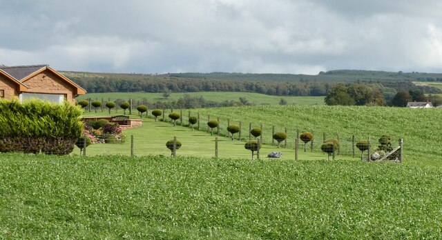
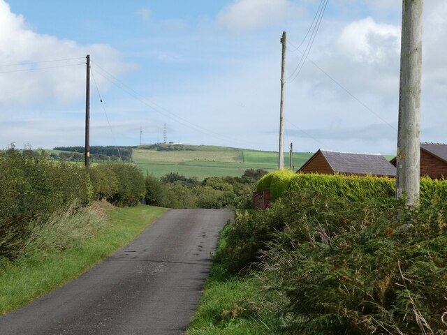
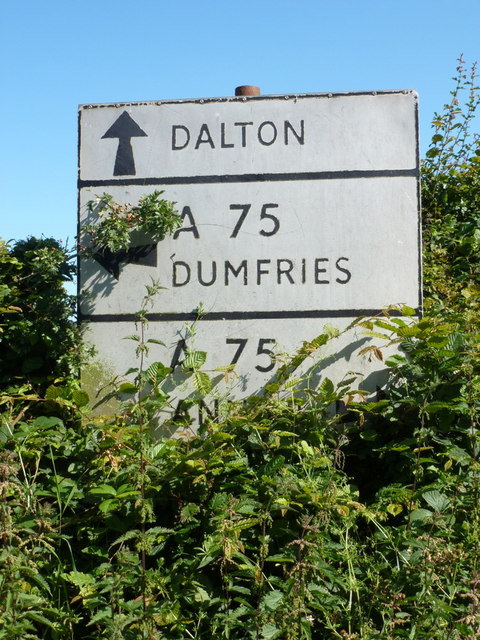
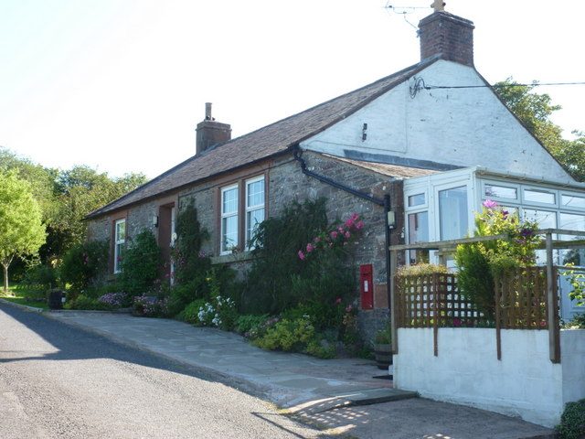
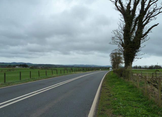
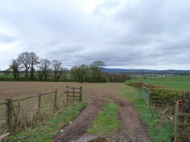
Bogside Wood Images

Images are sourced within 2km of 55.051454/-3.4881503 or Grid Reference NY0574. Thanks to Geograph Open Source API. All images are credited.

Cottages at the side of the A75 at Breconrae
Access Track Near Brocklehirst A short access track through a strip of native woodland leads to a large field near Brocklehirst.
Access Track Near Brocklehirst
A short access track through a strip of native woodland leads to a large field near Brocklehirst.
Old milestone A sad end to the 11 miles from Annan milestone just north west of Burnhill and Mouswald school.   The base of the stone is still in the ground but not all the broken pieces or plate are on the verge.  There is a cut bench mark on the front top which is the white painted section on the right of the photograph.
Old milestone
A sad end to the 11 miles from Annan milestone just north west of Burnhill and Mouswald school. The base of the stone is still in the ground but not all the broken pieces or plate are on the verge. There is a cut bench mark on the front top which is the white painted section on the right of the photograph.
Old milestone The position of the broken pieces of milestone Annan 11 with Burnhill in the distance.
Old milestone
The position of the broken pieces of milestone Annan 11 with Burnhill in the distance.
Old milestone Looking towards Mouswald Grange.    Another view of the sad demise of Dumfries 6 Annan 11.
Old milestone
Looking towards Mouswald Grange. Another view of the sad demise of Dumfries 6 Annan 11.
Old milestone This Dumfries 5 Annan 12 milestone used to be well painted but because it is on a narrow verge it now has much road splash causing deterioration.    The top left-hand corner of the plate was missing when this stone was first recorded for the Milestone Society in 2007.   There is a hole in the top which may be associated with a bench mark.
Old milestone
This Dumfries 5 Annan 12 milestone used to be well painted but because it is on a narrow verge it now has much road splash causing deterioration. The top left-hand corner of the plate was missing when this stone was first recorded for the Milestone Society in 2007. There is a hole in the top which may be associated with a bench mark.
Old milestone Looking towards Drummuir, this photograph shows the very narrow verge in which the Dumfries 5 milestone is set.
Old milestone
Looking towards Drummuir, this photograph shows the very narrow verge in which the Dumfries 5 milestone is set.
Automatic lawn mower in operation At Broomhill near Elizafield.
Automatic lawn mower in operation
At Broomhill near Elizafield.
Minor road at Elizafield With communication masts on Hazelshaw Hill in the distance.
Minor road at Elizafield
With communication masts on Hazelshaw Hill in the distance.
Mouswald: old road-sign at Cleughbrae A pre-Worboys direction sign just off the A75. The bottom panel names Annan, to the right.
Mouswald: old road-sign at Cleughbrae
A pre-Worboys direction sign just off the A75. The bottom panel names Annan, to the right.
Mouswald: Mill Cottage A small cottage just off the main road at Cleughbrae, with a postbox set into the wall - see <a href="https://www.geograph.org.uk/photo/2520123">NY0673 : Mouswald: postbox № DG1 117, Cleughbrae</a>.
Mouswald: Mill Cottage
A small cottage just off the main road at Cleughbrae, with a postbox set into the wall - see NY0673 : Mouswald: postbox № DG1 117, Cleughbrae.
Mouswald: postbox № DG1 117, Cleughbrae A George V-reign postbox set into the wall of <a href="https://www.geograph.org.uk/photo/2520118">NY0673 : Mouswald: Mill Cottage</a>, emptied finally at 11am on weekdays and fifteen minutes later on Saturdays.
Mouswald: postbox № DG1 117, Cleughbrae
A George V-reign postbox set into the wall of NY0673 : Mouswald: Mill Cottage, emptied finally at 11am on weekdays and fifteen minutes later on Saturdays.
Woodside Looking along the A75 towards Dumfries.
Woodside
Looking along the A75 towards Dumfries.
Millholm Shaw Looking towards this wood off the A75 and West Mains Farm.
Millholm Shaw
Looking towards this wood off the A75 and West Mains Farm.
Woodside View along the A75 to Rockhall Mains left of picture.
Woodside
View along the A75 to Rockhall Mains left of picture.
View to the Criffel Taken from the A75 by Woodside.
View to the Criffel
Taken from the A75 by Woodside.
Dwellings at Breconrae View of these cottages at the side of the A75 at Breconrae.
Dwellings at Breconrae
View of these cottages at the side of the A75 at Breconrae.
Road to Mouswald Banks Small road that leads off the A75 to the farm from Breconrae.
Road to Mouswald Banks
Small road that leads off the A75 to the farm from Breconrae.
Show me another place!

Bogside Wood is located at Grid Ref: NY0574 (Lat: 55.051454, Lng: -3.4881503)

Unitary Authority: Dumfries and Galloway

Police Authority: Dumfries and Galloway

What 3 Words

///confronts.sharpens.ample. Near Dumfries, Dumfries & Galloway

Nearby Locations

Bogside Wood Brocklehirst

Related Wikis

Rockhall Tower

Rockhall Tower, also known as Rockhall House or Rockhall Tower House, is a 16th-century tower house in Collin, Dumfries and Galloway. The castle originally...

Racks railway station

Racks railway station was a railway station in Dumfries and Galloway, Scotland, south of Dumfries, OS NGR NY 033 743, serving and effectively creating...

Mouswald

Mouswald is a rural village slightly east of Dumfries in south-west Scotland. It lies on the B724 south of the A75. The site views southward over the Solway...

Collin, Dumfries and Galloway

Collin is a small village between Dumfries and Gretna in Dumfries and Galloway, Scotland. It is located on the Lochar Water, and the A75 road. It lies...

Nearby Amenities

Located within 500m of 55.051454,-3.4881503
Brocklehirst
Place: locality
Lat/Long: 55.0505656/-3.4873539
Power: pole
Lat/Long: 55.0559201/-3.4886138
Power: pole
Lat/Long: 55.0555114/-3.4875474
Power: pole
Lat/Long: 55.055116/-3.4865453
Power: pole
Lat/Long: 55.0547147/-3.4854969
Power: pole
Lat/Long: 55.0543104/-3.4844691
Power: pole
Lat/Long: 55.0537866/-3.4834284
Power: pole
Lat/Long: 55.0532701/-3.4824315
Power: pole
Lat/Long: 55.0527611/-3.4814346
Power: pole
Lat/Long: 55.0522416/-3.4804377
Power: pole
Lat/Long: 55.052885/-3.4938405
Power: pole
Lat/Long: 55.0526651/-3.4925113
Power: pole
Lat/Long: 55.0524482/-3.4912387
Power: pole
Lat/Long: 55.0521856/-3.48967
Power: pole
Lat/Long: 55.0519052/-3.4880445
Power: pole
Lat/Long: 55.0522048/-3.4941032
Power: pole
Lat/Long: 55.0514965/-3.4943453
Power: pole
Lat/Long: 55.0507852/-3.4945772
Power: pole
Lat/Long: 55.0501655/-3.4947987
Power: pole
Lat/Long: 55.0495014/-3.4950099
The data included in this document is from www.openstreetmap.org. The data is made available under ODbL.

Have you been to Bogside Wood?

Leave your review of Bogside Wood below (or comments, questions and feedback).