Cowstrandburn Plantation

Wood, Forest in Fife

Scotland

Cowstrandburn Plantation

The B914 in Saline With the Ochils in the background.
The B914 in Saline Credit: David Purchase

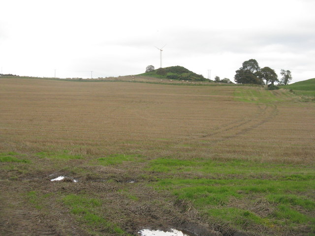
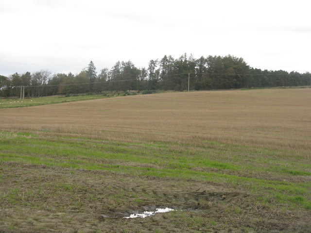
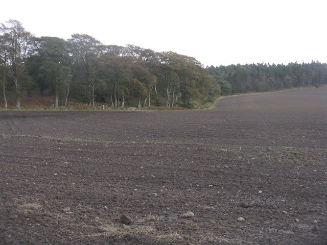
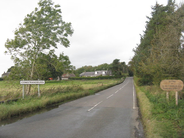
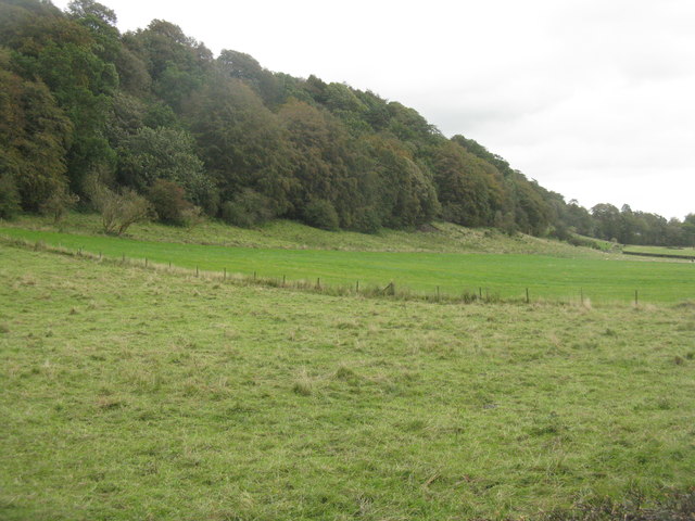
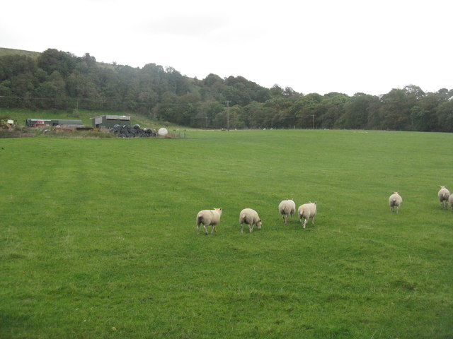
Cowstrandburn Plantation is a picturesque woodland located in Fife, Scotland. Spread over a sprawling area, it covers a total of 400 acres and is known for its diverse range of tree species. The plantation is situated on the eastern edge of the Lomond Hills Regional Park, offering visitors an opportunity to explore its natural beauty and abundant wildlife.

The woodland is predominantly composed of native species such as oak, birch, and Scots pine. These trees provide a natural habitat for numerous bird species, including great spotted woodpeckers, chaffinches, and nuthatches. The plantation also features several well-maintained footpaths and trails, allowing visitors to immerse themselves in the tranquil surroundings while engaging in outdoor activities like walking, cycling, and birdwatching.

Cowstrandburn Plantation is not only a haven for nature enthusiasts but also serves as an important site for conservation efforts. The Fife Coast and Countryside Trust, along with local volunteers, works tirelessly to maintain and protect the woodland's biodiversity. They undertake regular tree planting initiatives to enhance the existing forest cover and ensure a sustainable ecosystem for future generations.

With its serene atmosphere and stunning scenery, Cowstrandburn Plantation attracts visitors from near and far. Whether it's a leisurely stroll amidst the towering trees or a day spent exploring the hidden nooks and crannies, this woodland offers a delightful experience for all who visit.

If you have any feedback on the listing, please let us know in the comments section below.

Cowstrandburn Plantation Images

Images are sourced within 2km of 56.101687/-3.5507551 or Grid Reference NT0390. Thanks to Geograph Open Source API. All images are credited.

The B914 in Saline With the Ochils in the background.
The B914 in Saline
With the Ochils in the background.
Stubble field at Carnock Moor
Carnock Moor Farmland rising gently to woodland on the higher ground of the moor.
Carnock Moor
Farmland rising gently to woodland on the higher ground of the moor.
Harvest stored near Kinneddar Park Silage bales - not sure if the wrapping colour is of any significance?
Harvest stored near Kinneddar Park
Silage bales - not sure if the wrapping colour is of any significance?
Sheep pasture at Muirside of Kinneddar
Grass fields at Kinneddar Park Possibly the source of the silage at <a href="https://www.geograph.org.uk/photo/6291724">NT0290 : Harvest stored near Kinneddar Park</a>.
Grass fields at Kinneddar Park
Possibly the source of the silage at NT0290 : Harvest stored near Kinneddar Park.
Loanhead Poultry Farm, Saline A large enterprise south of Saline.
Loanhead Poultry Farm, Saline
A large enterprise south of Saline.
Farmland near Kinneddar Cattle at pasture and field margin trees.
Farmland near Kinneddar
Cattle at pasture and field margin trees.
Just chilling out! Cattle across the road from Loanhead Poultry Farm.
Just chilling out!
Cattle across the road from Loanhead Poultry Farm.
'The Views' at Saline New housing on a 2-3-year old development on the south side of the village.
'The Views' at Saline
New housing on a 2-3-year old development on the south side of the village.
Saline Post Office In a new location since recorded by Paul McIlroy in 2006 <a href="https://www.geograph.org.uk/photo/124249">NT0292 : Saline Post Office</a>. In Google Earth imagery of 2009 this was just a general store, and this makeover looks fairly recent.
Saline Post Office
In a new location since recorded by Paul McIlroy in 2006 NT0292 : Saline Post Office. In Google Earth imagery of 2009 this was just a general store, and this makeover looks fairly recent.
Newly sown field at Cowstrandburn No spilt grain, so no clues as to whether it is winter barley or wheat. With woodland on Carnock Moor beyond.
Newly sown field at Cowstrandburn
No spilt grain, so no clues as to whether it is winter barley or wheat. With woodland on Carnock Moor beyond.
Entering Cowstrandburn from the south A big name for a small place - there must be story behind the name.
Entering Cowstrandburn from the south
A big name for a small place - there must be story behind the name.
Trees on an escarpment near Saline Overlooking grass fields at Langfauld.
Trees on an escarpment near Saline
Overlooking grass fields at Langfauld.
Sheep at Langfauld Looking northeast to the woodland on the Bandrum escarpment.
Sheep at Langfauld
Looking northeast to the woodland on the Bandrum escarpment.
Path, Steelend Leading to Woodside Park, a former football ground.
Path, Steelend
Leading to Woodside Park, a former football ground.
Woodside Park This was home of Steelend Victoria Junior Football Club which ceased playing in September 2013. A view into a corner with a floodlight post.
Woodside Park
This was home of Steelend Victoria Junior Football Club which ceased playing in September 2013. A view into a corner with a floodlight post.
Woodside Park This was home of Steelend Victoria Junior Football Club which ceased playing in September 2013. There are plans to build a house here on the site of the changing rooms.
Woodside Park
This was home of Steelend Victoria Junior Football Club which ceased playing in September 2013. There are plans to build a house here on the site of the changing rooms.
Show me another place!

Cowstrandburn Plantation is located at Grid Ref: NT0390 (Lat: 56.101687, Lng: -3.5507551)

Unitary Authority: Fife

Police Authority: Fife

What 3 Words

///proclaims.outraged.closet. Near Saline, Fife

Nearby Locations

Cowstrandburn Plantation

Related Wikis

Dunfermline (district)

Dunfermline (Scottish Gaelic: Dùn Phàrlain, Scots: Dunfaurlin) was a local government district in the Fife region of Scotland from 1975 to 1996, lying...

Steelend

Steelend is a former mining village in West Fife, Scotland, located on the B914 road approximately three-quarters of a mile east of the village of Saline...

Oakley United F.C.

Oakley United Football Club are a Scottish football club based in Oakley, Fife. Formed in 1964, they play their home games at Blairwood Park. The club...

Saline, Fife

Saline is a village and parish in Fife, Scotland, situated 5 miles (8.0 km) to the north-west of Dunfermline. It lies in an elevated position on the western...

Nearby Amenities

Located within 500m of 56.101687,-3.5507551
Cowstrandburn
Place: hamlet
Lat/Long: 56.0999652/-3.5504734
Power: pole
Lat/Long: 56.1001926/-3.550615
Power: pole
Lat/Long: 56.1005828/-3.551054
Power: pole
Lat/Long: 56.1007784/-3.5513453
Power: pole
Lat/Long: 56.100529/-3.5520243
Power: pole
Lat/Long: 56.1002567/-3.5526972
Power: pole
Lat/Long: 56.1001972/-3.5538501
Power: pole
Lat/Long: 56.1001491/-3.5549374
Power: pole
Lat/Long: 56.1001022/-3.5560574
Power: pole
Lat/Long: 56.0997441/-3.555881
Power: pole
Lat/Long: 56.0989889/-3.5550974
Power: pole
Lat/Long: 56.0984328/-3.5545619
Power: pole
Lat/Long: 56.0977177/-3.5538009
Power: pole
Lat/Long: 56.1031845/-3.5539865
Power: pole
Lat/Long: 56.1039785/-3.5542265
Power: pole
Lat/Long: 56.1047153/-3.5544727
Power: pole
Lat/Long: 56.1044807/-3.5552707
Power: pole
Lat/Long: 56.105126/-3.553048
Power: pole
Lat/Long: 56.1055378/-3.5516181
Power: pole
Lat/Long: 56.1054246/-3.5502457
Power: pole
Lat/Long: 56.1053479/-3.5491133
Power: pole
Lat/Long: 56.1052701/-3.5479502
Power: pole
Lat/Long: 56.1051935/-3.5467316
The data included in this document is from www.openstreetmap.org. The data is made available under ODbL.

Have you been to Cowstrandburn Plantation?

Leave your review of Cowstrandburn Plantation below (or comments, questions and feedback).