Blairbell Wood

Wood, Forest in Perthshire

Scotland

Blairbell Wood

A9, northbound The A9 is a strategic link between the Highlands of Scotland and the Central Belt. It runs 279 miles from junction 5 of the M9 at Polmont to Scrabster. Originally it ran from Edinburgh.
<span class="nowrap"><a title="https://www.sabre-roads.org.uk/wiki/index.php?title=A9" rel="nofollow ugc noopener" href="https://www.sabre-roads.org.uk/wiki/index.php?title=A9">Link</a><img style="margin-left:2px;" alt="External link" title="External link - shift click to open in new window" src="https://s1.geograph.org.uk/img/external.png" width="10" height="10"/></span>
A9, northbound Credit: N Chadwick

Blairbell Wood is a picturesque forest located in Perthshire, Scotland. Covering an area of approximately 500 acres, this enchanting wood is known for its stunning natural beauty and diverse wildlife.

The wood is characterized by its dense canopy of towering trees, including oak, beech, and birch, which create a tranquil and serene atmosphere. The forest floor is carpeted with a rich variety of flora, such as bluebells, primroses, and wild garlic, which burst into vibrant colors during the spring and summer months.

Blairbell Wood is home to a wide range of wildlife, making it a popular destination for nature enthusiasts and photographers. Visitors may spot red deer, foxes, badgers, and a plethora of bird species, including woodpeckers, owls, and various songbirds. The wood is also inhabited by elusive creatures such as pine martens and red squirrels.

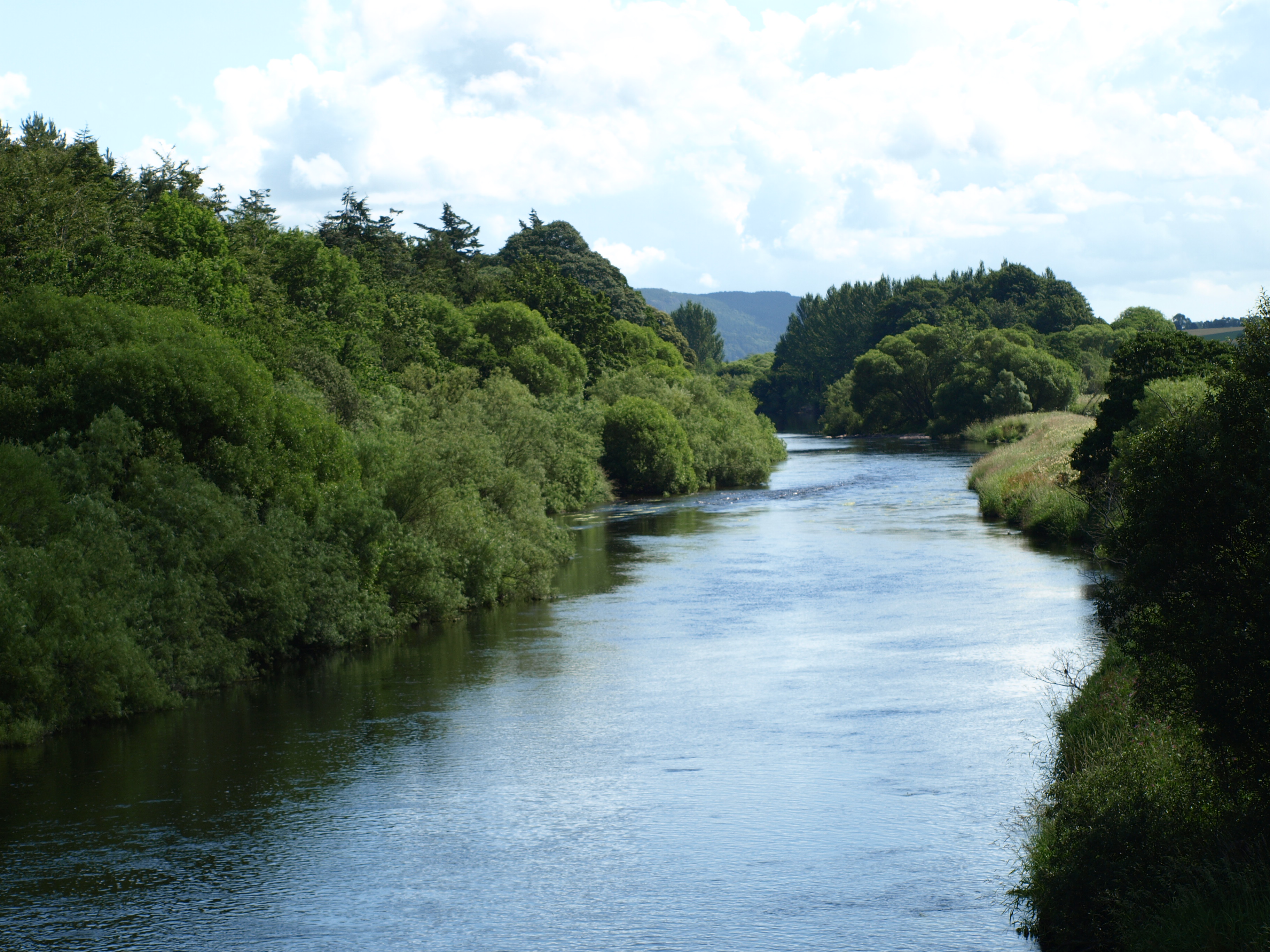
A network of well-maintained trails weaves through the wood, offering visitors the opportunity to explore its hidden gems. These paths provide access to breathtaking viewpoints, where one can admire the panoramic vistas of the surrounding countryside and nearby Loch Tay.

Blairbell Wood is not only a haven for wildlife but also a place of historical significance. The remnants of ancient settlements and burial sites can still be found within the wood, testifying to its long-standing human occupation.

Overall, Blairbell Wood is a captivating destination that showcases the beauty of nature in Perthshire. Whether one seeks solitude, wildlife encounters, or a scenic hike, this wood offers a truly immersive and memorable experience.

If you have any feedback on the listing, please let us know in the comments section below.

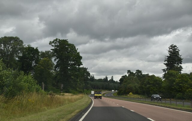
Blairbell Wood Images

Images are sourced within 2km of 56.363666/-3.5803511 or Grid Reference NO0220. Thanks to Geograph Open Source API. All images are credited.

A9, northbound The A9 is a strategic link between the Highlands of Scotland and the Central Belt. It runs 279 miles from junction 5 of the M9 at Polmont to Scrabster. Originally it ran from Edinburgh.
<span class="nowrap"><a title="https://www.sabre-roads.org.uk/wiki/index.php?title=A9" rel="nofollow ugc noopener" href="https://www.sabre-roads.org.uk/wiki/index.php?title=A9">Link</a><img style="margin-left:2px;" alt="External link" title="External link - shift click to open in new window" src="https://s1.geograph.org.uk/img/external.png" width="10" height="10"/></span>
A9, northbound
The A9 is a strategic link between the Highlands of Scotland and the Central Belt. It runs 279 miles from junction 5 of the M9 at Polmont to Scrabster. Originally it ran from Edinburgh. LinkExternal link
Signage - A9 northbound
Ploughed field and esker, Gask Ridge A very fine example of an esker, runs between two roads at Findo Gask.
Ploughed field and esker, Gask Ridge
A very fine example of an esker, runs between two roads at Findo Gask.
Oaks, Blairbell Wood
Road, Hill of Midgate It has been reactivated  and resurfaced for a short distance, .since <a href="https://www.geograph.org.uk/photo/3656715">NO0220 : Overgrown road</a> was taken.
Road, Hill of Midgate
It has been reactivated and resurfaced for a short distance, .since NO0220 : Overgrown road was taken.
Road, Hill of Midgate Until recently rather overgrown, there has been some forestry work removing birches here.
Road, Hill of Midgate
Until recently rather overgrown, there has been some forestry work removing birches here.
Summit, Hill of Midgate The track, previously overgrown, was covered in brashings from recent forestry work. (Mostly willow and birch)
Summit, Hill of Midgate
The track, previously overgrown, was covered in brashings from recent forestry work. (Mostly willow and birch)
Scattered trees, Hill of Midgate The ground is quite wet here.
Scattered trees, Hill of Midgate
The ground is quite wet here.
Triangulation pillar, Hill of Midgate In patchy trees west of a sometimes overgrown track running south from Westmuir.
Triangulation pillar, Hill of Midgate
In patchy trees west of a sometimes overgrown track running south from Westmuir.
Scattered trees, Hill of Midgate The area is peaty and wet in parts with scattered birches.
Scattered trees, Hill of Midgate
The area is peaty and wet in parts with scattered birches.
A9 climbing out of the Earn Valley The A9 is a strategic link between the Highlands of Scotland and the Central Belt. It runs 279 miles from junction 5 of the M9 at Polmont to Scrabster. Originally it ran from Edinburgh.
<span class="nowrap"><a title="https://www.sabre-roads.org.uk/wiki/index.php?title=A9" rel="nofollow ugc noopener" href="https://www.sabre-roads.org.uk/wiki/index.php?title=A9">Link</a><img style="margin-left:2px;" alt="External link" title="External link - shift click to open in new window" src="https://s1.geograph.org.uk/img/external.png" width="10" height="10"/></span>
A9 climbing out of the Earn Valley
The A9 is a strategic link between the Highlands of Scotland and the Central Belt. It runs 279 miles from junction 5 of the M9 at Polmont to Scrabster. Originally it ran from Edinburgh. LinkExternal link
A9, northbound The A9 is a strategic link between the Highlands of Scotland and the Central Belt. It runs 279 miles from junction 5 of the M9 at Polmont to Scrabster. Originally it ran from Edinburgh.
<span class="nowrap"><a title="https://www.sabre-roads.org.uk/wiki/index.php?title=A9" rel="nofollow ugc noopener" href="https://www.sabre-roads.org.uk/wiki/index.php?title=A9">Link</a><img style="margin-left:2px;" alt="External link" title="External link - shift click to open in new window" src="https://s1.geograph.org.uk/img/external.png" width="10" height="10"/></span>
A9, northbound
The A9 is a strategic link between the Highlands of Scotland and the Central Belt. It runs 279 miles from junction 5 of the M9 at Polmont to Scrabster. Originally it ran from Edinburgh. LinkExternal link
Signage - A9 northbound
Roman Road, Gask Ridge
Charlesfield Wood South side of the Gask Ridge.
Charlesfield Wood
South side of the Gask Ridge.
Overgrown path by Cairnie Wook
Show me another place!

Blairbell Wood is located at Grid Ref: NO0220 (Lat: 56.363666, Lng: -3.5803511)

Unitary Authority: Perth and Kinross

Police Authority: Tayside

What 3 Words

///elsewhere.wounds.assemble. Near Methven, Perth & Kinross

Related Wikis

Battle of Dupplin Moor

The Battle of Dupplin Moor was fought between supporters of King David II of Scotland, the son of King Robert Bruce, and English-backed invaders supporting...

RAF Findo Gask

RAF Findo Gask was a Royal Air Force satellite station located 7 mi (11 km) west of Perth, Scotland used during the Second World War. == History == RAF...

Findo Gask

Findo Gask is a small village in Perth and Kinross in Scotland, just off the main A9 road. It is in Strathearn. There are nearby remains associated with...
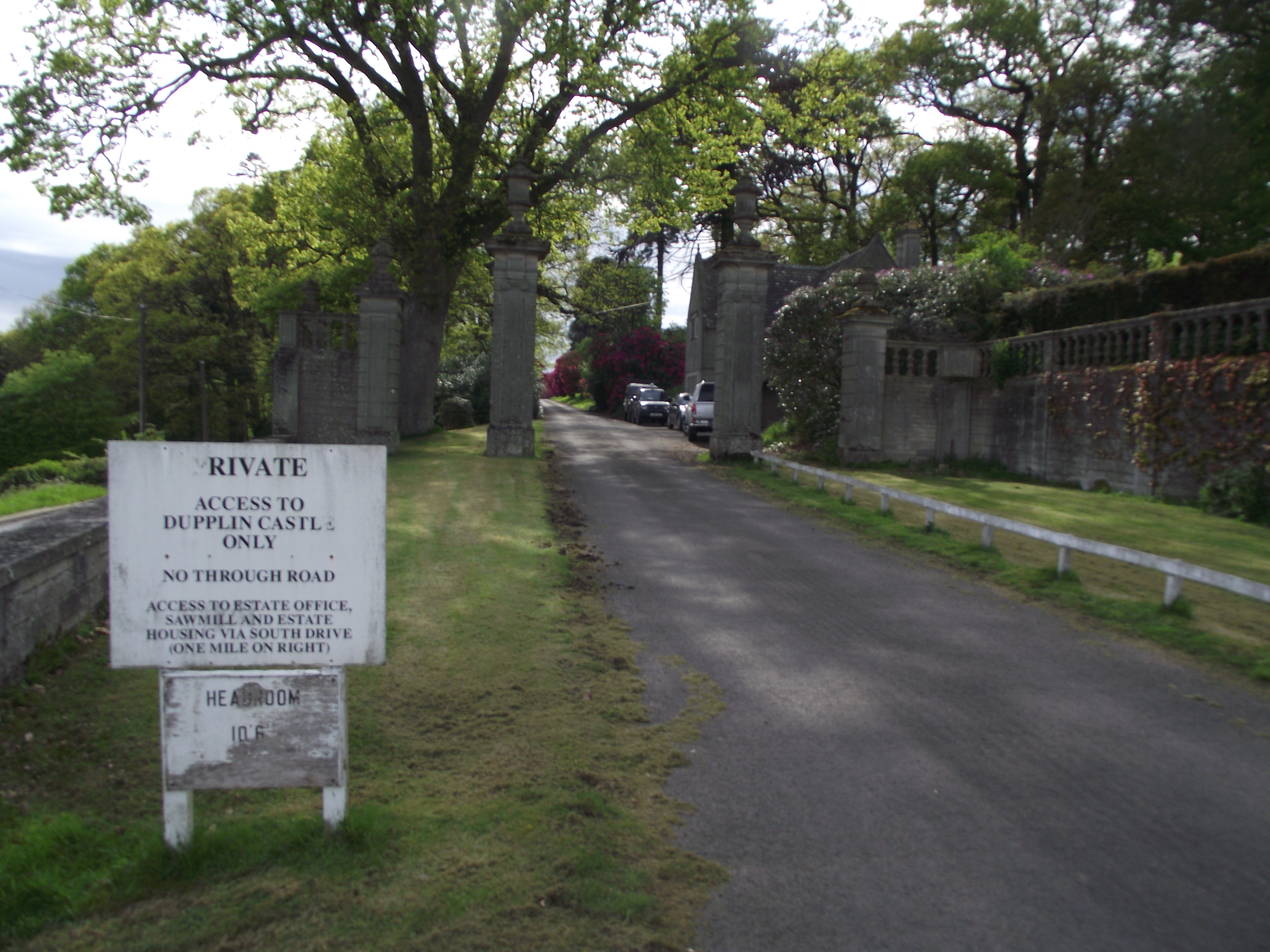
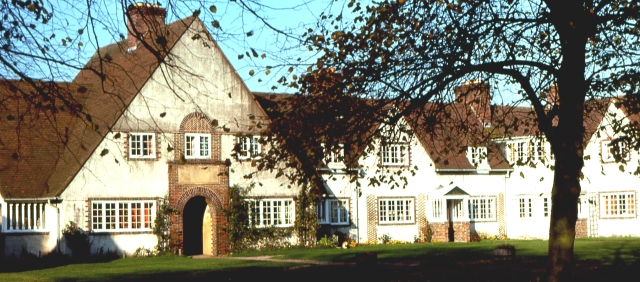
Dupplin Castle

Dupplin Castle is a country house and former castle in Perth and Kinross, Scotland, situated to the west of Aberdalgie and northeast of Forteviot and Dunning...

Forteviot railway station

Forteviot railway station served the village of Forteviot, Perth and Kinross, Scotland from 1848 to 1956 on the Scottish Central Railway. == History... ==

Forteviot

Forteviot (Scottish Gaelic: Fothair Tabhaicht) (Ordnance Survey grid reference NO052175) is a village in Strathearn, Scotland on the south bank of the...

Forteviot Bronze Age tomb

Forteviot Bronze Age tomb is a Bronze Age burial chamber discovered in 2009 at Forteviot near Perth, Scotland. The Bronze Age tomb is one of a number of...

Balgowan, Perth and Kinross

Balgowan is a village in Perth and Kinross, Scotland, approximately 5 miles (8 kilometres) west of Perth. The village is located near the junctions of...

Nearby Amenities

Located within 500m of 56.363666,-3.5803511
Power: pole
Lat/Long: 56.3619946/-3.5856097
Power: pole
Lat/Long: 56.3617547/-3.5869646
The data included in this document is from www.openstreetmap.org. The data is made available under ODbL.

Have you been to Blairbell Wood?

Leave your review of Blairbell Wood below (or comments, questions and feedback).