Beecraigs Wood

Wood, Forest in West Lothian

Scotland

Beecraigs Wood

Cutting barley, Beecraigs Silage barley harvest above Linlithgow next to Beecraigs Wood.
Cutting barley, Beecraigs Credit: Richard Webb

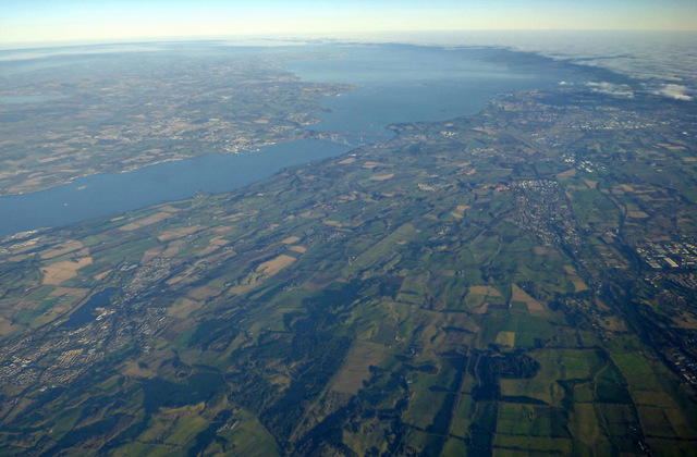
Beecraigs Wood is a picturesque woodland located in West Lothian, Scotland. Covering an area of approximately 913 acres, it is a significant natural attraction in the region. The wood is part of Beecraigs Country Park, which encompasses a diverse range of landscapes, including woodlands, meadows, and lochs.

The wood itself is a mix of ancient and managed woodland, boasting a rich variety of tree species, including oak, birch, beech, and pine. The dense canopy provides a haven for numerous bird species, such as woodpeckers, owls, and finches, making it a popular destination for birdwatching enthusiasts.

Traversing through the wood, visitors can explore a network of well-maintained footpaths and trails, allowing them to immerse themselves in the natural beauty of the surroundings. The wood is particularly popular among walkers, joggers, and cyclists, who can enjoy the peaceful ambience while engaging in outdoor activities.

For those seeking a more adventurous experience, Beecraigs Wood also offers mountain biking trails, with varying levels of difficulty to suit riders of all abilities. The trails wind through the forest, providing an exhilarating ride amidst the stunning scenery.

In addition to its natural beauty, Beecraigs Wood offers several amenities for visitors, including picnic areas, play parks, and a visitor center that provides information about the wood and its wildlife. The wood also has a café where visitors can relax and enjoy refreshments.

Overall, Beecraigs Wood is a captivating natural treasure in West Lothian, offering a tranquil escape and a range of outdoor activities for nature enthusiasts and leisure seekers alike.

If you have any feedback on the listing, please let us know in the comments section below.

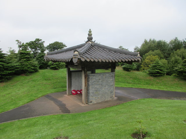
Beecraigs Wood Images

Images are sourced within 2km of 55.948755/-3.6014865 or Grid Reference NT0074. Thanks to Geograph Open Source API. All images are credited.

Cutting barley, Beecraigs Silage barley harvest above Linlithgow next to Beecraigs Wood.
Cutting barley, Beecraigs
Silage barley harvest above Linlithgow next to Beecraigs Wood.
View up the Forth Valley From Beecraigs one of the many clear days in 2015 when the weather was dominated by northerly winds.  Ben Tulachean, Cruach Ardrain, Ben Ledi, Stob Binnien  and Ben More are clearly visible beyond Stirling Castle and the plume of steam from Cowie.
View up the Forth Valley
From Beecraigs one of the many clear days in 2015 when the weather was dominated by northerly winds. Ben Tulachean, Cruach Ardrain, Ben Ledi, Stob Binnien and Ben More are clearly visible beyond Stirling Castle and the plume of steam from Cowie.
Preston Service Reservoir A covered reservoir built in to a hillside near Beecraigs, south of Preston house.
Preston Service Reservoir
A covered reservoir built in to a hillside near Beecraigs, south of Preston house.
Willow at Preston Reservoir A large bush at the entrance to the service reservoir.
Willow at Preston Reservoir
A large bush at the entrance to the service reservoir.
Preston Service Reservoir A covered reservoir embedded in the side of a steep slope.
Preston Service Reservoir
A covered reservoir embedded in the side of a steep slope.
Huts at the Preston Service Reservoir Presumably containing control equipment associated with the reservoir.
Huts at the Preston Service Reservoir
Presumably containing control equipment associated with the reservoir.
Midlothian from the air Linlithgow and Linlithgow Loch are in the left foreground, Livingston is on the right. The Forth bridges, Fife, Loch Leven, Edinburgh Airport and the city of Edinburgh can also be seen.
Midlothian from the air
Linlithgow and Linlithgow Loch are in the left foreground, Livingston is on the right. The Forth bridges, Fife, Loch Leven, Edinburgh Airport and the city of Edinburgh can also be seen.
Scottish Korean War Memorial Now in the form of a Korean shrine, a pagoda, the memorial is much altered compared with previous submissions. It contains name boards listing all the 1114 men who died. It is the only memorial in the United Kingdom dedicated to the Korean War that does this. The pagoda was dedicated on 27 July 2013, to mark the 60th anniversary of the armistice. See <span class="nowrap"><a title="http://www.undiscoveredscotland.co.uk/linlithgow/koreanwarmemorial/index.html" rel="nofollow ugc noopener" href="http://www.undiscoveredscotland.co.uk/linlithgow/koreanwarmemorial/index.html">Link</a><img style="margin-left:2px;" alt="External link" title="External link - shift click to open in new window" src="https://s1.geograph.org.uk/img/external.png" width="10" height="10"/></span> in the Undiscovered Scotland website for more information and photographs of the war memorial.
Scottish Korean War Memorial
Now in the form of a Korean shrine, a pagoda, the memorial is much altered compared with previous submissions. It contains name boards listing all the 1114 men who died. It is the only memorial in the United Kingdom dedicated to the Korean War that does this. The pagoda was dedicated on 27 July 2013, to mark the 60th anniversary of the armistice. See LinkExternal link in the Undiscovered Scotland website for more information and photographs of the war memorial.
Trig point on Cockleroy with view towards Bowden Hill
Pine tree avenue SE of Cockleroy
Information sign at Cockleroy Car Park Information sign at the start of the walk up Cockleroy in the car parking area.
Information sign at Cockleroy Car Park
Information sign at the start of the walk up Cockleroy in the car parking area.
Summit of Cockleroy The view indicator and trig pillar on the summit of Cockleroy.
Summit of Cockleroy
The view indicator and trig pillar on the summit of Cockleroy.
Sheep in a West Lothian landscape Sheep in a field to the south of Kipps Farm.
Sheep in a West Lothian landscape
Sheep in a field to the south of Kipps Farm.
Scottish Korean War Memorial The Scottish Korean War Memorial on the western side of Beecraigs Country Park.
Scottish Korean War Memorial
The Scottish Korean War Memorial on the western side of Beecraigs Country Park.
Road through Stoney Manuel Plantation Wooded section of the minor road near Craigmailing.
Road through Stoney Manuel Plantation
Wooded section of the minor road near Craigmailing.
Downhill road in West Lothian Steep downhill section of road near Wairdlaw.
Downhill road in West Lothian
Steep downhill section of road near Wairdlaw.
Cleared Woodland, Cockleroy
Scottish Korean War Memorial The path curves round to the memorial with the surrounding pines proving attractive to crossbills.
Scottish Korean War Memorial
The path curves round to the memorial with the surrounding pines proving attractive to crossbills.
Show me another place!

Beecraigs Wood is located at Grid Ref: NT0074 (Lat: 55.948755, Lng: -3.6014865)

Unitary Authority: West Lothian

Police Authority: The Lothians and Scottish Borders

What 3 Words

///zeal.fooling.conforms. Near Linlithgow, West Lothian

Nearby Locations

Beecraigs Wood

Related Wikis

Beecraigs

Beecraigs is a country park in West Lothian, approximately 2 miles (3.2 km) south of the town of Linlithgow and 3 miles (4.8 km) north-east of Bathgate...

Cockleroi

Cockleroi or Cockleroy is a prominent hill in Scotland. It is Linlithgow's local hill. On its top there are some remains of an Iron Age's hill fort....

Linlithgow Academy

Linlithgow Academy is a secondary school in Linlithgow, West Lothian, Scotland. The original academy was built in 1900 to a design by James Graham Fairley...

Cairnpapple Hill

Cairnpapple Hill is a hill with a dominating position in central lowland Scotland with views from coast to coast. It was used and re-used as a major ritual...

Nearby Amenities

Located within 500m of 55.948755,-3.6014865
Tourism: picnic_site
Lat/Long: 55.9499805/-3.6053622
Fixme: track continues
Lat/Long: 55.9512067/-3.5950622
Fixme: path continues
Lat/Long: 55.9483595/-3.6080193
Pluto - Kirkhill Pillar Project
Tourism: artwork
Lat/Long: 55.9494385/-3.6071083
Leisure: picnic_table
Lat/Long: 55.9489205/-3.6063899
Leisure: picnic_table
Lat/Long: 55.9488963/-3.6064555
Leisure: picnic_table
Lat/Long: 55.9489605/-3.6064246
Leisure: picnic_table
Lat/Long: 55.9489414/-3.6065084
Bench
Lat/Long: 55.9495315/-3.6062954
Leisure: picnic_table
Lat/Long: 55.9499399/-3.6051992
Bench
Lat/Long: 55.9495959/-3.6060271
Leisure: picnic_table
Lat/Long: 55.949992/-3.6052018
Leisure: picnic_table
Lat/Long: 55.94857/-3.6068014
Leisure: picnic_table
Lat/Long: 55.9485335/-3.6068295
Leisure: picnic_table
Lat/Long: 55.9485944/-3.6068817
Leisure: picnic_table
Lat/Long: 55.9485547/-3.6069188
Leisure: picnic_table
Lat/Long: 55.9509175/-3.603506
Bench
Lat/Long: 55.9508814/-3.6036994
Bench
Lat/Long: 55.9507285/-3.6043548
Leisure: picnic_table
Lat/Long: 55.9507919/-3.6038139
Bench
Lat/Long: 55.9503814/-3.6049792
Bench
Lat/Long: 55.9507161/-3.604422
Bench
Lat/Long: 55.9509074/-3.6036079
Bench
Lat/Long: 55.9510583/-3.6036683
Leisure: picnic_table
Lat/Long: 55.9492403/-3.6048787
Bench
Lat/Long: 55.9492326/-3.6050542
Leisure: picnic_table
Lat/Long: 55.9491231/-3.6049011
The data included in this document is from www.openstreetmap.org. The data is made available under ODbL.

Have you been to Beecraigs Wood?

Leave your review of Beecraigs Wood below (or comments, questions and feedback).