Banks Wood

Wood, Forest in Kirkcudbrightshire

Scotland

Banks Wood

Banks farm On the slopes rising from the River Nith.
Banks farm Credit: Russel Wills

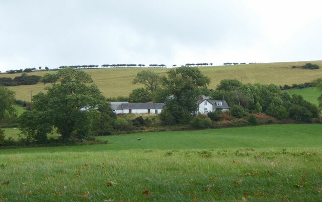
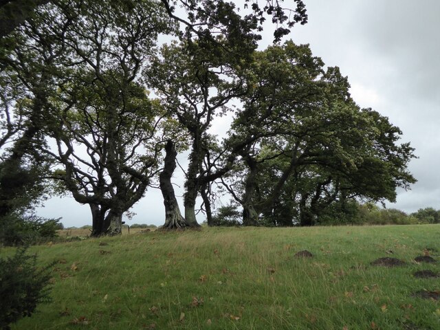
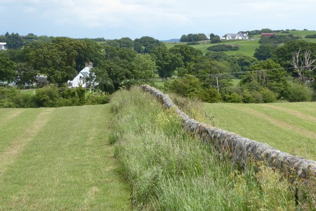
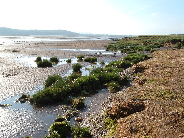
Banks Wood is a picturesque forest located in Kirkcudbrightshire, Scotland. Covering an area of approximately 100 acres, the wood is characterized by dense woodland, towering trees, and a variety of wildlife. The forest is home to a diverse range of plant and animal species, including oak, beech, and pine trees, as well as birds such as woodpeckers and owls.

Banks Wood is a popular destination for nature lovers and outdoor enthusiasts, offering a network of walking trails and paths for visitors to explore. The forest provides a peaceful and tranquil setting for individuals looking to escape the hustle and bustle of everyday life and immerse themselves in nature.

The wood is well-maintained, with designated picnic areas and benches scattered throughout the forest for visitors to rest and take in the natural beauty of their surroundings. Additionally, Banks Wood is a designated Site of Special Scientific Interest (SSSI), recognizing its importance as a habitat for a variety of rare and endangered species.

Overall, Banks Wood is a stunning natural oasis in Kirkcudbrightshire, offering visitors a chance to connect with nature and experience the beauty of the Scottish countryside.

If you have any feedback on the listing, please let us know in the comments section below.

Banks Wood Images

Images are sourced within 2km of 54.988147/-3.5829283 or Grid Reference NX9867. Thanks to Geograph Open Source API. All images are credited.

Banks farm On the slopes rising from the River Nith.
Banks farm
On the slopes rising from the River Nith.
House at Kenneth Bank Looking out across the Nith estuary.
House at Kenneth Bank
Looking out across the Nith estuary.
Barbour Memorial Hall, Glencaple The Barbour Memorial Hall, on Church Street, was opened in 1938.
Barbour Memorial Hall, Glencaple
The Barbour Memorial Hall, on Church Street, was opened in 1938.
Cottages at Glencaple Cottages at the corner of Church Street and Shore Road.
Cottages at Glencaple
Cottages at the corner of Church Street and Shore Road.
Small Boat at Glencaple Slipway
Estuary Sunset A sunset view from Glencaple Quay, looking across the River Nith towards the hills on the other side.
Estuary Sunset
A sunset view from Glencaple Quay, looking across the River Nith towards the hills on the other side.
Sunset at Glencaple Quay A sunset view from Glencaple Quay, looking across the River Nith towards the hills on the other side.
Sunset at Glencaple Quay
A sunset view from Glencaple Quay, looking across the River Nith towards the hills on the other side.
Glencaple Sunset A sunset view from Glencaple Quay, looking across the River Nith towards the hills on the other side.
Glencaple Sunset
A sunset view from Glencaple Quay, looking across the River Nith towards the hills on the other side.
RBS Millennium Milepost at Glencaple One of the 1000 cast iron mileposts funded by the Royal Bank of Scotland to mark the creation of the National Cycle Network. This one, next to Glencaple Quay, is on NCN route 7 which runs from Glasgow to Carlisle. 

There are four different designs of milepost in the series. This is an example of the design by Welsh artist, Andrew Rowe. It is based upon the nautical and industrial heritage of his native Swansea and can have up to four directional fingers. 

See <a title="https://www.geograph.org.uk/article/National-Cycle-Network/1" href="https://www.geograph.org.uk/article/National-Cycle-Network/1">Link</a>  for further examples and photos of millennium mileposts throughout the UK.
RBS Millennium Milepost at Glencaple
One of the 1000 cast iron mileposts funded by the Royal Bank of Scotland to mark the creation of the National Cycle Network. This one, next to Glencaple Quay, is on NCN route 7 which runs from Glasgow to Carlisle. There are four different designs of milepost in the series. This is an example of the design by Welsh artist, Andrew Rowe. It is based upon the nautical and industrial heritage of his native Swansea and can have up to four directional fingers. See Link for further examples and photos of millennium mileposts throughout the UK.
Glencaple Junction Glencaple is a small village situated on the banks of the River Nith; it once served as a port for nearby Dumfries. Glencaple is a Gaelic name meaning 'horse valley' from the words gleann 'narrow valley' and capall 'horse, mare' (Wikipedia).

The coastal (B725) road runs through the village; this photograph was taken at its junction with Church Street which is the only other route into the village.
Glencaple Junction
Glencaple is a small village situated on the banks of the River Nith; it once served as a port for nearby Dumfries. Glencaple is a Gaelic name meaning 'horse valley' from the words gleann 'narrow valley' and capall 'horse, mare' (Wikipedia). The coastal (B725) road runs through the village; this photograph was taken at its junction with Church Street which is the only other route into the village.
Mudflats at the mouth of the River Nith With Airds Point on the far bank with two large tanks at the sewage works there.
Mudflats at the mouth of the River Nith
With Airds Point on the far bank with two large tanks at the sewage works there.
Wind blown trees in hedge Beside the B725 Shore Road.
Wind blown trees in hedge
Beside the B725 Shore Road.
The Caerlaverock Cairn On the pier at Glencaple overlooking the River Nith, in the rain!
With boats on the mud on the left and cottages of Glencaple on the right.
An image of the plaque on the cairn is on <a title="https://www.geograph.org.uk/photo/4805343" href="https://www.geograph.org.uk/photo/4805343">Link</a>
The Caerlaverock Cairn
On the pier at Glencaple overlooking the River Nith, in the rain! With boats on the mud on the left and cottages of Glencaple on the right. An image of the plaque on the cairn is on Link
Beacon on the pier at Glencaple Overlooking the River Nith.
And the rain poured down!
Beacon on the pier at Glencaple
Overlooking the River Nith. And the rain poured down!
Carse downstream from New Abbey To the end of the wall and across the New Abbey Pow.
Carse downstream from New Abbey
To the end of the wall and across the New Abbey Pow.
Low tide on the River Nith
Scottish National Heritage nr Caerlaverock View across the Nith Estuary, Dumfries & Galloway.
Scottish National Heritage nr Caerlaverock
View across the Nith Estuary, Dumfries & Galloway.
House at Kenneth Bank
Show me another place!

Banks Wood is located at Grid Ref: NX9867 (Lat: 54.988147, Lng: -3.5829283)

Unitary Authority: Dumfries and Galloway

Police Authority: Dumfries and Galloway

What 3 Words

///validated.pictured.sunroof. Near Dumfries, Dumfries & Galloway

Nearby Locations

Banks Wood

Related Wikis

River Nith

The River Nith (Scottish Gaelic: Abhainn Nid; Common Brittonic: Nowios) is a river in south-west Scotland. The Nith rises in the Carsphairn hills of East...

Glencaple

Glencaple is a small settlement in the Dumfries and Galloway area of Scotland. Situated on the banks of the River Nith, it once served as a port for nearby...

Abbey Vale F.C.

Abbey Vale Football Club are a football club based in the village of New Abbey in the historical county of Kirkcudbright shire in the Dumfries and Galloway...

Sweetheart Abbey

The Abbey of Dulce Cor, better known as Sweetheart Abbey (Gaelic: An Abaid Ur), was a Cistercian monastery founded in 1275 in what is now the village of...

Nearby Amenities

Located within 500m of 54.988147,-3.5829283
Source: PGS
Lat/Long: 54.9904623/-3.5766858
Source: PGS
Lat/Long: 54.9863997/-3.5765499
Source: PGS
Lat/Long: 54.9874371/-3.5767202
Source: PGS
Lat/Long: 54.9879278/-3.5767598
Source: PGS
Lat/Long: 54.9884384/-3.576752
Source: PGS
Lat/Long: 54.9889408/-3.5767401
Source: PGS
Lat/Long: 54.9895081/-3.5767701
Source: PGS
Lat/Long: 54.989969/-3.57676
Power: pole
Lat/Long: 54.9897049/-3.5900504
Power: pole
Lat/Long: 54.9888832/-3.589886
Power: pole
Lat/Long: 54.9879875/-3.5896959
Power: pole
Lat/Long: 54.9871403/-3.5895245
Power: pole
Lat/Long: 54.986316/-3.5893437
Power: pole
Lat/Long: 54.9855522/-3.5891935
The data included in this document is from www.openstreetmap.org. The data is made available under ODbL.

Have you been to Banks Wood?

Leave your review of Banks Wood below (or comments, questions and feedback).