Cas-bach

Settlement in Monmouthshire

Wales

Cas-bach

St Mellon’s Golf and County Club
St Mellon’s Golf and County Club Credit: Alan Hughes

Cas-bach is a small village located in the county of Monmouthshire, Wales. Situated in the southeastern part of the county, it lies in the scenic Usk Valley, surrounded by picturesque countryside. The village is nestled between the towns of Usk and Abergavenny, approximately 10 miles from each.

Cas-bach is characterized by its quaint and rural charm, exemplified by its traditional stone buildings and rolling green landscapes. The village is home to a close-knit community, with a population of around 500 residents. The local economy is primarily driven by agriculture, with farming being a prevalent occupation for many residents.

Despite its small size, Cas-bach boasts a few amenities for its inhabitants and visitors. The village has a local pub, providing a gathering place for locals and a welcome stop for tourists exploring the area. Additionally, Cas-bach benefits from its proximity to larger towns, where residents can access a wider range of services, including schools, shops, and healthcare facilities.

The village's location in the Usk Valley offers ample opportunities for outdoor activities and exploration. The nearby Brecon Beacons National Park is a popular destination for hiking, cycling, and wildlife spotting. The picturesque River Usk flows through the valley, providing a scenic setting for fishing and boating enthusiasts.

Cas-bach is a tranquil and idyllic village, perfect for those seeking a peaceful escape from the hustle and bustle of city life. Its beautiful surroundings, friendly community, and access to the natural wonders of Monmouthshire make it an attractive place to visit or call home.

If you have any feedback on the listing, please let us know in the comments section below.
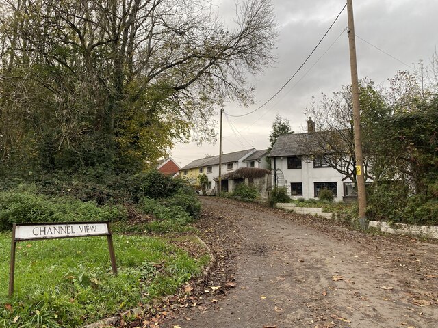
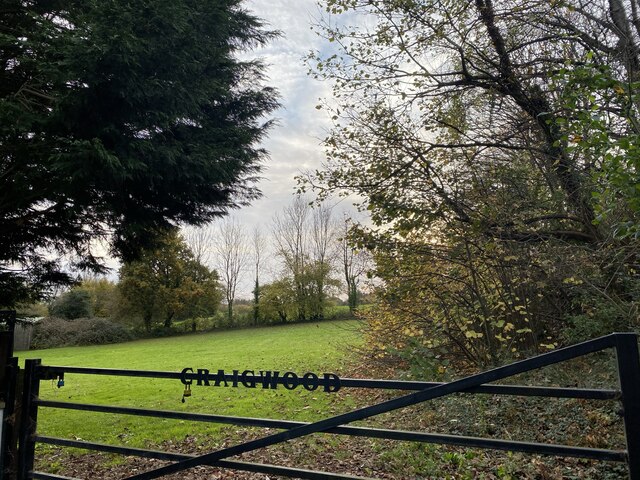
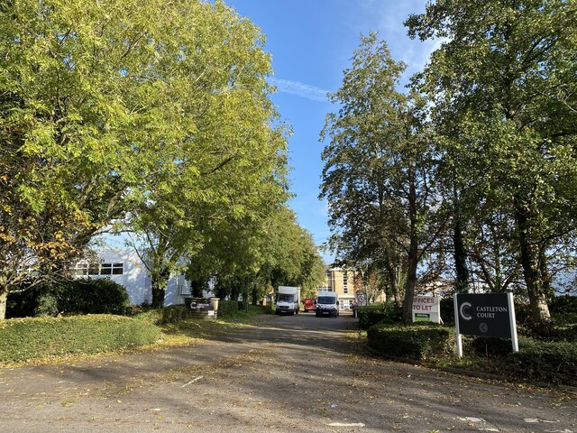
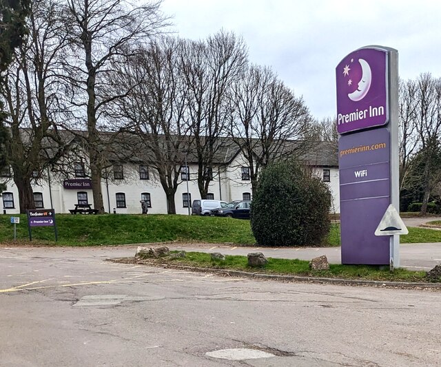
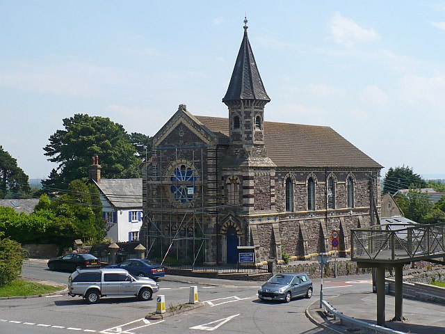
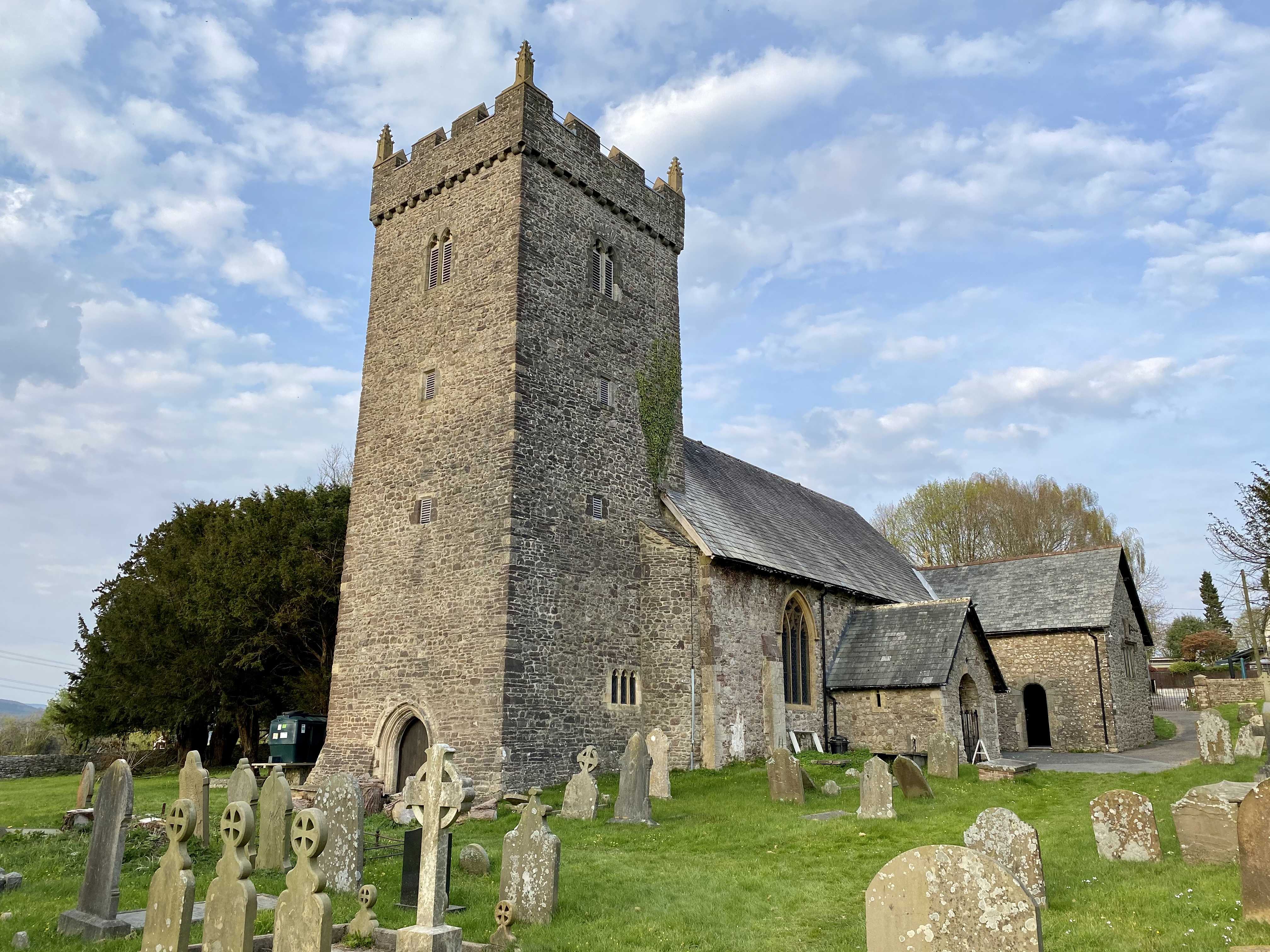
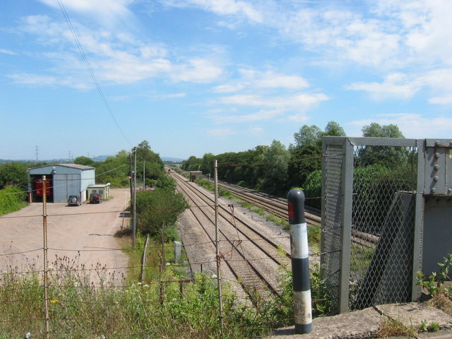
Cas-bach Images

Images are sourced within 2km of 51.543964/-3.076605 or Grid Reference ST2583. Thanks to Geograph Open Source API. All images are credited.

St Mellon’s Golf and County Club
Channel View The old road before the A48 was straightened and widened.
Channel View
The old road before the A48 was straightened and widened.
Gateway to Craigwood
The old A48 A section of the old road before it was straightened.
The old A48
A section of the old road before it was straightened.
Houses adjacent to the old A48
Tree, gate and field A tranquil scene alongside the busy A48.
Tree, gate and field
A tranquil scene alongside the busy A48.
Lane leading towards the old rectory
Farm shop at Berryhill Farm
Marshfield pharmacy
Marshfield pharmacy
Y Mafrun Public house near Marshfield.
Y Mafrun
Public house near Marshfield.
St Mellons Business Park
Roadside dummy, Marshfield I don't know the significance of this dummy alongside St Mellons Road in March 2023.
Roadside dummy, Marshfield
I don't know the significance of this dummy alongside St Mellons Road in March 2023.
West side of Gateway Christian Centre, Marshfield Alongside St Mellons Road.
West side of Gateway Christian Centre, Marshfield
Alongside St Mellons Road.
Celebrate with us - 200 years of Christian witness in the area, Marshfield Text on the notice on Gateway Christian Centre in March 2023 includes
"1823 Castleton Baptist Church
2023 Gateway Christian Centre"
Celebrate with us - 200 years of Christian witness in the area, Marshfield
Text on the notice on Gateway Christian Centre in March 2023 includes "1823 Castleton Baptist Church 2023 Gateway Christian Centre"
The Masons Arms direction sign, Marshfield Facing St Mellons Road. Next left for the traditional village pub.
The Masons Arms direction sign, Marshfield
Facing St Mellons Road. Next left for the traditional village pub.
Guinness Six Nations banner, St Mellons Road, Marshfield Outside the Masons Arms pub on March 6th 2023.
Guinness Six Nations banner, St Mellons Road, Marshfield
Outside the Masons Arms pub on March 6th 2023.
Sky Sports Live Here, St Mellons Road, Marshfield Banner outside the Masons Arms in March 2023.
Sky Sports Live Here, St Mellons Road, Marshfield
Banner outside the Masons Arms in March 2023.
Premier Inn name sign, Castleton Facing the A48. Premier Inn Cardiff East is in the background.
Premier Inn name sign, Castleton
Facing the A48. Premier Inn Cardiff East is in the background.
Show me another place!

Cas-bach is located at Grid Ref: ST2583 (Lat: 51.543964, Lng: -3.076605)

Unitary Authority: Newport

Police Authority: Gwent

Also known as: Castleton

What 3 Words

///mocking.depending.amber. Near Marshfield, Newport

Nearby Locations

Castleton Cas-bach

Related Wikis

Castleton, Newport

Castleton (Welsh: Cas-bach) is a hamlet in the city of Newport, South Wales. == Location == Castleton is in the Marshfield ward on the A48 dual carriageway...

South East Wales

South East Wales is a loosely defined region of Wales generally corresponding to the preserved counties of Mid Glamorgan, South Glamorgan and Gwent. Highly...

Vaendre Hall

Vaendre Hall (or Faendre Hall) is a large detached house in the Cardiff suburb of St Mellons. Set in four acres (1.6 ha) of grounds, it is bordered on...

Michaelston-y-Fedw

Michaelston-y-Fedw (Welsh: Llanfihangel-y-fedw) is a small rural village and community to the west of the city of Newport, Wales, on the borders of Cardiff...

Pontprennau and Old St Mellons

Pontprennau and Old St Mellons (Welsh: Pontprennau a Phentref Llaneirwg) is an electoral ward in Cardiff, Wales. Covering the communities of Old St Mellons...

Marshfield railway station

Marshfield railway station was a former station on the South Wales Main Line which served Marshfield, Newport, in South Wales. == History and description... ==

Marshfield, Newport

Marshfield (Welsh: Maerun) is a village and community of Newport, Wales. It sits approximately 5 miles (8 km) southwest of Newport, and 7 miles (11 km...

Tredegar Park and Marshfield

Tredegar Park and Marshfield is an electoral ward for Newport City Council in south Wales. It was created in 2022 by combining the former wards of Tredegar...

Nearby Amenities

Located within 500m of 51.543964,-3.076605
Fuel
Esso
Addr City: Castleton
Addr Postcode: CF3 2UR
Addr Street: Newport Road
Branch: Castleton
Brand: Esso
Brand Wikidata: Q867662
Fuel Diesel: yes
Fuel Gasoline: yes
Name Cy: Esso
Operator: Motor Fuel Group
Operator Website: https://www.motorfuelgroup.com/locations/castleton-fs720/
Operator Wikidata: Q107271358
Lat/Long: 51.5435968/-3.0806125
Bus Stop
Lat/Long: 51.5452465/-3.079445
Parking
Lat/Long: 51.5462339/-3.0784408
Place Of Worship
Castleton Baptist Church Fellowship
Denomination: baptist
Religion: christian
Lat/Long: 51.5446775/-3.0788755
Police
Lat/Long: 51.5449418/-3.0774298
Castleton
Place: village
Wikidata: Q5050623
Lat/Long: 51.5436738/-3.0777337
Bus Stop
Post Office Castelton
Local Ref: Bus Stop
Naptan AtcoCode: 5310AWA10070
Naptan NaptanCode: nwpamtd
Lat/Long: 51.5443464/-3.0799147
Kinsey Motor Services
Shop: car
Lat/Long: 51.5438459/-3.0803063
Crossing
Crossing: uncontrolled
Crossing Ref: zebra
Lat/Long: 51.541254/-3.0756716
Social Facility
Bryn Ivor Lodge Care Home
Addr City: Cardiff
Addr Postcode: CF3 2UQ
Addr Street: Newport Road
Social Facility: nursing_home
Social Facility For: senior
Lat/Long: 51.5481123/-3.0777967
Direction: SSW
Generator Method: photovoltaic
Generator Output Electricity: yes
Generator Solar Modules: 20
Generator Source: solar
Generator Type: solar_photovoltaic_panel
Location: roof
Power: generator
Lat/Long: 51.5411439/-3.0751567
Direction: SW
Generator Method: photovoltaic
Generator Output Electricity: yes
Generator Solar Modules: 12
Generator Source: solar
Generator Type: solar_photovoltaic_panel
Location: roof
Power: generator
Lat/Long: 51.5451624/-3.0764696
Direction: SE
Generator Method: photovoltaic
Generator Output Electricity: yes
Generator Solar Modules: 18
Generator Source: solar
Generator Type: solar_photovoltaic_panel
Location: roof
Power: generator
Lat/Long: 51.5452483/-3.0768357
Direction: 125
Generator Method: photovoltaic
Generator Output Electricity: yes
Generator Solar Modules: 4
Generator Source: solar
Generator Type: solar_photovoltaic_panel
Location: roof
Power: generator
Lat/Long: 51.5439439/-3.0800436
Direction: 215
Generator Method: photovoltaic
Generator Output Electricity: yes
Generator Solar Modules: 8
Generator Source: solar
Generator Type: solar_photovoltaic_panel
Location: roof
Power: generator
Lat/Long: 51.5439547/-3.0801094
Direction: 215
Generator Method: photovoltaic
Generator Output Electricity: yes
Generator Solar Modules: 3
Generator Source: solar
Generator Type: solar_photovoltaic_panel
Location: roof
Power: generator
Lat/Long: 51.5439973/-3.080163
Direction: ESE
Generator Method: photovoltaic
Generator Output Electricity: yes
Generator Solar Modules: 18
Generator Source: solar
Generator Type: solar_photovoltaic_panel
Location: roof
Power: generator
Lat/Long: 51.5434259/-3.0797634
Direction: 195
Generator Method: photovoltaic
Generator Output Electricity: yes
Generator Solar Modules: 16
Generator Source: solar
Generator Type: solar_photovoltaic_panel
Location: roof
Power: generator
Lat/Long: 51.5429213/-3.0798653
Direction: 125
Generator Method: photovoltaic
Generator Output Electricity: yes
Generator Solar Modules: 16
Generator Source: solar
Generator Type: solar_photovoltaic_panel
Location: roof
Power: generator
Lat/Long: 51.5419188/-3.0805063
Direction: SW
Generator Method: photovoltaic
Generator Output Electricity: yes
Generator Solar Modules: 14
Generator Source: solar
Generator Type: solar_photovoltaic_panel
Location: roof
Power: generator
Lat/Long: 51.5416293/-3.0803306
Direction: SSW
Generator Method: photovoltaic
Generator Output Electricity: yes
Generator Solar Modules: 9
Generator Source: solar
Generator Type: solar_photovoltaic_panel
Location: roof
Power: generator
Lat/Long: 51.5416552/-3.076361
Direction: 190
Generator Method: photovoltaic
Generator Output Electricity: yes
Generator Solar Modules: 15
Generator Source: solar
Generator Type: solar_photovoltaic_panel
Location: roof
Power: generator
Lat/Long: 51.5404808/-3.0764441
The data included in this document is from www.openstreetmap.org. The data is made available under ODbL.

Have you been to Cas-bach?

Leave your review of Cas-bach below (or comments, questions and feedback).