Belvedere Wood

Wood, Forest in West Lothian

Scotland

Belvedere Wood

Provost Lamp, Marjoribanks Street This old lamp has stood here for the last 30 years or so, save for a brief period a couple of years back when it was taken away to get tarted up a bit, and modified so it could once again be hooked up to the electricity. In days gone by it used to move about more regularly. The Provost of Bathgate used to have the honour of having the lamp positioned directly in front of his house, and it moved from place to place over time accordingly.
A provost is loosely the equivalent of a mayor in England, though the title seems to have become more ceremonial as time has gone on. Bathgate was a Burgh Council  - this meant it had a certain amount of autonomy in running its own affairs - until everything to do with local administration was shook up in Scotland in the mid 1970s. All its powers were then subsumed into West Lothian Council, which itself still has a provost, along with about two-thirds of Scotland's other local council areas.
The coat of arms adorning the lamp is fanciful in the extreme. There is no disputing that Bathgate once had a castle, but it is generally thought to have been uninhabited since the early 1300s, and a report of the late 1700s states that there wasn't a stone of it left at the time. Then, as now, it was a small unimpressive mound; it is currently located in the middle of Bathgate Golf Course.
The flag in between the two Saltires is supposedly that of a family who lived in the castle several hundreds of years ago. The water seems to arise from artistic license, as the moat was tiny, and there are - and were - only smallish ponds in the area, but these are quite a distance away. The uninspiring and meaningless Latin motto translates as : 'The common good between the walls'.
While it is perfectly fine in my book to retain the lamp in its original state, I would hope that, should there ever be a need for coats of arms here in the future, this lazy heraldry gets replaced. Quicksmart!
Provost Lamp, Marjoribanks Street Credit: Ian Dodds

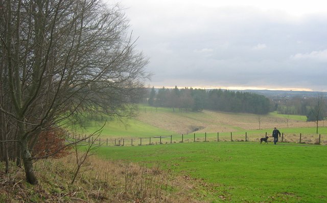
Belvedere Wood is a picturesque forest located in West Lothian, Scotland. Spanning over a vast area, it is a popular destination for nature enthusiasts, hikers, and families seeking a peaceful retreat.

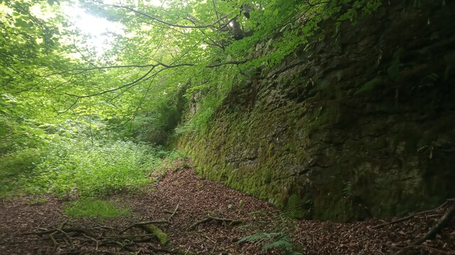
The wood is known for its diverse range of trees, including oak, birch, and beech, which create a stunning canopy overhead. The forest floor is adorned with a variety of wildflowers, adding bursts of color to the landscape. Belvedere Wood is also home to a rich array of wildlife, with red squirrels, roe deer, and a wide variety of bird species commonly spotted.

The forest offers several well-maintained trails that wind through its enchanting surroundings. These paths are suitable for all fitness levels and provide an opportunity to explore the wood's beauty at one's leisure. Along the way, visitors can experience breathtaking views, tranquil streams, and even stumble upon hidden picnic spots.

Belvedere Wood is not only a place of natural beauty but also holds historical significance. The remains of an Iron Age hillfort can be found within its boundaries, serving as a reminder of the area's ancient past.

The wood is easily accessible, with ample parking available for visitors. It is a popular spot for locals and tourists alike, offering a serene and rejuvenating environment away from the hustle and bustle of city life. Belvedere Wood truly embodies the essence of Scotland's natural beauty and is a must-visit destination for anyone seeking solace in nature.

If you have any feedback on the listing, please let us know in the comments section below.

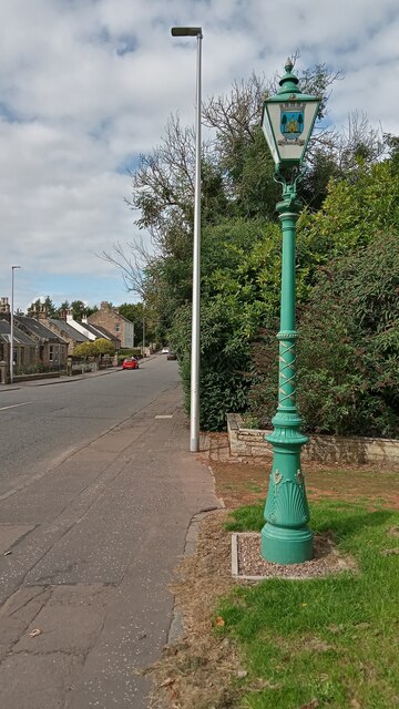
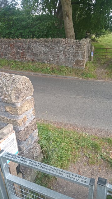
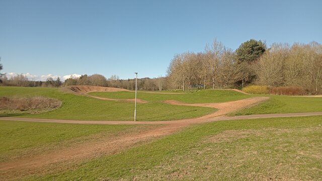
Belvedere Wood Images

Images are sourced within 2km of 55.910677/-3.6540727 or Grid Reference NS9669. Thanks to Geograph Open Source API. All images are credited.

Provost Lamp, Marjoribanks Street This old lamp has stood here for the last 30 years or so, save for a brief period a couple of years back when it was taken away to get tarted up a bit, and modified so it could once again be hooked up to the electricity. In days gone by it used to move about more regularly. The Provost of Bathgate used to have the honour of having the lamp positioned directly in front of his house, and it moved from place to place over time accordingly.
A provost is loosely the equivalent of a mayor in England, though the title seems to have become more ceremonial as time has gone on. Bathgate was a Burgh Council  - this meant it had a certain amount of autonomy in running its own affairs - until everything to do with local administration was shook up in Scotland in the mid 1970s. All its powers were then subsumed into West Lothian Council, which itself still has a provost, along with about two-thirds of Scotland's other local council areas.
The coat of arms adorning the lamp is fanciful in the extreme. There is no disputing that Bathgate once had a castle, but it is generally thought to have been uninhabited since the early 1300s, and a report of the late 1700s states that there wasn't a stone of it left at the time. Then, as now, it was a small unimpressive mound; it is currently located in the middle of Bathgate Golf Course.
The flag in between the two Saltires is supposedly that of a family who lived in the castle several hundreds of years ago. The water seems to arise from artistic license, as the moat was tiny, and there are - and were - only smallish ponds in the area, but these are quite a distance away. The uninspiring and meaningless Latin motto translates as : 'The common good between the walls'.
While it is perfectly fine in my book to retain the lamp in its original state, I would hope that, should there ever be a need for coats of arms here in the future, this lazy heraldry gets replaced. Quicksmart!
Provost Lamp, Marjoribanks Street
This old lamp has stood here for the last 30 years or so, save for a brief period a couple of years back when it was taken away to get tarted up a bit, and modified so it could once again be hooked up to the electricity. In days gone by it used to move about more regularly. The Provost of Bathgate used to have the honour of having the lamp positioned directly in front of his house, and it moved from place to place over time accordingly. A provost is loosely the equivalent of a mayor in England, though the title seems to have become more ceremonial as time has gone on. Bathgate was a Burgh Council - this meant it had a certain amount of autonomy in running its own affairs - until everything to do with local administration was shook up in Scotland in the mid 1970s. All its powers were then subsumed into West Lothian Council, which itself still has a provost, along with about two-thirds of Scotland's other local council areas. The coat of arms adorning the lamp is fanciful in the extreme. There is no disputing that Bathgate once had a castle, but it is generally thought to have been uninhabited since the early 1300s, and a report of the late 1700s states that there wasn't a stone of it left at the time. Then, as now, it was a small unimpressive mound; it is currently located in the middle of Bathgate Golf Course. The flag in between the two Saltires is supposedly that of a family who lived in the castle several hundreds of years ago. The water seems to arise from artistic license, as the moat was tiny, and there are - and were - only smallish ponds in the area, but these are quite a distance away. The uninspiring and meaningless Latin motto translates as : 'The common good between the walls'. While it is perfectly fine in my book to retain the lamp in its original state, I would hope that, should there ever be a need for coats of arms here in the future, this lazy heraldry gets replaced. Quicksmart!
Interesting and Worrying Writing on Gate This gate is one of two leading into the Petershill Wildlife Reserve just North of Bathgate. The writing on the top of the gate says:
AGGRESSIVE OLD MAN IN(?) BLUE BERGHAUS JACKET & BLONDE LABRADOR BITING PEOPLE AND CHASING WILDLIFE REPORTED TO POLICE 17/04/22 12PM
Apart from never having seen anything like this on a metal gate before, two things struck me - (1) The writer used all the space available but never looked like running out of gate, and  (2) To own an aggressive labrador you must surely be some kind of psychopath - luckily he was unarmed!
Interesting and Worrying Writing on Gate
This gate is one of two leading into the Petershill Wildlife Reserve just North of Bathgate. The writing on the top of the gate says: AGGRESSIVE OLD MAN IN(?) BLUE BERGHAUS JACKET & BLONDE LABRADOR BITING PEOPLE AND CHASING WILDLIFE REPORTED TO POLICE 17/04/22 12PM Apart from never having seen anything like this on a metal gate before, two things struck me - (1) The writer used all the space available but never looked like running out of gate, and (2) To own an aggressive labrador you must surely be some kind of psychopath - luckily he was unarmed!
The Hidden Part of Petershill Reserve Petershill Wildlife Reserve occupies most of the site of a former limestone quarry. The bit on the left of the very steep road leading North from Bathgate has two gates and is mostly situated where two former reservoirs had been created from the quarry ponds. The bit on the right of the road caught my attention because of the steep drops down from the stone wall that runs alongside the road, and the lack of any obvious water down below.
There is a stone wall surrounding this sunken area - broken in a few places, with the usual agricultural makeshift defences in place to avoid the rescuing of livestock.
I discovered upon my return that this bit was once part of the quarry too . The stone face pictured isn't actually a part of the perimeter wall as I, disoriented as usual, had initially thought, but is further South. Old maps, at the time of the reservoirs simply denote it as pond (with an area of 0.24 acres). Presumably this was drained at the same time the reservoirs were - in the 1980s. I am always intrigued as to how they manage to drain places that have turned into ponds and lakes, considering that the bodies of water  have formed due to the ground having been excavated to the bedrock. Anyway, all that remains of the pond today  is a big muddy puddle.
And this is actually a part of the Scottish Wildlife Trust managed reserve, they just don't tell anybody.
The Hidden Part of Petershill Reserve
Petershill Wildlife Reserve occupies most of the site of a former limestone quarry. The bit on the left of the very steep road leading North from Bathgate has two gates and is mostly situated where two former reservoirs had been created from the quarry ponds. The bit on the right of the road caught my attention because of the steep drops down from the stone wall that runs alongside the road, and the lack of any obvious water down below. There is a stone wall surrounding this sunken area - broken in a few places, with the usual agricultural makeshift defences in place to avoid the rescuing of livestock. I discovered upon my return that this bit was once part of the quarry too . The stone face pictured isn't actually a part of the perimeter wall as I, disoriented as usual, had initially thought, but is further South. Old maps, at the time of the reservoirs simply denote it as pond (with an area of 0.24 acres). Presumably this was drained at the same time the reservoirs were - in the 1980s. I am always intrigued as to how they manage to drain places that have turned into ponds and lakes, considering that the bodies of water have formed due to the ground having been excavated to the bedrock. Anyway, all that remains of the pond today is a big muddy puddle. And this is actually a part of the Scottish Wildlife Trust managed reserve, they just don't tell anybody.
Short cycle track Depending on which large-scale online map you go to, this part of the oddly named 'Park of Peace' at the NorthWest edge of Bathgate (more research is required here, but I think the name has something to do with the fact that there are some war memorials within the park) is either broadly described as a play area, or specifically described as a 'cycle racing facility'.
It is obviously designed with fun in mind as, despite the bumps and berms, it is downhill all the way. However, the starting point and finishing point must only be 50 feet apart. So why not join them up, thereby facilitating (pun intended) proper races over several laps. As every true fan of cycling knows, it is the uphill struggles that are the most exciting. There is a vague grassy route between the two ends but it is obviously not designed to be ridden up.
I passed by on the first proper T-Shirt day of spring. Therefore all the targeted users were just drinking and socializing. Good on 'em - I have to admit I felt  twinge of jealousy!
Short cycle track
Depending on which large-scale online map you go to, this part of the oddly named 'Park of Peace' at the NorthWest edge of Bathgate (more research is required here, but I think the name has something to do with the fact that there are some war memorials within the park) is either broadly described as a play area, or specifically described as a 'cycle racing facility'. It is obviously designed with fun in mind as, despite the bumps and berms, it is downhill all the way. However, the starting point and finishing point must only be 50 feet apart. So why not join them up, thereby facilitating (pun intended) proper races over several laps. As every true fan of cycling knows, it is the uphill struggles that are the most exciting. There is a vague grassy route between the two ends but it is obviously not designed to be ridden up. I passed by on the first proper T-Shirt day of spring. Therefore all the targeted users were just drinking and socializing. Good on 'em - I have to admit I felt twinge of jealousy!
Doorway painted on a wall This is one of two. There is one behind camera exactly the same size which has '20 P' above it. They were painted in the 1990s to mark the former entrances to air raid shelters that were dug out of the banking behind the wall. There is a plaque nearby which says that it is all connected to 50th anniversary VE Day goings-on, and the writing above the imaginary lintels denotes how many people each air raid shelter could accommodate. The plaque also mentions that Challenge Anneka, a popular TV programme back then, filmed here at the time and that the challenge had something to do with relocating a war memorial. Whether the presenter, Anneka Rice, ever did a piece about the air raid shelters, or was filmed in front of them, is not mentioned.
Considering that Bathgate has (and also had during the war) a population of several thousand I should hope that there were a few more dotted about and that these two were highlighted due to their central location, on Bathgate's main road. Thankfully they were never really needed. The plaque states that only one bomb fell on Bathgate in World War Two and didn't explode. For those that know the area it fell on the West side of Whitburn Road, on the ground now occupied by the big surgery just up from Morrisons supermarket.
Doorway painted on a wall
This is one of two. There is one behind camera exactly the same size which has '20 P' above it. They were painted in the 1990s to mark the former entrances to air raid shelters that were dug out of the banking behind the wall. There is a plaque nearby which says that it is all connected to 50th anniversary VE Day goings-on, and the writing above the imaginary lintels denotes how many people each air raid shelter could accommodate. The plaque also mentions that Challenge Anneka, a popular TV programme back then, filmed here at the time and that the challenge had something to do with relocating a war memorial. Whether the presenter, Anneka Rice, ever did a piece about the air raid shelters, or was filmed in front of them, is not mentioned. Considering that Bathgate has (and also had during the war) a population of several thousand I should hope that there were a few more dotted about and that these two were highlighted due to their central location, on Bathgate's main road. Thankfully they were never really needed. The plaque states that only one bomb fell on Bathgate in World War Two and didn't explode. For those that know the area it fell on the West side of Whitburn Road, on the ground now occupied by the big surgery just up from Morrisons supermarket.
A North British 'Glen' 4-4-0 at Bathgate Locomotive Depot View  northward, just east of Bathgate Upper station, which was then on the ex-NB Edinburgh - Bathgate - Glasgow secondary line. Passenger services had ceased in 1956, so the Depot was then (1962) only servicing freight locomotives and had become mainly a dump for withdrawn engines: this D34, No. 62484 'Glen Lyon', had been condemned in 11/61, nearly a year before the photograph.
A North British 'Glen' 4-4-0 at Bathgate Locomotive Depot
View northward, just east of Bathgate Upper station, which was then on the ex-NB Edinburgh - Bathgate - Glasgow secondary line. Passenger services had ceased in 1956, so the Depot was then (1962) only servicing freight locomotives and had become mainly a dump for withdrawn engines: this D34, No. 62484 'Glen Lyon', had been condemned in 11/61, nearly a year before the photograph.
Condemned ex-NB 0-6-0 dumped with many other locomotives at Bathgate View NE, in a dump on the Edinburgh side of Bathgate (Upper) station on the ex-North British subsidiary Edinburgh - Glasgow line. This was one of about 25 withdrawn Scottish Region engines at that site awaiting disposal in September 1962; ex-NB Reid J35 0-6-0 No. 64479. Note the tender-cab, fitted for protection of the crew when running backwards in bad weather. (See also <a href="https://www.geograph.org.uk/photo/2328735">NS9768 : A North British 'Glen' 4-4-0 at Bathgate Locomotive Depot</a>).
Condemned ex-NB 0-6-0 dumped with many other locomotives at Bathgate
View NE, in a dump on the Edinburgh side of Bathgate (Upper) station on the ex-North British subsidiary Edinburgh - Glasgow line. This was one of about 25 withdrawn Scottish Region engines at that site awaiting disposal in September 1962; ex-NB Reid J35 0-6-0 No. 64479. Note the tender-cab, fitted for protection of the crew when running backwards in bad weather. (See also NS9768 : A North British 'Glen' 4-4-0 at Bathgate Locomotive Depot).
The Steelyard, Bathgate View across the plaza called The Steelyard in Bathgate, with the spire of St David's church on George Street showing above the roofs of the shops on King's Street.  Built in 1904, the church is now used for some commercial purpose.  See also close-up shot at <a href="https://www.geograph.org.uk/photo/2627742">NS9768 : Belltower of St David's, Bathgate</a>.
The Steelyard, Bathgate
View across the plaza called The Steelyard in Bathgate, with the spire of St David's church on George Street showing above the roofs of the shops on King's Street. Built in 1904, the church is now used for some commercial purpose. See also close-up shot at NS9768 : Belltower of St David's, Bathgate.
Belltower of St David's, Bathgate Close-up of the belltower of St David's church on George Street in Bathgate, showing above the roofs of the shops on King's Street - supplemental to my photograph at <a href="https://www.geograph.org.uk/photo/2627726">NS9768 : The Steelyard, Bathgate</a>.
Belltower of St David's, Bathgate
Close-up of the belltower of St David's church on George Street in Bathgate, showing above the roofs of the shops on King's Street - supplemental to my photograph at NS9768 : The Steelyard, Bathgate.
Victorian drinking fountain at The Steelyard, Bathgate Late 19th or very early 20th C cast-iron fountain donated to Bathgate by the wife of Peter Mclagan, MP for Linlithgowshire (who died in 1900).  It originally stood at the top end of George Street, at the crossroads with Hopetoun Street, but was moved to the plaza called The Steelyard at the low end of George Street, presumably because its presence at the crossroads interfered with traffic.
Victorian drinking fountain at The Steelyard, Bathgate
Late 19th or very early 20th C cast-iron fountain donated to Bathgate by the wife of Peter Mclagan, MP for Linlithgowshire (who died in 1900). It originally stood at the top end of George Street, at the crossroads with Hopetoun Street, but was moved to the plaza called The Steelyard at the low end of George Street, presumably because its presence at the crossroads interfered with traffic.
Robertson Avenue, Falside
Falside Crescent, Falside
Ex-NB 0-6-0s abound in the Locomotive Yard at Bathgate A view across the yards at Bathgate reveals no less than four of the ex-NB Holmes J36 0-6-0s that did much of the donkey-work in the area: Nos. 65261/5/77 and 65341 (former LNER Nos. 9690, 9248, 9706/89 respectively), were built between 3/1892 and 12/1900 and not withdrawn by BR until 6-12/63. (Cf. <a href="https://www.geograph.org.uk/photo/2356300">NS9768 : Condemned ex-NB 0-6-0 dumped with many other locomotives at Bathgate</a>).
Ex-NB 0-6-0s abound in the Locomotive Yard at Bathgate
A view across the yards at Bathgate reveals no less than four of the ex-NB Holmes J36 0-6-0s that did much of the donkey-work in the area: Nos. 65261/5/77 and 65341 (former LNER Nos. 9690, 9248, 9706/89 respectively), were built between 3/1892 and 12/1900 and not withdrawn by BR until 6-12/63. (Cf. NS9768 : Condemned ex-NB 0-6-0 dumped with many other locomotives at Bathgate).
EX_NBR N15 0-6-2T dumped at Bathgate Locomotive Depot No. 69219 is one of the NBR Reid standard class A 0-6-2Ts (LNER N15) that were perpetuated after Grouping; it was built in 2/24 as No. 9099, reumbered 9219 in 1946 and withdrawn in 12/61. (See also <a href="https://www.geograph.org.uk/photo/2356300">NS9768 : Condemned ex-NB 0-6-0 dumped with many other locomotives at Bathgate</a>).
EX_NBR N15 0-6-2T dumped at Bathgate Locomotive Depot
No. 69219 is one of the NBR Reid standard class A 0-6-2Ts (LNER N15) that were perpetuated after Grouping; it was built in 2/24 as No. 9099, reumbered 9219 in 1946 and withdrawn in 12/61. (See also NS9768 : Condemned ex-NB 0-6-0 dumped with many other locomotives at Bathgate).
Condemned ex-NBR 0-6-0T in dump at Bathgate Locomotive Depot (See also <a href="https://www.geograph.org.uk/photo/2887287">NS9768 : EX_NBR N15 0-6-2T dumped at Bathgate Locomotive Depot</a> and others). No 68470 is an ex-NBR Holmes class D (LNER J83), built 4/1901 as No. 823 (became LNER No. 9823, 8470 in 1946), officially withdrawn in 10/62.
Condemned ex-NBR 0-6-0T in dump at Bathgate Locomotive Depot
(See also NS9768 : EX_NBR N15 0-6-2T dumped at Bathgate Locomotive Depot and others). No 68470 is an ex-NBR Holmes class D (LNER J83), built 4/1901 as No. 823 (became LNER No. 9823, 8470 in 1946), officially withdrawn in 10/62.
Bathgate (interim) station car park As explained in the description to my other photo for this square <a href="https://www.geograph.org.uk/photo/940149">NS9768 : Bathgate (interim) railway station</a> the station was relocated some years after the photo was taken.

It was clearly a cold day after recent snow.
Bathgate (interim) station car park
As explained in the description to my other photo for this square NS9768 : Bathgate (interim) railway station the station was relocated some years after the photo was taken. It was clearly a cold day after recent snow.
Bathgate (1986) station View SE, towards Edinburgh. This single-platform station was opened on 24/3/86 on the site of the former Bathgate Upper station on the ex-NB Edinburgh - Bathgate - Airdrie - Glasgow line, which closed along with the route between Ratho (Bathgate Junction) and Airdrie from 9/1/56 but was restored (Edinburgh - Bathgate) in March 1986. On 18/10/10 this station was replaced a short distance away when the rest (Bathgate - Drumgelloch - Airdrie) of the former route was restored as a modern electrified railway.
Bathgate (1986) station
View SE, towards Edinburgh. This single-platform station was opened on 24/3/86 on the site of the former Bathgate Upper station on the ex-NB Edinburgh - Bathgate - Airdrie - Glasgow line, which closed along with the route between Ratho (Bathgate Junction) and Airdrie from 9/1/56 but was restored (Edinburgh - Bathgate) in March 1986. On 18/10/10 this station was replaced a short distance away when the rest (Bathgate - Drumgelloch - Airdrie) of the former route was restored as a modern electrified railway.
Bathgate Station This station replaced the previous Bathgate station, which was sited a little further west and itself dated from only 1986, in 2010 when through services to Glasgow via Airdrie were reinstated.
Bathgate Station
This station replaced the previous Bathgate station, which was sited a little further west and itself dated from only 1986, in 2010 when through services to Glasgow via Airdrie were reinstated.
Show me another place!

Belvedere Wood is located at Grid Ref: NS9669 (Lat: 55.910677, Lng: -3.6540727)

Unitary Authority: West Lothian

Police Authority: The Lothians and Scottish Borders

What 3 Words

///stereos.sundial.bloom. Near Bathgate, West Lothian

Nearby Locations

Belvedere Wood

Related Wikis

Bathgate Lower railway station

Bathgate Lower railway station was a railway station serving the town of Bathgate in West Lothian, Scotland. It was located on the Bathgate Branch of the...

Mill Park, Bathgate

Mill Park was a football ground in Bathgate, Scotland. It was the home ground of Bathgate F.C. from 1902 until they folded in 1938. == History == Bathgate...

Balbardie House

Balbardie House was an 18th-century Scottish mansion house in West Lothian, Scotland, near to the town of Bathgate. == History == The house stood on the...

Ballencrieff, West Lothian

Ballencrieff is a settlement in West Lothian, Scotland, situated equidistant between the towns of Bathgate and Torphichen and seven miles south of Linlithgow...

Nearby Amenities

Located within 500m of 55.910677,-3.6540727
Addr City: Bathgate
Addr Housenumber: 44
Addr Postcode: EH48 4GU
Addr Street: Jardine Place
Lat/Long: 55.9071949/-3.65856
Addr City: Bathgate
Addr Housenumber: 42
Addr Postcode: EH48 4GU
Addr Street: Jardine Place
Lat/Long: 55.9072038/-3.6588055
Addr City: Bathgate
Addr Housenumber: 40
Addr Postcode: EH48 4GU
Addr Street: Jardine Place
Lat/Long: 55.9072036/-3.6590402
Addr City: Bathgate
Addr Housenumber: 20
Addr Postcode: EH48 4GU
Addr Street: Jardine Place
Lat/Long: 55.9077166/-3.6600161
Addr City: Bathgate
Addr Housenumber: 18
Addr Postcode: EH48 4GU
Addr Street: Jardine Place
Lat/Long: 55.9078147/-3.6599384
Addr City: Bathgate
Addr Housenumber: 16
Addr Postcode: EH48 4GU
Addr Street: Jardine Place
Lat/Long: 55.9079188/-3.659857
Addr City: Bathgate
Addr Housenumber: 12
Addr Postcode: EH48 4GU
Addr Street: Jardine Place
Lat/Long: 55.9074171/-3.6595209
Addr City: Bathgate
Addr Housenumber: 10
Addr Postcode: EH48 4GU
Addr Street: Jardine Place
Lat/Long: 55.9074217/-3.6593024
Addr City: Bathgate
Addr Housenumber: 13
Addr Postcode: EH48 4GU
Addr Street: Jardine Place
Lat/Long: 55.9074544/-3.6587567
Addr City: Bathgate
Addr Housenumber: 11
Addr Postcode: EH48 4GU
Addr Street: Jardine Place
Lat/Long: 55.9075777/-3.6586462
Addr City: Bathgate
Addr Housenumber: 9
Addr Postcode: EH48 4GU
Addr Street: Jardine Place
Lat/Long: 55.9076969/-3.6584738
Addr City: Bathgate
Addr Housenumber: 7
Addr Postcode: EH48 4GU
Addr Street: Jardine Place
Lat/Long: 55.9077061/-3.6581611
Addr City: Bathgate
Addr Housenumber: 5
Addr Postcode: EH48 4GU
Addr Street: Jardine Place
Lat/Long: 55.9076818/-3.657958
Addr City: Bathgate
Addr Housenumber: 3
Addr Postcode: EH48 4GU
Addr Street: Jardine Place
Lat/Long: 55.9076751/-3.6577507
Addr City: Bathgate
Addr Housenumber: 1
Addr Postcode: EH48 4GU
Addr Street: Jardine Place
Lat/Long: 55.9076849/-3.6575258
Addr City: Bathgate
Addr Housenumber: 8
Addr Postcode: EH48 4GU
Addr Street: Jardine Place
Lat/Long: 55.9077456/-3.6589351
Addr City: Bathgate
Addr Housenumber: 6
Addr Postcode: EH48 4GU
Addr Street: Jardine Place
Lat/Long: 55.9077965/-3.6591073
Addr City: Bathgate
Addr Housenumber: 4
Addr Postcode: EH48 4GU
Addr Street: Jardine Place
Lat/Long: 55.9078467/-3.6592921
Addr City: Bathgate
Addr Housenumber: 2
Addr Postcode: EH48 4GU
Addr Street: Jardine Place
Lat/Long: 55.9078809/-3.6595194
Noexit: yes
Lat/Long: 55.9088402/-3.6610685
Noexit: yes
Lat/Long: 55.9087431/-3.6610973
Power: pole
Lat/Long: 55.9134858/-3.6528415
Power: pole
Lat/Long: 55.913055/-3.6527395
Power: pole
Lat/Long: 55.9125728/-3.6526228
Power: pole
Lat/Long: 55.9121384/-3.6525145
Power: pole
Lat/Long: 55.9116632/-3.6524082
Power: pole
Lat/Long: 55.9112161/-3.6522874
Power: pole
Lat/Long: 55.9069542/-3.6566309
Power: pole
Lat/Long: 55.9069261/-3.6564663
Power: pole
Lat/Long: 55.9068514/-3.6559101
Power: pole
Lat/Long: 55.9067159/-3.6547122
Power: pole
Lat/Long: 55.9066307/-3.6539602
Power: pole
Lat/Long: 55.9066891/-3.6523103
Fixme: continue
Lat/Long: 55.9109513/-3.6529752
The data included in this document is from www.openstreetmap.org. The data is made available under ODbL.

Have you been to Belvedere Wood?

Leave your review of Belvedere Wood below (or comments, questions and feedback).