Garden Wood
Wood, Forest in Kirkcudbrightshire
Scotland
Garden Wood

Garden Wood is a picturesque woodland located in Kirkcudbrightshire, Scotland. Situated on the outskirts of the town of Kirkcudbright, it covers an area of approximately 50 acres. The wood is known for its natural beauty and diverse flora and fauna, making it a popular destination for both locals and tourists.
The woodland is predominantly made up of native broadleaf trees such as oak, beech, and birch, which provide a rich habitat for a variety of wildlife. Visitors can expect to encounter a range of bird species, including woodpeckers, owls, and various songbirds. Squirrels, badgers, and foxes are also known to make their homes within the wood.
Garden Wood is intersected by a network of well-maintained trails, allowing visitors to explore the area at their own pace. These paths offer stunning views of the surrounding countryside, with glimpses of the nearby River Dee. The wood also boasts a small stream that adds to its natural charm.
The wood is managed by the local council, ensuring that it remains a protected and well-preserved environment. Visitors are encouraged to respect the natural surroundings and adhere to any posted guidelines.
Garden Wood provides a tranquil escape from the hustle and bustle of daily life, offering a peaceful retreat for nature enthusiasts, walkers, and families alike. With its idyllic setting and abundant wildlife, it is a must-visit location for anyone seeking to immerse themselves in the beauty of the Scottish countryside.
If you have any feedback on the listing, please let us know in the comments section below.
Garden Wood Images
Images are sourced within 2km of 55.025389/-3.6420451 or Grid Reference NX9571. Thanks to Geograph Open Source API. All images are credited.


Garden Wood is located at Grid Ref: NX9571 (Lat: 55.025389, Lng: -3.6420451)
Unitary Authority: Dumfries and Galloway
Police Authority: Dumfries and Galloway
What 3 Words
///stable.guess.remembers. Near Dumfries, Dumfries & Galloway
Nearby Locations
Related Wikis

Mabie, Dumfries and Galloway
Mabie is a collection of mountain biking routes located in Dumfries and Galloway, southwest Scotland. The mountain bike routes are part of the 7Stanes...
Pict's Knowe
Pict's Knowe (grid reference NX 9538 7213) is a henge monument in the parish of Troqueer, Dumfries and Galloway. It is one of a small group of henge monuments...
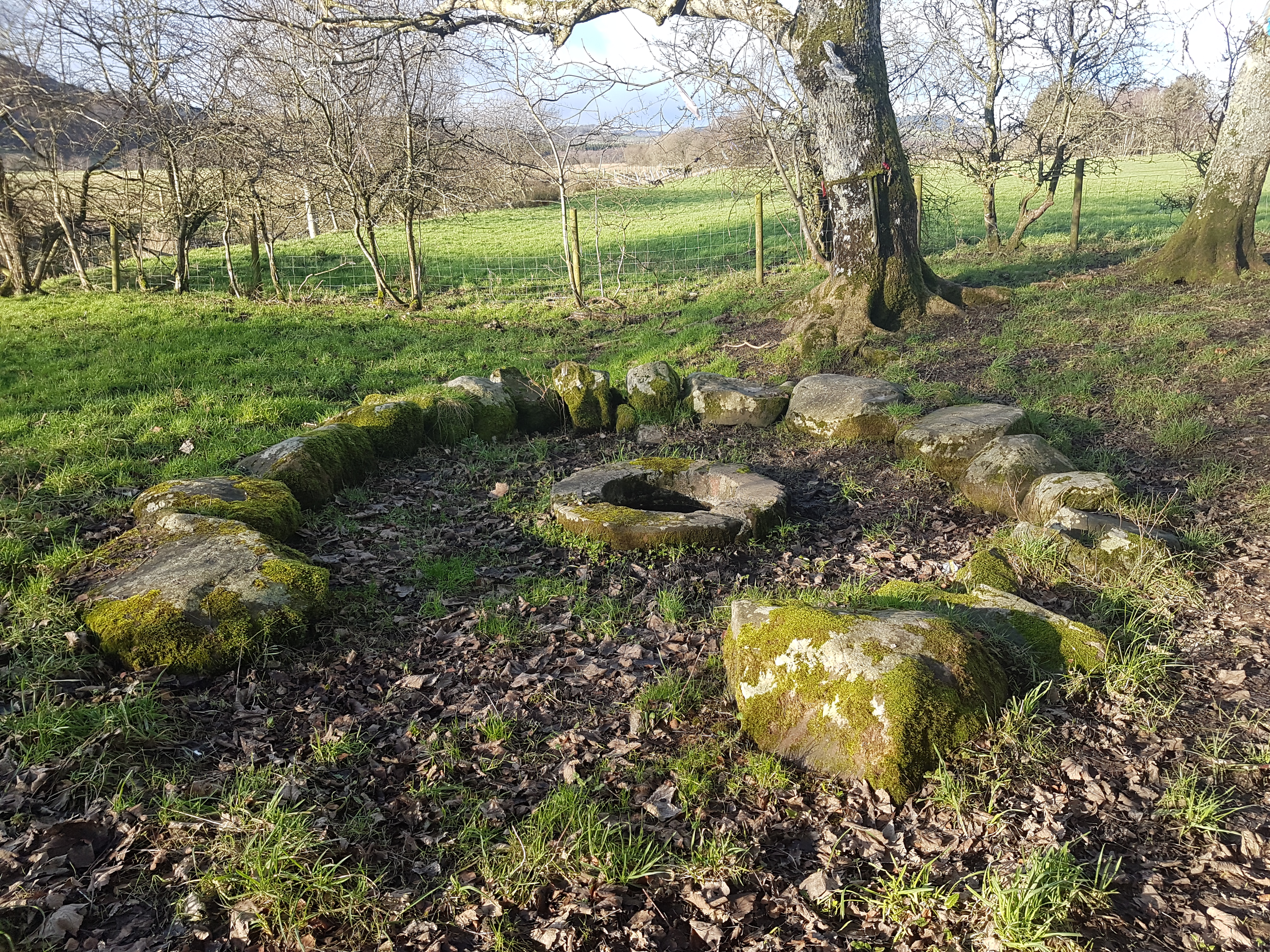
St Queran's Well
St Queran's Well is a holy well in Dumfries and Galloway, located in the parish of Troqueer in the historic county of Kirkcudbrightshire. A spring feeds...

Lochaber Loch
Lochaber Loch is a small, lowland freshwater loch that lies among steep-sided hills, approximately 4.5 mi (7.2 km) to the west of Dumfries, Scotland. The...
Cargenbridge
Cargenbridge is a village located in Dumfries and Galloway, United Kingdom southwest of Dumfries. It is in Troqueer parish, in the historic county of Kirkcudbrightshire...

Lochanhead railway station
Lochanhead railway station served the settlement of Lochanhead, Dumfries and Galloway, Scotland from 1859 to 1965 on the Castle Douglas and Dumfries Railway...

River Nith
The River Nith (Scottish Gaelic: Abhainn Nid; Common Brittonic: Nowios) is a river in south-west Scotland. The Nith rises in the Carsphairn hills of East...
Curriestanes cursus
Curriestanes cursus (grid reference NX 95990 75170) is a large neolithic ditched enclosure on the outskirts of Dumfries, in the parish of Troqueer, Dumfries...
Nearby Amenities
Located within 500m of 55.025389,-3.6420451Have you been to Garden Wood?
Leave your review of Garden Wood below (or comments, questions and feedback).