Ballentore Wood
Wood, Forest in Nairnshire
Scotland
Ballentore Wood
Ballentore Wood is a picturesque forest located in the county of Nairnshire, Scotland. Spread across an area of approximately 100 hectares, the wood is characterized by its diverse range of flora and fauna, making it a popular destination for nature enthusiasts and hikers.
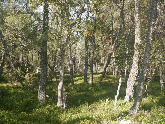
The wood is predominantly composed of native tree species, such as Scots pine, birch, and oak, which create a rich and vibrant canopy overhead. These trees provide a habitat for a variety of wildlife, including red squirrels, roe deer, and a wide array of bird species.
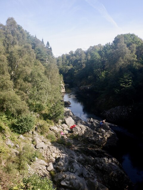
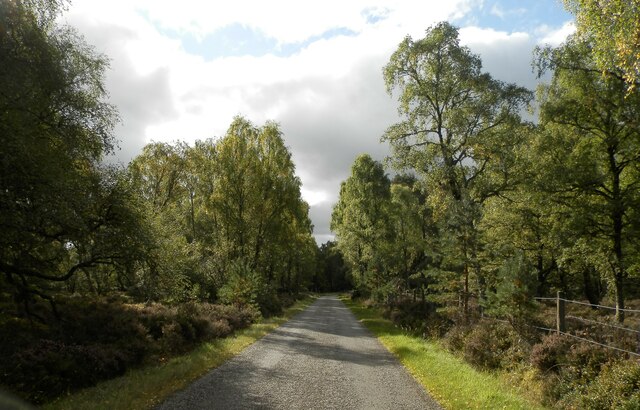
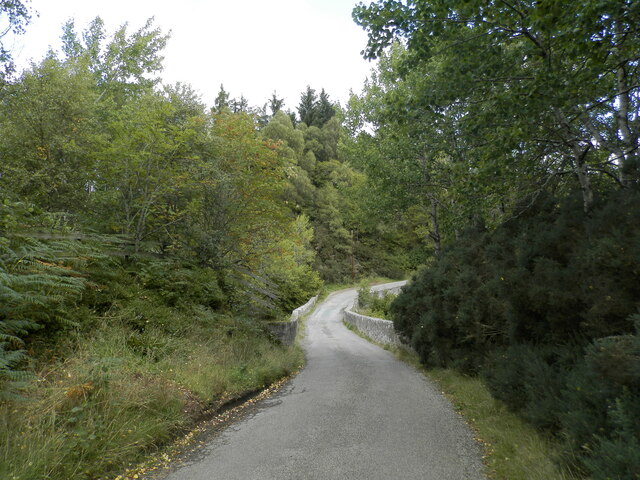
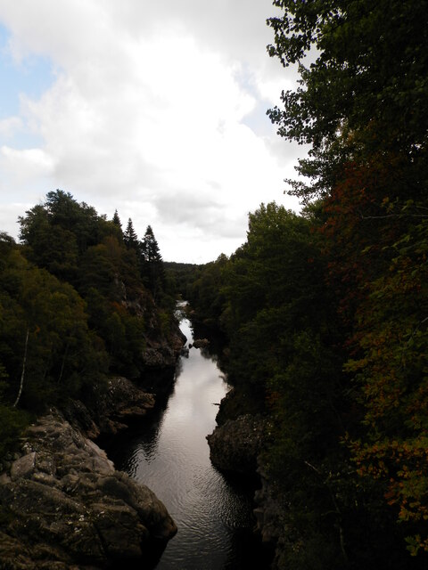
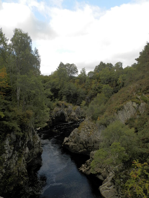
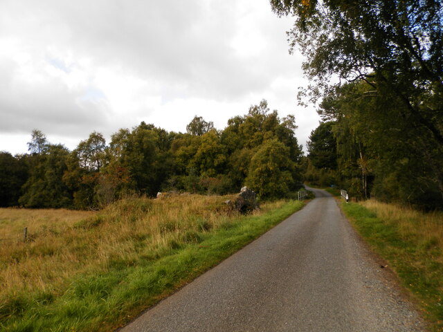
Traversing through Ballentore Wood, visitors can explore its well-maintained network of paths and trails, which offer breathtaking views of the surrounding landscape. The wood is intersected by a small river, adding to its natural beauty and providing a peaceful ambiance.
The wood is managed by the local forestry commission, who ensure the preservation of its natural resources and maintain the area for public access. They also organize educational and recreational activities for visitors, including guided walks, bird-watching events, and workshops on woodland conservation.
Ballentore Wood is open to the public throughout the year, allowing visitors to experience the changing seasons and witness the vibrant colors of autumn or the fresh greenery of spring. The wood provides an ideal setting for a peaceful stroll, a family picnic, or simply a chance to immerse oneself in the tranquility of nature.
If you have any feedback on the listing, please let us know in the comments section below.
Ballentore Wood Images
Images are sourced within 2km of 57.457731/-3.7559288 or Grid Reference NH9442. Thanks to Geograph Open Source API. All images are credited.


Ballentore Wood is located at Grid Ref: NH9442 (Lat: 57.457731, Lng: -3.7559288)
Unitary Authority: Highland
Police Authority: Highlands and Islands
What 3 Words
///gurgled.decanter.tedious. Near Nairn, Highland
Nearby Locations
Related Wikis

Dunearn
Dunearn is a hill fort located 15 kilometres (9.3 mi) south south east of Nairn in Highland, Scotland. It is situated on a steep-sided hill called Doune...

Ardclach
Ardclach (Gaelic: Àird Chlach) is a small crofting hamlet, close to Glenferness in the old county of Nairn, Scotland, within the Scottish council area...

Ferness
Ferness (Scottish Gaelic: Feàrnais) is a settlement and rural area in Strathdearn, in the council area of Highland.The settlement is situated in a forested...
Ardclach Bell Tower
Ardclach Bell Tower is an historic structure in Ardclach, Scottish Highlands. Dating to at least 1655, it is now a Category A listed building. It is believed...

Dorback Burn, Findhorn
The Dorback Burn (Scottish Gaelic: Dorbag / Uisge Dhorbaig) is a right-bank tributary of the River Findhorn in northeast Scotland. It emerges from the...

Lochindorb
Lochindorb (from the Scottish Gaelic: Loch nan Doirb meaning "loch of the minnows") is a freshwater loch north of Grantown on Spey in the Highland council...

County of Nairn
The County of Nairn (also called Nairnshire) (Scottish Gaelic: Siorrachd Inbhir Narann) is a historic county, registration county and lieutenancy area...

Dava railway station
Dava railway station was opened in 1864, on the Inverness and Perth Junction Railway, one year after the route was opened. == Station layout == The station...
Nearby Amenities
Located within 500m of 57.457731,-3.7559288Have you been to Ballentore Wood?
Leave your review of Ballentore Wood below (or comments, questions and feedback).