Barlay Wood

Wood, Forest in Kirkcudbrightshire

Scotland

Barlay Wood

Waterloo Monument The Waterloo Monument New Abbey, on a dull morning.
Waterloo Monument Credit: Rab McMurdo

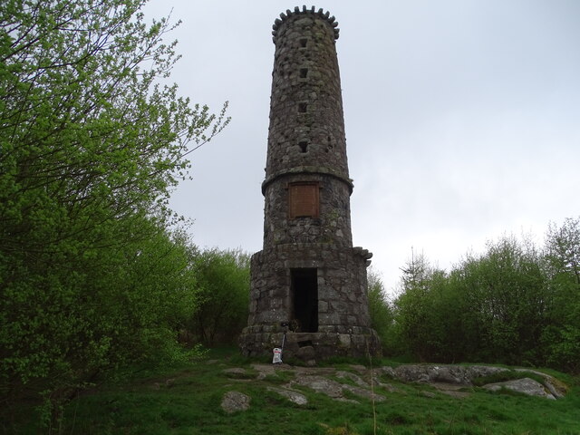
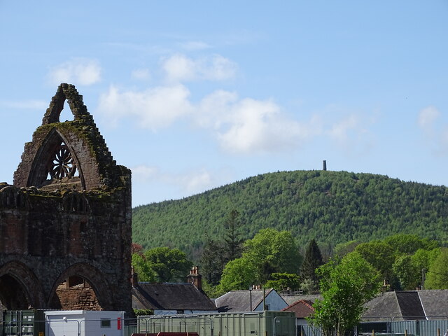
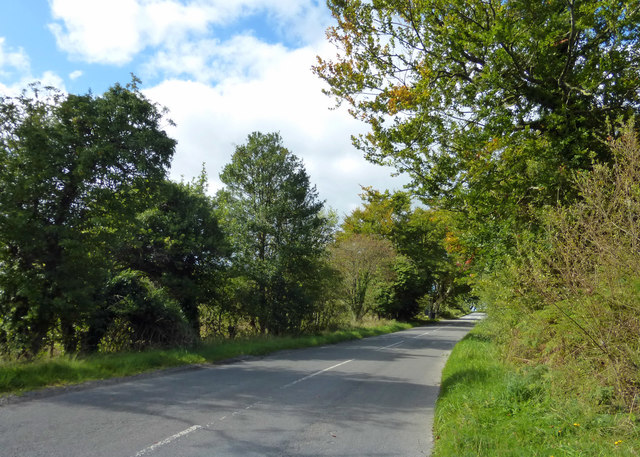
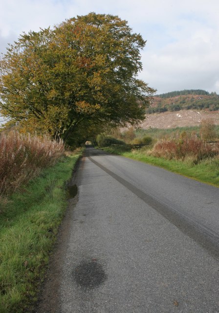
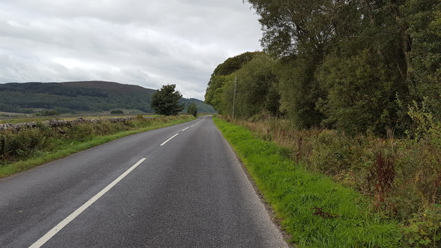
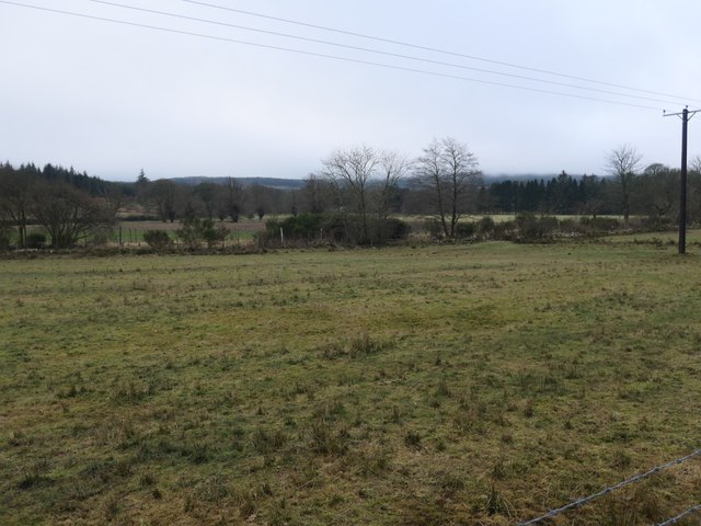
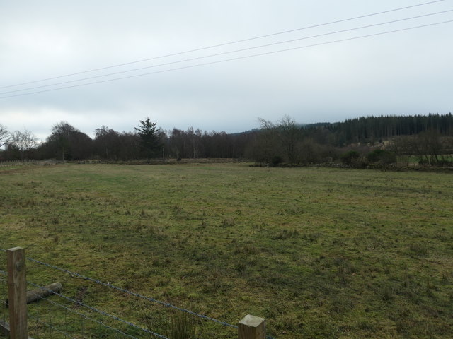
Barlay Wood is a picturesque forest located in Kirkcudbrightshire, a historic county in southwest Scotland. This enchanting woodland covers an area of approximately 150 acres and is renowned for its stunning natural beauty and diverse array of flora and fauna.

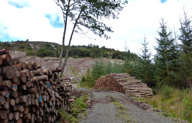
The forest is dominated by a mix of deciduous and coniferous trees, including oak, birch, and Scots pine. The lush undergrowth is adorned with a variety of wildflowers, creating a vibrant tapestry of colors throughout the seasons. The canopy of the trees provides a welcoming shade during summer months and a breathtaking display of autumnal foliage as the leaves change color.

Barlay Wood is also home to a rich variety of wildlife. It is a haven for birdwatchers, with various species of songbirds, woodpeckers, and owls calling the forest their home. The woodland floor is frequented by small mammals like squirrels, rabbits, and hedgehogs, while larger mammals such as deer and foxes can occasionally be spotted.

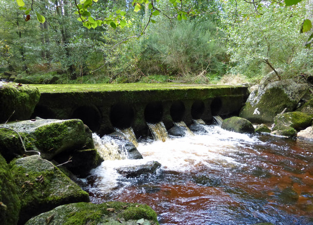
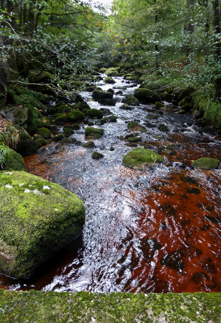
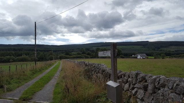
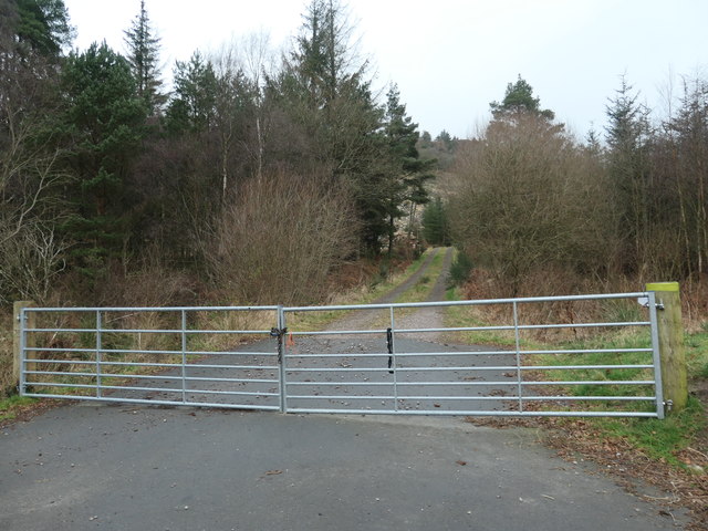
The forest offers several walking trails, allowing visitors to explore its hidden treasures. These paths wind through the woods, passing by babbling brooks and small ponds. The serenity and tranquility of Barlay Wood make it an ideal destination for nature lovers, hikers, and those seeking solace in the great outdoors.

Barlay Wood is easily accessible, located just a short drive from the town of Kirkcudbright. Its natural beauty and peaceful ambiance make it a popular destination for locals and tourists alike, offering a delightful escape into nature's embrace.

If you have any feedback on the listing, please let us know in the comments section below.

Barlay Wood Images

Images are sourced within 2km of 54.982117/-3.6584369 or Grid Reference NX9366. Thanks to Geograph Open Source API. All images are credited.

Waterloo Monument The Waterloo Monument New Abbey, on a dull morning.
Waterloo Monument
The Waterloo Monument New Abbey, on a dull morning.
The Waterloo Memorial A view of the Waterloo Memorial from New Abbey graveyard.
The Waterloo Memorial
A view of the Waterloo Memorial from New Abbey graveyard.
Shambellie Wood A mid-September view, looking down the access track for this lovely woodland near New Abbey.
Shambellie Wood
A mid-September view, looking down the access track for this lovely woodland near New Abbey.
Crossing New Abbey Pow This substantial ford-bridge takes a rough track across the river.
Crossing New Abbey Pow
This substantial ford-bridge takes a rough track across the river.
New Abbey Pow An upstream view of this small river near New Abbey.
New Abbey Pow
An upstream view of this small river near New Abbey.
This Way to Beeswing The minor road between New Abbey and Beeswing, viewed in mid-September with the trees just beginning to show some autumn colour.
This Way to Beeswing
The minor road between New Abbey and Beeswing, viewed in mid-September with the trees just beginning to show some autumn colour.
Timber Operations in Auchengray Forest This view compares well with <a href="https://www.geograph.org.uk/photo/3194340">NX9367 : A track into the Auchengray Plantation</a> taken in 2012.
Timber Operations in Auchengray Forest
This view compares well with NX9367 : A track into the Auchengray Plantation taken in 2012.
New Abbey to Beeswing road
Field beside the New Abbey to Beeswing road In the distance is Auchengray Hill. Part of the plantation covering the middle slopes of the hill have been felled recently.
Field beside the New Abbey to Beeswing road
In the distance is Auchengray Hill. Part of the plantation covering the middle slopes of the hill have been felled recently.
Track to Riddlebank The private track to Riddlebank cottage.
Track to Riddlebank
The private track to Riddlebank cottage.
The road to Beeswing The road from New Abbey heading towards Beeswing.
The road to Beeswing
The road from New Abbey heading towards Beeswing.
Old Milestone by Barlay Wood, New Abbey Parish By the UC road, in parish of New Abbey (Nithsdale District), Barlay, just East of track to house.

Inscription reads:- : New Abbey / 1¾ : : Killywhan / 4 :

Surveyed

Milestone Society National ID: DG_NABW02
Old Milestone by Barlay Wood, New Abbey Parish
By the UC road, in parish of New Abbey (Nithsdale District), Barlay, just East of track to house. Inscription reads:- : New Abbey / 1¾ : : Killywhan / 4 : Surveyed Milestone Society National ID: DG_NABW02
Old Milestone near Riddlebank, New Abbey parish Milestone by the UC road, in parish of New Abbey (Nithsdale District), Riddlebank, just East of, and opposite track to house.

Inscription once read:-
: (Killywhan / 3) : : (New Abbey / 2¾) :   

Surveyed

Milestone Society National ID: DG_NABW03
Old Milestone near Riddlebank, New Abbey parish
Milestone by the UC road, in parish of New Abbey (Nithsdale District), Riddlebank, just East of, and opposite track to house. Inscription once read:- : (Killywhan / 3) : : (New Abbey / 2¾) : Surveyed Milestone Society National ID: DG_NABW03
Old Milestone in Shambellie Wood, west of New Abbey Milestone by the UC road, in parish of New Abbey (Nithsdale District), Shambellie Wood, near track.

Inscription once read:-
: (New Abbey / ¾) : : (Killywhan / 5) :
Carved benchmark recorded.

Surveyed

N.B. Modern O.S. map shows the MS in incorrect position. Surveyed position agrees with all Old-maps.

Milestone Society National ID: DG_NABW01
Old Milestone in Shambellie Wood, west of New Abbey
Milestone by the UC road, in parish of New Abbey (Nithsdale District), Shambellie Wood, near track. Inscription once read:- : (New Abbey / ¾) : : (Killywhan / 5) : Carved benchmark recorded. Surveyed N.B. Modern O.S. map shows the MS in incorrect position. Surveyed position agrees with all Old-maps. Milestone Society National ID: DG_NABW01
Forestry track into Auchengray plantation Skirting Auchengray Hill.
Forestry track into Auchengray plantation
Skirting Auchengray Hill.
The road to Beeswing at Auchengray Hill Heading west at a 65 metre spot height.
The road to Beeswing at Auchengray Hill
Heading west at a 65 metre spot height.
The route of Glensone Burn Marked by the patchy hedge.
The route of Glensone Burn
Marked by the patchy hedge.
Pasture alongside Glensone Burn On the south side of the road between New Abbey and Beeswing.
Pasture alongside Glensone Burn
On the south side of the road between New Abbey and Beeswing.
Show me another place!

Barlay Wood is located at Grid Ref: NX9366 (Lat: 54.982117, Lng: -3.6584369)

Unitary Authority: Dumfries and Galloway

Police Authority: Dumfries and Galloway

What 3 Words

///trim.skater.clutches. Near Dumfries, Dumfries & Galloway

Nearby Locations

Barlay Wood

Related Wikis

National Museum of Costume

The National Museum of Costume was located at Shambellie House, in New Abbey, Dumfries and Galloway, Scotland and it formed part of the National Museums...

New Abbey

New Abbey (Scottish Gaelic: An Abaid Ùr) is a village in the historical county of Kirkcudbrightshire in Dumfries and Galloway, Scotland. It is 6 miles...

Sweetheart Abbey

The Abbey of Dulce Cor, better known as Sweetheart Abbey (Gaelic: An Abaid Ur), was a Cistercian monastery founded in 1275 in what is now the village of...

Abbey Vale F.C.

Abbey Vale Football Club are a football club based in the village of New Abbey in the historical county of Kirkcudbright shire in the Dumfries and Galloway...

Loch Arthur logboat

The Loch Arthur logboat or dugout canoe (also called Loch Arthur 1, Loch Lotus or Lotus Loch) was found in 1874 when the water level was low on the south...

River Nith

The River Nith (Scottish Gaelic: Abhainn Nid; Common Brittonic: Nowios) is a river in south-west Scotland. The Nith rises in the Carsphairn hills of East...

Loch Arthur

Loch Arthur (also known as Loch Lotus) is a lake in the council area of Dumfries and Galloway in Scotland near the village of Beeswing.Loch Arthur lies...

Lochaber Loch

Lochaber Loch is a small, lowland freshwater loch that lies among steep-sided hills, approximately 4.5 mi (7.2 km) to the west of Dumfries, Scotland. The...

Nearby Amenities

Located within 500m of 54.982117,-3.6584369
Power: pole
Lat/Long: 54.9846614/-3.663622
Power: pole
Lat/Long: 54.9842877/-3.6625444
Power: pole
Lat/Long: 54.9839189/-3.6614582
Power: pole
Lat/Long: 54.9835488/-3.6603635
Power: pole
Lat/Long: 54.9832031/-3.6594089
Power: pole
Lat/Long: 54.9793878/-3.657856
Power: pole
Lat/Long: 54.9801682/-3.6587936
Power: pole
Lat/Long: 54.9804324/-3.6597122
Power: pole
Lat/Long: 54.9806807/-3.6605735
Power: pole
Lat/Long: 54.9805845/-3.6610699
Power: pole
Lat/Long: 54.9811798/-3.6613266
Power: pole
Lat/Long: 54.9817678/-3.6616173
Power: pole
Lat/Long: 54.9834904/-3.6516932
Power: pole
Lat/Long: 54.983701/-3.65307
Power: pole
Lat/Long: 54.9839042/-3.6544553
Power: pole
Lat/Long: 54.9841063/-3.6558936
Power: pole
Lat/Long: 54.9843181/-3.6573532
Power: pole
Lat/Long: 54.9839432/-3.6580575
Power: pole
Lat/Long: 54.9835646/-3.6587661
Power: pole
Lat/Long: 54.9827563/-3.660722
Power: pole
Lat/Long: 54.9823558/-3.6618803
Power: pole
Lat/Long: 54.9798322/-3.6607114
The data included in this document is from www.openstreetmap.org. The data is made available under ODbL.

Have you been to Barlay Wood?

Leave your review of Barlay Wood below (or comments, questions and feedback).