High Wood

Wood, Forest in Kirkcudbrightshire

Scotland

High Wood

Entrance to a yard at Garroch Business Park
Entrance to a yard at Garroch Business Park Credit: Steven Brown

High Wood is a picturesque forest located in Kirkcudbrightshire, a historic county in southwestern Scotland. Stretching over a vast area of land, this woodland offers a tranquil and enchanting escape for nature enthusiasts and outdoor adventurers alike.

The forest is characterized by its dense canopy of tall, mature trees, primarily consisting of oak, beech, and birch. These towering giants create a shaded and cool environment, perfect for leisurely walks or more vigorous hikes. The forest floor is adorned with a rich variety of flora, including bluebells, ferns, and wild garlic, adding splashes of color throughout the seasons.

A network of well-marked trails and paths meander through High Wood, inviting visitors to explore its depths. For those seeking a shorter stroll, there are gentle pathways that wind through the heart of the woodland, showcasing its natural beauty. More adventurous hikers can venture further afield, discovering hidden glens, glistening streams, and magnificent viewpoints.

The forest is also home to a diverse range of wildlife, with many species finding sanctuary within its borders. Birdwatchers can spot woodland birds such as woodpeckers, owls, and finches, while lucky observers might catch a glimpse of roe deer or red squirrels darting amongst the trees.

High Wood offers a peaceful retreat from the hustle and bustle of everyday life, providing an opportunity to reconnect with nature and soak in the tranquility of the Scottish countryside. Whether you are seeking solitude, exercise, or simply a chance to appreciate the wonders of the natural world, High Wood is a destination not to be missed.

If you have any feedback on the listing, please let us know in the comments section below.
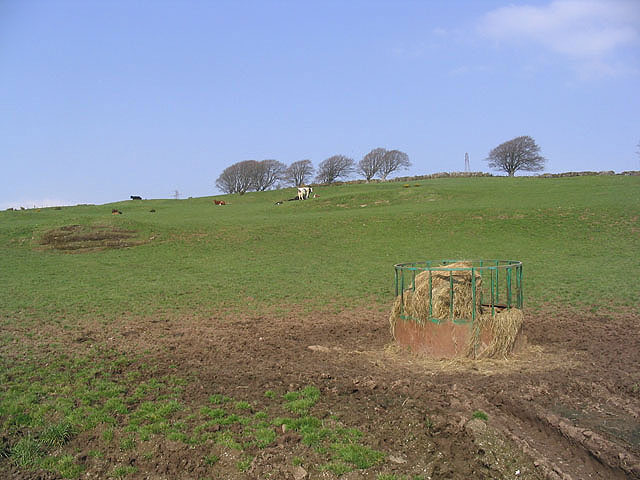
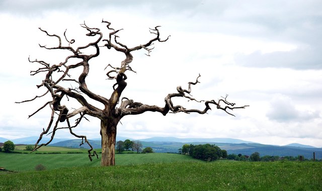
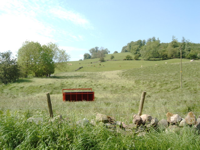
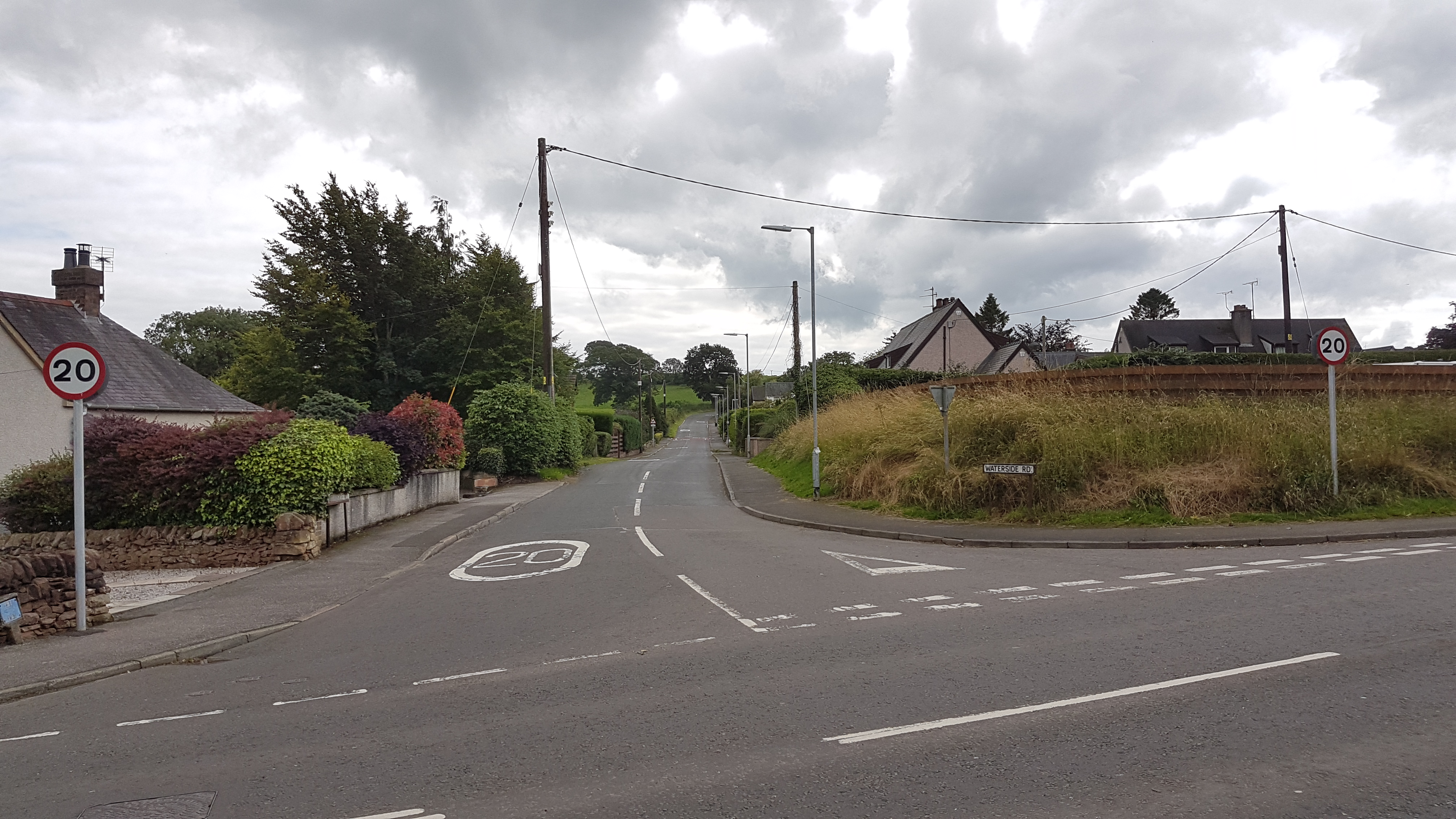
High Wood Images

Images are sourced within 2km of 55.056577/-3.6657262 or Grid Reference NX9374. Thanks to Geograph Open Source API. All images are credited.

Entrance to a yard at Garroch Business Park
Access road to council depot at Cargenbridge
Road junction with the A711
Old Milestone by the Old Military Road, Easthill, Lochrutton parish Stone post by the UC road, in parish of Lochrutton (Stewartry District), Easthill, on verge of North side of Old Military Road.

inscription once read:-
(Dumfries)
(4)

Surveyed

Milestone Society National ID: DG_DFCDUC04
Old Milestone by the Old Military Road, Easthill, Lochrutton parish
Stone post by the UC road, in parish of Lochrutton (Stewartry District), Easthill, on verge of North side of Old Military Road. inscription once read:- (Dumfries) (4) Surveyed Milestone Society National ID: DG_DFCDUC04
Goldielea House with viaduct behind, once carried the "Paddy" the direct railway to the Irish ferries.
Goldielea
House with viaduct behind, once carried the "Paddy" the direct railway to the Irish ferries.
Tower at Chemical Plant This is the Dupont Teijin Films plant on the outskirts of Dumfries.  Formerly (years ago), it was an ICI plant.
Tower at Chemical Plant
This is the Dupont Teijin Films plant on the outskirts of Dumfries. Formerly (years ago), it was an ICI plant.
Rabbits near entrance to Chemical Plant
Tregallon Farm Viewed from the old military road.
Tregallon Farm
Viewed from the old military road.
A country road at Carruchan
Cattle field On West Hill near Tregallon Farm.
Cattle field
On West Hill near Tregallon Farm.
Moss Road Single track road, viewed near Dalbeattie Rd end heading toward New Abbey Road
Moss Road
Single track road, viewed near Dalbeattie Rd end heading toward New Abbey Road
Road near Cargenbridge
Twister Impressive lone tree - with view over towards Terregles.  Can be seen above from the A75 as you leave Dumfries heading towards Stranraer, locally known as "The Glen" road.
Twister
Impressive lone tree - with view over towards Terregles. Can be seen above from the A75 as you leave Dumfries heading towards Stranraer, locally known as "The Glen" road.
Field on the side of Hoods Hill near Terregles
A75 Bridge
A75 Bridge
Old railway viaduct
Old railway viaduct
Maxwelltown Cycle Path, route no. 7 of the National Cycle Path Network It follows the route of a disused railway at this point.
Maxwelltown Cycle Path, route no. 7 of the National Cycle Path Network
It follows the route of a disused railway at this point.
Cargen Water seen from an old railway bridge, now a cycle path.
Cargen Water
seen from an old railway bridge, now a cycle path.
Show me another place!

High Wood is located at Grid Ref: NX9374 (Lat: 55.056577, Lng: -3.6657262)

Unitary Authority: Dumfries and Galloway

Police Authority: Dumfries and Galloway

What 3 Words

///foreheads.sooner.spurring. Near Dumfries, Dumfries & Galloway

Nearby Locations

High Wood West Hill

Related Wikis

Dumfries and Galloway Royal Infirmary

Dumfries and Galloway Royal Infirmary is the main hospital in Dumfries and Galloway, Scotland. The hospital is managed by NHS Dumfries and Galloway....

Cargenbridge

Cargenbridge is a village located in Dumfries and Galloway, United Kingdom, southwest of Dumfries. It is in Troqueer parish, in the historic county of...

Easthill stone circle

Easthill stone circle (grid reference NX91937388), also known as the Seven Grey Stanes, is a small oval stone circle 3¾ miles south-west of Dumfries. Eight...

Curriestanes cursus

Curriestanes cursus (grid reference NX 95990 75170) is a large neolithic ditched enclosure on the outskirts of Dumfries, in the parish of Troqueer, Dumfries...

Nearby Amenities

Located within 500m of 55.056577,-3.6657262
Power: tower
Lat/Long: 55.054954/-3.6611238
Place: farm
Lat/Long: 55.0596/-3.6701016
Power: tower
Lat/Long: 55.0549425/-3.6717618
Power: tower
Lat/Long: 55.0549475/-3.6671162
Steps
Lat/Long: 55.0577005/-3.6591713
Steps
Lat/Long: 55.0576102/-3.6591887
Steps
Lat/Long: 55.0573538/-3.6592361
Steps
Lat/Long: 55.0572713/-3.659255
Power: pole
Lat/Long: 55.0568144/-3.6723147
Power: pole
Lat/Long: 55.0564086/-3.6710609
Power: pole
Lat/Long: 55.0560173/-3.6694359
Power: pole
Lat/Long: 55.0557184/-3.6682266
Power: pole
Lat/Long: 55.0553879/-3.6668965
Power: pole
Lat/Long: 55.0550573/-3.6655579
Power: pole
Lat/Long: 55.054818/-3.6646499
Power: pole
Lat/Long: 55.054547/-3.6636167
Power: pole
Lat/Long: 55.0540196/-3.662172
Power: pole
Lat/Long: 55.0535044/-3.660827
The data included in this document is from www.openstreetmap.org. The data is made available under ODbL.

Have you been to High Wood?

Leave your review of High Wood below (or comments, questions and feedback).