Craigend Wood

Wood, Forest in Stirlingshire

Scotland

Craigend Wood

War Memorial, Standburn This war memorial is unusual since it is in the form of a memorial fountain. It is made from silver grey granite and occupies a very prominent position in the village of Standburn on the B825, Avonbridge to Linlithgow road.
War Memorial, Standburn Credit: G Laird

Craigend Wood is a picturesque woodland located in Stirlingshire, Scotland. Covering an area of approximately 57 hectares, this ancient forest is a haven for nature lovers and outdoor enthusiasts alike. The wood is situated on the eastern slopes of the Campsie Fells, offering breathtaking views of the surrounding landscape.

Characterized by its diverse range of trees, Craigend Wood is predominantly made up of native broadleaf species such as oak, birch, and ash, which create a rich and vibrant canopy. The forest floor is adorned with a variety of wildflowers, including bluebells and wood anemones, adding a splash of color to the woodland during springtime.

The wood is crisscrossed by a network of well-maintained footpaths and trails, making it an ideal destination for walkers and hikers. These paths wind through the forest, leading visitors to hidden gems such as a tranquil pond and a small waterfall, adding to the charm and serenity of the woodland experience.

Craigend Wood is also home to a diverse array of wildlife. Birdwatchers can spot species such as woodpeckers, owls, and various songbirds, while lucky visitors might catch a glimpse of red squirrels and roe deer. The forest provides a vital habitat for these creatures, contributing to the overall biodiversity of the area.

Overall, Craigend Wood is a natural treasure within Stirlingshire, offering visitors a chance to immerse themselves in the beauty of nature. Whether one is seeking a peaceful stroll or a more challenging hike, this enchanting woodland provides a serene escape from the hustle and bustle of everyday life.

If you have any feedback on the listing, please let us know in the comments section below.

Craigend Wood Images

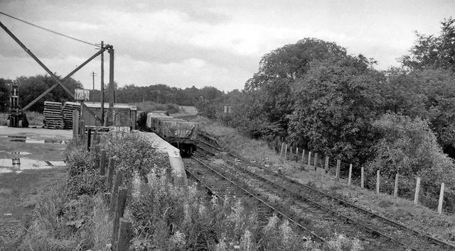
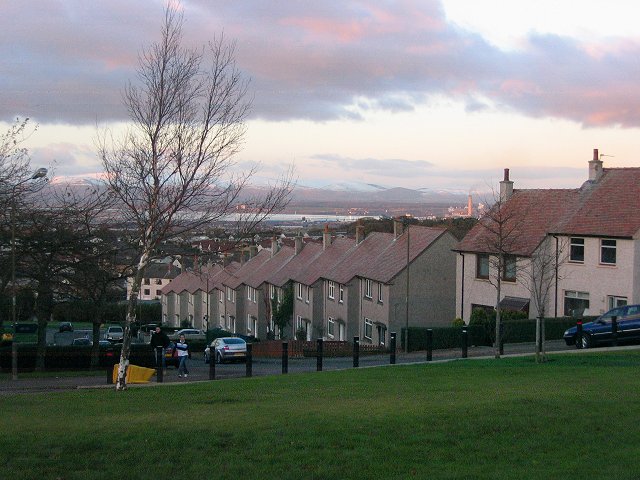
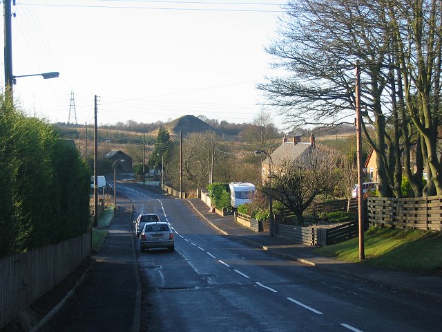
Images are sourced within 2km of 55.960591/-3.7051258 or Grid Reference NS9375. Thanks to Geograph Open Source API. All images are credited.

War Memorial, Standburn This war memorial is unusual since it is in the form of a memorial fountain. It is made from silver grey granite and occupies a very prominent position in the village of Standburn on the B825, Avonbridge to Linlithgow road.
War Memorial, Standburn
This war memorial is unusual since it is in the form of a memorial fountain. It is made from silver grey granite and occupies a very prominent position in the village of Standburn on the B825, Avonbridge to Linlithgow road.
Near Snabhead Pasture above Maddiston.
Near Snabhead
Pasture above Maddiston.
Field by Woodend Cottage Awaiting the sheep with hay racks still out from the previous Winter.
Field by Woodend Cottage
Awaiting the sheep with hay racks still out from the previous Winter.
Car park, Candie Woods Now overgrown with a locked gate. The paths within the wood are pretty much overgrown.
Car park, Candie Woods
Now overgrown with a locked gate. The paths within the wood are pretty much overgrown.
Candie Woods Maturing nicely. The path leads into the woodland from the now closed car park.
Candie Woods
Maturing nicely. The path leads into the woodland from the now closed car park.
Overgrown path, Candie Woods The Sitka have filled the space used by a path.  This is what the place looked like in 2005 <a href="https://www.geograph.org.uk/photo/85199">NS9374 : Candie Wood.</a>
Overgrown path, Candie Woods
The Sitka have filled the space used by a path. This is what the place looked like in 2005 NS9374 : Candie Wood.
Candie Woods Maturing nicely. View towards the car park, now blocked off.
Candie Woods
Maturing nicely. View towards the car park, now blocked off.
Field by Whitstonedge Candie, Stirlingshire.
Field by Whitstonedge
Candie, Stirlingshire.
California Road, Maddiston That is California, Stirlingshire not West Lothian.
California Road, Maddiston
That is California, Stirlingshire not West Lothian.
Maddiston Evangelical Church On California Road.
Maddiston Evangelical Church
On California Road.
Old Milepost by the B825, Easter Bowhouse, Muiravonside parish Stirling GM casting by the B825, in parish of Muiravonside (Falkirk District), 150m East of A801 junction, in front of low wall and bungalow in field, North side of road.

Surveyed

Milestone Society National ID: FK_LLAV04
Old Milepost by the B825, Easter Bowhouse, Muiravonside parish
Stirling GM casting by the B825, in parish of Muiravonside (Falkirk District), 150m East of A801 junction, in front of low wall and bungalow in field, North side of road. Surveyed Milestone Society National ID: FK_LLAV04
B825. Loan Passing Muiravonside. The signs appear confusing with a diversion heading for a road closure.
B825. Loan
Passing Muiravonside. The signs appear confusing with a diversion heading for a road closure.
Metal Milestone on North Side of B725 near Roundabout From a distance I thought this was a stone milestone but on closer inspection discovered it was a painted metal plate, so, not being an expert on these things, don't know whether they have been occasionally constructed like this for generations, or whether it is a replacement for a lost or damaged older one. 
It should be noted that the more knowledgeable Milestone Society describe it as an old milestone on their picture from 2009, since when it has been handsomely repainted.
Metal Milestone on North Side of B725 near Roundabout
From a distance I thought this was a stone milestone but on closer inspection discovered it was a painted metal plate, so, not being an expert on these things, don't know whether they have been occasionally constructed like this for generations, or whether it is a replacement for a lost or damaged older one. It should be noted that the more knowledgeable Milestone Society describe it as an old milestone on their picture from 2009, since when it has been handsomely repainted.
Cattle, California Road
Maddiston
Maddiston
Maddiston
Maddiston
Ion Engagement Centre (Maddiston Inn)
Minor roads by Melonsplace
Show me another place!

Craigend Wood is located at Grid Ref: NS9375 (Lat: 55.960591, Lng: -3.7051258)

Unitary Authority: Falkirk

Police Authority: Forth Valley

What 3 Words

///splash.grapes.cable. Near Maddiston, Falkirk

Nearby Locations

Craigend Wood

Related Wikis

Bowhouse railway station

Bowhouse railway station served the suburb of Bowhouse, Falkirk, Scotland, from the 1840s to 1964 on the Slamannan Railway. == History == The station was...

Maddiston

Maddiston is a village in the Falkirk council area of Scotland. It lies 3.8 miles (6.1 km) west-southwest of Linlithgow, 1.3 miles (2.1 km) south of Polmont...

Standburn

Standburn is a small village which lies within the Falkirk council area in central Scotland. It is located 1.3 miles (2.1 km) south-west of Maddiston,...

Rumford, Falkirk

Rumford is a small village between Maddiston and Brightons in the Falkirk council area, of Scotland. The village went through a great deal of expansion...

Nearby Amenities

Located within 500m of 55.960591,-3.7051258
Barrier: motorcycle_barrier
Foot: yes
Lat/Long: 55.9580871/-3.7109808
The data included in this document is from www.openstreetmap.org. The data is made available under ODbL.

Have you been to Craigend Wood?

Leave your review of Craigend Wood below (or comments, questions and feedback).