Alton Barnes

Settlement in Wiltshire

England

Alton Barnes

Stanton St Bernard (Wiltshire) The parish church of All Saints
Stanton St Bernard (Wiltshire) Credit: ChurchCrawler

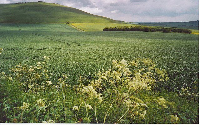
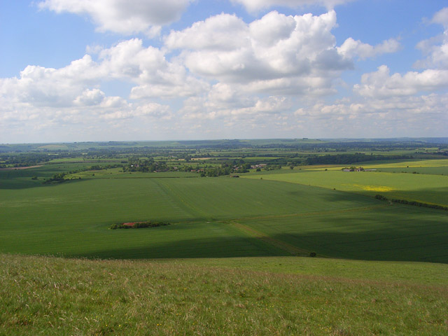
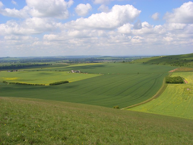
Alton Barnes is a small village located in the county of Wiltshire, England. Situated in the heart of the picturesque Vale of Pewsey, it is surrounded by rolling countryside and offers a tranquil and idyllic setting. The village is part of the civil parish of Alton, and is approximately 7 miles east of the town of Devizes.

The village is known for its charming rural character, with traditional thatched cottages, historic buildings, and a close-knit community. The main focal point of the village is the 12th-century Church of St. Mary the Virgin, which is a Grade I listed building and features a stunning Norman doorway and a medieval font.

Alton Barnes is also renowned for its connection to the ancient practice of crop circles. Every summer, these intricate and mysterious formations appear in the nearby fields, attracting visitors from around the world. The village has become a hub for crop circle enthusiasts, with dedicated tours and events taking place during the season.

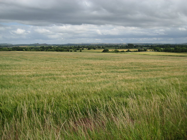
The Pewsey Vale, which surrounds Alton Barnes, offers breathtaking scenery and is a popular destination for outdoor activities such as walking, cycling, and horse riding. The nearby Alton Barnes White Horse, a chalk hill figure dating back to the late 18th century, is another prominent landmark and a popular spot for hikers and nature lovers.

In terms of amenities, Alton Barnes has a village hall, a primary school, and a local pub, providing essential services for residents and visitors alike. The village is well-connected by road, with the A361 passing close by, providing easy access to nearby towns and cities.

If you have any feedback on the listing, please let us know in the comments section below.
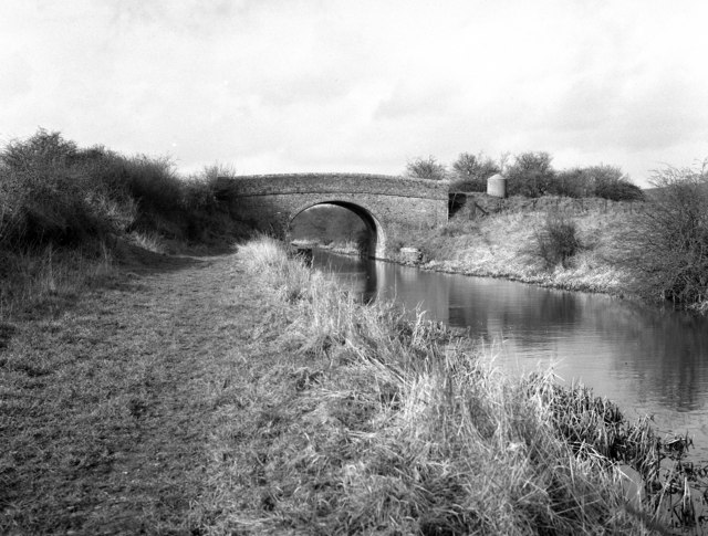
Alton Barnes Images

Images are sourced within 2km of 51.357556/-1.852474 or Grid Reference SU1062. Thanks to Geograph Open Source API. All images are credited.

Stanton St Bernard (Wiltshire) The parish church of All Saints
Stanton St Bernard (Wiltshire)
The parish church of All Saints
Kennet & Avon Canal Stanton Bridge
Kennet & Avon Canal
Stanton Bridge
Kennet & Avon Canal Kennet & Avon Canal East of Stanton Bridge
Kennet & Avon Canal
Kennet & Avon Canal East of Stanton Bridge
Downland West of Milk Hill. Rolling grassy fields north-west of Pewsey lead up to Milk Hill which has a white horse carved on the other side of it.
Downland West of Milk Hill.
Rolling grassy fields north-west of Pewsey lead up to Milk Hill which has a white horse carved on the other side of it.
Kennet and Avon Canal The White Horse Trail also runs along the towpath beside this section of the canal.
Kennet and Avon Canal
The White Horse Trail also runs along the towpath beside this section of the canal.
View towards the Alton Barnes White Horse The crop fields and trees to be found in this area contrast with the almost treeless downland on the hills.

The Alton Barnes White Horse was constructed in 1812.  It can be seen here between Milk Hill on the left and Walkers Hill to the right of centre.
View towards the Alton Barnes White Horse
The crop fields and trees to be found in this area contrast with the almost treeless downland on the hills. The Alton Barnes White Horse was constructed in 1812. It can be seen here between Milk Hill on the left and Walkers Hill to the right of centre.
Stanton Bridge, Kennet and Avon Canal Stanton Bridge carries a minor metalled road, so why the 'tank trap' visible on the right is there is a mystery, as clearly it cannot obstruct the passage of the bridge.
Stanton Bridge, Kennet and Avon Canal
Stanton Bridge carries a minor metalled road, so why the 'tank trap' visible on the right is there is a mystery, as clearly it cannot obstruct the passage of the bridge.
West Stanton, or England's, Bridge, Kennet and Avon Canal This bridge, here seen from the east, carries a right of way on foot only, otherwise it is of little importance.
West Stanton, or England's, Bridge, Kennet and Avon Canal
This bridge, here seen from the east, carries a right of way on foot only, otherwise it is of little importance.
England's Bridge - No.126 - K&A Canal Stanton St.Bernard 2004 The "bridge 'oles" on this canal as originally designed by John Rennie are a little eccentric, the towpath side being slightly flattened.
Rennie was also the engineer of the Lancaster Canal so it is not surprising that the bridges there have a similar appearance.
England's Bridge - No.126 - K&A Canal Stanton St.Bernard 2004
The "bridge 'oles" on this canal as originally designed by John Rennie are a little eccentric, the towpath side being slightly flattened. Rennie was also the engineer of the Lancaster Canal so it is not surprising that the bridges there have a similar appearance.
Downland view, Stanton St Bernard This is the view from the rounded ridge protruding westwards from the top of Milk Hill. The farm buildings are just within this grid-square.
Downland view, Stanton St Bernard
This is the view from the rounded ridge protruding westwards from the top of Milk Hill. The farm buildings are just within this grid-square.
Farmland, Stanton St Bernard These fields of wheat and rape are typical of the Vale of Pewsey and are viewed from west of Milk Hill, on the scarp that defines the northern extent of the Vale. Etchilhampton Hill, an isolated chalk hill, is seen in the background.
Farmland, Stanton St Bernard
These fields of wheat and rape are typical of the Vale of Pewsey and are viewed from west of Milk Hill, on the scarp that defines the northern extent of the Vale. Etchilhampton Hill, an isolated chalk hill, is seen in the background.
Downland view, Stanton St Bernard A view across the Vale of Pewsey towards Salisbury Plain. The group of old farm buildings, left of centre, is beside the footpath between the village and Milk Hill.
Downland view, Stanton St Bernard
A view across the Vale of Pewsey towards Salisbury Plain. The group of old farm buildings, left of centre, is beside the footpath between the village and Milk Hill.
Downland view, Stanton St Bernard A view of the western part of the Vale of Pewsey where arable fields dominate the scene.
Downland view, Stanton St Bernard
A view of the western part of the Vale of Pewsey where arable fields dominate the scene.
Farmland, All Cannings Alongside the wooded margin on the northern side of the Kennet and Avon Canal.
Farmland, All Cannings
Alongside the wooded margin on the northern side of the Kennet and Avon Canal.
Pillbox, Stanton St Bernard Just north of the Kennet and Avon Canal to the west of the village. In the background you can see the Alton Barnes White Horse.
Pillbox, Stanton St Bernard
Just north of the Kennet and Avon Canal to the west of the village. In the background you can see the Alton Barnes White Horse.
Church Road, Stanton St Bernard Some of the village's more modern houses. The church is dedicated to All Saints.
Church Road, Stanton St Bernard
Some of the village's more modern houses. The church is dedicated to All Saints.
The Street, Stanton St Bernard Corner Cottage at the junction of The Street (ahead), Church Road (behind) and Coate Lane (left).
The Street, Stanton St Bernard
Corner Cottage at the junction of The Street (ahead), Church Road (behind) and Coate Lane (left).
Main road, Stanton St Bernard The Pewsey to Devizes road which skirts to the north of the village.
Main road, Stanton St Bernard
The Pewsey to Devizes road which skirts to the north of the village.
Show me another place!

Alton Barnes is located at Grid Ref: SU1062 (Lat: 51.357556, Lng: -1.852474)

Unitary Authority: Wiltshire

Police Authority: Wiltshire

What 3 Words

///piglet.soil.burden. Near Woodborough, Wiltshire

Nearby Locations

Alton Barnes

Related Wikis

Nearby Amenities

Located within 500m of 51.357556,-1.852474
Honeystreet
Place: village
Lat/Long: 51.3534085/-1.854174
Crop Circle Visitor Centre & Exhibition
Tourism: attraction
Website: https://www.cropcircleaccess.com
Lat/Long: 51.3533916/-1.8525549
Post Box
Brand: Royal Mail
Brand Wikidata: Q638098
Collection Times: Mo-Fr 09:00; Sa 07:00
Drive Through: no
Operator: Royal Mail
Operator Wikidata: Q638098
Post Box Type: lamp
Ref: SN8 94D
Royal Cypher: EIIR
Royal Cypher Wikidata: Q33102113
Lat/Long: 51.3571619/-1.8492139
Post Box
Brand: Royal Mail
Brand Wikidata: Q638098
Collection Times: Mo-Fr 09:00; Sa 07:00
Drive Through: no
Operator: Royal Mail
Operator Wikidata: Q638098
Post Box Type: wall
Ref: SN9 12D
Royal Cypher: EIIR
Royal Cypher Wikidata: Q33102113
Lat/Long: 51.353626/-1.8524621
The data included in this document is from www.openstreetmap.org. The data is made available under ODbL.

Have you been to Alton Barnes?

Leave your review of Alton Barnes below (or comments, questions and feedback).