Black Plantation
Wood, Forest in Perthshire
Scotland
Black Plantation

Black Plantation is a picturesque woodland located in Perthshire, Scotland. It covers an area of approximately 100 hectares and is renowned for its stunning natural beauty and rich biodiversity. The plantation is situated near the village of Blackford, just a short distance from the historic city of Perth.
The woodland is predominantly made up of mature coniferous trees, including pine, spruce, and fir. These towering trees create a dense canopy, providing a cool and shaded environment, especially during the summer months. The forest floor is covered in a thick carpet of mosses, ferns, and wildflowers, creating a vibrant and enchanting atmosphere.
Black Plantation is home to a diverse range of wildlife, including various bird species such as red kites, buzzards, and owls. The woodland also supports a healthy population of red squirrels, which can often be spotted darting between the trees. Additionally, the plantation is known to be a habitat for deer and other small mammals.
The woodland offers several well-maintained trails, allowing visitors to explore its natural wonders. These paths wind through the forest, offering breathtaking views of the surrounding landscape. The plantation is a popular destination for nature enthusiasts, walkers, and birdwatchers, who can enjoy the tranquility and serenity of the woodland.
Overall, Black Plantation in Perthshire is a captivating woodland that offers a peaceful retreat from the bustling city life. Its lush greenery, diverse wildlife, and scenic trails make it a perfect destination for nature lovers and those seeking to reconnect with nature.
If you have any feedback on the listing, please let us know in the comments section below.
Black Plantation Images
Images are sourced within 2km of 56.266882/-3.7468265 or Grid Reference NN9109. Thanks to Geograph Open Source API. All images are credited.


![South West from Barns Looking west, the main A9 is hidden [ as is the railway line ] but on extreme left you can see the A823 bridge taking you right, up towards Gleneagles. The first hedgerow beyond the cattle, marks the minor road heading back down towards Auchterarder.](https://s0.geograph.org.uk/photos/55/70/557036_c110f899.jpg)
![S/W from Barns Looking south east, the minor road joins the road coming down [left] from Barns heading towards Millhill.](https://s2.geograph.org.uk/photos/55/70/557046_e6dcb1e8.jpg)


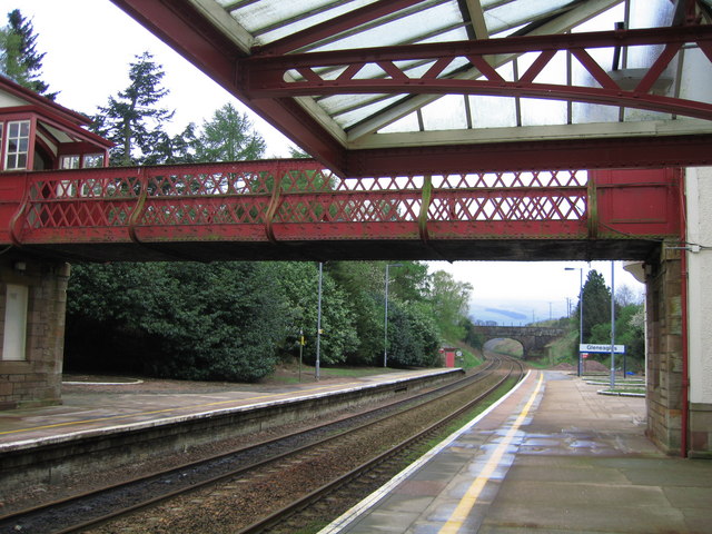
![Railway Bridge south of Station Looking west[ish] over the bridge. Gleneagles golf course is behind the distant trees.](https://s0.geograph.org.uk/photos/55/74/557456_ace07be2.jpg)

Black Plantation is located at Grid Ref: NN9109 (Lat: 56.266882, Lng: -3.7468265)
Unitary Authority: Perth and Kinross
Police Authority: Tayside
What 3 Words
///moon.engine.snowstorm. Near Auchterarder, Perth & Kinross
Nearby Locations
Related Wikis
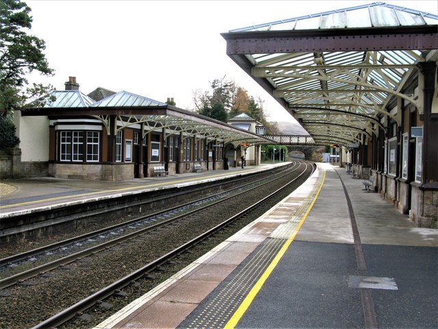
Gleneagles railway station
Gleneagles railway station serves the town of Auchterarder in Perth and Kinross, Scotland. == History == The station was opened by the Scottish Central...

Gleneagles (Scotland)
Glen Eagles (Scottish Gaelic: Gleann na h-Eaglais/Gleann Eagas) is a glen which connects with Glen Devon to form a pass through the Ochil Hills of Perth...
2018 European Golf Team Championships
The 2018 European Golf Team Championships was a golf tournament played in August 2018 at Gleneagles, Scotland. It was the inaugural event and consisted...

Blackford railway station
Blackford railway station served the village of Blackford, Perth and Kinross, Scotland from 1848 to 1956 on the Scottish Central Railway. == History... ==
2018 European Golf Team Championships – Men's team
The 2018 European Golf Team Championships men's team event was an event forming part of the 2018 European Golf Team Championships tournament being played...

2019 Solheim Cup
The 2019 Solheim Cup was the 16th edition of the Solheim Cup matches, held from 13 to 15 September at the Gleneagles PGA Centenary Course in Scotland....
2018 European Golf Team Championships – Mixed team
The 2018 European Golf Team Championships mixed team event was an event forming part of the 2018 European Golf Team Championships tournament being played...

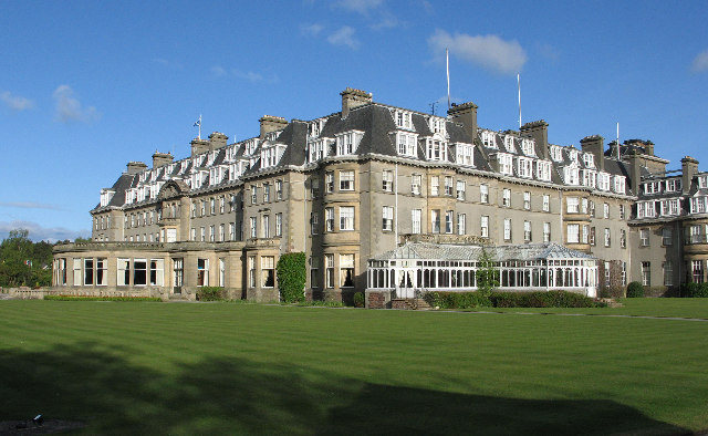
Gleneagles Hotel
Gleneagles Hotel is a hotel near Auchterarder, Scotland. It was commissioned by the Caledonian Railway and opened in 1924. The bandleader Henry Hall performed...
Nearby Amenities
Located within 500m of 56.266882,-3.7468265Have you been to Black Plantation?
Leave your review of Black Plantation below (or comments, questions and feedback).