Black Sea Wood

Wood, Forest in Kirkcudbrightshire

Scotland

Black Sea Wood

Dumfries and Galloway farmland Viewed from the B793
Dumfries and Galloway farmland Credit: Eirian Evans

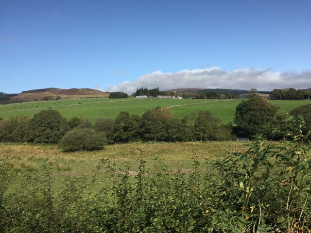
Black Sea Wood is a serene and captivating woodland located in the picturesque region of Kirkcudbrightshire, Scotland. Covering an area of approximately 100 acres, this enchanting forest is a haven for nature enthusiasts and outdoor adventurers alike.

The woodland is named after the Black Sea river, which runs through its heart, adding to the charm and beauty of the surroundings. With its dense canopy of towering trees, including oak, birch, and pine, Black Sea Wood offers a tranquil and peaceful atmosphere, making it an ideal escape from the hustle and bustle of daily life.

The forest is home to a rich and diverse array of flora and fauna. Wildflowers, such as bluebells and primroses, carpet the forest floor during the spring, creating a vibrant and colorful landscape. The woodland is also a sanctuary for various bird species, including woodpeckers, owls, and buzzards, making it a paradise for bird watchers.

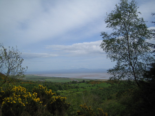
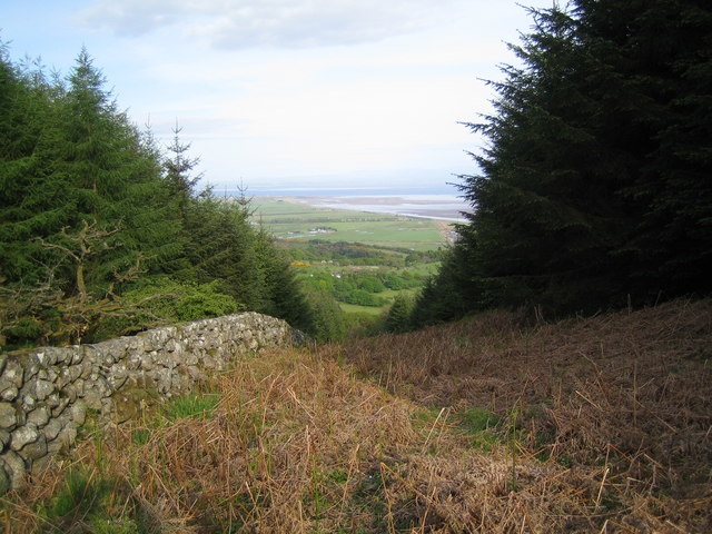
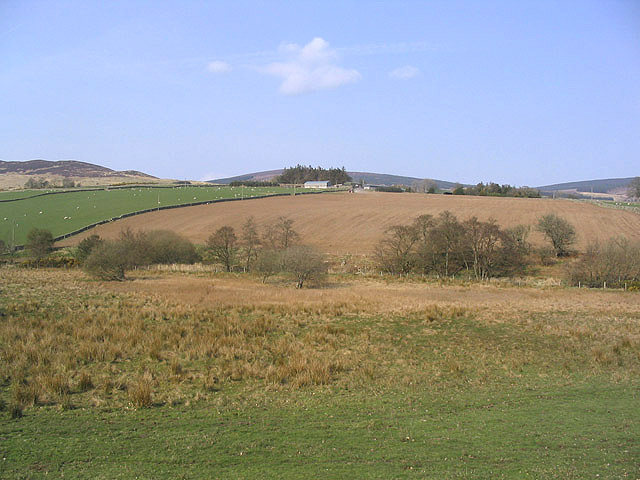
For those seeking adventure, Black Sea Wood offers a network of well-maintained trails, allowing visitors to explore its hidden treasures. Hiking through the forest unveils breathtaking views of the surrounding countryside, with glimpses of the nearby rolling hills and meandering streams.

In addition to its natural beauty, Black Sea Wood is also steeped in history and folklore. It is believed to have inspired many local myths and legends, adding an element of mystery and intrigue to the woodland.

Overall, Black Sea Wood in Kirkcudbrightshire is a captivating destination that offers a unique blend of natural beauty, wildlife, and history. Whether you are a nature lover, a hiker, or simply seeking a peaceful retreat, this enchanting forest is sure to leave a lasting impression.

If you have any feedback on the listing, please let us know in the comments section below.

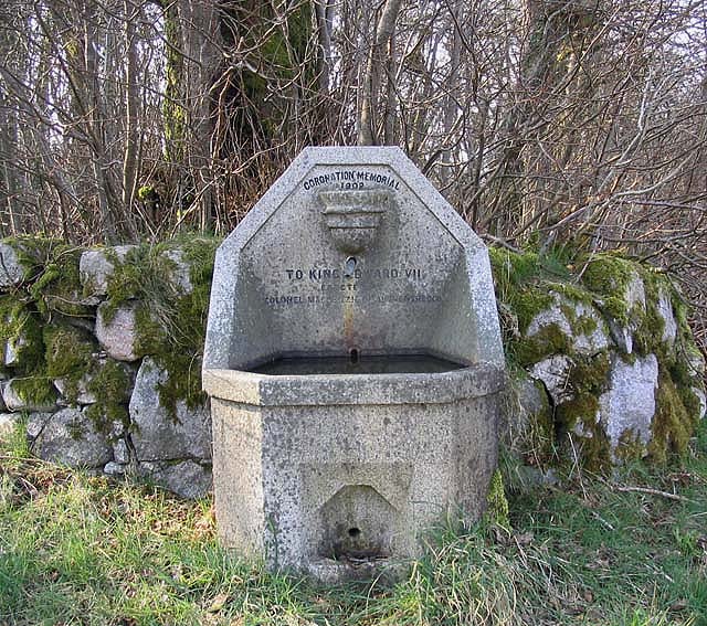
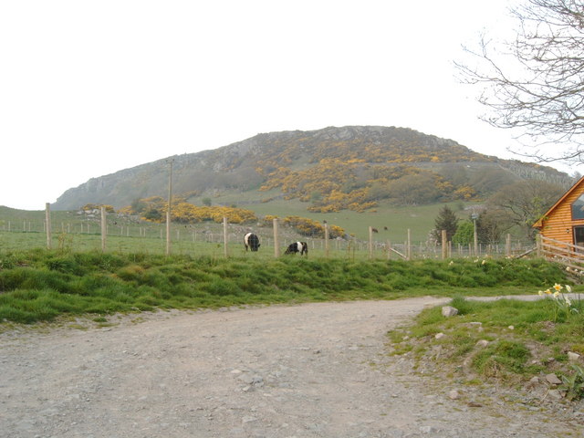
Black Sea Wood Images

Images are sourced within 2km of 54.902686/-3.7159658 or Grid Reference NX9057. Thanks to Geograph Open Source API. All images are credited.

Dumfries and Galloway farmland Viewed from the B793
Dumfries and Galloway farmland
Viewed from the B793
Cattle grazing near Bogfoot
View towards Mersehead Sands, Solway Firth The picture of Mersehead Sands was taken whilst ascending Bainloch Hill.
View towards Mersehead Sands, Solway Firth
The picture of Mersehead Sands was taken whilst ascending Bainloch Hill.
View down the firebreak to the Solway Firth
Cemetery near Sandyhills (former church)
Mixed farmland Viewed from the B793 with Glensone Farm in the background.
Mixed farmland
Viewed from the B793 with Glensone Farm in the background.
Coronation Memorial Fountain Dated 1902 to King Edward VII and erected by Colonel Mackenzie of Auchenskeoch. By the side of the B793.
Coronation Memorial Fountain
Dated 1902 to King Edward VII and erected by Colonel Mackenzie of Auchenskeoch. By the side of the B793.
Clifton Craig Info from a climbing website:  Clifton is one of Southern Scotland's best kept secrets. South facing, quick drying, close to the road and in a beautiful location: its only weak point is the diminutive stature of the climbs. However, these pack such a punch into their short length that they are guaranteed to leave you just as drained as a 50m pitch would on most other crags.  Please keep dogs on a lead when in the fields. In spring, peregrines often nest near The Main Area or Red Slab and these buttresses should be avoided at this time.
Clifton Craig
Info from a climbing website: Clifton is one of Southern Scotland's best kept secrets. South facing, quick drying, close to the road and in a beautiful location: its only weak point is the diminutive stature of the climbs. However, these pack such a punch into their short length that they are guaranteed to leave you just as drained as a 50m pitch would on most other crags. Please keep dogs on a lead when in the fields. In spring, peregrines often nest near The Main Area or Red Slab and these buttresses should be avoided at this time.
Clifton Craig From a climbing website: "Clifton is one of Southern Scotland's best kept secrets. South facing, quick drying, close to the road and in a beautiful location: its only weak point is the diminutive stature of the climbs. However, these pack such a punch into their short length that they are guaranteed to leave you just as drained as a 50m pitch would on most other crags.  Please keep dogs on a lead when in the fields. In spring, peregrines often nest near The Main Area or Red Slab and these buttresses should be avoided at this time."
Clifton Craig
From a climbing website: "Clifton is one of Southern Scotland's best kept secrets. South facing, quick drying, close to the road and in a beautiful location: its only weak point is the diminutive stature of the climbs. However, these pack such a punch into their short length that they are guaranteed to leave you just as drained as a 50m pitch would on most other crags. Please keep dogs on a lead when in the fields. In spring, peregrines often nest near The Main Area or Red Slab and these buttresses should be avoided at this time."
Entrance to Southwick Cemetery
Southwick Cemetery The neat little wall surrounding Southwick cemetery - and the old Yew trees within.
Southwick Cemetery
The neat little wall surrounding Southwick cemetery - and the old Yew trees within.
Weathered Gravestones at Southwick Cemetery.
The "Beltie" Belted Galloway Bull - licking his lips or picking his nose?
The "Beltie"
Belted Galloway Bull - licking his lips or picking his nose?
Castle Farm Sign Many of the farm signs in this area are highly individual - fun representations of the farms they signify.
Castle Farm Sign
Many of the farm signs in this area are highly individual - fun representations of the farms they signify.
Southwick cemetery Geographers in this square obviously have a thing about mortality.
Southwick cemetery
Geographers in this square obviously have a thing about mortality.
Belted Galloway cows and calf Debbie's 'Beltie' bull <a href="https://www.geograph.org.uk/photo/675197">NX9156 : The "Beltie"</a> obviously did his job.
Belted Galloway cows and calf
Debbie's 'Beltie' bull NX9156 : The "Beltie" obviously did his job.
Clonyard Farm Isolated hill farm enclosed by Hawthorn Hill and Clonyard Wood.  The farm retains some old farm buildings including a horse engine shed (right of photograph).
Clonyard Farm
Isolated hill farm enclosed by Hawthorn Hill and Clonyard Wood. The farm retains some old farm buildings including a horse engine shed (right of photograph).
Millbank Hill View SE on a unusually wet and windy June day towards the coast showing the Clonyard Farm fields on the eastern slopes of Millbank Hill.
Millbank Hill
View SE on a unusually wet and windy June day towards the coast showing the Clonyard Farm fields on the eastern slopes of Millbank Hill.
Show me another place!

Black Sea Wood is located at Grid Ref: NX9057 (Lat: 54.902686, Lng: -3.7159658)

Unitary Authority: Dumfries and Galloway

Police Authority: Dumfries and Galloway

What 3 Words

///suspends.bearable.routines. Near Dalbeattie, Dumfries & Galloway

Related Wikis

Colvend and Southwick

Colvend and Southwick is a community council area and civil parish within the Stewartry area of Dumfries and Galloway, Scotland. It is also part of the...

Criffel

Criffel is a hill in the historical county of Kirkcudbrightshire, Dumfries and Galloway, south-west Scotland. It is 570 m (1,870 ft) high but appears higher...

Rockcliffe, Dumfries and Galloway

Rockcliffe is a small, coastal village in Kirkcudbrightshire, Dumfries and Galloway in Scotland, with a view of Rough Island, Hestan Island, the Solway...

Kippford

Kippford (/ˈkɪpfəd/; otherwise Scaur) is a small village along the Solway coast, in the historic county of Kirkcudbrightshire in Dumfries and Galloway...

Nearby Amenities

Located within 500m of 54.902686,-3.7159658
Power: pole
Lat/Long: 54.8996757/-3.7116399
Power: pole
Lat/Long: 54.9003552/-3.7124121
Power: pole
Lat/Long: 54.9011017/-3.7133243
Power: pole
Lat/Long: 54.9018006/-3.7141093
Power: pole
Lat/Long: 54.9023898/-3.7147966
Power: pole
Lat/Long: 54.9030948/-3.7156006
Power: pole
Lat/Long: 54.9035815/-3.7169774
Power: pole
Lat/Long: 54.9039255/-3.7179894
Power: pole
Lat/Long: 54.9043304/-3.7191434
Power: pole
Lat/Long: 54.9046927/-3.7202275
Power: pole
Lat/Long: 54.9051013/-3.7214176
Power: pole
Lat/Long: 54.9070423/-3.714437
Power: pole
Lat/Long: 54.906696/-3.7151753
Power: pole
Lat/Long: 54.9063581/-3.7159008
The data included in this document is from www.openstreetmap.org. The data is made available under ODbL.

Have you been to Black Sea Wood?

Leave your review of Black Sea Wood below (or comments, questions and feedback).