Coille Sròn an Duine

Wood, Forest in Perthshire

Scotland

Coille Sròn an Duine

Ruins at Ach Mhairc Mhoir The remains of a depopulated township in Glen Tilt. In total it comprises twenty-seven buildings, four corn-drying kilns and several enclosures within an area of lazy-bed cultivation and clearance heaps. The remains vary from grass covered footings 0.5m high to drystone walls 1.5m high suggesting two phases of depopulation, the first beginning about 1850. See <span class="nowrap"><a title="https://canmore.org.uk/site/25886/ach-mhaire-mhoir" rel="nofollow ugc noopener" href="https://canmore.org.uk/site/25886/ach-mhaire-mhoir">Link</a><img style="margin-left:2px;" alt="External link" title="External link - shift click to open in new window" src="https://s1.geograph.org.uk/img/external.png" width="10" height="10"/></span>

The name means 'big field/meadow of the horse', I think, although I may be corrected by a proper Gaelic scholar.
Ruins at Ach Mhairc Mhoir Credit: Alan O'Dowd

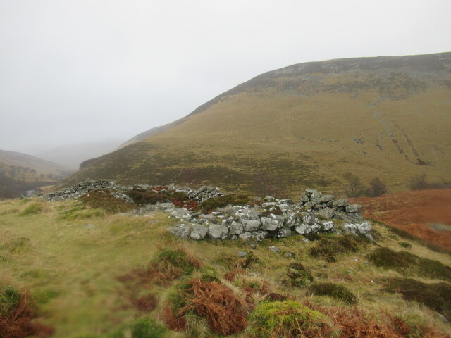
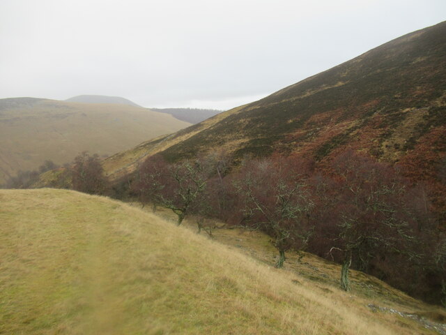
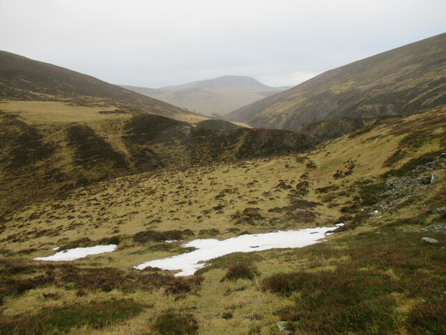
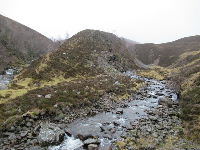
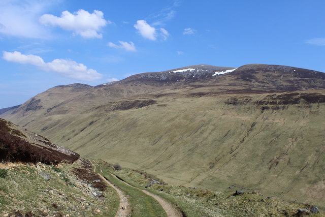
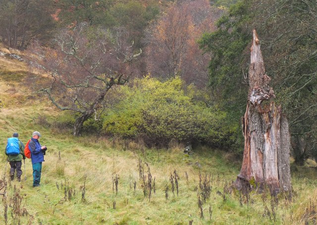
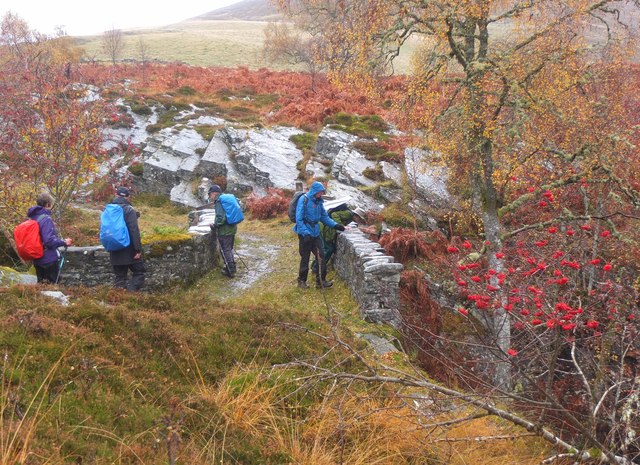
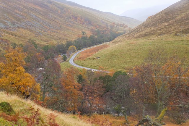
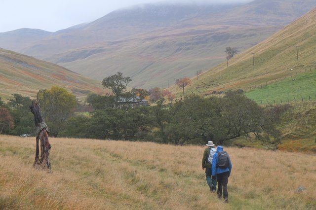
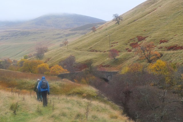
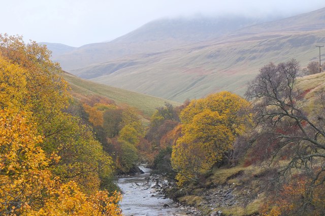
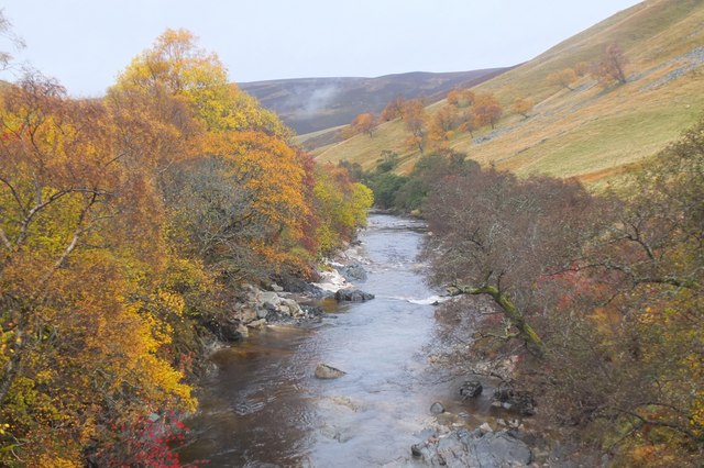
Coille Sròn an Duine, located in Perthshire, Scotland, is a picturesque wood or forest that attracts nature enthusiasts and outdoor adventurers alike. Spanning across a vast area, this woodland is known for its breathtaking beauty and diverse flora and fauna.

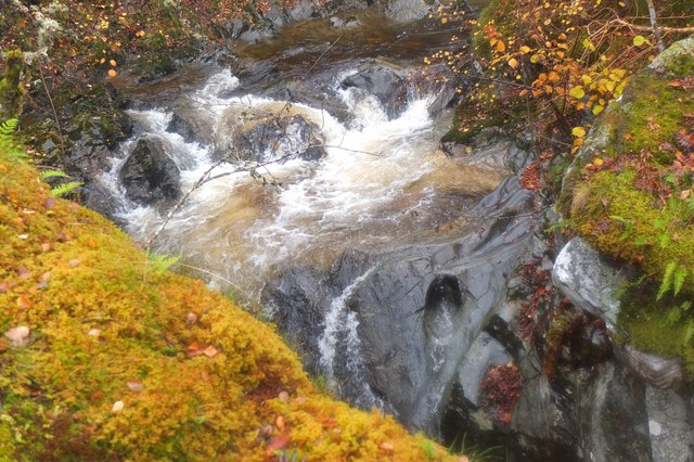
The forest boasts a rich variety of tree species, including oak, birch, and pine, creating a dense canopy that provides a cool shade during summer months. The woodland floor is adorned with a carpet of wildflowers, adding vibrant colors to the serene landscape. Visitors can expect to encounter a plethora of wildlife, such as red squirrels, roe deer, and a variety of bird species, making it a haven for wildlife enthusiasts and birdwatchers.

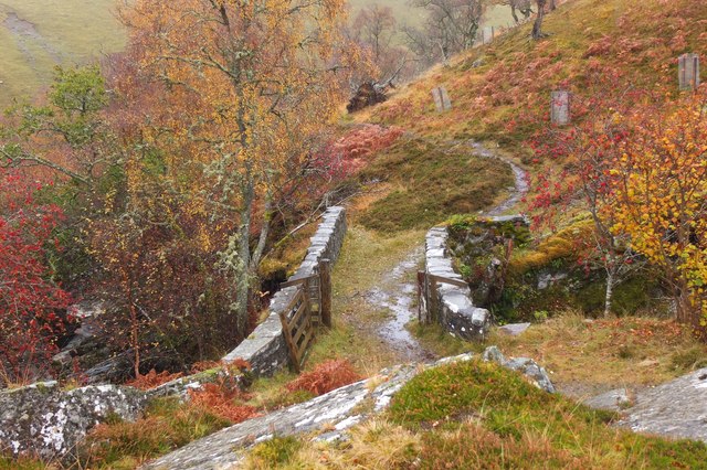
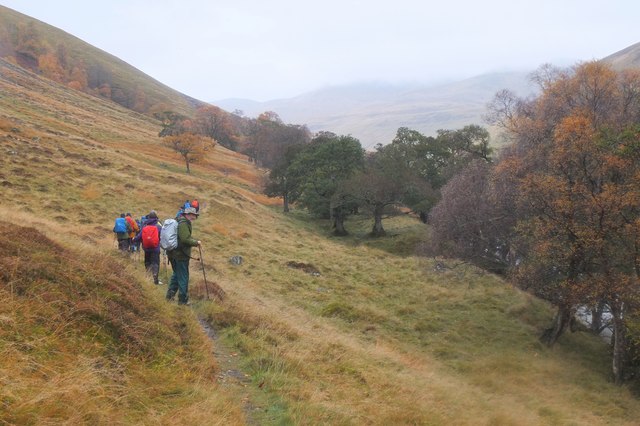
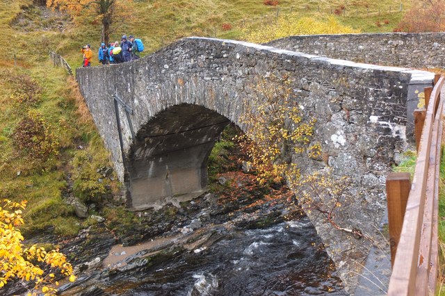
Coille Sròn an Duine offers a range of outdoor activities for visitors to immerse themselves in the natural surroundings. Hiking trails meander through the forest, allowing adventurers to explore the hidden gems within. The tranquil atmosphere also makes it an ideal spot for peaceful walks, picnics, and photography.

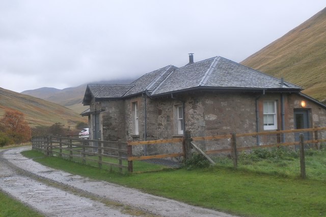
The forest is well-maintained, with designated picnic areas and well-marked trails for visitors' convenience and safety. The management team also conducts educational programs and guided tours, providing insights into the forest's ecology and conservation efforts.

Coille Sròn an Duine truly offers a captivating experience for nature enthusiasts, providing a respite from the hustle and bustle of city life. Whether it is the scenic beauty, diverse wildlife, or outdoor activities, this woodland has something to offer everyone seeking a connection with nature.

If you have any feedback on the listing, please let us know in the comments section below.

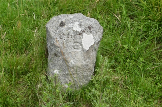
Coille Sròn an Duine Images

Images are sourced within 2km of 56.824641/-3.8079452 or Grid Reference NN8971. Thanks to Geograph Open Source API. All images are credited.

Ruins at Ach Mhairc Mhoir The remains of a depopulated township in Glen Tilt. In total it comprises twenty-seven buildings, four corn-drying kilns and several enclosures within an area of lazy-bed cultivation and clearance heaps. The remains vary from grass covered footings 0.5m high to drystone walls 1.5m high suggesting two phases of depopulation, the first beginning about 1850. See <span class="nowrap"><a title="https://canmore.org.uk/site/25886/ach-mhaire-mhoir" rel="nofollow ugc noopener" href="https://canmore.org.uk/site/25886/ach-mhaire-mhoir">Link</a><img style="margin-left:2px;" alt="External link" title="External link - shift click to open in new window" src="https://s1.geograph.org.uk/img/external.png" width="10" height="10"/></span>

The name means 'big field/meadow of the horse', I think, although I may be corrected by a proper Gaelic scholar.
Ruins at Ach Mhairc Mhoir
The remains of a depopulated township in Glen Tilt. In total it comprises twenty-seven buildings, four corn-drying kilns and several enclosures within an area of lazy-bed cultivation and clearance heaps. The remains vary from grass covered footings 0.5m high to drystone walls 1.5m high suggesting two phases of depopulation, the first beginning about 1850. See LinkExternal link The name means 'big field/meadow of the horse', I think, although I may be corrected by a proper Gaelic scholar.
Path on the east bank of the Allt Diridh ('the straight/perpendicular burn') Close to the ruined township of Ach Mhairc Mhoir.
Path on the east bank of the Allt Diridh ('the straight/perpendicular burn')
Close to the ruined township of Ach Mhairc Mhoir.
Hillside above the confluence of the Allt Diridh and Allt Mhairc Very snowless conditions for January, with this probably being the lowest remnant of any snow on this hill.

Allt Diridh translates from Gaelic as 'straight or perpendicular burn/stream' and Allt Mhairc means 'burn/stream of the horse'.
Hillside above the confluence of the Allt Diridh and Allt Mhairc
Very snowless conditions for January, with this probably being the lowest remnant of any snow on this hill. Allt Diridh translates from Gaelic as 'straight or perpendicular burn/stream' and Allt Mhairc means 'burn/stream of the horse'.
At the confluence of Allt Diridh and Allt Mhairc Allt Diridh ('straight or perpendicular burn') and Allt Mhairc ('burn of the horse') meet here, at the foot of Beinn Mheadhonach ('middle hill'), which may well have got its name from its position between the two burns.
At the confluence of Allt Diridh and Allt Mhairc
Allt Diridh ('straight or perpendicular burn') and Allt Mhairc ('burn of the horse') meet here, at the foot of Beinn Mheadhonach ('middle hill'), which may well have got its name from its position between the two burns.
Old milestone The track north up Glen Tilt from Blair Castle has many milestones marked on the 1898 OS Map from 2 miles from the castle to 13 just beyond the bridge over the Tarf Water.    This 6 mile stone is on the north side of the track, east of Balaneasie and the bridge over the Allt Craoinidh.   The roughly hewn stone has a 6 on the bevel
Old milestone
The track north up Glen Tilt from Blair Castle has many milestones marked on the 1898 OS Map from 2 miles from the castle to 13 just beyond the bridge over the Tarf Water. This 6 mile stone is on the north side of the track, east of Balaneasie and the bridge over the Allt Craoinidh. The roughly hewn stone has a 6 on the bevel
View towards Beinn a' Ghlo From the Carn a' Chlamain track
View towards Beinn a' Ghlo
From the Carn a' Chlamain track
Tree stump near the River Tilt The remains of a substantial tree in an area of rough grazing by the river.
Tree stump near the River Tilt
The remains of a substantial tree in an area of rough grazing by the river.
Ach-mhairc Bridge, Glen Tilt A stone bridge over the Allt Mhairc which originates at Loch Mhairc, not far from the headwaters of the Tarf Water.
Ach-mhairc Bridge, Glen Tilt
A stone bridge over the Allt Mhairc which originates at Loch Mhairc, not far from the headwaters of the Tarf Water.
Waterworn rock, Allt Mhairc In the rocky bed of the burn by the bridge; note the smoothed-out hole R of centre.
Waterworn rock, Allt Mhairc
In the rocky bed of the burn by the bridge; note the smoothed-out hole R of centre.
Ach-mhairc Bridge, Glen Tilt A stone bridge, very much in keeping with the surrounding rocky scenery.
Ach-mhairc Bridge, Glen Tilt
A stone bridge, very much in keeping with the surrounding rocky scenery.
Glen Tilt view A bend in the line of the glen seen from the path to Gaw's Bridge.
Glen Tilt view
A bend in the line of the glen seen from the path to Gaw's Bridge.
Path above the Tilt The path on the west bank to Gaw's Bridge.
Path above the Tilt
The path on the west bank to Gaw's Bridge.
Grassy path near Marble Lodge Marble Lodge is an Atholl Estates cottage in view through the pine trees. It is available for self-catering.

The path here is lower down than the one shown on the 1:25,000 map.
Grassy path near Marble Lodge
Marble Lodge is an Atholl Estates cottage in view through the pine trees. It is available for self-catering. The path here is lower down than the one shown on the 1:25,000 map.
Nearing Gaw's Bridge, Glen Tilt Here the main track up the glen crosses from the east to the west bank to continue for some distance past Forest Lodge and eventually through the wild country around the Geldie Burn to Deeside.
Nearing Gaw's Bridge, Glen Tilt
Here the main track up the glen crosses from the east to the west bank to continue for some distance past Forest Lodge and eventually through the wild country around the Geldie Burn to Deeside.
Gaw's Bridge, Glen Tilt A sturdy single-arch bridge just upstream from Marble Lodge.
Gaw's Bridge, Glen Tilt
A sturdy single-arch bridge just upstream from Marble Lodge.
Upstream from Gaw's Bridge, Glen Tilt In the background are the lower slopes of Braigh Coire Chruinn-bhalgain, one of the 1000m-plus tops of the Beinn a' Ghlo massif.
Upstream from Gaw's Bridge, Glen Tilt
In the background are the lower slopes of Braigh Coire Chruinn-bhalgain, one of the 1000m-plus tops of the Beinn a' Ghlo massif.
Downstream from Gaw's Bridge, Glen Tilt
Marble Lodge, Glen Tilt Perhaps not quite as grand from the outside as its name suggests, but this estate cottage is available for self-catering from Atholl Estates.
Marble Lodge, Glen Tilt
Perhaps not quite as grand from the outside as its name suggests, but this estate cottage is available for self-catering from Atholl Estates.
Show me another place!

Coille Sròn an Duine is located at Grid Ref: NN8971 (Lat: 56.824641, Lng: -3.8079452)

Unitary Authority: Perth and Kinross

Police Authority: Tayside

What 3 Words

///passenger.tables.rides. Near Blair Atholl, Perth & Kinross

Related Wikis

Glen Tilt

Glen Tilt (Scottish Gaelic: Gleann Teilt) is a glen in the extreme north of Perthshire, Scotland. Beginning at the confines of Aberdeenshire, it follows...

Càrn Liath (Munro)

Carn Liath (976 m) is a mountain in the Grampian Mountains of Scotland. It lies east of Blair Atholl in Perthshire, Scotland. Although belonging to the...

Carn a' Chlamain

Càrn a' Chlamain (Gaelic: Càrn a' Chlamhain) is a Scottish mountain situated roughly 12 kilometres north of Blair Atholl in the Forest of Atholl. It is...

Beinn a' Ghlò

Beinn a’ Ghlò is a Scottish mountain situated roughly 10 km (6 mi) north east of Blair Atholl in the Forest of Atholl in between Glen Tilt and Glen Loch...

Loch Moraig

Loch Moraig is a freshwater loch, located 2 miles northeast of Blair Atholl. Loch Moraig was an artificial loch, originally a Snipe marsh, that was dammed...

Lude House

Lude House (also known as House of Lude or Lude Estate) is a Category B listed country house and estate in Blair Atholl, Perth and Kinross, Scotland. It...

Bridge of Tilt

Bridge of Tilt (Scottish Gaelic: Drochaid Theilt) is a village in Perthshire, Scotland, built around the River Tilt (Scottish Gaelic: Abhainn Teilt), near...

Blair Atholl

Blair Atholl (from the Scottish Gaelic: Blàr Athall, originally Blàr Ath Fhodla) is a village in Perthshire, Scotland, built about the confluence of the...

Nearby Amenities

Located within 500m of 56.824641,-3.8079452
Barrier: cattle_grid
Lat/Long: 56.8243361/-3.8042931
Power: pole
Lat/Long: 56.8222362/-3.8136238
Power: pole
Lat/Long: 56.8223164/-3.8124667
Power: pole
Lat/Long: 56.8223917/-3.8114404
Power: pole
Lat/Long: 56.8224559/-3.8104186
Power: pole
Lat/Long: 56.8225324/-3.809363
Power: pole
Lat/Long: 56.8227571/-3.8084224
Power: pole
Lat/Long: 56.8230385/-3.8072517
Power: pole
Lat/Long: 56.8232891/-3.8062254
Power: pole
Lat/Long: 56.8235433/-3.8051878
Power: pole
Lat/Long: 56.823805/-3.8041593
Power: pole
Lat/Long: 56.824021/-3.8032796
Power: pole
Lat/Long: 56.8243505/-3.8018969
Power: pole
Lat/Long: 56.8246097/-3.8006406
The data included in this document is from www.openstreetmap.org. The data is made available under ODbL.

Have you been to Coille Sròn an Duine?

Leave your review of Coille Sròn an Duine below (or comments, questions and feedback).