Burnhead Moss
Wood, Forest in Stirlingshire
Scotland
Burnhead Moss

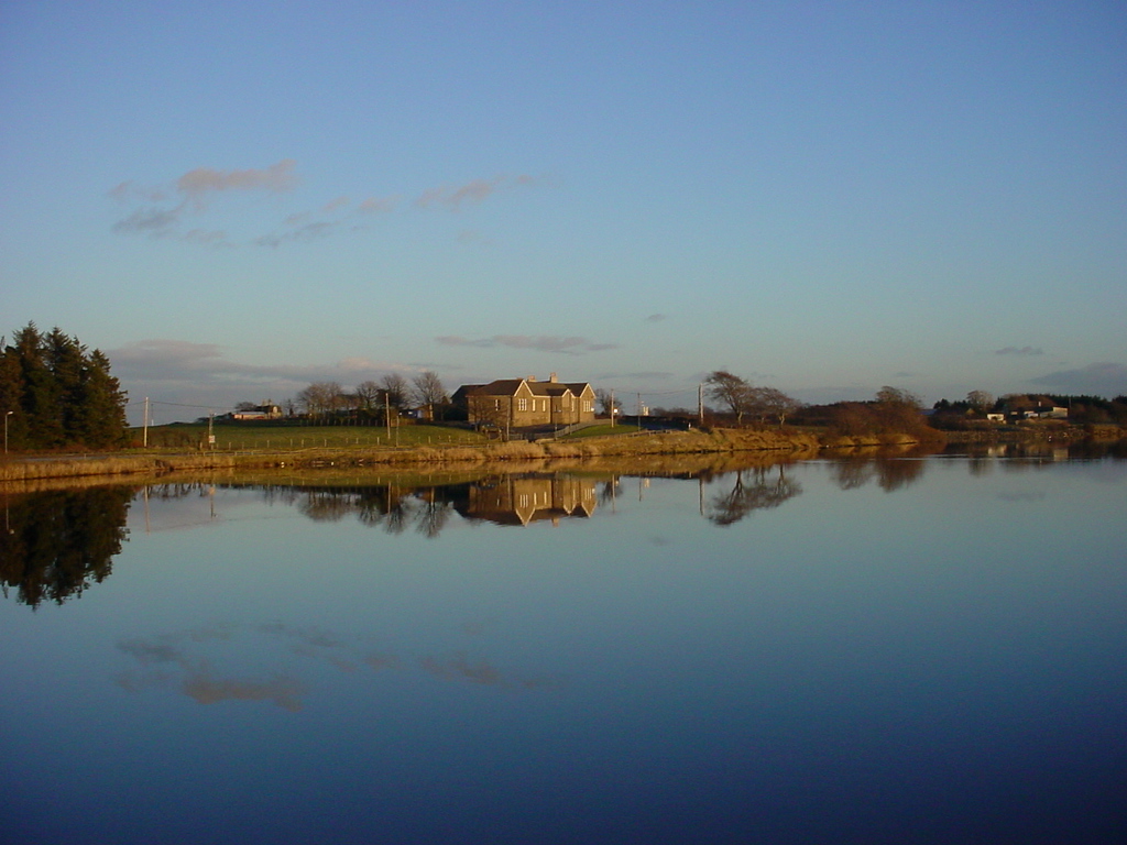
Burnhead Moss is a vast and ecologically significant woodland located in Stirlingshire, Scotland. Covering an area of approximately 1,000 acres, it is a prominent feature of the local landscape and has been designated as a Site of Special Scientific Interest (SSSI) due to its exceptional biodiversity and unique habitats.
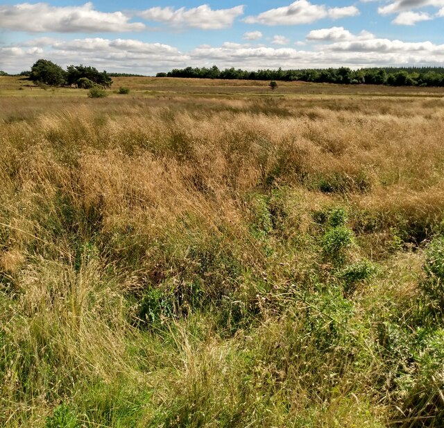
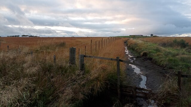
The moss comprises a mixture of wetland, peat bog, and woodland, creating a diverse and dynamic ecosystem. The wetland areas are characterized by the presence of sphagnum moss and various species of sedges and rushes, which thrive in the waterlogged conditions. These wetland habitats provide ideal breeding grounds for a range of bird species, including snipes, curlews, and lapwings.
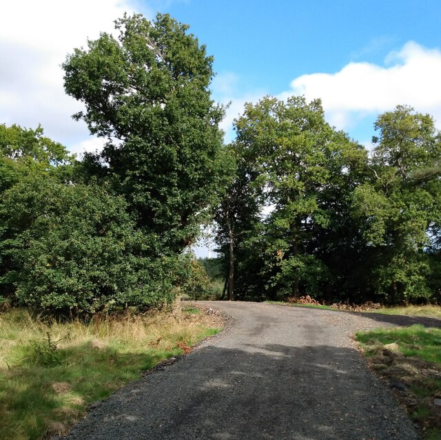
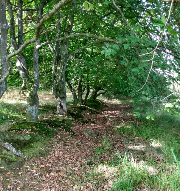
The woodland areas of Burnhead Moss are predominantly composed of native species such as birch, oak, and rowan, which support a diverse array of flora and fauna. The forest floor is carpeted with a rich tapestry of wildflowers, including bluebells, primroses, and wood sorrels, attracting a wide variety of insects and small mammals.
Burnhead Moss also plays a vital role in carbon capture and storage, as the peat bog acts as a natural carbon sink. The peat stores large amounts of carbon, further contributing to the site's ecological importance.
In addition to its environmental significance, Burnhead Moss offers recreational opportunities for visitors. Several walking trails wind through the woodland, providing a chance to explore the diverse habitats and observe the abundant wildlife. Interpretive panels along the trails offer educational information, enhancing the overall visitor experience.
Overall, Burnhead Moss is a valuable and captivating natural resource, providing a sanctuary for wildlife, supporting biodiversity, and offering an immersive experience for nature enthusiasts.
If you have any feedback on the listing, please let us know in the comments section below.
Burnhead Moss Images
Images are sourced within 2km of 55.908191/-3.7851201 or Grid Reference NS8869. Thanks to Geograph Open Source API. All images are credited.


Burnhead Moss is located at Grid Ref: NS8869 (Lat: 55.908191, Lng: -3.7851201)
Unitary Authority: Falkirk
Police Authority: Forth Valley
What 3 Words
///clasping.notion.void. Near Blackridge, West Lothian
Nearby Locations
Related Wikis

Blawhorn Moss
Blawhorn Moss is a raised bog located to the northwest of the village of Blackridge, about 6 kilometres (3.7 mi) west of Armadale in the council area of...
Black Loch
The Black Loch is a small freshwater loch or reservoir in the Falkirk council area, Scotland. It is near the village of Limerigg and close to the boundary...

Blackridge, West Lothian
Blackridge (Scots: Blackrig, Scottish Gaelic: An Druim Dubh) is a small town in the western part of West Lothian, Scotland. The village name dates to 1581...
Limerigg
Limerigg is a village in the Falkirk council area of Scotland. It lies on the B825 road between Slamannan and Caldercruix surrounded by extensive woodlands...

Hillend Loch Railway Path
The Hillend Loch Railway Path, also known as the Airdrie to Bathgate Railway Path, is a rail trail located in central Scotland. The path is approximately...
Westcraigs (1st station) railway station
Westcraigs railway station served the area of West Craigs (Blackridge) in West Lothian, Scotland, from 1862 to 1956 on the Bathgate and Coatbridge Railway...

Blackridge railway station
Blackridge railway station is a railway station on the North Clyde Line. It serves the village of Blackridge in West Lothian, Scotland. == History == The...
Slamannan railway station
Slamannan railway station served the village of Slamannan, Falkirk, Scotland, from 1840 to 1930 on the Slamannan Railway. == History == The station was...
Nearby Amenities
Located within 500m of 55.908191,-3.7851201Have you been to Burnhead Moss?
Leave your review of Burnhead Moss below (or comments, questions and feedback).