Barnsoul Wood

Wood, Forest in Kirkcudbrightshire

Scotland

Barnsoul Wood

Fallen Check it out on my Flickr page.

<span class="nowrap"><a title="www.flickr.com/photos/jetjohn/32819058425/in/dateposted-public/" rel="nofollow ugc noopener" href="http://www.flickr.com/photos/jetjohn/32819058425/in/dateposted-public/">Link</a><img style="margin-left:2px;" alt="External link" title="External link - shift click to open in new window" src="https://s1.geograph.org.uk/img/external.png" width="10" height="10"/></span>

At the Routin' Bridge - Irongray.
Fallen Credit: James Johnstone

Barnsoul Wood is a picturesque woodland located in Kirkcudbrightshire, Scotland. Covering an area of approximately 100 hectares, it is a popular destination for nature enthusiasts and outdoor enthusiasts alike. The wood is easily accessible from the nearby town of Dumfries, making it a convenient location for both locals and tourists.

The woodland is characterized by a diverse range of tree species, including oak, beech, birch, and Scots pine. These trees provide a vibrant canopy that offers shade and shelter to a variety of wildlife. Visitors can expect to encounter a plethora of bird species, such as woodpeckers, owls, and jays, as well as small mammals like red squirrels and badgers.

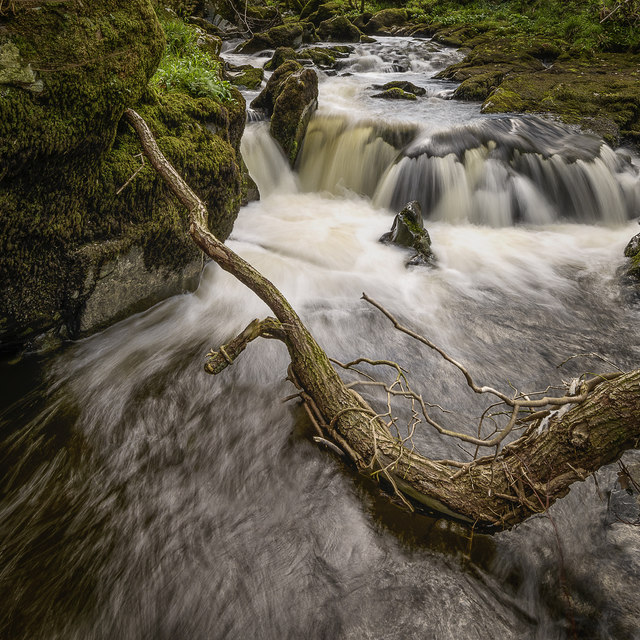
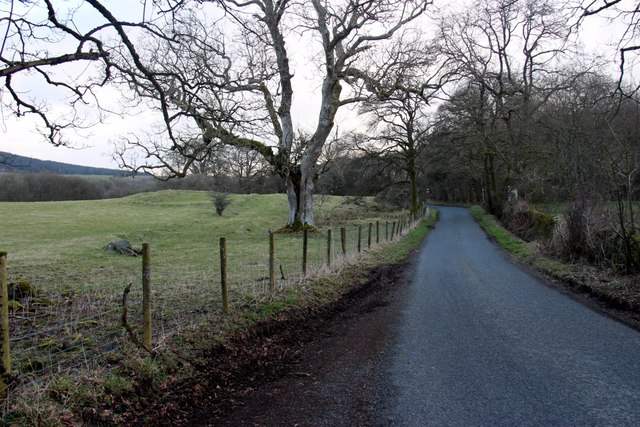
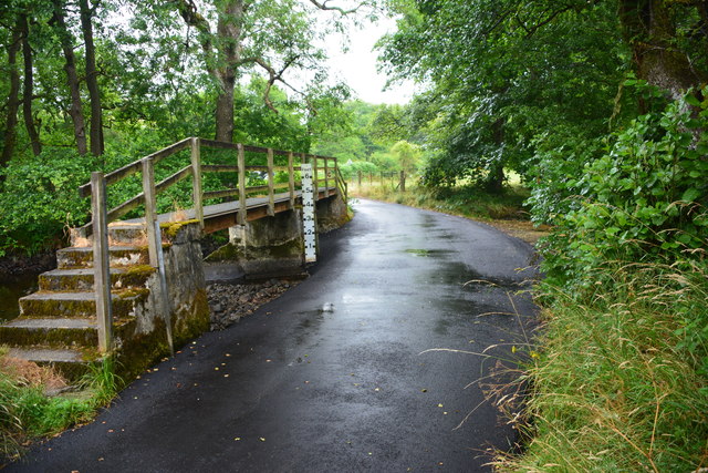
There are several well-maintained trails that wind through Barnsoul Wood, offering visitors the opportunity to explore its natural beauty. These paths vary in difficulty, catering to both casual walkers and more experienced hikers. Along the way, hikers can enjoy breathtaking views of the surrounding countryside and may even stumble upon a hidden waterfall or two.

In addition to its natural beauty, Barnsoul Wood also offers a range of recreational activities. There is a designated picnic area where visitors can relax and enjoy a meal amidst the tranquil surroundings. The wood is also popular for camping, with several designated camping spots available for those looking to spend a night under the stars.

Overall, Barnsoul Wood is a gem in Kirkcudbrightshire, offering a peaceful retreat for nature lovers and outdoor enthusiasts. Its diverse flora and fauna, combined with its accessibility and recreational opportunities, make it a must-visit destination for anyone seeking a true Scottish woodland experience.

If you have any feedback on the listing, please let us know in the comments section below.

Barnsoul Wood Images

Images are sourced within 2km of 55.081621/-3.7537002 or Grid Reference NX8877. Thanks to Geograph Open Source API. All images are credited.

Fallen Check it out on my Flickr page.

<span class="nowrap"><a title="www.flickr.com/photos/jetjohn/32819058425/in/dateposted-public/" rel="nofollow ugc noopener" href="http://www.flickr.com/photos/jetjohn/32819058425/in/dateposted-public/">Link</a><img style="margin-left:2px;" alt="External link" title="External link - shift click to open in new window" src="https://s1.geograph.org.uk/img/external.png" width="10" height="10"/></span>

At the Routin' Bridge - Irongray.
Fallen
Check it out on my Flickr page. LinkExternal link At the Routin' Bridge - Irongray.
Three rivers from the air Cairn Water and Old Water converge to form Cluden Water, immediately left of  the water treatment works which can be seen on the left.
Three rivers from the air
Cairn Water and Old Water converge to form Cluden Water, immediately left of the water treatment works which can be seen on the left.
Driveway to Oakbank
Driveway to Oakbank
Minor road to Knockshinnoch
Barnsoul Wood replanted
Drumclyer, a house near Old Water
Country road near Routin Bridge
Midrig Ford This newly tarmacadamed ford on Old Water is found at Midrig near Drumclyer.
Midrig Ford
This newly tarmacadamed ford on Old Water is found at Midrig near Drumclyer.
Old Cluden to Rosebank footpath Signeage on the Old Cluden to Rosebank footpath which is an old coffin road.
Old Cluden to Rosebank footpath
Signeage on the Old Cluden to Rosebank footpath which is an old coffin road.
Road through Barnsoul Wood
Ford and footbridge near Midrig
Ford and footbridge near Midrig An ordinary car can cross this easily when water levels are low.
Ford and footbridge near Midrig
An ordinary car can cross this easily when water levels are low.
Minor road near Crochmore
New Friends
New Friends
The road to Boreland
Beech Shadow
Beech Shadow
A domestic scene
A domestic scene
Prime Beef
Prime Beef
Show me another place!

Barnsoul Wood is located at Grid Ref: NX8877 (Lat: 55.081621, Lng: -3.7537002)

Unitary Authority: Dumfries and Galloway

Police Authority: Dumfries and Galloway

What 3 Words

///coining.mentions.unfounded. Near Dumfries, Dumfries & Galloway

Related Wikis

Newtonairds railway station

Newtonairds (NX877801) was one of the principal stations on the now closed Cairn Valley Light Railway branch from Dumfries. It served a very rural area...

Hallhill Covenanter Martyrs Memorial

The Hallhill Covenanter Martyrs Memorial at Irongray (NX 910797) near Kirkpatrick Irongray Church in the old county of Kirkcudbrightshire, now Dumfries...

Stepford railway station

Stepford (NX864815) was one of the minor request stop stations on the Cairn Valley Light Railway branch from Dumfries. It served a very rural area in...

Glenkiln Sculpture Park

Glenkiln Sculpture Park was a sculpture landscape in the historic county of Kirkcudbrightshire in Dumfries and Galloway, south-west Scotland. After one...

Nearby Amenities

Located within 500m of 55.081621,-3.7537002
Barnsoul
Place: locality
Source: OS_OpenData_StreetView
Lat/Long: 55.0808914/-3.7607415
Power: pole
Lat/Long: 55.0780112/-3.7574071
Power: pole
Lat/Long: 55.0788227/-3.7582852
Power: pole
Lat/Long: 55.0796594/-3.7591889
Power: pole
Lat/Long: 55.0803674/-3.7599441
Power: pole
Lat/Long: 55.0811397/-3.7607779
Power: pole
Lat/Long: 55.0819497/-3.7607779
Power: pole
Lat/Long: 55.0827621/-3.7607694
Power: pole
Lat/Long: 55.0785822/-3.756658
Power: pole
Lat/Long: 55.0791275/-3.7559346
Power: pole
Lat/Long: 55.083538/-3.7542077
Power: pole
Lat/Long: 55.083317/-3.7560873
Power: pole
Lat/Long: 55.0831264/-3.7577866
Power: pole
Lat/Long: 55.0829309/-3.7593438
The data included in this document is from www.openstreetmap.org. The data is made available under ODbL.

Have you been to Barnsoul Wood?

Leave your review of Barnsoul Wood below (or comments, questions and feedback).