Carrington

Settlement in Midlothian

Scotland

Carrington

Bridge at Carrington Mill Bridge on old path from Carrington Mill to Temple
<span class="nowrap"><a title="https://www.wikidata.org/wiki/Q56606505" rel="nofollow ugc noopener" href="https://www.wikidata.org/wiki/Q56606505">Link</a><img style="margin-left:2px;" alt="External link" title="External link - shift click to open in new window" src="https://s1.geograph.org.uk/img/external.png" width="10" height="10"/></span>
Bridge at Carrington Mill Credit: mountainmonkey

Carrington is a small village located in Midlothian, Scotland. Situated approximately 10 miles south of the capital city of Edinburgh, Carrington is nestled in a scenic countryside setting. The village is home to a population of around 500 residents, offering a close-knit community atmosphere.

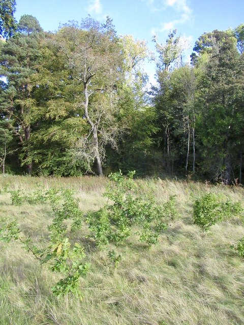
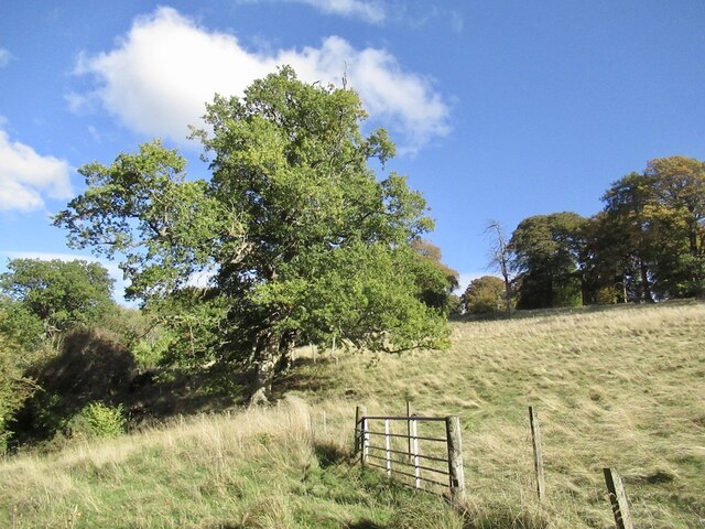
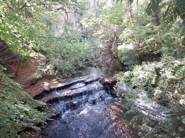
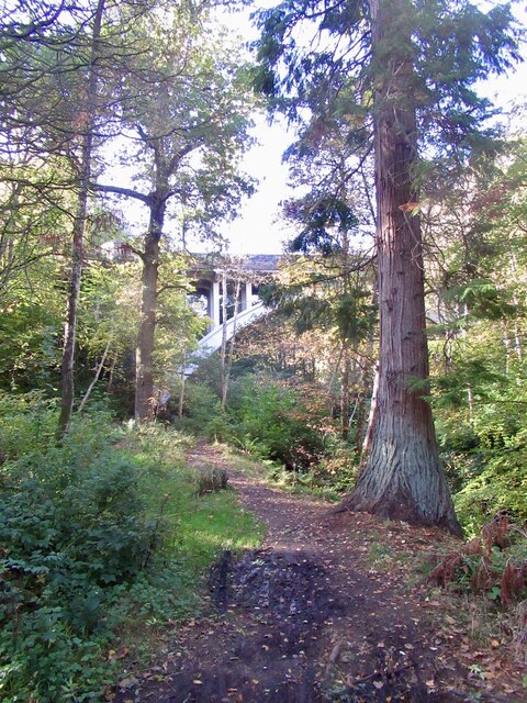
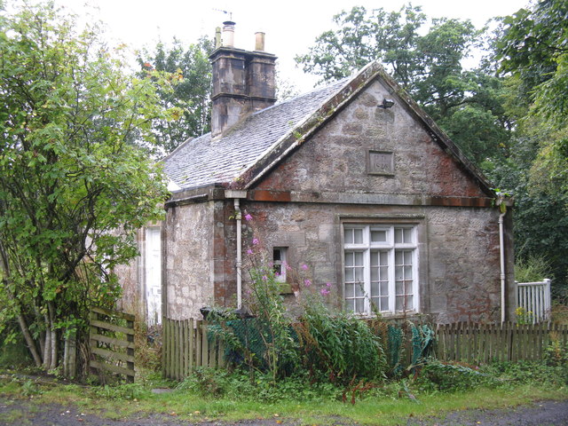
Carrington features a mix of traditional and modern architecture, with charming stone cottages and contemporary houses. The surrounding landscape is characterized by rolling hills, lush green fields, and picturesque woodlands, providing residents with stunning views and ample opportunities for outdoor activities.

Despite its small size, Carrington is well-equipped with amenities to cater to the needs of its residents. The village boasts a primary school, providing education to local children, and a community center that serves as a hub for various social events and gatherings. Additionally, there is a local pub where residents can relax and socialize.

Carrington's location provides convenient access to nearby towns and cities. The village is well-connected by road, with the A702 passing through, allowing for easy travel to Edinburgh and other surrounding areas. The nearby Pentland Hills Regional Park offers a range of recreational activities, including hiking, cycling, and horse riding.

Overall, Carrington offers a tranquil and idyllic setting for residents seeking a peaceful village lifestyle while still being within close proximity to urban amenities. With its beautiful surroundings and strong sense of community, Carrington is a desirable place to live for those seeking a balance between rural and urban living.

If you have any feedback on the listing, please let us know in the comments section below.

Carrington Images

Images are sourced within 2km of 55.833212/-3.0886829 or Grid Reference NT3160. Thanks to Geograph Open Source API. All images are credited.

Bridge at Carrington Mill Bridge on old path from Carrington Mill to Temple
<span class="nowrap"><a title="https://www.wikidata.org/wiki/Q56606505" rel="nofollow ugc noopener" href="https://www.wikidata.org/wiki/Q56606505">Link</a><img style="margin-left:2px;" alt="External link" title="External link - shift click to open in new window" src="https://s1.geograph.org.uk/img/external.png" width="10" height="10"/></span>
Bridge at Carrington Mill
Bridge on old path from Carrington Mill to Temple LinkExternal link
Young oak trees, Arniston A field which has not been grazed for a while. There is a nearby mature oak.
Young oak trees, Arniston
A field which has not been grazed for a while. There is a nearby mature oak.
Field, Arniston
Field, Arniston
Woodland, Arniston Estate There are some big trees here including this redwood.
Woodland, Arniston Estate
There are some big trees here including this redwood.
Woodland, Arniston Beside the South Esk. Home of some big trees.
Woodland, Arniston
Beside the South Esk. Home of some big trees.
River South Esk Downstream of Temple.
River South Esk
Downstream of Temple.
Braidwood Bridge Crossing the South Esk near Temple.
Braidwood Bridge
Crossing the South Esk near Temple.
Braidwood Bridge
Braidwood Bridge
Autumn at Arniston Under the canopy of a giant Beech tree, with a carpet of Beech leaves and looking towards one of the magnificent big conifers on the Arniston estate near Gorebridge.
Autumn at Arniston
Under the canopy of a giant Beech tree, with a carpet of Beech leaves and looking towards one of the magnificent big conifers on the Arniston estate near Gorebridge.
Arniston House Rear This is the back of Arniston House near Gorebridge, designed by William Adam in 1726 for Robert Dundas.
<span class="nowrap"><a title="https://arnistonhouse.com/" rel="nofollow ugc noopener" href="https://arnistonhouse.com/">Link</a><img style="margin-left:2px;" alt="External link" title="External link - shift click to open in new window" src="https://s1.geograph.org.uk/img/external.png" width="10" height="10"/></span>
Arniston House Rear
This is the back of Arniston House near Gorebridge, designed by William Adam in 1726 for Robert Dundas. LinkExternal link
B6372 near Braidwood Bridge
B6372 towards Gorebridge
Braidwood Bridge over the River South Esk Erected in 1811 by Robert Dundas of Arniston, Chief Baron of the Exchequer.
Braidwood Bridge over the River South Esk
Erected in 1811 by Robert Dundas of Arniston, Chief Baron of the Exchequer.
Inscription on Braidwood Bridge On the eastern parapet of the bridge <a href="https://www.geograph.org.uk/photo/2592804">NT3158 : Braidwood Bridge over the River South Esk</a>.
Inscription on Braidwood Bridge
On the eastern parapet of the bridge NT3158 : Braidwood Bridge over the River South Esk.
The River South Esk Looking down into the deep valley from the Braidwood Bridge.
The River South Esk
Looking down into the deep valley from the Braidwood Bridge.
Rain drops keep falling past my head Looking down into the River South Esk from Braidwood Bridge, through a canopy of alder and ash.
Rain drops keep falling past my head
Looking down into the River South Esk from Braidwood Bridge, through a canopy of alder and ash.
Beech Avenue Cottage With a date stone 'PD1826', and looking slightly unloved.
Beech Avenue Cottage
With a date stone 'PD1826', and looking slightly unloved.
Rowans at Arniston Looking towards the B6372 Gorebridge-Penicuik road at its junction with the road from Middleton, and by the [closed] gates to Arniston.
Rowans at Arniston
Looking towards the B6372 Gorebridge-Penicuik road at its junction with the road from Middleton, and by the [closed] gates to Arniston.
Show me another place!

Carrington is located at Grid Ref: NT3160 (Lat: 55.833212, Lng: -3.0886829)

Unitary Authority: Midlothian

Police Authority: The Lothians and Scottish Borders

What 3 Words

///creatures.devoured.things. Near Gorebridge, Midlothian

Nearby Locations

Carrington Hendean Wood

Related Wikis

Carrington, Midlothian

Carrington is a small, rural village in Midlothian, Scotland. It is located to the south of Bonnyrigg. The civil parish of the same name has a population...
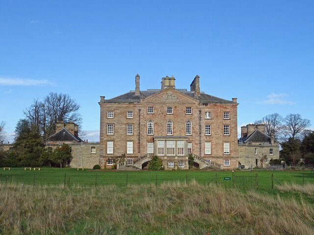
Arniston House

Arniston House is a historic house in Midlothian, Scotland, near the village of Temple. This Georgian mansion was designed by William Adam in 1726 for...

Midlothian (UK Parliament constituency)

Midlothian in Scotland is a county constituency of the House of Commons of the Parliament of the United Kingdom. It elects one Member of Parliament (MP...

Temple, Midlothian

Temple (Scottish Gaelic: Baile nan Trodach) is a village and civil parish in Midlothian, Scotland. Situated to the south of Edinburgh, the village lies...

Nearby Amenities

Located within 500m of 55.833212,-3.0886829
Traffic Calming: hump
Lat/Long: 55.8340577/-3.0875546
Midlothian
Gns Classification: ADM1
Gns Uni: -3579610
Is In Country: United Kingdom
Is In Country Code: GB
Place: county
Source: GNS
Lat/Long: 55.833333/-3.083333
Traffic Calming: hump
Lat/Long: 55.832834/-3.0915954
Carrington
Place: village
Wikidata: Q5046425
Lat/Long: 55.8336239/-3.0886232
Defibrillator
Access: yes
Booth: K6
Covered: booth
Defibrillator Location: inside old red phone box in front of church, Main St, Carrington
Disused Amenity: telephone
Emergency: defibrillator
Indoor: no
Man Made: telephone_box
Note: phonebox now owned by the community
Old Phone: +44 1875 830250
Source: survey
Lat/Long: 55.833472/-3.0891306
Post Box
Collection Times: Mo-Fr 15:15; Sa 11:45
Operator: Royal Mail
Post Box Type: wall
Ref: EH23 207
Royal Cypher: VR
Royal Cypher Wikidata: Q33102356
Lat/Long: 55.8334567/-3.0891886
Give Way
Direction: backward
Lat/Long: 55.8332954/-3.0887043
Traffic Calming: hump
Lat/Long: 55.8329462/-3.0910452
Traffic Calming: hump
Lat/Long: 55.8330696/-3.0904282
Advertising: board
Lat/Long: 55.8334308/-3.0892641
Bench
Backrest: yes
Lat/Long: 55.8334113/-3.0892883
Give Way
Direction: forward
Lat/Long: 55.8335434/-3.0884762
Give Way
Direction: forward
Lat/Long: 55.8333955/-3.0888185
Power: pole
Lat/Long: 55.833058/-3.0925474
Power: pole
Lat/Long: 55.8336162/-3.0926766
Power: pole
Lat/Long: 55.8341229/-3.0928037
Power: pole
Lat/Long: 55.8346331/-3.0929308
Power: pole
Lat/Long: 55.8349678/-3.0919557
Power: pole
Lat/Long: 55.8353036/-3.0909513
Power: pole
Lat/Long: 55.835609/-3.0900283
Power: pole
Lat/Long: 55.8363637/-3.0897282
Power: pole
Lat/Long: 55.8370529/-3.0895074
Power: pole
Lat/Long: 55.8313659/-3.0917202
Power: pole
Lat/Long: 55.831119/-3.0921515
Power: pole
Lat/Long: 55.8317181/-3.0923432
Power: pole
Lat/Long: 55.8308931/-3.0913181
Power: pole
Lat/Long: 55.8302764/-3.0908117
Power: pole
Lat/Long: 55.8294794/-3.0901658
Power: pole
Lat/Long: 55.8288509/-3.0897553
The data included in this document is from www.openstreetmap.org. The data is made available under ODbL.

Have you been to Carrington?

Leave your review of Carrington below (or comments, questions and feedback).