Clunas Moss
Wood, Forest in Nairnshire
Scotland
Clunas Moss

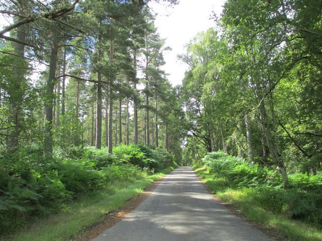
Clunas Moss is a wooded area located in Nairnshire, a county in the Highland region of Scotland. This picturesque moss is situated near the village of Clunas and covers a vast expanse of land, making it a popular destination for nature lovers and outdoor enthusiasts.
The moss is predominantly composed of dense forest and woodlands, characterized by a variety of tree species such as oak, birch, and pine. The lush greenery and towering trees create a serene and tranquil ambiance that attracts visitors seeking a peaceful retreat.
As an integral part of the Nairnshire landscape, Clunas Moss serves as a vital habitat for numerous wildlife species. It provides shelter and sustenance to a diverse range of animals, including red squirrels, roe deer, and various bird species. The moss is particularly renowned for its population of red kites, which can often be seen soaring gracefully through the skies.
Visitors to Clunas Moss can enjoy a range of outdoor activities such as walking, hiking, and birdwatching. There are well-maintained trails that wind through the moss, allowing visitors to explore its natural beauty at their own pace. The moss also features several viewpoints, providing breathtaking vistas of the surrounding countryside.
Clunas Moss is not only a haven for wildlife and nature enthusiasts but also serves as an important ecological site. Its preservation and conservation efforts ensure the longevity of the moss and its inhabitants, making it a valuable asset to the local community and the wider region of Nairnshire.
If you have any feedback on the listing, please let us know in the comments section below.
Clunas Moss Images
Images are sourced within 2km of 57.50188/-3.8775648 or Grid Reference NH8747. Thanks to Geograph Open Source API. All images are credited.


Clunas Moss is located at Grid Ref: NH8747 (Lat: 57.50188, Lng: -3.8775648)
Unitary Authority: Highland
Police Authority: Highlands and Islands
What 3 Words
///various.leaned.inversion. Near Nairn, Highland
Nearby Locations
Related Wikis

County of Nairn
The County of Nairn (also called Nairnshire) (Scottish Gaelic: Siorrachd Inbhir Narann) is a historic county, registration county and lieutenancy area...

Cawdor
Cawdor (Scottish Gaelic: Caladair) is a village and parish in the Highland council area, Scotland. The village is 5 miles (8 kilometres) south-southwest...
Culcharry
Culcharry is a small residential settlement, close to the village of Cawdor and the hamlet of Brackla, lying 4 miles southwest of Nairn, in Nairnshire...

Cawdor Castle
Cawdor Castle is a castle in the parish of Cawdor in Nairnshire, Scotland. It is built around a 15th-century tower house, with substantial additions in...
Piperhill
Piperhill is a village, located four miles south of Nairn in Nairnshire, Scottish Highlands and is in the Scottish council area of Highland.
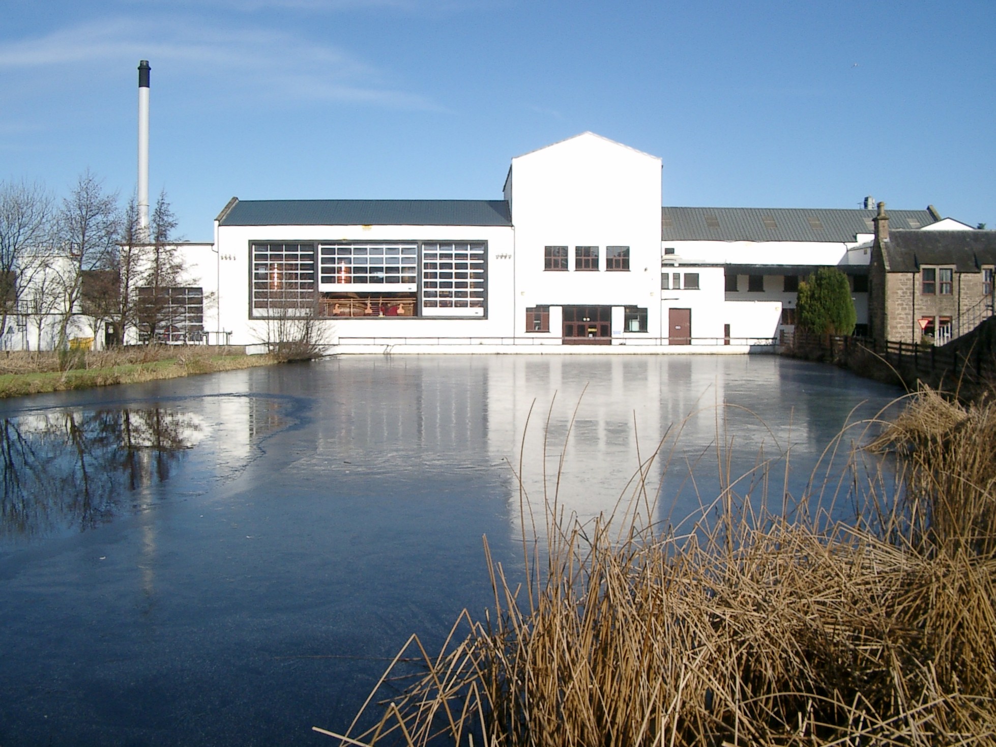
Royal Brackla distillery
Royal Brackla distillery is a Highland Scotch whisky distillery on the Cawdor Estate, near Nairn in Scotland. The distillery is operated by John Dewar...
Dun Evan
Dun Evan or the Doune of Cawdor is a hill fort located 2.5 kilometres (1.6 mi) south west of Cawdor in the Highland area of Scotland. It is situated on...
RAF Brackla
Royal Air Force Brackla or more simply RAF Brackla is a former Royal Air Force satellite station located in Scotland. == History == The following units...
Nearby Amenities
Located within 500m of 57.50188,-3.8775648Have you been to Clunas Moss?
Leave your review of Clunas Moss below (or comments, questions and feedback).