Boreland Wood

Wood, Forest in Kirkcudbrightshire

Scotland

Boreland Wood

Torrent Check it out on my Flickr page.

<span class="nowrap"><a title="www.flickr.com/photos/jetjohn/32467318296/in/dateposted-public/" rel="nofollow ugc noopener" href="http://www.flickr.com/photos/jetjohn/32467318296/in/dateposted-public/">Link</a><img style="margin-left:2px;" alt="External link" title="External link - shift click to open in new window" src="https://s1.geograph.org.uk/img/external.png" width="10" height="10"/></span>

At the Routin' Bridge - Irongray.

The only river strictly belonging to the parish is the Auld, which has its source on the confines of Kirkpatrick-Durham, and, after flowing for some miles through this parish in an eastern course, curves towards the north, and falls into the Cairn, which, afterwards taking the name of the Cluden, forms a boundary of the parish. The Auld water, near its influx into the Cairn, makes a small but picturesque cascade of two falls, the highest of which is twenty feet; and near the lower fall is a romantic bridge of one arch, which, from the noise of the water, has obtained the appellation of the Routing Bridge.

The above description is taken from  "A Topographical Dictionary of Scotland" by Samuel Lewis, published in 1846.
Torrent Credit: James Johnstone

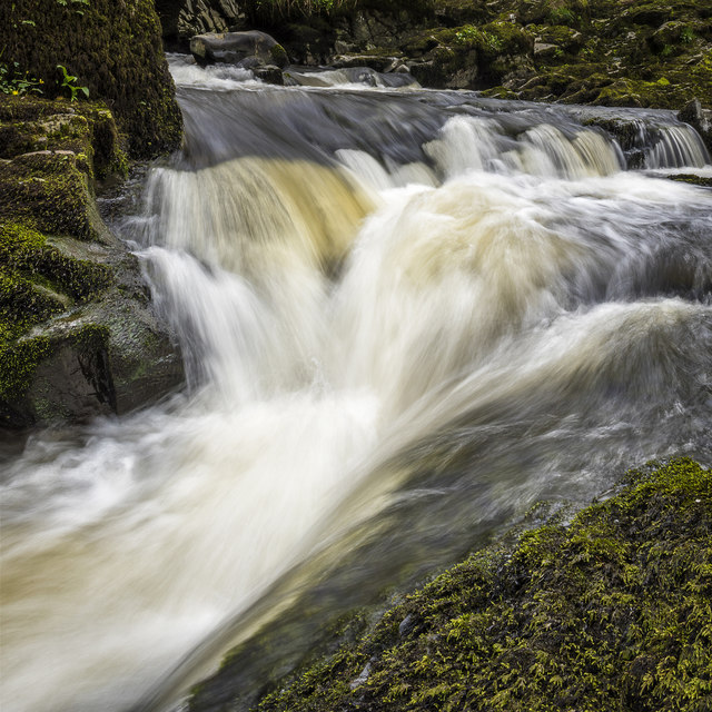
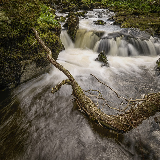
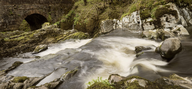
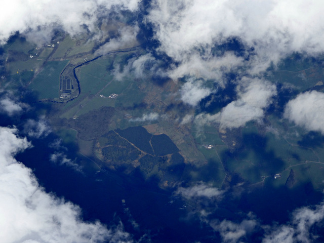
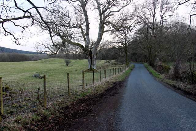
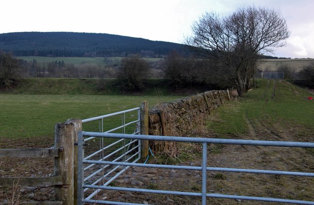
Boreland Wood is a scenic forest located in Kirkcudbrightshire, Scotland. Covering an area of approximately 300 hectares, the wood is characterized by a mix of native and exotic tree species, creating a diverse and vibrant ecosystem. The wood is home to a variety of wildlife, including red squirrels, roe deer, and a wide range of bird species.

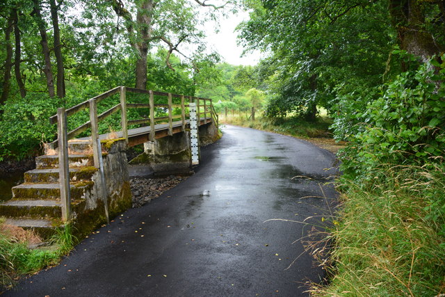
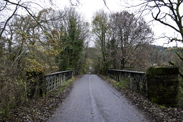
Visitors to Boreland Wood can enjoy a network of well-maintained trails that wind through the forest, providing opportunities for hiking, cycling, and wildlife spotting. The wood is also popular with birdwatchers, who come to catch a glimpse of rare species such as the red kite and the Scottish crossbill.

In addition to its natural beauty, Boreland Wood has historical significance, with remnants of ancient settlements and structures scattered throughout the forest. The wood is also a designated Site of Special Scientific Interest (SSSI), recognizing its importance for biodiversity and conservation.

Overall, Boreland Wood offers visitors a peaceful and serene escape into nature, with opportunities for recreation, exploration, and appreciation of the natural world.

If you have any feedback on the listing, please let us know in the comments section below.

Boreland Wood Images

Images are sourced within 2km of 55.094488/-3.7650927 or Grid Reference NX8779. Thanks to Geograph Open Source API. All images are credited.

Torrent Check it out on my Flickr page.

<span class="nowrap"><a title="www.flickr.com/photos/jetjohn/32467318296/in/dateposted-public/" rel="nofollow ugc noopener" href="http://www.flickr.com/photos/jetjohn/32467318296/in/dateposted-public/">Link</a><img style="margin-left:2px;" alt="External link" title="External link - shift click to open in new window" src="https://s1.geograph.org.uk/img/external.png" width="10" height="10"/></span>

At the Routin' Bridge - Irongray.

The only river strictly belonging to the parish is the Auld, which has its source on the confines of Kirkpatrick-Durham, and, after flowing for some miles through this parish in an eastern course, curves towards the north, and falls into the Cairn, which, afterwards taking the name of the Cluden, forms a boundary of the parish. The Auld water, near its influx into the Cairn, makes a small but picturesque cascade of two falls, the highest of which is twenty feet; and near the lower fall is a romantic bridge of one arch, which, from the noise of the water, has obtained the appellation of the Routing Bridge.

The above description is taken from  "A Topographical Dictionary of Scotland" by Samuel Lewis, published in 1846.
Torrent
Check it out on my Flickr page. LinkExternal link At the Routin' Bridge - Irongray. The only river strictly belonging to the parish is the Auld, which has its source on the confines of Kirkpatrick-Durham, and, after flowing for some miles through this parish in an eastern course, curves towards the north, and falls into the Cairn, which, afterwards taking the name of the Cluden, forms a boundary of the parish. The Auld water, near its influx into the Cairn, makes a small but picturesque cascade of two falls, the highest of which is twenty feet; and near the lower fall is a romantic bridge of one arch, which, from the noise of the water, has obtained the appellation of the Routing Bridge. The above description is taken from "A Topographical Dictionary of Scotland" by Samuel Lewis, published in 1846.
Fallen Check it out on my Flickr page.

<span class="nowrap"><a title="www.flickr.com/photos/jetjohn/32819058425/in/dateposted-public/" rel="nofollow ugc noopener" href="http://www.flickr.com/photos/jetjohn/32819058425/in/dateposted-public/">Link</a><img style="margin-left:2px;" alt="External link" title="External link - shift click to open in new window" src="https://s1.geograph.org.uk/img/external.png" width="10" height="10"/></span>

At the Routin' Bridge - Irongray.
Fallen
Check it out on my Flickr page. LinkExternal link At the Routin' Bridge - Irongray.
At The Routin' Bridge At the Routin' Bridge - Irongray.

Check it out on my Flickr page.

<span class="nowrap"><a title="https://flic.kr/p/R1gN57" rel="nofollow ugc noopener" href="https://flic.kr/p/R1gN57">Link</a><img style="margin-left:2px;" alt="External link" title="External link - shift click to open in new window" src="https://s1.geograph.org.uk/img/external.png" width="10" height="10"/></span>
At The Routin' Bridge
At the Routin' Bridge - Irongray. Check it out on my Flickr page. LinkExternal link
Three rivers from the air Cairn Water and Old Water converge to form Cluden Water, immediately left of  the water treatment works which can be seen on the left.
Three rivers from the air
Cairn Water and Old Water converge to form Cluden Water, immediately left of the water treatment works which can be seen on the left.
Barnsoul Wood replanted
Drumclyer, a house near Old Water
Country road near Routin Bridge
Disused Railway Embankment
Midrig Ford This newly tarmacadamed ford on Old Water is found at Midrig near Drumclyer.
Midrig Ford
This newly tarmacadamed ford on Old Water is found at Midrig near Drumclyer.
Cairn on Bishop Forest Hill An eight foot high well built cairn on the eastern side of Bishop Forest Hill.
Cairn on Bishop Forest Hill
An eight foot high well built cairn on the eastern side of Bishop Forest Hill.
Communion Stone Memorial "Communion Stones", Skeoch Hill: In a secluded hollow in the moorland at the N end of Skeoch Hill is a modern obelisk, bearing an inscription to the effect that at this spot a large number of Convenanters met in the summer of 1678 for worship and that about three thousand communicants on that occasion celebrated the sacrament of the Lord's Supper. To the NE of this monument are four distinct rows of flattish stones and a fifth less distinct stretching for a distance of from 40'-45' and 4' apart, on which the people are believed to have sat.
Communion Stone Memorial
"Communion Stones", Skeoch Hill: In a secluded hollow in the moorland at the N end of Skeoch Hill is a modern obelisk, bearing an inscription to the effect that at this spot a large number of Convenanters met in the summer of 1678 for worship and that about three thousand communicants on that occasion celebrated the sacrament of the Lord's Supper. To the NE of this monument are four distinct rows of flattish stones and a fifth less distinct stretching for a distance of from 40'-45' and 4' apart, on which the people are believed to have sat.
Skeoch Hill Rough grazing on Skeoch Hill for the many sheep around.
Skeoch Hill
Rough grazing on Skeoch Hill for the many sheep around.
Road through Barnsoul Wood
Ford and footbridge near Midrig
Ford and footbridge near Midrig An ordinary car can cross this easily when water levels are low.
Ford and footbridge near Midrig
An ordinary car can cross this easily when water levels are low.
Drumpark bridge
Drumpark bridge
Dalquhairn
Dalquhairn
New Friends
New Friends
Show me another place!

Boreland Wood is located at Grid Ref: NX8779 (Lat: 55.094488, Lng: -3.7650927)

Unitary Authority: Dumfries and Galloway

Police Authority: Dumfries and Galloway

What 3 Words

///spooked.excavated.decrease. Near Dumfries, Dumfries & Galloway

Related Wikis

Newtonairds railway station

Newtonairds (NX877801) was one of the principal stations on the now closed Cairn Valley Light Railway branch from Dumfries. It served a very rural area...

Stepford railway station

Stepford (NX864815) was one of the minor request stop stations on the Cairn Valley Light Railway branch from Dumfries. It served a very rural area in...

Hallhill Covenanter Martyrs Memorial

The Hallhill Covenanter Martyrs Memorial at Irongray (NX 910797) near Kirkpatrick Irongray Church in the old county of Kirkcudbrightshire, now Dumfries...

Glenkiln Sculpture Park

Glenkiln Sculpture Park was a sculpture landscape in the historic county of Kirkcudbrightshire in Dumfries and Galloway, south-west Scotland. After one...

Nearby Amenities

Located within 500m of 55.094488,-3.7650927
Borewood
Place: locality
Lat/Long: 55.095702/-3.7600951
Power: pole
Lat/Long: 55.0927679/-3.7579712
Power: pole
Lat/Long: 55.0911241/-3.7625302
Power: pole
Lat/Long: 55.0911654/-3.7613231
Power: pole
Lat/Long: 55.0912151/-3.7601308
Power: pole
Lat/Long: 55.0933676/-3.759051
Power: pole
Lat/Long: 55.0939503/-3.7600714
Power: pole
Lat/Long: 55.0944565/-3.7609773
Power: pole
Lat/Long: 55.0949554/-3.7618556
Power: pole
Lat/Long: 55.0954155/-3.7626596
Power: pole
Lat/Long: 55.095878/-3.7634891
Power: pole
Lat/Long: 55.0965954/-3.7634869
Power: pole
Lat/Long: 55.0973492/-3.7634785
Power: pole
Lat/Long: 55.0980277/-3.7634896
Power: pole
Lat/Long: 55.0986456/-3.7634997
Power: pole
Lat/Long: 55.0979998/-3.7645795
Power: pole
Lat/Long: 55.0979695/-3.7657378
Power: pole
Lat/Long: 55.0982232/-3.7668982
Power: pole
Lat/Long: 55.0984744/-3.7681032
The data included in this document is from www.openstreetmap.org. The data is made available under ODbL.

Have you been to Boreland Wood?

Leave your review of Boreland Wood below (or comments, questions and feedback).