Muir of Spot Wood

Wood, Forest in Perthshire

Scotland

Muir of Spot Wood

A823 towards Auchterarder
A823 towards Auchterarder Credit: Steven Brown

The requested URL returned error: 429 Too Many Requests

If you have any feedback on the listing, please let us know in the comments section below.

Muir of Spot Wood Images

Images are sourced within 2km of 56.324581/-3.8265223 or Grid Reference NN8716. Thanks to Geograph Open Source API. All images are credited.
A823 towards Auchterarder
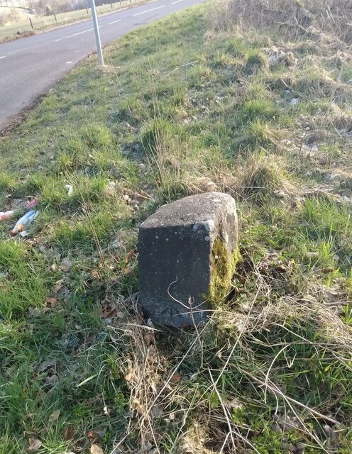
Old Milestone by the A822, south of Muthill Carved square stone by the A822, in parish of Muthill (Perthshire), Bishop's Bridge, just South of junction A822/A823. An earlier photograph can be found here <a title="https://www.geograph.org.uk/photo/6035261" href="https://www.geograph.org.uk/photo/6035261">Link</a>.

Inscription once read:- : Edinburgh {by Stirling 52 {by Gleneagles 42 : 
Carved benchmark on lower face.

Surveyed

Milestone Society National ID: PK_CFDB05
Old Milestone by the A822, south of Muthill
Carved square stone by the A822, in parish of Muthill (Perthshire), Bishop's Bridge, just South of junction A822/A823. An earlier photograph can be found here Link. Inscription once read:- : Edinburgh {by Stirling 52 {by Gleneagles 42 : Carved benchmark on lower face. Surveyed Milestone Society National ID: PK_CFDB05
Football pitch, Muthill In a small park off the road to Crieff.
Football pitch, Muthill
In a small park off the road to Crieff.
Stubble, Borland Near Muthill
Stubble, Borland
Near Muthill
Road to Muthill Descent through arable land and  past the golf course.
Road to Muthill
Descent through arable land and past the golf course.
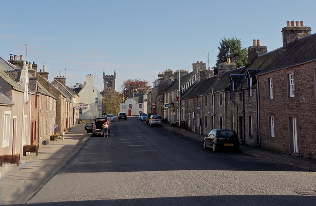
Muthill main street
Muthill main street
Bridge over Machany Water
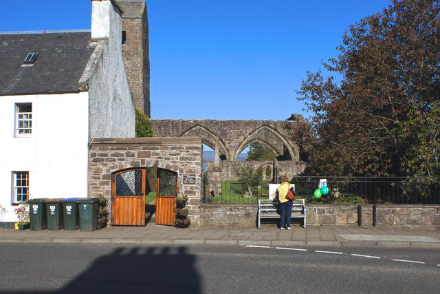
Entrance to Muthill Old Church Ruins and cemetery
Entrance to Muthill Old Church
Ruins and cemetery
Home of the Culdees Romanesque ruins of the church which housed the Culdees (Servants of God) in the 12th century.
Home of the Culdees
Romanesque ruins of the church which housed the Culdees (Servants of God) in the 12th century.
Graveyard, Muthill Old Church
Award-winning restaurant, Muthill
Interior, Barley Bree restaurant Book early to avoid disappointment.
Interior, Barley Bree restaurant
Book early to avoid disappointment.
Sitting Room Barley Bree restaurant, Muthill
Sitting Room
Barley Bree restaurant, Muthill
Tower, Muthill Parish Church A surprisingly grand building for a small village.
Tower, Muthill Parish Church
A surprisingly grand building for a small village.
Muthill Museum
Muthill Museum
Muthill Post Office Drummond Street
Muthill Post Office
Drummond Street
Willoughby Street, Muthill
Ordnance Survey 1GL Bolt This OS Bolt can be found on the NW angle of Muthill Church. It marks a point 76.231m above mean sea level.
Ordnance Survey 1GL Bolt
This OS Bolt can be found on the NW angle of Muthill Church. It marks a point 76.231m above mean sea level.
Show me another place!

Muir of Spot Wood is located at Grid Ref: NN8716 (Lat: 56.324581, Lng: -3.8265223)

Unitary Authority: Perth and Kinross

Police Authority: Tayside

What 3 Words

///mammal.brimmed.ironclad. Near Crieff, Perth & Kinross

Nearby Locations

Muir of Spot Wood

Related Wikis

Muthill

Muthill, pronounced [ˈmjuːθɪl], is a village in Perth and Kinross, Perthshire, Scotland. The name derives from Scottish Gaelic Maothail meaning “soft-ground...

Muthill railway station

Muthill railway station served the village of Muthill in Scotland. The station is now the premises of James Haggart & Sons LTD (A potato grower and exporter...

Pond of Drummond

Pond of Drummond is a small shallow freshwater artificial loch in the grounds of Drummond Castle, and is orientated on an east to west orientation, being...

Drummond Castle

Drummond Castle is located in Perthshire, Scotland. The castle is known for its gardens, described by Historic Environment Scotland as "the best example...

Nearby Amenities

Located within 500m of 56.324581,-3.8265223
Design: barrel
Power: tower
Lat/Long: 56.3224906/-3.8224375
Design: barrel
Power: tower
Lat/Long: 56.3260482/-3.8211179
Power: pole
Lat/Long: 56.3223262/-3.8205338
Power: pole
Lat/Long: 56.3229487/-3.8211305
Power: pole
Lat/Long: 56.3253766/-3.8194163
The data included in this document is from www.openstreetmap.org. The data is made available under ODbL.

Have you been to Muir of Spot Wood?

Leave your review of Muir of Spot Wood below (or comments, questions and feedback).