Bargrug Sandpit Wood

Wood, Forest in Kirkcudbrightshire

Scotland

Bargrug Sandpit Wood

Sawmill, Barclosh. Big sawmill, as you might expect to find with all the commercial forestry in Galloway.
Sawmill, Barclosh. Credit: Richard Webb

Bargrug Sandpit Wood, located in Kirkcudbrightshire, is a charming woodland area that offers a serene and tranquil atmosphere for visitors to enjoy. Spread across a vast area, this wood is known for its diverse range of flora and fauna, making it a popular destination for nature enthusiasts and wildlife lovers alike.

The wood is characterized by its dense canopy of deciduous and coniferous trees, which provide ample shade and shelter for the myriad of wildlife that call this place home. Visitors can expect to encounter a variety of bird species, including woodpeckers, owls, and songbirds, as they explore the winding trails that meander through the wood.

The forest floor is carpeted with a rich tapestry of mosses, ferns, and wildflowers, creating a vibrant and colorful landscape. Bluebells, primroses, and wood sorrels are just a few of the flowers that bloom here during the spring, adding a touch of beauty to the surroundings.

For those seeking a peaceful retreat, Bargrug Sandpit Wood offers several picnic spots where visitors can relax and enjoy the sounds of nature. The wood is also equipped with well-maintained footpaths, making it accessible for individuals of all ages and abilities.

Overall, Bargrug Sandpit Wood is a remarkable natural gem in Kirkcudbrightshire, providing a haven for both wildlife and humans alike. Its diverse ecosystem and picturesque surroundings make it a must-visit destination for anyone looking to connect with nature and enjoy the tranquility of the great outdoors.

If you have any feedback on the listing, please let us know in the comments section below.

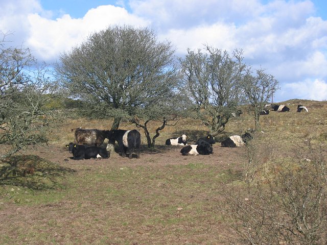
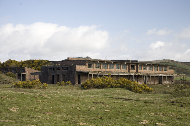
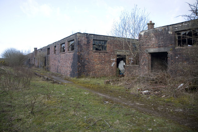
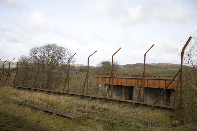
Bargrug Sandpit Wood Images

Images are sourced within 2km of 54.951106/-3.7751823 or Grid Reference NX8663. Thanks to Geograph Open Source API. All images are credited.

Sawmill, Barclosh. Big sawmill, as you might expect to find with all the commercial forestry in Galloway.
Sawmill, Barclosh.
Big sawmill, as you might expect to find with all the commercial forestry in Galloway.
Nether Hill Granite revealed by felling a Forestry Commission plantation.
Nether Hill
Granite revealed by felling a Forestry Commission plantation.
Belties Local breed on Barclosh Hill.
Belties
Local breed on Barclosh Hill.
Barclosh Hill Some of this rough hill has avoided the munching belties and is covered in hazel wood.
Barclosh Hill
Some of this rough hill has avoided the munching belties and is covered in hazel wood.
Loch Fern View east over a small reservoir towards Long Fern, one of the incredibly rough Solway granite hills.
Loch Fern
View east over a small reservoir towards Long Fern, one of the incredibly rough Solway granite hills.
Isles Farmland near Isles  with Clawbelly Hill in the distance.
Isles
Farmland near Isles with Clawbelly Hill in the distance.
Falgunzeon. Farm amongst the sour soils of the Solway granite. NE view.
Falgunzeon.
Farm amongst the sour soils of the Solway granite. NE view.
Woodland, Clawbelly Hill. A pocket of deciduous woodland in the pine forest on Clawbelly. Sadly it's another noxious introduced weed, sycamore.
Woodland, Clawbelly Hill.
A pocket of deciduous woodland in the pine forest on Clawbelly. Sadly it's another noxious introduced weed, sycamore.
Culdrain View NW across wet farmland
Culdrain
View NW across wet farmland
Torkirra. View SE up the farm drive.
Torkirra.
View SE up the farm drive.
Boulders, Bentfoot Granite boulders piled up after being cleared from the fields.
Boulders, Bentfoot
Granite boulders piled up after being cleared from the fields.
Edingham Moss WWII cordite works One of several disused cordite drying buildings on the extensive World War II depot site north west of Dalbeatie. Opened in 1939 it finally closed in 1960. The site is dangerous and must not be visited without the owners permission. More information here <span class="nowrap"><a title="http://www.dalbeattie.com/ministryofsupplyfactorydalbeattie/index.html" rel="nofollow ugc noopener" href="http://www.dalbeattie.com/ministryofsupplyfactorydalbeattie/index.html">Link</a><img style="margin-left:2px;" alt="External link" title="External link - shift click to open in new window" src="https://s1.geograph.org.uk/img/external.png" width="10" height="10"/></span>
Edingham Moss WWII cordite works
One of several disused cordite drying buildings on the extensive World War II depot site north west of Dalbeatie. Opened in 1939 it finally closed in 1960. The site is dangerous and must not be visited without the owners permission. More information here LinkExternal link
Edingham Moss WWII cordite works Railway loading bays, part of extensive World War II depot site north west of Dalbeattie. Opened in 1939 it finally closed in 1960. This site is dangerous and must not be visited without the owners permission. More information here <span class="nowrap"><a title="http://www.dalbeattie.com/ministryofsupplyfactorydalbeattie/index.html" rel="nofollow ugc noopener" href="http://www.dalbeattie.com/ministryofsupplyfactorydalbeattie/index.html">Link</a><img style="margin-left:2px;" alt="External link" title="External link - shift click to open in new window" src="https://s1.geograph.org.uk/img/external.png" width="10" height="10"/></span>
Edingham Moss WWII cordite works
Railway loading bays, part of extensive World War II depot site north west of Dalbeattie. Opened in 1939 it finally closed in 1960. This site is dangerous and must not be visited without the owners permission. More information here LinkExternal link
Edingham Moss WWII cordite works Looking from the trackbed of the disused "Port Road" Dumfries to Stranraer railway line across to a railway bridge inside the extensive World War II depot site. Opened in 1939 it finally closed in 1960. This site is dangerous and must not be visited without the owners permission. More information here <span class="nowrap"><a title="http://www.dalbeattie.com/ministryofsupplyfactorydalbeattie/index.html" rel="nofollow ugc noopener" href="http://www.dalbeattie.com/ministryofsupplyfactorydalbeattie/index.html">Link</a><img style="margin-left:2px;" alt="External link" title="External link - shift click to open in new window" src="https://s1.geograph.org.uk/img/external.png" width="10" height="10"/></span>
Edingham Moss WWII cordite works
Looking from the trackbed of the disused "Port Road" Dumfries to Stranraer railway line across to a railway bridge inside the extensive World War II depot site. Opened in 1939 it finally closed in 1960. This site is dangerous and must not be visited without the owners permission. More information here LinkExternal link
Track to a gate at Plascow
Edge of a small wooded area at Plascow
Road past Plascow Cottage
Country Road Looking along the road which leads to Quahead.
Country Road
Looking along the road which leads to Quahead.
Show me another place!

Bargrug Sandpit Wood is located at Grid Ref: NX8663 (Lat: 54.951106, Lng: -3.7751823)

Unitary Authority: Dumfries and Galloway

Police Authority: Dumfries and Galloway

What 3 Words

///noisy.campfires.outgrown. Near Dalbeattie, Dumfries & Galloway

Related Wikis

Southwick railway station (Scotland)

Southwick (Dumfries & Galloway) railway station served the civil parish of Colvend and Southwick, Dumfries and Galloway, Scotland from 1859 to 1965 on...

Kirkgunzeon railway station

Kirkgunzeon railway station served the village of Kirkgunzeon, Dumfries and Galloway, Scotland from 1859 to 1950 on the Castle Douglas and Dumfries Railway...

Dalbeattie Star F.C.

Dalbeattie Star Football Club is a Scottish association football club based in Dalbeattie, Dumfries and Galloway. It currently competes in the South of...

Kirkgunzeon

Kirkgunȝeon (Scottish Gaelic: Cill Fhionnain) is a village and civil parish in Dumfries and Galloway, south west Scotland. The village is 10.4 miles (16...

Dalbeattie Town Hall

Dalbeattie Town Hall is a municipal building in the High Street in Dalbeattie, Dumfries and Galloway, Scotland. The structure, which is used as community...

Dalbeattie

Dalbeattie (, Scots: Dawbeattie, Scottish Gaelic: Dail Bheithe meaning 'haugh of the birch' or Dail bhàite 'drowned (i.e. liable to flood) haugh') is a...

Dalbeattie railway station

Dalbeattie railway station served the town of Dalbeattie, Dumfries and Galloway, Scotland from 1859 to 1965 on the Castle Douglas and Dumfries Railway...

Stewartry

Stewartry was a local government district from 1975 until 1996 within the Dumfries and Galloway region in south-west Scotland. Under the name Stewartry...

Nearby Amenities

Located within 500m of 54.951106,-3.7751823
Bargrug
Place: hamlet
Lat/Long: 54.9538023/-3.769586
Power: pole
Lat/Long: 54.9471067/-3.7724585
Power: pole
Lat/Long: 54.953872/-3.7703031
Power: pole
Lat/Long: 54.9546127/-3.7706277
The data included in this document is from www.openstreetmap.org. The data is made available under ODbL.

Have you been to Bargrug Sandpit Wood?

Leave your review of Bargrug Sandpit Wood below (or comments, questions and feedback).