The Belt

Wood, Forest in Dumfriesshire

Scotland

The Belt

Kirkgate, Dunscore
Kirkgate, Dunscore Credit: Leslie Barrie

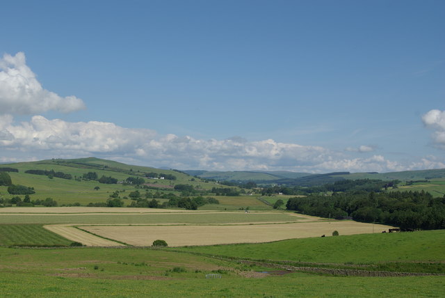
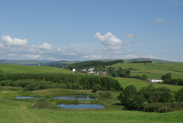
The Belt, located in Dumfriesshire, Scotland, is a beautiful woodland and forest area that stretches across approximately 5,000 acres of land. It is situated in the southern part of the country, near the town of Dumfries. The Belt is known for its diverse and rich ecosystem, making it a popular destination for nature enthusiasts and wildlife lovers.

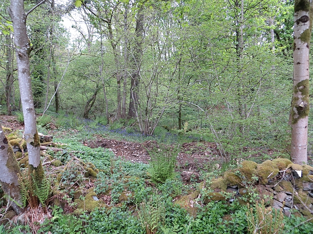
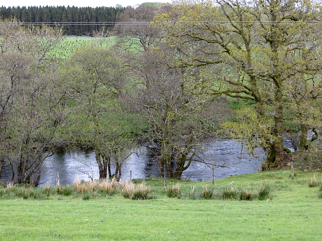
The woodland is predominantly made up of native tree species such as oak, birch, and pine, providing a picturesque landscape throughout the year. The forest floor is covered in a thick carpet of moss and ferns, adding to the overall enchanting atmosphere of the area. The Belt is also home to a variety of wildlife, including red squirrels, deer, foxes, and a wide range of bird species.

The woodland offers numerous walking trails and paths, allowing visitors to explore and immerse themselves in the natural beauty of the surroundings. There are options for all levels of fitness and interests, from leisurely strolls to more challenging hikes. The Belt also provides opportunities for camping and picnicking, allowing visitors to spend more time connecting with nature.

In addition to its natural beauty, The Belt holds historical significance. It was once part of the royal hunting grounds and has remnants of ancient settlements, including stone circles and burial mounds. These historical features add an extra layer of intrigue and fascination to the area.

Overall, The Belt in Dumfriesshire is a captivating woodland and forest that offers a unique combination of natural beauty, rich wildlife, and historical heritage. It is a must-visit destination for anyone seeking a peaceful and immersive experience in the heart of Scotland's countryside.

If you have any feedback on the listing, please let us know in the comments section below.

The Belt Images

Images are sourced within 2km of 55.125757/-3.793276 or Grid Reference NX8582. Thanks to Geograph Open Source API. All images are credited.

Kirkgate, Dunscore
Kirkgate, Dunscore
Dunscore War Memorial
Landscape near Dunscore
Jane Haining Memorial, Dunscore Born at Lochanhead Farm near Dunscore in 1897, Jane became a Church of Scotland missionary and later went to Hungary where in 1932 where she was appointed matron in The Girls' Home of the Jewish Mission Station in Budapest. Although she came home to Dunscore in 1939, she later returned to Hungary, was arrested by the Gestapo and perished at Auschwitz in 1944.
Jane Haining Memorial, Dunscore
Born at Lochanhead Farm near Dunscore in 1897, Jane became a Church of Scotland missionary and later went to Hungary where in 1932 where she was appointed matron in The Girls' Home of the Jewish Mission Station in Budapest. Although she came home to Dunscore in 1939, she later returned to Hungary, was arrested by the Gestapo and perished at Auschwitz in 1944.
Old Moss-Side, Dunscore
Fields & ponds west of Mansegate View towards the village of Dunscore
Fields & ponds west of Mansegate
View towards the village of Dunscore
Dunscore Kirk on an autumnal morning
Sheep on Speddoch Hill
Eastward across Cairn Water valley at site of Dunscore station View NE: the station had been on the left: ex-G&SW Dumfries - Moniaive Light Railway; all closed to passengers 3/5/43, to goods 4/7/49 - just a gateway is left in 1991.
Eastward across Cairn Water valley at site of Dunscore station
View NE: the station had been on the left: ex-G&SW Dumfries - Moniaive Light Railway; all closed to passengers 3/5/43, to goods 4/7/49 - just a gateway is left in 1991.
New electricity pole Awaiting erection by a minor road over to Glenkiln.
New electricity pole
Awaiting erection by a minor road over to Glenkiln.
Barbuie Burn In Barbuie Wood which is very attractive.
Barbuie Burn
In Barbuie Wood which is very attractive.
Barbuie Wood A marshy bit beside the Barbuie Burn. There is a ruined dyke running beside the burn here. A cuckoo was calling.
Barbuie Wood
A marshy bit beside the Barbuie Burn. There is a ruined dyke running beside the burn here. A cuckoo was calling.
Field, Speddochhill There is a large clearance cairn in the foreground, a lot of work went into making these fields.
Field, Speddochhill
There is a large clearance cairn in the foreground, a lot of work went into making these fields.
Kilnshang Plantation Woodland, Speddoch.
Kilnshang Plantation
Woodland, Speddoch.
Bus shelter, Speddoch Soon after I took this, a bus passed.
Bus shelter, Speddoch
Soon after I took this, a bus passed.
Cairn Water Quite a big river at this stage.
Cairn Water
Quite a big river at this stage.
Junction, Milton The tulips were apt, about ten Harley Davidson bikes passed - a Dutch club run by the look of it. They obviously know a good road. 
The mapped telephone box has disappeared.
Junction, Milton
The tulips were apt, about ten Harley Davidson bikes passed - a Dutch club run by the look of it. They obviously know a good road. The mapped telephone box has disappeared.
Show me another place!

The Belt is located at Grid Ref: NX8582 (Lat: 55.125757, Lng: -3.793276)

Unitary Authority: Dumfries and Galloway

Police Authority: Dumfries and Galloway

What 3 Words

///soggy.polar.clubbing. Near Thornhill, Dumfries & Galloway

Related Wikis

Dunscore railway station

Dunscore (NX858840) was one of the four principal stations on the Cairn Valley Light Railway (CVR) branch, from Dumfries. It served the rural area of...

Stepford railway station

Stepford (NX864815) was one of the minor request stop stations on the Cairn Valley Light Railway branch from Dumfries. It served a very rural area in...

Dunscore

Dunscore (['dʌnskər] / 'DUN-skur', less commonly ['dunskɔ:r] / 'DUN-score') is a small village which lies 9 miles (14 km) northwest of Dumfries on the...

Newtonairds railway station

Newtonairds (NX877801) was one of the principal stations on the now closed Cairn Valley Light Railway branch from Dumfries. It served a very rural area...

Nearby Amenities

Located within 500m of 55.125757,-3.793276
Power: pole
Lat/Long: 55.1217306/-3.7929899
Power: pole
Lat/Long: 55.1225676/-3.7926271
Power: pole
Lat/Long: 55.1250883/-3.8006271
Power: pole
Lat/Long: 55.1244115/-3.8001222
Power: pole
Lat/Long: 55.1235357/-3.7994582
Power: pole
Lat/Long: 55.1233355/-3.7980835
Power: pole
Lat/Long: 55.123162/-3.7969188
Power: pole
Lat/Long: 55.1229655/-3.7954529
Power: pole
Lat/Long: 55.1227581/-3.7940145
Power: pole
Lat/Long: 55.1223044/-3.7909448
Power: pole
Lat/Long: 55.1221552/-3.7900029
Power: pole
Lat/Long: 55.121995/-3.7889867
Power: pole
Lat/Long: 55.1238874/-3.7863752
Power: pole
Lat/Long: 55.124887/-3.7861822
Power: pole
Lat/Long: 55.1258671/-3.7860082
Power: pole
Lat/Long: 55.1264687/-3.7858809
Power: pole
Lat/Long: 55.1270497/-3.7857812
The data included in this document is from www.openstreetmap.org. The data is made available under ODbL.

Have you been to The Belt?

Leave your review of The Belt below (or comments, questions and feedback).