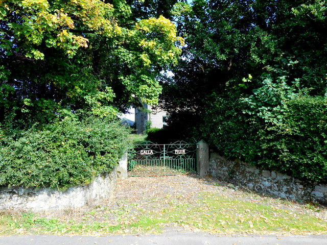
Gallamuir Wood

Wood, Forest in Stirlingshire

Scotland

Gallamuir Wood

Barley, Plean
Barley, Plean Credit: Richard Webb

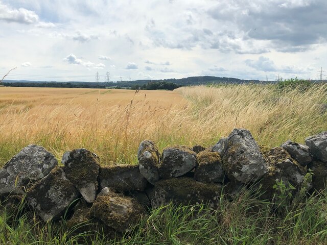
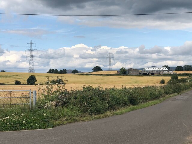
Gallamuir Wood is a picturesque forest located in Stirlingshire, Scotland. Covering an area of approximately 400 hectares, it is a captivating natural landscape that attracts visitors from both near and far. The wood is situated on a gently sloping hillside, providing stunning views of the surrounding countryside.

The woodland consists primarily of native broadleaf trees such as oak, birch, and beech, creating a diverse and flourishing ecosystem. These trees provide a habitat for a wide range of wildlife, including birds, squirrels, and various species of insects. The forest floor is adorned with an array of wildflowers, adding to the vibrant and enchanting atmosphere of the wood.

Gallamuir Wood offers a network of well-maintained walking trails, allowing visitors to explore its beauty at their own pace. These paths wind through the forest, offering glimpses of small streams and ponds along the way. The tranquility of the wood provides an ideal setting for nature lovers, hikers, and photographers seeking to capture the breathtaking scenery.

The wood is also known for its historical significance. It is believed to have been a part of the ancient Caledonian Forest, which once covered large parts of Scotland. The remnants of this ancient woodland can still be observed in some areas, adding a sense of mystery and wonder to the overall experience.

Overall, Gallamuir Wood is a magnificent natural treasure in Stirlingshire. Its lush vegetation, diverse wildlife, and captivating walking trails make it a haven for those seeking solace in nature, as well as a popular destination for outdoor enthusiasts and history aficionados alike.

If you have any feedback on the listing, please let us know in the comments section below.

Gallamuir Wood Images

Images are sourced within 2km of 56.072136/-3.8558991 or Grid Reference NS8488. Thanks to Geograph Open Source API. All images are credited.

Barley, Plean
Barley, Plean
Small Burn, Plean
Small Burn, Plean
Railway bridge, Gallamuir A few years after electrification between Falkirk and Dunblane.
Railway bridge, Gallamuir
A few years after electrification between Falkirk and Dunblane.
Cattle, Plean
Cattle, Plean
Barley, Plean
Barley, Plean
Whitehill, near Plean
Old Milestone by the A9 Main Street, Plean, St. Ninians Parish Stirling BB by the A9, in parish of St Ninians (Stirling District), Plean, opposite Touchill & Bends sign.

Inscription reads:- 
STIRLING / 5 MILES :: FALKIRK / 6 MLS / EDINBURGH / 30 MLS

Surveyed

Milestone Society National ID: ST_STFK05.
Old Milestone by the A9 Main Street, Plean, St. Ninians Parish
Stirling BB by the A9, in parish of St Ninians (Stirling District), Plean, opposite Touchill & Bends sign. Inscription reads:- STIRLING / 5 MILES :: FALKIRK / 6 MLS / EDINBURGH / 30 MLS Surveyed Milestone Society National ID: ST_STFK05.
Gallamuir This is the entrance gateway to Gallamuir which is a large working dairy farm that stands on its own just south of Gallamuir Wood.
Gallamuir
This is the entrance gateway to Gallamuir which is a large working dairy farm that stands on its own just south of Gallamuir Wood.
The B9124 This is the minor road from Plean to Airth just as it passes the dairy farm known as Gallamuir one of whose trees over hangs the road. In the distance is the detached house known as Gallamuir Farm Cottage next to the farm.
The B9124
This is the minor road from Plean to Airth just as it passes the dairy farm known as Gallamuir one of whose trees over hangs the road. In the distance is the detached house known as Gallamuir Farm Cottage next to the farm.
Plean, Cowie and the River Forth from the air The Nordbord wood products factory <span class="nowrap"><a title="http://norbord.co.uk/" rel="nofollow ugc noopener" href="http://norbord.co.uk/">Link</a><img style="margin-left:2px;" alt="External link" title="External link - shift click to open in new window" src="https://s1.geograph.org.uk/img/external.png" width="10" height="10"/></span> at Cowie can be seen. Taken from a Prague bound flight from Glasgow.
Plean, Cowie and the River Forth from the air
The Nordbord wood products factory LinkExternal link at Cowie can be seen. Taken from a Prague bound flight from Glasgow.
Cowie and the River Forth from the air The Nordbord wood products factory <span class="nowrap"><a title="http://norbord.co.uk/" rel="nofollow ugc noopener" href="http://norbord.co.uk/">Link</a><img style="margin-left:2px;" alt="External link" title="External link - shift click to open in new window" src="https://s1.geograph.org.uk/img/external.png" width="10" height="10"/></span> at Cowie can be seen. Taken from a Prague bound flight from Glasgow.
Cowie and the River Forth from the air
The Nordbord wood products factory LinkExternal link at Cowie can be seen. Taken from a Prague bound flight from Glasgow.
Plean, Cowie and the River Forth from the air The Nordbord wood products factory <span class="nowrap"><a title="http://norbord.co.uk/" rel="nofollow ugc noopener" href="http://norbord.co.uk/">Link</a><img style="margin-left:2px;" alt="External link" title="External link - shift click to open in new window" src="https://s1.geograph.org.uk/img/external.png" width="10" height="10"/></span> at Cowie can be seen in the foreground. The former RN munitions depot at Bandeath (within the meander on the Forth) can also be seen, as can the bonded whisky warehouses at Greenkerse <a href="https://www.geograph.org.uk/photo/243451">NS8494 : Bonded warehouses</a> across the Forth. Taken from a Prague bound flight from Glasgow.
Plean, Cowie and the River Forth from the air
The Nordbord wood products factory LinkExternal link at Cowie can be seen in the foreground. The former RN munitions depot at Bandeath (within the meander on the Forth) can also be seen, as can the bonded whisky warehouses at Greenkerse NS8494 : Bonded warehouses across the Forth. Taken from a Prague bound flight from Glasgow.
Cowie Bowling Club Opposite the Norbord factory.
Cowie Bowling Club
Opposite the Norbord factory.
Norbord, Cowie A factory making wood panels.  The plume of condensed steam which is often seen above the place is a familiar landmark.
Norbord, Cowie
A factory making wood panels. The plume of condensed steam which is often seen above the place is a familiar landmark.
Garages, Cowie On Ochilview but in this case the view is of Norbord's perimeter fence.
Garages, Cowie
On Ochilview but in this case the view is of Norbord's perimeter fence.
Ochilview, Cowie
Ochilview, Cowie
Unsealed road, Cowie Used by the National Cycle Network.
Unsealed road, Cowie
Used by the National Cycle Network.
Arable land and an Ochil view The tramlines seem to be used by more than tractors on this urban fringe field.
Arable land and an Ochil view
The tramlines seem to be used by more than tractors on this urban fringe field.
Show me another place!

Gallamuir Wood is located at Grid Ref: NS8488 (Lat: 56.072136, Lng: -3.8558991)

Unitary Authority: Stirling

Police Authority: Forth Valley

What 3 Words

///degrading.though.flitting. Near Cowie, Stirling

Nearby Locations

Gallamuir Wood

Related Wikis

Plean railway station

Plean railway station served the village of Plean, Stirlingshire, Scotland from 1904 to 1956 on the Scottish Central Railway. == History == The station...
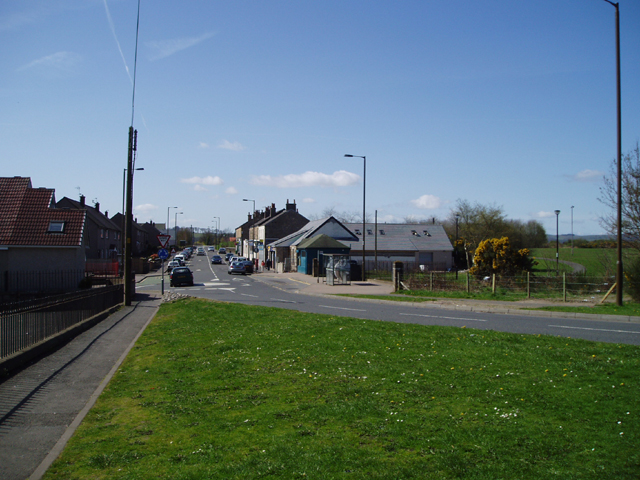
Cowie, Stirling

Cowie (Scottish Gaelic: Collaidh, meaning wooded place) is a village in the Stirling council area of Scotland. Historically part of Stirlingshire, it lies...
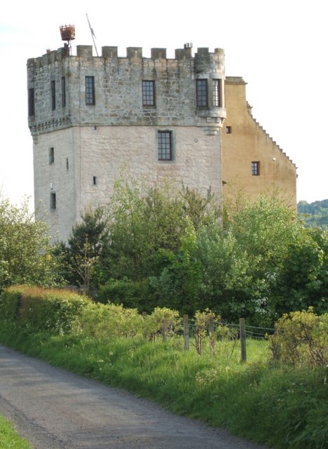
Plean Castle

Plean Tower, also known as Cock-a-bendy Castle, Mengie Castle, Menzies Castle and Plane Castle, is located around 1 mile (1.6 km) from Plean, in Stirling...

Stirling and Falkirk

Stirling and Falkirk is a lieutenancy area of Scotland. It consists of the local government areas of Stirling and Falkirk, which cover the same areas as...

Nearby Amenities

Located within 500m of 56.072136,-3.8558991
Material: wood
Power: pole
Lat/Long: 56.0757211/-3.859621
Material: wood
Power: pole
Lat/Long: 56.0746134/-3.8599616
Material: wood
Power: pole
Lat/Long: 56.0736463/-3.8602781
Material: wood
Power: pole
Lat/Long: 56.072763/-3.8605303
Material: wood
Power: pole
Lat/Long: 56.071757/-3.860836
Material: wood
Power: pole
Lat/Long: 56.0707749/-3.8611203
Material: wood
Power: pole
Lat/Long: 56.0697718/-3.8614422
Material: wood
Power: pole
Lat/Long: 56.0756922/-3.8586998
Material: wood
Power: pole
Lat/Long: 56.0759135/-3.8577795
Material: wood
Power: pole
Lat/Long: 56.0696821/-3.8606489
Material: wood
Power: pole
Lat/Long: 56.0696506/-3.8601397
The data included in this document is from www.openstreetmap.org. The data is made available under ODbL.

Have you been to Gallamuir Wood?

Leave your review of Gallamuir Wood below (or comments, questions and feedback).